Codington County is a county in the U.S. state of South Dakota. As of the 2020 United States Census, the population was 28,325. Its county seat is Watertown. The county was created in 1877 and organized in 1878. It is named for Rev. George S. S. Codington, Dakota Territory legislator.
Codington County comprises the Watertown, SD Micropolitan Statistical Area.
| Name: | Codington County |
|---|---|
| FIPS code: | 46-029 |
| State: | South Dakota |
| Founded: | 1877 |
| Named for: | Reverend George S. S. Codington |
| Seat: | Watertown |
| Largest city: | Watertown |
| Total Area: | 717 sq mi (1,860 km²) |
| Land Area: | 688 sq mi (1,780 km²) |
| Total Population: | 28,325 |
| Population Density: | 40/sq mi (15/km²) |
| Time zone: | UTC−6 (Central) |
| Summer Time Zone (DST): | UTC−5 (CDT) |
| Website: | www.codington.org |
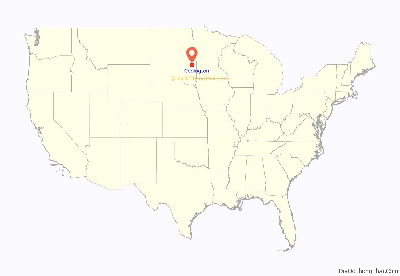
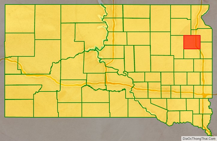
Codington County location map. Where is Codington County?
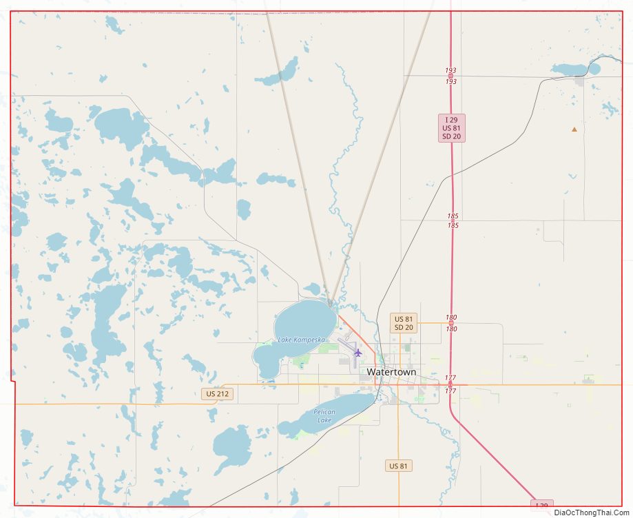
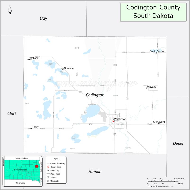
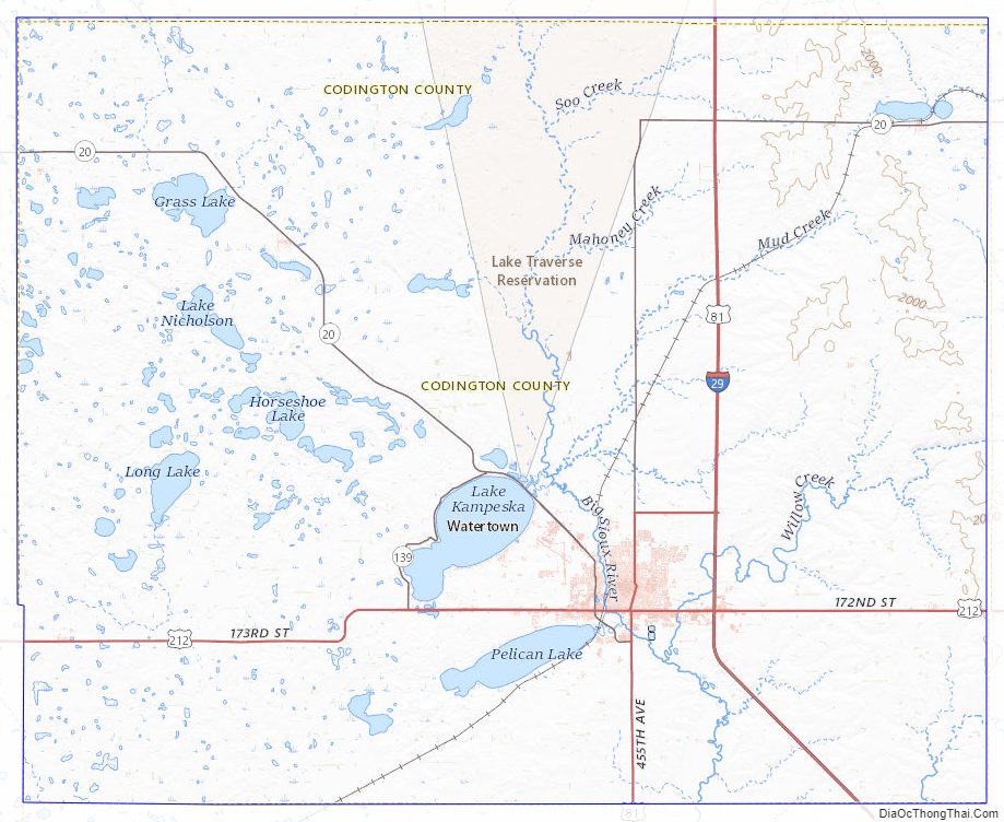
Codington County Road Map
Geography
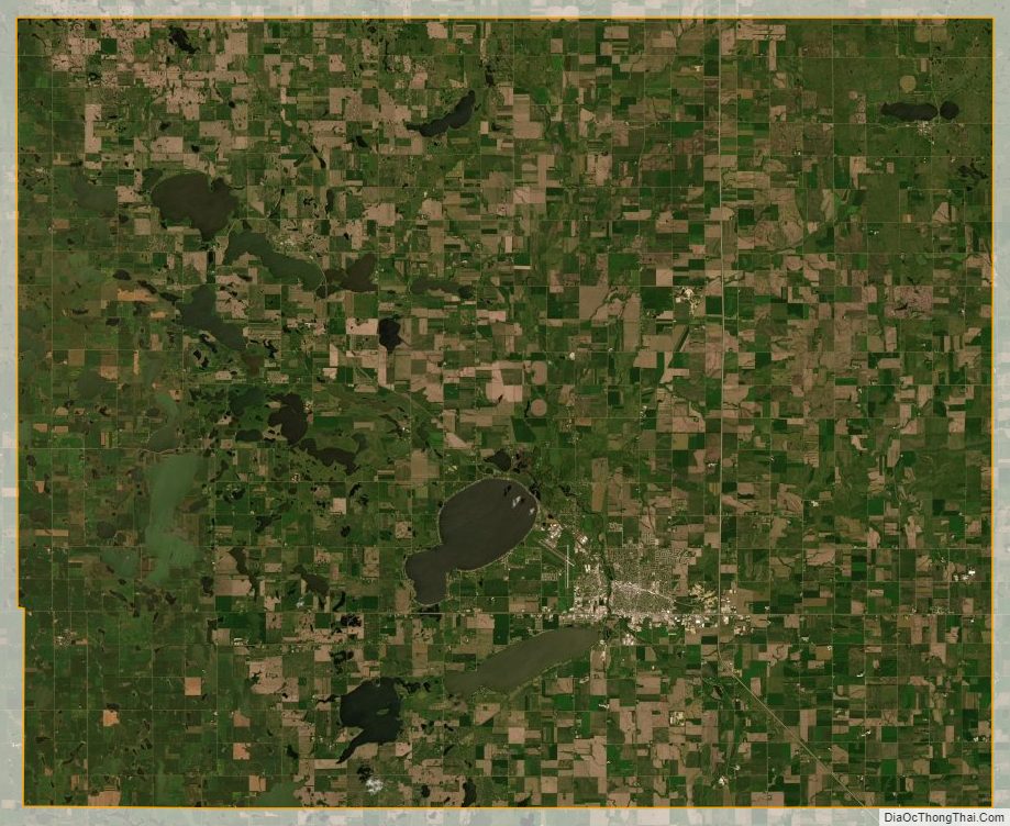
Codington County terrain consists of rolling hills dotted with lakes and ponds, especially in the southwest portion. The land is largely devoted to agriculture. The terrain is higher on the county’s east and west sides, and generally slopes to the south. The county has a total area of 717 square miles (1,860 km), of which 688 square miles (1,780 km) is land and 29 square miles (75 km) (4.0%) is water.
Major highways
- Interstate 29
- U.S. Highway 81
- U.S. Highway 212
- South Dakota Highway 20
- South Dakota Highway 20P
Adjacent counties
- Grant County – northeast
- Deuel County – southeast
- Hamlin County – south
- Clark County – west
- Day County – northwest
Protected areas
- American Game Association State Game Production Area
- Blythe State Game Production Area
- Christopherson Game Production Area
- Clarksean State Game Production Area
- Codington County State Game Production Area
- Curley State Game Production Area
- Elmore State Game Production Area
- Gilbert State Game Production Area
- Goose Lake State Game Production Area
- Hanson State Game Production Area
- Horseshoe Lake State Game Production Area
- Larson State Game Production Area
- McKillicans Lake State Game Production Area
- North Nichols State Game Production Area
- North Stink Lake State Game Production Area
- Pelican Lake State Recreation Area
- Punished Womans Lake State Game Production Area
- Sandy Shore State Recreation Area
- Spencer State Game Production Area
- Spoonbill Pass State Game Production Area
- Thompson’s Point State Lakeside Use Area
- Warner Lake State Game Production Area
- Wolf State Game Production Area (partial)
Major lakes
- Cottonwood Lake
- Dry Lake
- Goose Lake
- Grass Lake
- Horseshoe Lake
- Kings Lake
- Lake Kampeska
- Lake Nicholson
- Long Lake
- McKillicans Lake
- Medicine Lake
- Pelican Lake
- Punished Womans Lake
- Round Lake
- Still Lake
- Warner Lake
Codington County Topographic Map
Codington County Satellite Map
Codington County Outline Map

See also
Map of South Dakota State and its subdivision:- Aurora
- Beadle
- Bennett
- Bon Homme
- Brookings
- Brown
- Brule
- Buffalo
- Butte
- Campbell
- Charles Mix
- Clark
- Clay
- Codington
- Corson
- Custer
- Davison
- Day
- Deuel
- Dewey
- Douglas
- Edmunds
- Fall River
- Faulk
- Grant
- Gregory
- Haakon
- Hamlin
- Hand
- Hanson
- Harding
- Hughes
- Hutchinson
- Hyde
- Jackson
- Jerauld
- Jones
- Kingsbury
- Lake
- Lawrence
- Lincoln
- Lyman
- Marshall
- McCook
- McPherson
- Meade
- Mellette
- Miner
- Minnehaha
- Moody
- Pennington
- Perkins
- Potter
- Roberts
- Sanborn
- Shannon
- Spink
- Stanley
- Sully
- Todd
- Tripp
- Turner
- Union
- Walworth
- Yankton
- Ziebach
- Alabama
- Alaska
- Arizona
- Arkansas
- California
- Colorado
- Connecticut
- Delaware
- District of Columbia
- Florida
- Georgia
- Hawaii
- Idaho
- Illinois
- Indiana
- Iowa
- Kansas
- Kentucky
- Louisiana
- Maine
- Maryland
- Massachusetts
- Michigan
- Minnesota
- Mississippi
- Missouri
- Montana
- Nebraska
- Nevada
- New Hampshire
- New Jersey
- New Mexico
- New York
- North Carolina
- North Dakota
- Ohio
- Oklahoma
- Oregon
- Pennsylvania
- Rhode Island
- South Carolina
- South Dakota
- Tennessee
- Texas
- Utah
- Vermont
- Virginia
- Washington
- West Virginia
- Wisconsin
- Wyoming