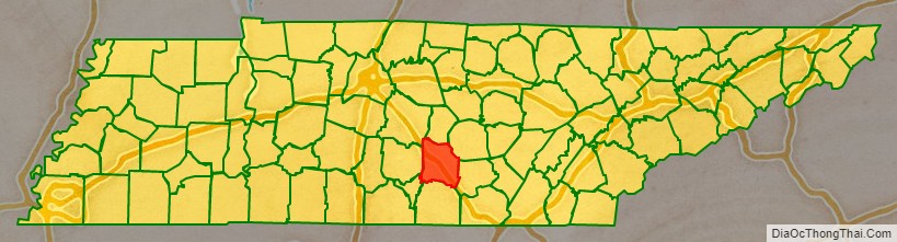
Coffee County is a county located in the central part of the state of Tennessee, in the United States. As of the 2020 census, the county’s population was 57,889. Its county seat is Manchester. Coffee County is part of the Tullahoma–Manchester, TN Micropolitan Statistical Area. It is also part of Middle Tennessee, one of the three Grand Divisions of the state.
| Name: | Coffee County |
|---|---|
| FIPS code: | 47-031 |
| State: | Tennessee |
| Founded: | January 8, 1836 |
| Named for: | John Coffee |
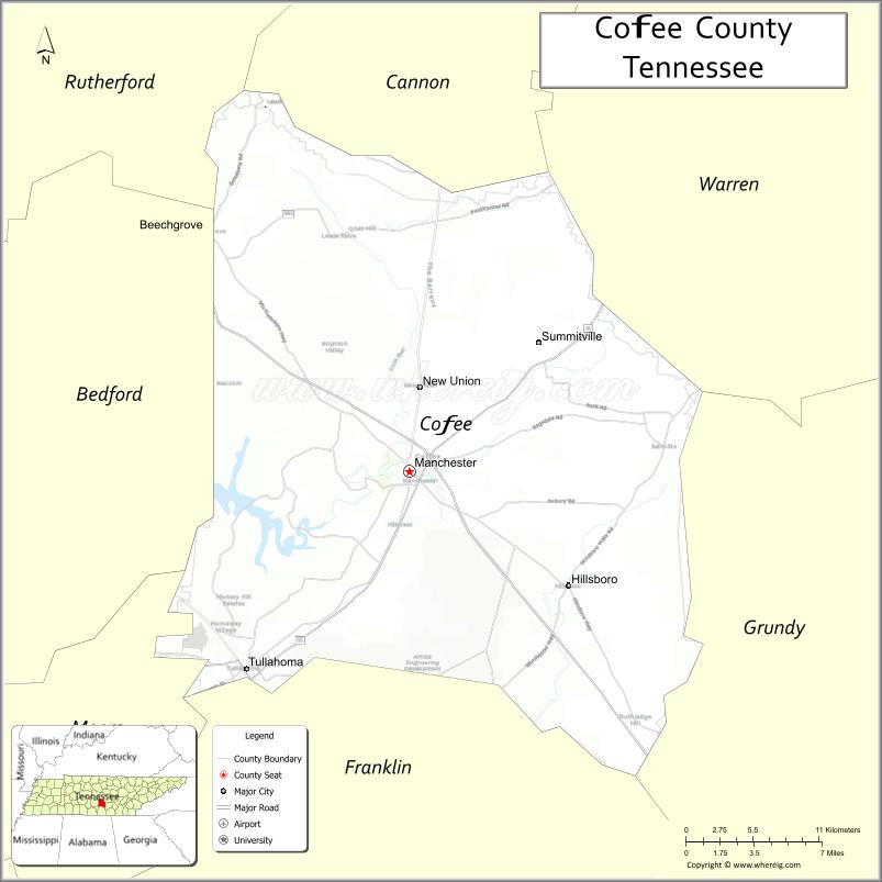
| Seat: | Manchester |
| Largest city: | Tullahoma |
| Total Area: | 435 sq mi (1,130 km²) |
| Land Area: | 429 sq mi (1,110 km²) |
| Total Population: | 57,889 |
| Population Density: | 123/sq mi (47/km²) |
| Time zone: | UTC−6 (Central) |
| Summer Time Zone (DST): | UTC−5 (CDT) |
| Website: | coffeecountytn.org |
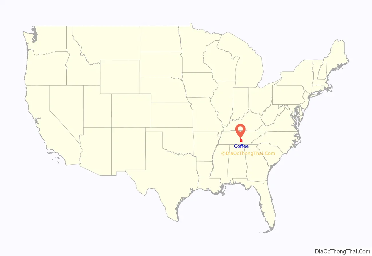
Coffee County location map. Where is Coffee County?
History
Coffee County was formed in 1836 from parts of Bedford, Warren, and Franklin counties. It was named for John Coffee, a prominent planter, land speculator, and militia officer. Similar to other counties in this area of the state, planters here cultivated mostly tobacco and hemp, produced by the labor of Black slaves.
In the period after the Reconstruction era ended (1877) and into the early 20th century, whites in Coffee County committed eight lynchings of Blacks. This was the fifth-highest total of any county in the state, but three other counties also had eight lynchings each.
Century Farms
Coffee County has twelve Century Farms, the classification for farms that have been operating for more than 100 years. The oldest Century Farm is Shamrock Acres, founded in 1818. Other Century Farms include:
- Beckman Farm
- Brown Dairy Farm
- Carden Ranch
- Crouch-Ramsey Farm
- Freeze Farm
- The Homestead Farm
- Jacobs Farm
- Long Farm
- Shamrock Acres
- Sunrise View Farm
- Thomas Farm, site of the Farrar Distillery
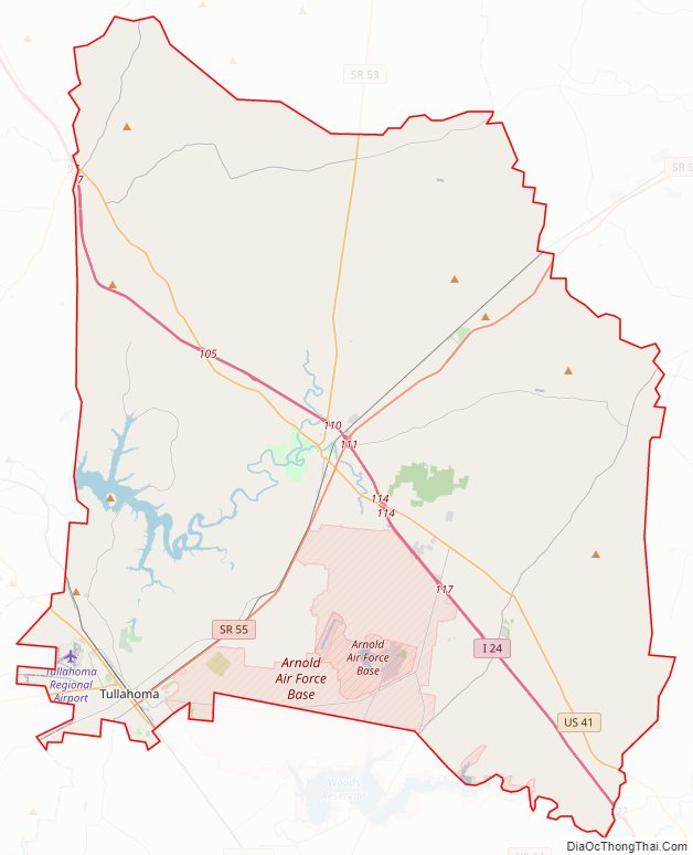
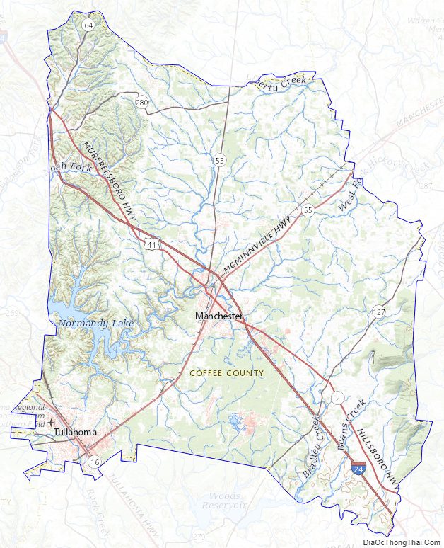
Coffee County Road Map
Geography
According to the U.S. Census Bureau, the county has a total area of 435 square miles (1,130 km), of which 429 square miles (1,110 km) is land and 5.6 square miles (15 km) (1.3%) is water.
Adjacent counties
- Cannon County (north)
- Warren County (northeast)
- Grundy County (east)
- Franklin County (south)
- Moore County (southwest)
- Bedford County (west)
- Rutherford County (northwest)
Major highways
- Interstate 24
- U.S. Route 41
- U.S. Route 41A
State protected areas
- Arnold Engineering Development Complex Wildlife Management Area (jointly managed by TWRA and USAF)
- Bark Camp Barrens Wildlife Management Area
- Hickory Flats Wildlife Management Area
- Maple Hill Wildlife Management Area
- May Prairie State Natural Area
- Normandy Wildlife Management Area (part)
- Old Stone Fort State Archaeological Park
- Short Springs State Natural Area
Coffee County Topographic Map
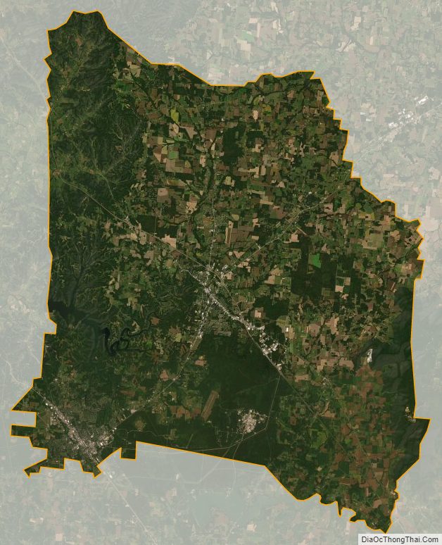
Coffee County Satellite Map
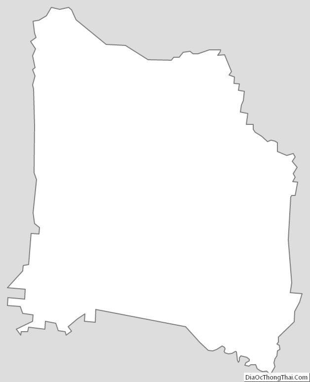
Coffee County Outline Map
See also
Map of Tennessee State and its subdivision:- Anderson
- Bedford
- Benton
- Bledsoe
- Blount
- Bradley
- Campbell
- Cannon
- Carroll
- Carter
- Cheatham
- Chester
- Claiborne
- Clay
- Cocke
- Coffee
- Crockett
- Cumberland
- Davidson
- Decatur
- DeKalb
- Dickson
- Dyer
- Fayette
- Fentress
- Franklin
- Gibson
- Giles
- Grainger
- Greene
- Grundy
- Hamblen
- Hamilton
- Hancock
- Hardeman
- Hardin
- Hawkins
- Haywood
- Henderson
- Henry
- Hickman
- Houston
- Humphreys
- Jackson
- Jefferson
- Johnson
- Knox
- Lake
- Lauderdale
- Lawrence
- Lewis
- Lincoln
- Loudon
- Macon
- Madison
- Marion
- Marshall
- Maury
- McMinn
- McNairy
- Meigs
- Monroe
- Montgomery
- Moore
- Morgan
- Obion
- Overton
- Perry
- Pickett
- Polk
- Putnam
- Rhea
- Roane
- Robertson
- Rutherford
- Scott
- Sequatchie
- Sevier
- Shelby
- Smith
- Stewart
- Sullivan
- Sumner
- Tipton
- Trousdale
- Unicoi
- Union
- Van Buren
- Warren
- Washington
- Wayne
- Weakley
- White
- Williamson
- Wilson
- Alabama
- Alaska
- Arizona
- Arkansas
- California
- Colorado
- Connecticut
- Delaware
- District of Columbia
- Florida
- Georgia
- Hawaii
- Idaho
- Illinois
- Indiana
- Iowa
- Kansas
- Kentucky
- Louisiana
- Maine
- Maryland
- Massachusetts
- Michigan
- Minnesota
- Mississippi
- Missouri
- Montana
- Nebraska
- Nevada
- New Hampshire
- New Jersey
- New Mexico
- New York
- North Carolina
- North Dakota
- Ohio
- Oklahoma
- Oregon
- Pennsylvania
- Rhode Island
- South Carolina
- South Dakota
- Tennessee
- Texas
- Utah
- Vermont
- Virginia
- Washington
- West Virginia
- Wisconsin
- Wyoming