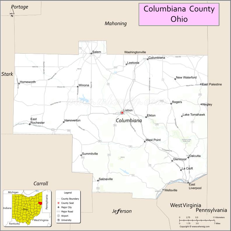
Columbiana County is a county located in the U.S. state of Ohio. As of the 2020 census, the population was 101,877. The county seat is Lisbon and its largest city is Salem. The county name is derived from the explorer of the Americas, Christopher Columbus.
Columbiana County comprises the Salem, OH Micropolitan Statistical Area, which is also included in the larger Youngstown-Warren, OH-PA Combined Statistical Area. Due to its location, Columbiana County is traditionally considered a part of Appalachian Ohio. While northern communities are more associated with Northeast Ohio, southern communities generally share more in common culturally with Greater Pittsburgh and the Upper Ohio Valley. The largely rural county sits midway between the two urban clusters. Officially considered part of the Youngstown media market, the Steubenville market media stations regularly report in the area as well.
| Name: | Columbiana County |
|---|---|
| FIPS code: | 39-029 |
| State: | Ohio |
| Founded: | May 1, 1803 |
| Named for: | Christopher Columbus |
| Seat: | Lisbon |
| Largest city: | Salem |
| Total Area: | 535 sq mi (1,390 km²) |
| Land Area: | 532 sq mi (1,380 km²) |
| Total Population: | 101,877 |
| Population Density: | 190/sq mi (70/km²) |
| Time zone: | UTC−5 (Eastern) |
| Summer Time Zone (DST): | UTC−4 (EDT) |
| Website: | www.columbianacounty.org |
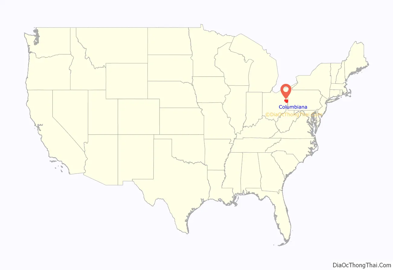
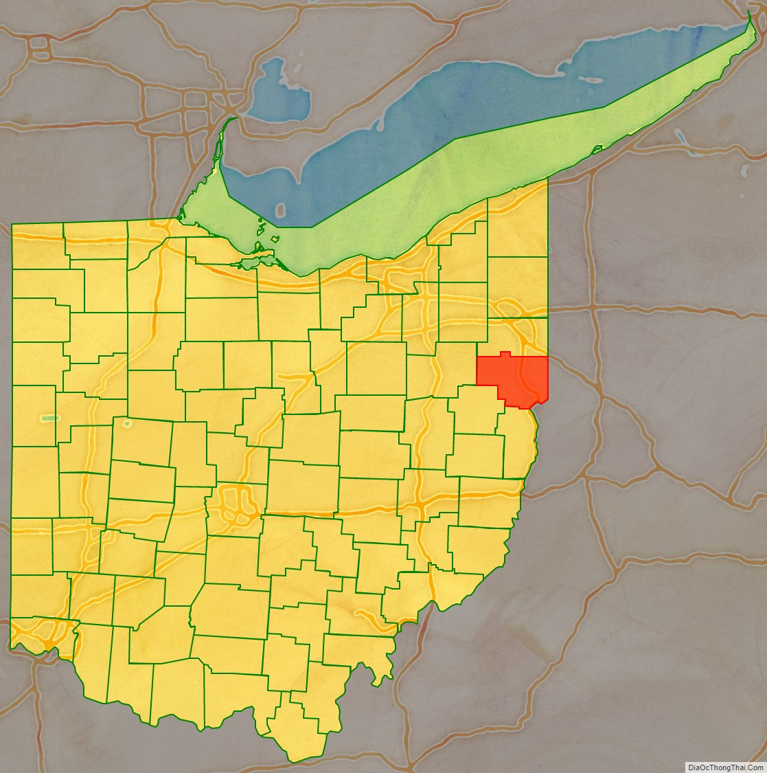
Columbiana County location map. Where is Columbiana County?
History
The principal historic Native American peoples in the area were the Lenape, Mingo, and Wyandot. The Wyandot had an encampment where the city of Salem now stands. Several important indigenous trails ran through the county, the most important being the Great Trail which ran through the southern parts of the county towards Sandusky. Throughout the second half of the 18th century, starting with Christopher Gist in 1750, American colonists explored the area as the Ohio Company surveyed. George Washington, while engaged in land examinations, camped in the area of present-day East Liverpool in October 1770.
In the 1780s, the Native Americans relinquished control of the area, and the region was surveyed in accordance with the Land Ordinance of 1785. The ensuing Public Land Survey System of the United States started by surveyor Thomas Hutchins on north bank of the Ohio River in present-day East Liverpool resulted in the Seven Ranges, believed to be “the first mathematically designed system and nationally conducted cadastral survey in any modern country.”
The first permanent settlement in the area was in 1792 or 1793, by hunter John Quinn, who settled near present-day Calcutta in St. Clair Township. Columbiana County was founded in 1803 and named in honor of Christopher Columbus, combining his surname with the suffix -iana. It was settled early on by Quakers and Scotch-Irish from Pennsylvania, but was later settled primary by Germans. The county was the scene of one of the northernmost action fought during the American Civil War; on July 26, 1863, Confederate raiders under John Morgan were surrounded and captured by Union forces at the Battle of Salineville.
The county was home to the largest pottery industry in the world, in East Liverpool & surrounding communities, which produced more than half of the United States’ annual ceramics output. Throughout East Liverpool’s ceramics history, there were more than 300 potteries. Other chief industries included iron and brick making, as well as transportation via the Ohio River, Sandy and Beaver Canal, and Pennsylvania Railroad system.
On February 3, 2023, a freight train containing hazardous materials including vinyl chloride derailed in East Palestine. After burning for more than two days, emergency crews conducted a controlled burn of the train’s contents, releasing toxic hydrogen chloride and phosgene into the air, and contaminating the Ohio River.
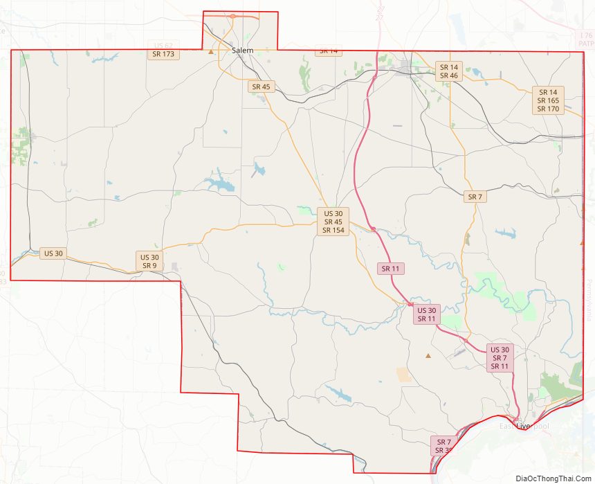
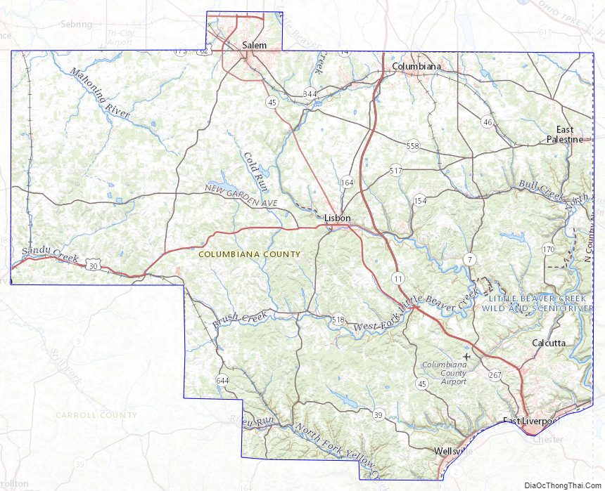
Columbiana County Road Map
Geography
According to the U.S. Census Bureau, the county has a total area of 535 square miles (1,390 km), of which 532 square miles (1,380 km) is land and 2.8 square miles (7.3 km) (0.5%) is water.
Adjacent counties
- Mahoning County (north)
- Lawrence County, Pennsylvania (northeast)
- Beaver County, Pennsylvania (east)
- Hancock County, West Virginia (southeast)
- Jefferson County (south)
- Carroll County (southwest)
- Stark County (west)
Major highways
- US 30
- US 62
- SR 7
- SR 9
- SR 11
- SR 14
- SR 39
- SR 45
- SR 46
- SR 154
- SR 164
- SR 170
- SR 172
- SR 173
- SR 267
- SR 344
- SR 517
- SR 518
- SR 558
- SR 644
Columbiana County Topographic Map
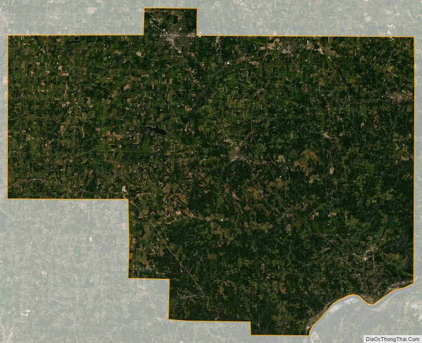
Columbiana County Satellite Map
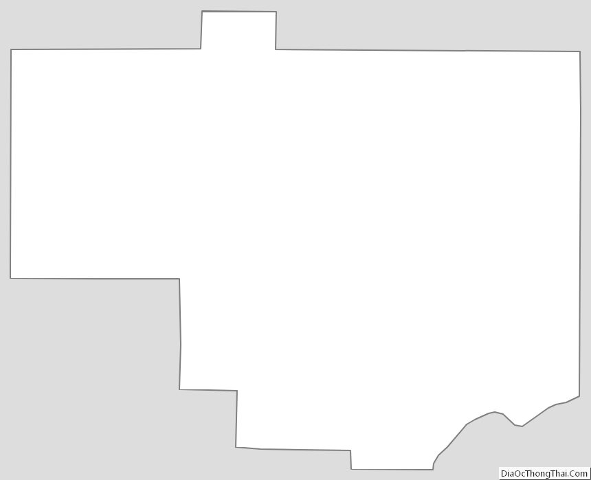
Columbiana County Outline Map
See also
Map of Ohio State and its subdivision:- Adams
- Allen
- Ashland
- Ashtabula
- Athens
- Auglaize
- Belmont
- Brown
- Butler
- Carroll
- Champaign
- Clark
- Clermont
- Clinton
- Columbiana
- Coshocton
- Crawford
- Cuyahoga
- Darke
- Defiance
- Delaware
- Erie
- Fairfield
- Fayette
- Franklin
- Fulton
- Gallia
- Geauga
- Greene
- Guernsey
- Hamilton
- Hancock
- Hardin
- Harrison
- Henry
- Highland
- Hocking
- Holmes
- Huron
- Jackson
- Jefferson
- Knox
- Lake
- Lake Erie
- Lawrence
- Licking
- Logan
- Lorain
- Lucas
- Madison
- Mahoning
- Marion
- Medina
- Meigs
- Mercer
- Miami
- Monroe
- Montgomery
- Morgan
- Morrow
- Muskingum
- Noble
- Ottawa
- Paulding
- Perry
- Pickaway
- Pike
- Portage
- Preble
- Putnam
- Richland
- Ross
- Sandusky
- Scioto
- Seneca
- Shelby
- Stark
- Summit
- Trumbull
- Tuscarawas
- Union
- Van Wert
- Vinton
- Warren
- Washington
- Wayne
- Williams
- Wood
- Wyandot
- Alabama
- Alaska
- Arizona
- Arkansas
- California
- Colorado
- Connecticut
- Delaware
- District of Columbia
- Florida
- Georgia
- Hawaii
- Idaho
- Illinois
- Indiana
- Iowa
- Kansas
- Kentucky
- Louisiana
- Maine
- Maryland
- Massachusetts
- Michigan
- Minnesota
- Mississippi
- Missouri
- Montana
- Nebraska
- Nevada
- New Hampshire
- New Jersey
- New Mexico
- New York
- North Carolina
- North Dakota
- Ohio
- Oklahoma
- Oregon
- Pennsylvania
- Rhode Island
- South Carolina
- South Dakota
- Tennessee
- Texas
- Utah
- Vermont
- Virginia
- Washington
- West Virginia
- Wisconsin
- Wyoming