| Name: | Crane County |
|---|---|
| FIPS code: | 48-103 |
| State: | Texas |
| Founded: | 1927 |
| Named for: | William Carey Crane |
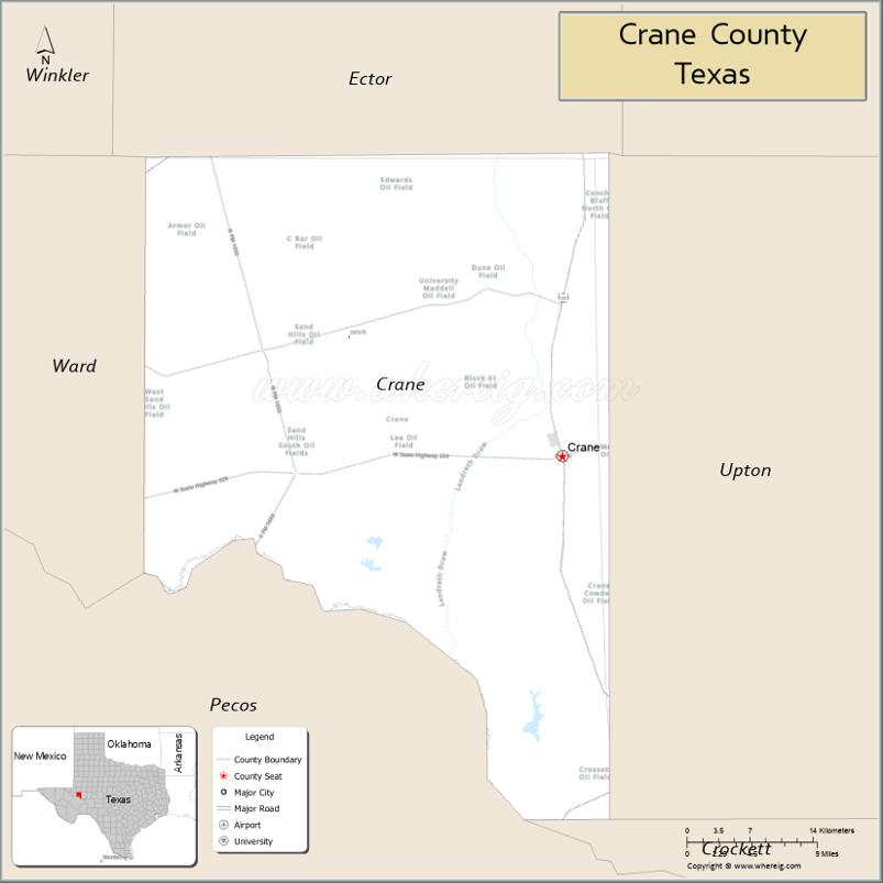
| Seat: | Crane |
| Largest city: | Crane |
| Total Area: | 786 sq mi (2,040 km²) |
| Land Area: | 785 sq mi (2,030 km²) |
| Total Population: | 4,675 |
| Population Density: | 5.9/sq mi (2.3/km²) |
| Time zone: | UTC−6 (Central) |
| Summer Time Zone (DST): | UTC−5 (CDT) |
| Website: | www.co.crane.tx.us |
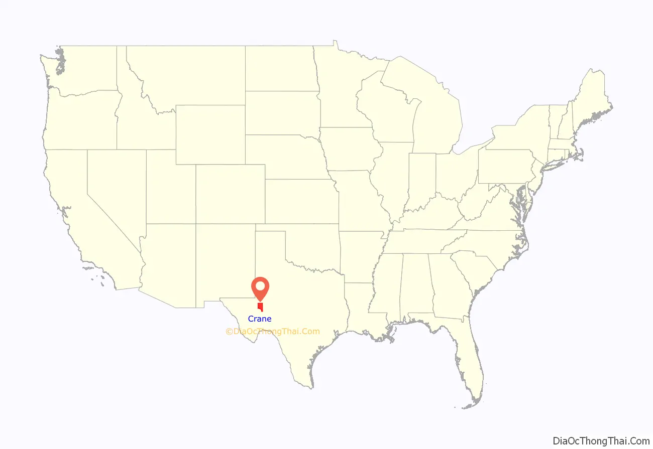
Crane County location map. Where is Crane County?
History
Native Americans
Indigenous peoples were the first inhabitants of the area. Later Indian tribes included Comanches, Lipan Apache, and Kiowa.
County establishment and growth
Crane County was formed in 1887 from Tom Green County, and named after William Carey Crane, former president of Baylor University. Settlement came years later, and the county was not organized until 1927. In 1900, the United States census enumerated only 51 people and 12 ranches in the county. As late as 1918, the county had no roads.
Church and Fields Exploration Company obtained a permit late in 1925 to drill for oil. The first well came in March 1926.
By 1927, an estimated 6,000 people were in the county, with 4,500 of them within the city of Crane. Water was trucked in and brought from $1.00 to $2.25 a barrel, though at times the rates could be as high as $5.00 a barrel. A barrel of drinking water would typically last a month if used judiciously, and barrels of nonpotable water were available for cleaning and washing purposes. Crane City was incorporated in the early 1930s, and with that came state funds for the building of a city water system. At the same time, the Texas Rangers were working to clean up oil towns, and the population in Crane began to include more families. As such, numerous raids by law enforcement closed the red light district centered on Alford Street. By the beginning of 1991, almost 1,552,324,000 barrels (246,799,800 m) of oil had been produced in the county since discovery in 1926.
County history is preserved in the Museum of the Desert Southwest, which opened in Crane in 1980.
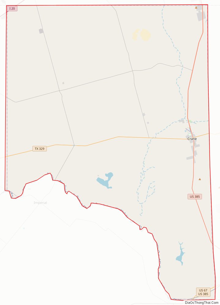
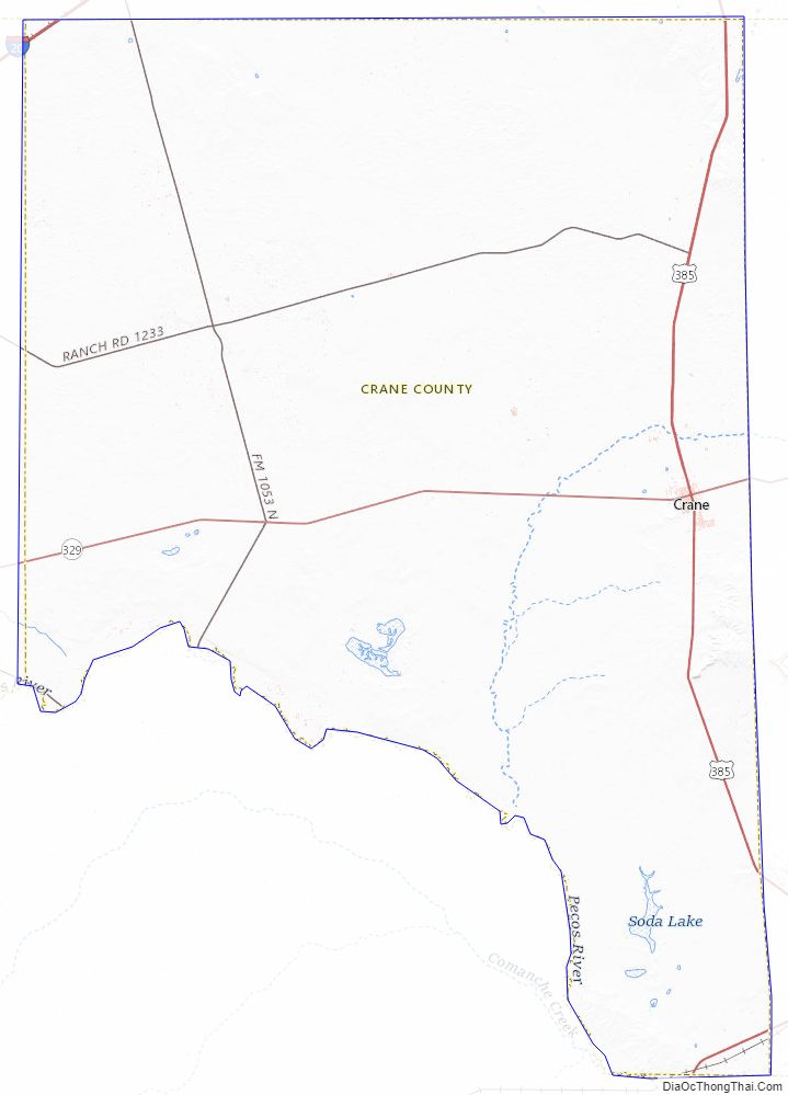
Crane County Road Map
Geography
According to the U.S. Census Bureau, the county has a total area of 786 sq mi (2,040 km), of which 785 sq mi (2,030 km) are land and 0.7 square miles (1.8 km) (0.08%) is covered by water.
Major highways
- U.S. Highway 385
- State Highway 329
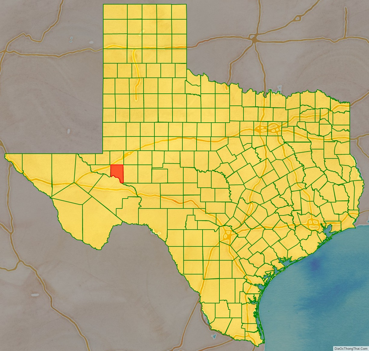
Adjacent counties
- Ector County (north)
- Upton County (east)
- Crockett County (south)
- Pecos County (south)
- Ward County (west)
Crane County Topographic Map
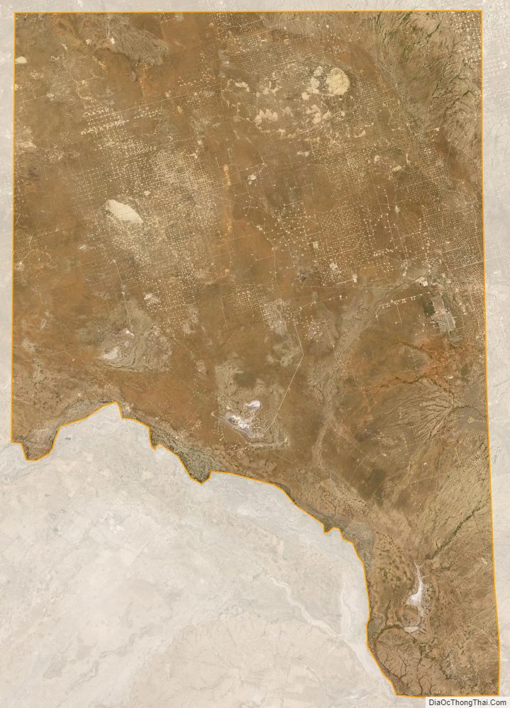
Crane County Satellite Map
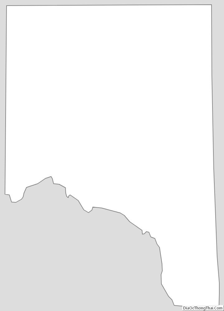
Crane County Outline Map
See also
Map of Texas State and its subdivision:- Anderson
- Andrews
- Angelina
- Aransas
- Archer
- Armstrong
- Atascosa
- Austin
- Bailey
- Bandera
- Bastrop
- Baylor
- Bee
- Bell
- Bexar
- Blanco
- Borden
- Bosque
- Bowie
- Brazoria
- Brazos
- Brewster
- Briscoe
- Brooks
- Brown
- Burleson
- Burnet
- Caldwell
- Calhoun
- Callahan
- Cameron
- Camp
- Carson
- Cass
- Castro
- Chambers
- Cherokee
- Childress
- Clay
- Cochran
- Coke
- Coleman
- Collin
- Collingsworth
- Colorado
- Comal
- Comanche
- Concho
- Cooke
- Coryell
- Cottle
- Crane
- Crockett
- Crosby
- Culberson
- Dallam
- Dallas
- Dawson
- Deaf Smith
- Delta
- Denton
- Dewitt
- Dickens
- Dimmit
- Donley
- Duval
- Eastland
- Ector
- Edwards
- El Paso
- Ellis
- Erath
- Falls
- Fannin
- Fayette
- Fisher
- Floyd
- Foard
- Fort Bend
- Franklin
- Freestone
- Frio
- Gaines
- Galveston
- Garza
- Gillespie
- Glasscock
- Goliad
- Gonzales
- Gray
- Grayson
- Gregg
- Grimes
- Guadalupe
- Hale
- Hall
- Hamilton
- Hansford
- Hardeman
- Hardin
- Harris
- Harrison
- Hartley
- Haskell
- Hays
- Hemphill
- Henderson
- Hidalgo
- Hill
- Hockley
- Hood
- Hopkins
- Houston
- Howard
- Hudspeth
- Hunt
- Hutchinson
- Irion
- Jack
- Jackson
- Jasper
- Jeff Davis
- Jefferson
- Jim Hogg
- Jim Wells
- Johnson
- Jones
- Karnes
- Kaufman
- Kendall
- Kenedy
- Kent
- Kerr
- Kimble
- King
- Kinney
- Kleberg
- Knox
- La Salle
- Lamar
- Lamb
- Lampasas
- Lavaca
- Lee
- Leon
- Liberty
- Limestone
- Lipscomb
- Live Oak
- Llano
- Loving
- Lubbock
- Lynn
- Madison
- Marion
- Martin
- Mason
- Matagorda
- Maverick
- McCulloch
- McLennan
- McMullen
- Medina
- Menard
- Midland
- Milam
- Mills
- Mitchell
- Montague
- Montgomery
- Moore
- Morris
- Motley
- Nacogdoches
- Navarro
- Newton
- Nolan
- Nueces
- Ochiltree
- Oldham
- Orange
- Palo Pinto
- Panola
- Parker
- Parmer
- Pecos
- Polk
- Potter
- Presidio
- Rains
- Randall
- Reagan
- Real
- Red River
- Reeves
- Refugio
- Roberts
- Robertson
- Rockwall
- Runnels
- Rusk
- Sabine
- San Augustine
- San Jacinto
- San Patricio
- San Saba
- Schleicher
- Scurry
- Shackelford
- Shelby
- Sherman
- Smith
- Somervell
- Starr
- Stephens
- Sterling
- Stonewall
- Sutton
- Swisher
- Tarrant
- Taylor
- Terrell
- Terry
- Throckmorton
- Titus
- Tom Green
- Travis
- Trinity
- Tyler
- Upshur
- Upton
- Uvalde
- Val Verde
- Van Zandt
- Victoria
- Walker
- Waller
- Ward
- Washington
- Webb
- Wharton
- Wheeler
- Wichita
- Wilbarger
- Willacy
- Williamson
- Wilson
- Winkler
- Wise
- Wood
- Yoakum
- Young
- Zapata
- Zavala
- Alabama
- Alaska
- Arizona
- Arkansas
- California
- Colorado
- Connecticut
- Delaware
- District of Columbia
- Florida
- Georgia
- Hawaii
- Idaho
- Illinois
- Indiana
- Iowa
- Kansas
- Kentucky
- Louisiana
- Maine
- Maryland
- Massachusetts
- Michigan
- Minnesota
- Mississippi
- Missouri
- Montana
- Nebraska
- Nevada
- New Hampshire
- New Jersey
- New Mexico
- New York
- North Carolina
- North Dakota
- Ohio
- Oklahoma
- Oregon
- Pennsylvania
- Rhode Island
- South Carolina
- South Dakota
- Tennessee
- Texas
- Utah
- Vermont
- Virginia
- Washington
- West Virginia
- Wisconsin
- Wyoming