Crawford County is a county in the Commonwealth of Pennsylvania. As of the 2020 census, the population was 83,938. Its county seat is Meadville. The county was created on March 12, 1800, from part of Allegheny County and named for Colonel William Crawford.
Crawford County comprises the Meadville, PA Micropolitan Statistical Area, which is also included in the Erie-Meadville, PA Combined Statistical Area.
| Name: | Crawford County |
|---|---|
| FIPS code: | 42-039 |
| State: | Pennsylvania |
| Founded: | March 12, 1800 |
| Named for: | William Crawford |
| Seat: | Meadville |
| Largest city: | Meadville |
| Total Area: | 1,038 sq mi (2,690 km²) |
| Land Area: | 1,012 sq mi (2,620 km²) |
| Total Population: | 83,938 |
| Population Density: | 81/sq mi (31/km²) |
| Time zone: | UTC−5 (Eastern) |
| Summer Time Zone (DST): | UTC−4 (EDT) |
| Website: | www.crawfordcountypa.net |
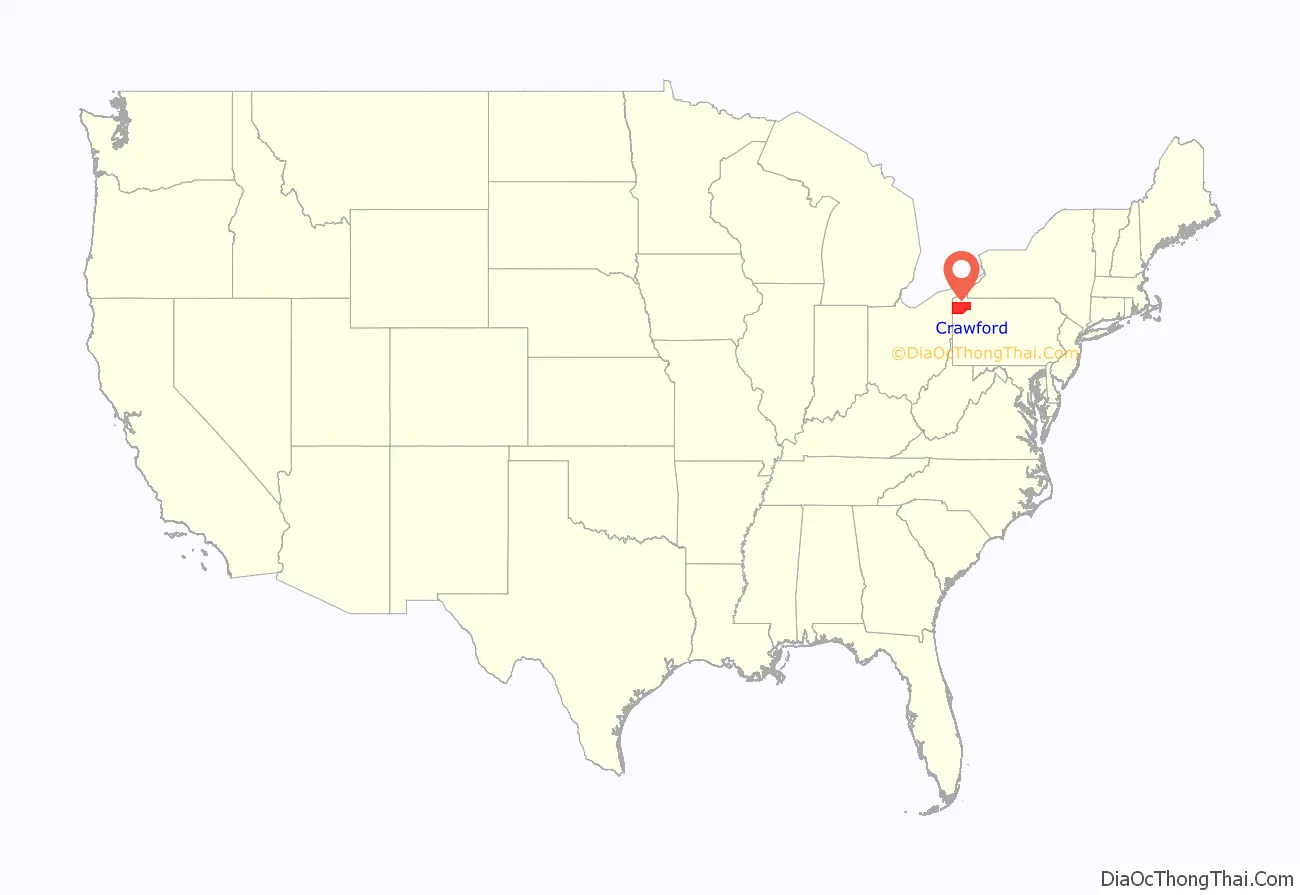
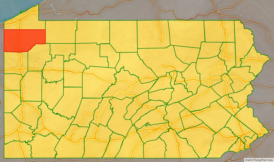
Crawford County location map. Where is Crawford County?
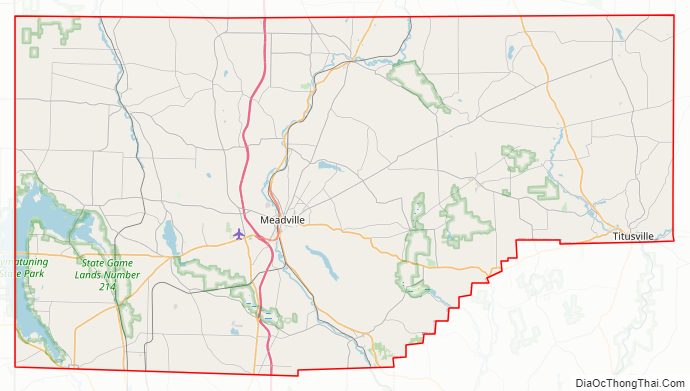
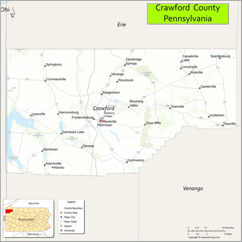
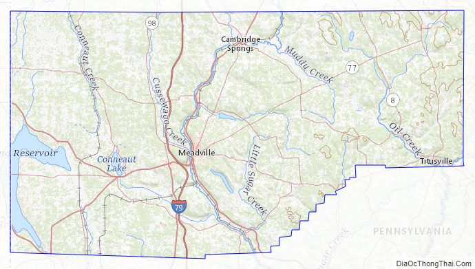
Crawford County Road Map
Geography
According to the U.S. Census Bureau, the county has a total area of 1,038 square miles (2,690 km), of which 1,012 square miles (2,620 km) is land and 25 square miles (65 km) (2.4%) is water. It has a warm-summer humid continental climate (Dfb) and average monthly temperatures in Meadville range from 24.9 °F in January to 69.5 °F in July, while in Titusville they range from 24.2 °F in January to 68.8 °F in July. [1]
Adjacent counties
- Erie County (north)
- Warren County (east)
- Venango County (southeast)
- Mercer County (south)
- Trumbull County, Ohio (southwest)
- Ashtabula County, Ohio (west)
National protected area
- Erie National Wildlife Refuge
State protected area
Pymatuning State Park is on Pymatuning Reservoir.
Major highways
- I-79
- US 6
- US 19
- US 322
- PA 8
- PA 8 Truck
- PA 18
- PA 27
- PA 27 Truck
- PA 77
- PA 86
- PA 89
- PA 98
- PA 99
- PA 102
- PA 173
- PA 198
- PA 285
- PA 408
- PA 428
Crawford County Topographic Map
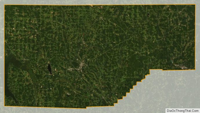
Crawford County Satellite Map
Crawford County Outline Map

See also
Map of Pennsylvania State and its subdivision:- Adams
- Allegheny
- Armstrong
- Beaver
- Bedford
- Berks
- Blair
- Bradford
- Bucks
- Butler
- Cambria
- Cameron
- Carbon
- Centre
- Chester
- Clarion
- Clearfield
- Clinton
- Columbia
- Crawford
- Cumberland
- Dauphin
- Delaware
- Elk
- Erie
- Fayette
- Forest
- Franklin
- Fulton
- Greene
- Huntingdon
- Indiana
- Jefferson
- Juniata
- Lackawanna
- Lancaster
- Lawrence
- Lebanon
- Lehigh
- Luzerne
- Lycoming
- Mc Kean
- Mercer
- Mifflin
- Monroe
- Montgomery
- Montour
- Northampton
- Northumberland
- Perry
- Philadelphia
- Pike
- Potter
- Schuylkill
- Snyder
- Somerset
- Sullivan
- Susquehanna
- Tioga
- Union
- Venango
- Warren
- Washington
- Wayne
- Westmoreland
- Wyoming
- York
- Alabama
- Alaska
- Arizona
- Arkansas
- California
- Colorado
- Connecticut
- Delaware
- District of Columbia
- Florida
- Georgia
- Hawaii
- Idaho
- Illinois
- Indiana
- Iowa
- Kansas
- Kentucky
- Louisiana
- Maine
- Maryland
- Massachusetts
- Michigan
- Minnesota
- Mississippi
- Missouri
- Montana
- Nebraska
- Nevada
- New Hampshire
- New Jersey
- New Mexico
- New York
- North Carolina
- North Dakota
- Ohio
- Oklahoma
- Oregon
- Pennsylvania
- Rhode Island
- South Carolina
- South Dakota
- Tennessee
- Texas
- Utah
- Vermont
- Virginia
- Washington
- West Virginia
- Wisconsin
- Wyoming