| Name: | Crittenden County |
|---|---|
| FIPS code: | 05-035 |
| State: | Arkansas |
| Founded: | October 22, 1825 |
| Named for: | Robert Crittenden |
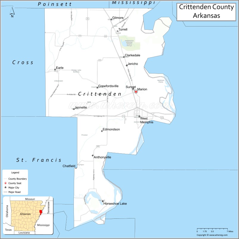
| Seat: | Marion |
| Largest city: | West Memphis |
| Total Area: | 636 sq mi (1,650 km²) |
| Land Area: | 610 sq mi (1,600 km²) |
| Total Population: | 48,163 |
| Population Density: | 76/sq mi (29/km²) |
| Time zone: | UTC−6 (Central) |
| Summer Time Zone (DST): | UTC−5 (CDT) |
| Website: | crittenden.ark.org |
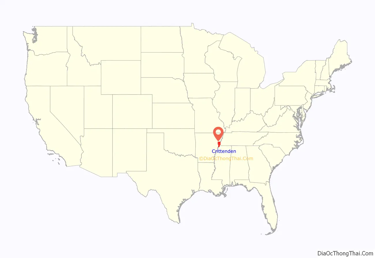
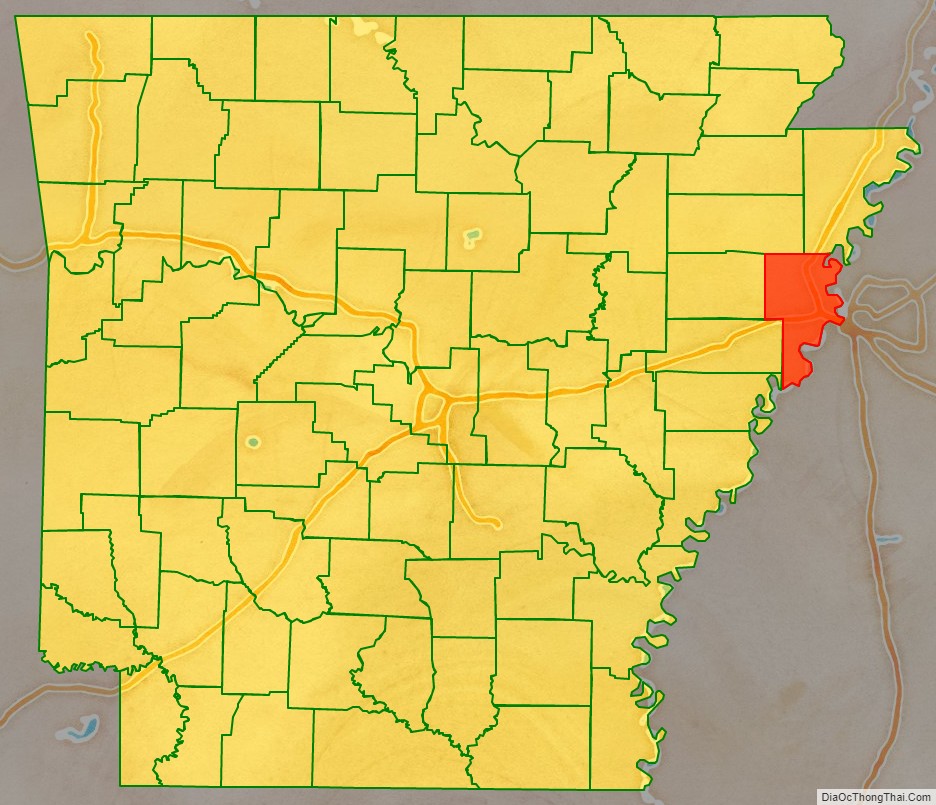
Crittenden County location map. Where is Crittenden County?
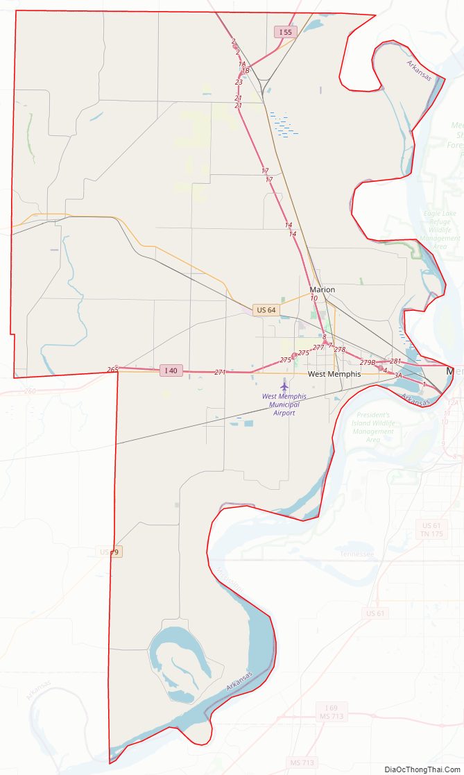
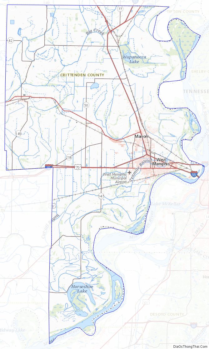
Crittenden County Road Map
Geography
According to the U.S. Census Bureau, the county has a total area of 636 square miles (1,650 km), of which 610 square miles (1,600 km) is land and 27 square miles (70 km) (4.2%) is water.
Adjacent counties
- Mississippi County (northeast)
- Tipton County, Tennessee (east)
- Shelby County, Tennessee (east)
- DeSoto County, Mississippi (southeast)
- Tunica County, Mississippi (south)
- Lee County (southwest)
- St. Francis County (west)
- Cross County (west)
- Poinsett County (northwest)
National protected area
- Wapanocca National Wildlife Refuge
Crittenden County Topographic Map
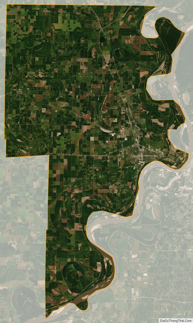
Crittenden County Satellite Map
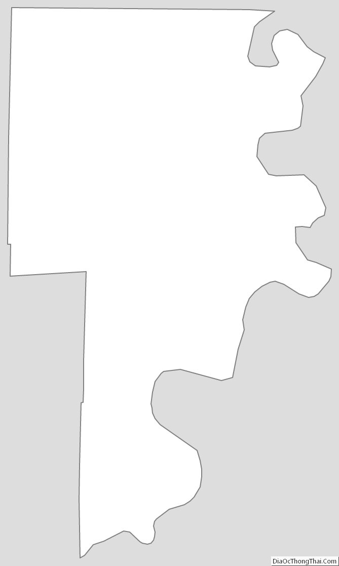
Crittenden County Outline Map
See also
Map of Arkansas State and its subdivision:- Arkansas
- Ashley
- Baxter
- Benton
- Boone
- Bradley
- Calhoun
- Carroll
- Chicot
- Clark
- Clay
- Cleburne
- Cleveland
- Columbia
- Conway
- Craighead
- Crawford
- Crittenden
- Cross
- Dallas
- Desha
- Drew
- Faulkner
- Franklin
- Fulton
- Garland
- Grant
- Greene
- Hempstead
- Hot Spring
- Howard
- Independence
- Izard
- Jackson
- Jefferson
- Johnson
- Lafayette
- Lawrence
- Lee
- Lincoln
- Little River
- Logan
- Lonoke
- Madison
- Marion
- Miller
- Mississippi
- Monroe
- Montgomery
- Nevada
- Newton
- Ouachita
- Perry
- Phillips
- Pike
- Poinsett
- Polk
- Pope
- Prairie
- Pulaski
- Randolph
- Saint Francis
- Saline
- Scott
- Searcy
- Sebastian
- Sevier
- Sharp
- Stone
- Union
- Van Buren
- Washington
- White
- Woodruff
- Yell
- Alabama
- Alaska
- Arizona
- Arkansas
- California
- Colorado
- Connecticut
- Delaware
- District of Columbia
- Florida
- Georgia
- Hawaii
- Idaho
- Illinois
- Indiana
- Iowa
- Kansas
- Kentucky
- Louisiana
- Maine
- Maryland
- Massachusetts
- Michigan
- Minnesota
- Mississippi
- Missouri
- Montana
- Nebraska
- Nevada
- New Hampshire
- New Jersey
- New Mexico
- New York
- North Carolina
- North Dakota
- Ohio
- Oklahoma
- Oregon
- Pennsylvania
- Rhode Island
- South Carolina
- South Dakota
- Tennessee
- Texas
- Utah
- Vermont
- Virginia
- Washington
- West Virginia
- Wisconsin
- Wyoming