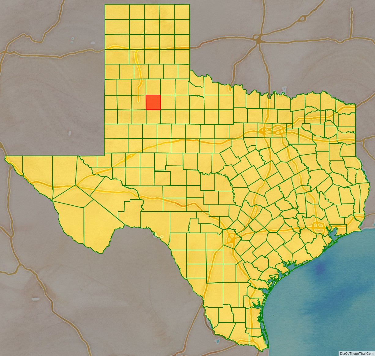
Crosby County is a county located in the U.S. state of Texas. As of the 2020 census, its population was 5,133. The county seat is Crosbyton. The county was founded in 1876 and later organized in 1886. Both the county and its seat are named for Stephen Crosby, a land commissioner in Texas.
Crosby County, along with Lubbock and Lynn Counties, is part of the Lubbock Metropolitan Statistical Area (MSA). The Lubbock MSA and Levelland Micropolitan Statistical Area (µSA), encompassing only Hockley County, form the larger Lubbock–Levelland Combined Statistical Area.
Until the passage of a referendum to permit liquor sales, held on May 11, 2013, Crosby County had been one of 19 remaining prohibition or entirely dry counties within Texas. That same day, voters in Denver City and Yoakum County also approved separate referendums to permit liquor sales. The number of prohibition counties in Texas at that time hence dropped to 17. Part of the large Matador Ranch of West Texas extends into the county.
| Name: | Crosby County |
|---|---|
| FIPS code: | 48-107 |
| State: | Texas |
| Founded: | 1886 |
| Named for: | Stephen Crosby |
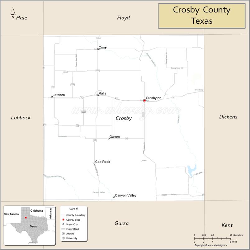
| Seat: | Crosbyton |
| Largest city: | Crosbyton |
| Total Area: | 902 sq mi (2,340 km²) |
| Land Area: | 900 sq mi (2,000 km²) |
| Total Population: | 5,133 |
| Population Density: | 5.7/sq mi (2.2/km²) |
| Time zone: | UTC−6 (Central) |
| Summer Time Zone (DST): | UTC−5 (CDT) |
| Website: | www.co.crosby.tx.us |
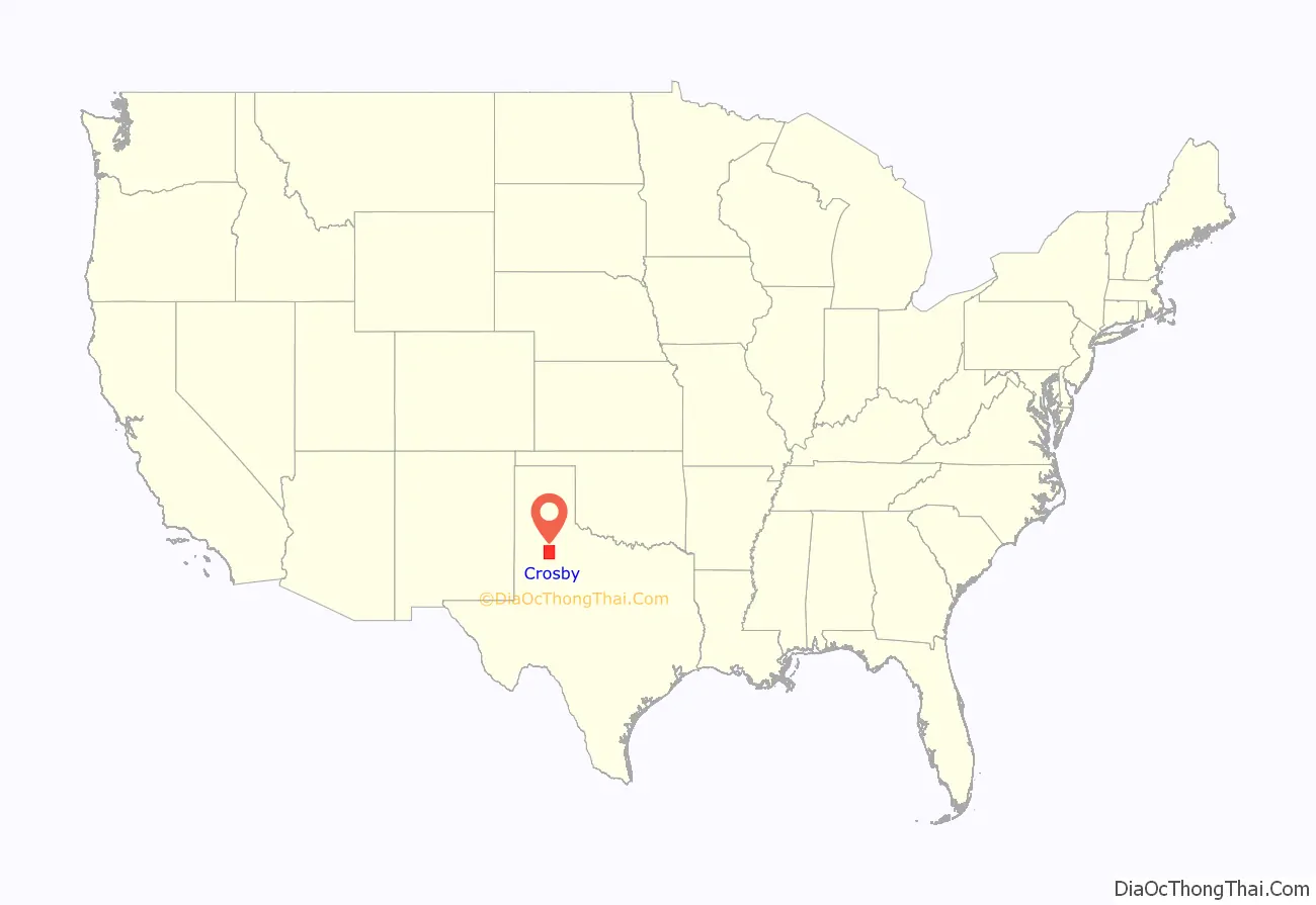
Crosby County location map. Where is Crosby County?
History
Around 11,000 BC, Paleo-Indians were the first inhabitants. Archeological artifacts indicate hunter-gatherers hunted the mammoth, mastodon, saber-toothed cat, and giant ground sloth. Later Native American inhabitants included the Comanche. In 1871, Ranald S. Mackenzie fought Quanah Parker and other Comanches at the Battle of Blanco Canyon. The campaign established the Mackenzie Trail used by the first settlers in Crosby County in the late 1870s.
The Texas Legislature formed Crosby County from Young and Bexar districts in 1876. Bavarian Heinrich Schmidtt (Henry “Hank” Clay Smith) and his wife Elizabeth Boyle and their six children became the first permanent settlers in the area in 1878; Hank was active in the county’s organization.
Confederate veteran Paris Cox first visited the Caprock Escarpment of the Llano Estacado with a group of buffalo hunters in 1879. Estacado was named the county seat in 1886. By 1900, the beef industry was thriving, supporting 30,618 head.
The country and western song (Ghost) Riders in the Sky was inspired by a legend of a stampede that took place in Crosby County in 1889 reference https://texashillcountry.com/legend-ghost-riders/
In 1908, the Bar-N-Bar Ranch began selling acreage to farmers.
Crosbyton became the new county seat in 1910. Some 45,400 acres (184 km) in the county were planted in cotton, and 15,000 apple and peach trees were growing in the county in 1920. By 1929, farmers owned 83,000 chickens and sold 395,000 dozen eggs that year.
The first soil conservation district in the county was formed in 1941. In 1955, oil was discovered in the county.
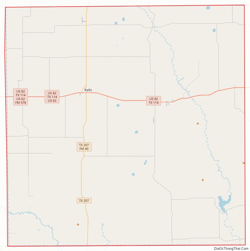
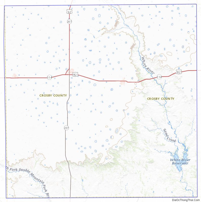
Crosby County Road Map
Geography
According to the U.S. Census Bureau, the county has a total area of 902 square miles (2,340 km), of which 900 square miles (2,300 km) are land and 1.5 square miles (3.9 km) (0.2%) are covered by water.
Major highways
- U.S. Highway 62
- U.S. Highway 82/State Highway 114
- State Highway 207
Adjacent counties
- Floyd County (north)
- Motley County (northeast)
- Dickens County (east)
- Kent County (southeast)
- Garza County (south)
- Lynn County (southwest)
- Lubbock County (west)
- Hale County (northwest)
Geographic features
- Blanco Canyon
- White River, Silver Falls
- Mount Blanco
- Caprock Escarpment
Crosby County Topographic Map
Crosby County Satellite Map

Crosby County Outline Map

See also
Map of Texas State and its subdivision:- Anderson
- Andrews
- Angelina
- Aransas
- Archer
- Armstrong
- Atascosa
- Austin
- Bailey
- Bandera
- Bastrop
- Baylor
- Bee
- Bell
- Bexar
- Blanco
- Borden
- Bosque
- Bowie
- Brazoria
- Brazos
- Brewster
- Briscoe
- Brooks
- Brown
- Burleson
- Burnet
- Caldwell
- Calhoun
- Callahan
- Cameron
- Camp
- Carson
- Cass
- Castro
- Chambers
- Cherokee
- Childress
- Clay
- Cochran
- Coke
- Coleman
- Collin
- Collingsworth
- Colorado
- Comal
- Comanche
- Concho
- Cooke
- Coryell
- Cottle
- Crane
- Crockett
- Crosby
- Culberson
- Dallam
- Dallas
- Dawson
- Deaf Smith
- Delta
- Denton
- Dewitt
- Dickens
- Dimmit
- Donley
- Duval
- Eastland
- Ector
- Edwards
- El Paso
- Ellis
- Erath
- Falls
- Fannin
- Fayette
- Fisher
- Floyd
- Foard
- Fort Bend
- Franklin
- Freestone
- Frio
- Gaines
- Galveston
- Garza
- Gillespie
- Glasscock
- Goliad
- Gonzales
- Gray
- Grayson
- Gregg
- Grimes
- Guadalupe
- Hale
- Hall
- Hamilton
- Hansford
- Hardeman
- Hardin
- Harris
- Harrison
- Hartley
- Haskell
- Hays
- Hemphill
- Henderson
- Hidalgo
- Hill
- Hockley
- Hood
- Hopkins
- Houston
- Howard
- Hudspeth
- Hunt
- Hutchinson
- Irion
- Jack
- Jackson
- Jasper
- Jeff Davis
- Jefferson
- Jim Hogg
- Jim Wells
- Johnson
- Jones
- Karnes
- Kaufman
- Kendall
- Kenedy
- Kent
- Kerr
- Kimble
- King
- Kinney
- Kleberg
- Knox
- La Salle
- Lamar
- Lamb
- Lampasas
- Lavaca
- Lee
- Leon
- Liberty
- Limestone
- Lipscomb
- Live Oak
- Llano
- Loving
- Lubbock
- Lynn
- Madison
- Marion
- Martin
- Mason
- Matagorda
- Maverick
- McCulloch
- McLennan
- McMullen
- Medina
- Menard
- Midland
- Milam
- Mills
- Mitchell
- Montague
- Montgomery
- Moore
- Morris
- Motley
- Nacogdoches
- Navarro
- Newton
- Nolan
- Nueces
- Ochiltree
- Oldham
- Orange
- Palo Pinto
- Panola
- Parker
- Parmer
- Pecos
- Polk
- Potter
- Presidio
- Rains
- Randall
- Reagan
- Real
- Red River
- Reeves
- Refugio
- Roberts
- Robertson
- Rockwall
- Runnels
- Rusk
- Sabine
- San Augustine
- San Jacinto
- San Patricio
- San Saba
- Schleicher
- Scurry
- Shackelford
- Shelby
- Sherman
- Smith
- Somervell
- Starr
- Stephens
- Sterling
- Stonewall
- Sutton
- Swisher
- Tarrant
- Taylor
- Terrell
- Terry
- Throckmorton
- Titus
- Tom Green
- Travis
- Trinity
- Tyler
- Upshur
- Upton
- Uvalde
- Val Verde
- Van Zandt
- Victoria
- Walker
- Waller
- Ward
- Washington
- Webb
- Wharton
- Wheeler
- Wichita
- Wilbarger
- Willacy
- Williamson
- Wilson
- Winkler
- Wise
- Wood
- Yoakum
- Young
- Zapata
- Zavala
- Alabama
- Alaska
- Arizona
- Arkansas
- California
- Colorado
- Connecticut
- Delaware
- District of Columbia
- Florida
- Georgia
- Hawaii
- Idaho
- Illinois
- Indiana
- Iowa
- Kansas
- Kentucky
- Louisiana
- Maine
- Maryland
- Massachusetts
- Michigan
- Minnesota
- Mississippi
- Missouri
- Montana
- Nebraska
- Nevada
- New Hampshire
- New Jersey
- New Mexico
- New York
- North Carolina
- North Dakota
- Ohio
- Oklahoma
- Oregon
- Pennsylvania
- Rhode Island
- South Carolina
- South Dakota
- Tennessee
- Texas
- Utah
- Vermont
- Virginia
- Washington
- West Virginia
- Wisconsin
- Wyoming