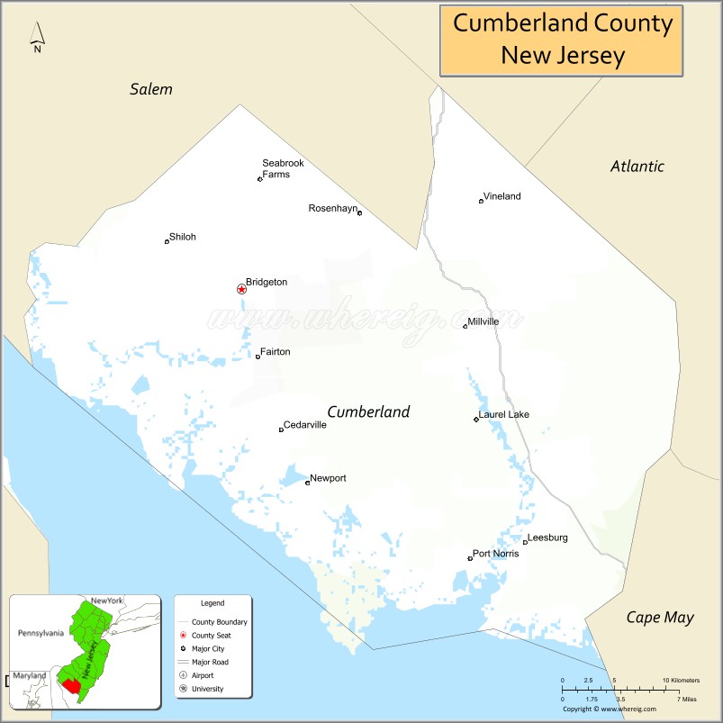
| Name: | Cumberland County |
|---|---|
| FIPS code: | 34-011 |
| State: | New Jersey |
| Founded: | 1748 |
| Named for: | Prince William, Duke of Cumberland |
| Seat: | Bridgeton |
| Total Area: | 677.62 sq mi (1,755.0 km²) |
| Land Area: | 483.70 sq mi (1,252.8 km²) |
| Total Population: | 154,152 |
| Population Density: | 318.9/sq mi (123.1/km²) |
| Website: | co.cumberland.nj.us |
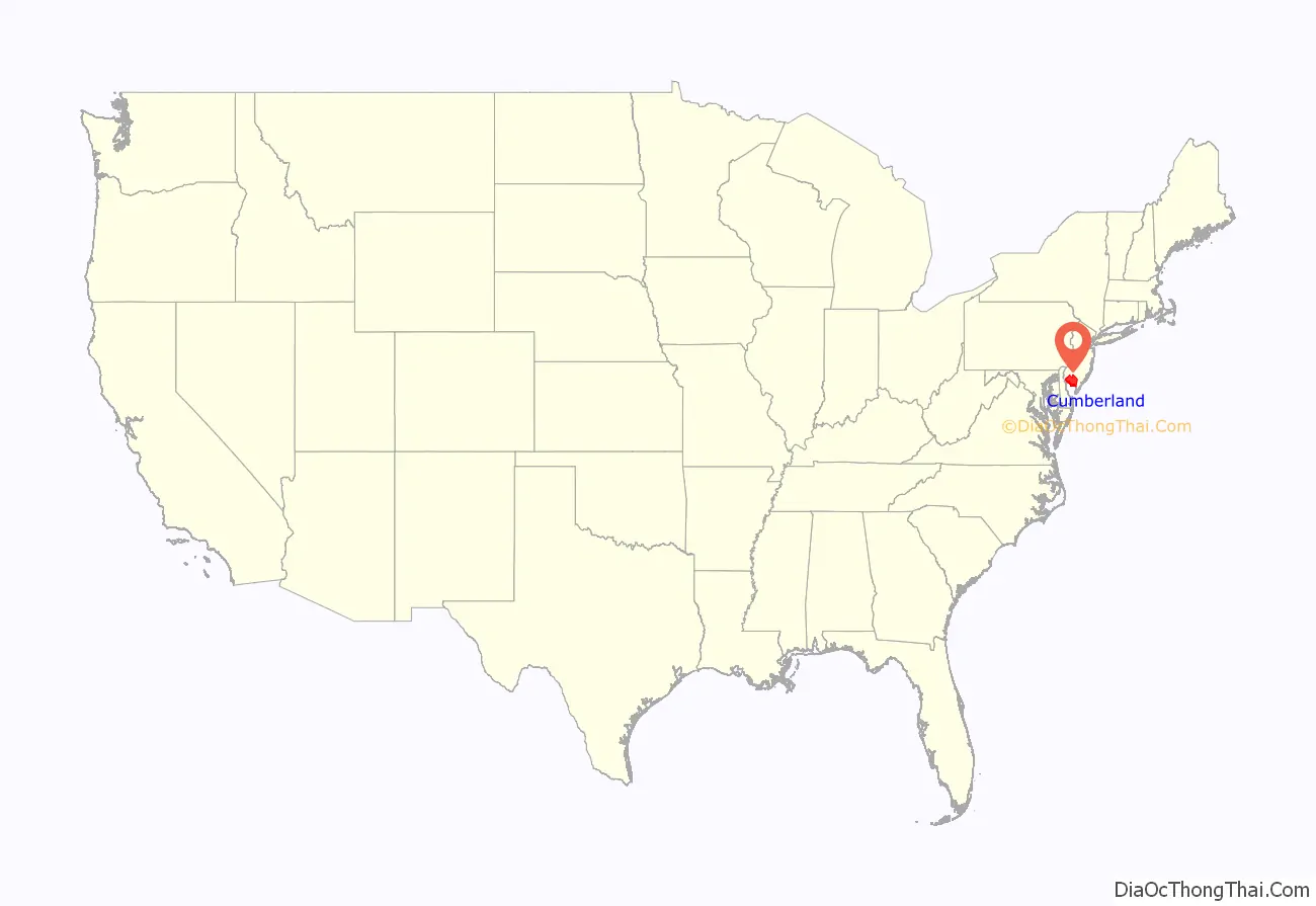
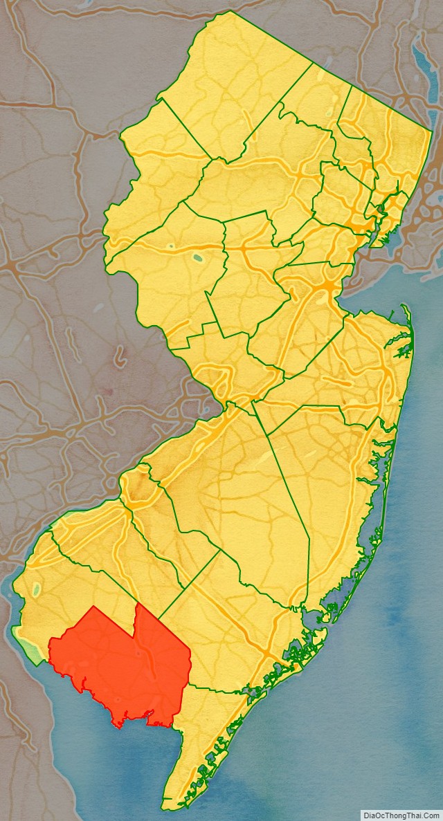
Cumberland County location map. Where is Cumberland County?
History
Etymology
The county is named for Prince William, Duke of Cumberland who is best remembered for his role in putting down the Jacobite Rising at the Battle of Culloden in 1746, which made him immensely popular throughout parts of Britain.
Pre-settlement
The first people to populate Cumberland County were early descendants of the Lenape, also known as the Delaware, who include all Native American people who have lived in New Jersey Water sources such as the Cohansey River and Maurice River made Cumberland County a resourceful environment for early native groups to utilize. Archaeological materials such as stone tools and pottery have been excavated in sites in Bridgeton, Fairfield, Greenwich and Stow Creek. Some of the earliest cultures that inhabited Cumberland County utilized clovis spear points which date to the Paleoindian period (10,000 BC to 8000 BC). As the climate switched from a tundra to woodlands during the archaic period (8000 BC to 1000 BC), ancestors of the Lenape developed axe technology, and later pottery during the woodland period (1000 BC to 1600 AD). The prehistoric period ended when European conquest arrived in the area bringing with it disease and warfare which ultimately killed or displaced much of the Native populations. Today, many Lenape people still reside in Cumberland County, such as the Nanticoke tribe who make up the Native American people from Southern New Jersey and the Delmarva Peninsula.
History
Early European settlement began with the Swedish who called what is now New Jersey New Sweden during the first half of the 17th century. Prior to the United States gaining its independence from Great Britain, Cumberland County was deemed separate from Salem County, and was named after the Duke of Cumberland in 1748. Cumberland County’s economic exploits were agricultural and manufacturing, more specifically the county focused on fruits and vegetables, as well as glassware and preserved foods.
America’s early successes in glassmaking began in Southern New Jersey during the 18th century and eventually led to John Landis Mason of Vineland New Jersey to invent the mason jar for storing and preserving food at home during the 1850s. Cumberland County’s population has historically been “majority-minority”. Cumberland County went from holding one hundred and twenty enslaved people in 1790, to two by 1830. Cumberland County included several towns settled by Black Americans many of whom escaped slavery. Parts of the county were used for the Underground Railroad, and housed Harriet Tubman and William Still.
Maritime history
Along with agriculture and glassware, Cumberland County is also known for its maritime industries. Cumberland County’s main maritime export was oysters until the 1950s when disease destroyed the oyster population. With the oyster industry came shipbuilding in 1780. Later, the industrial revolution and railroad development increased the number of ships and the types of ships being made. By the late 19th century, ships switched from the sloop model to the schooner to be more useful for oystering. Whaling was also an industry in Cumberland County until 1775 when settlers turned to raising, farming, and trapping. Caviar was a short-lived industry in the area from the 1860s to 1925, when sturgeon had been overfished. 19th and 20th century maritime related artifacts such as ship models, building plans, tools, and rigging equipment can be viewed at the John Dubois Maritime Museum in Bridgeton.
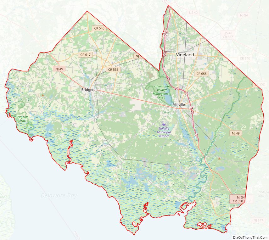
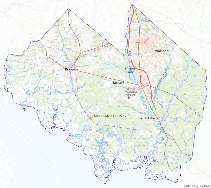
Cumberland County Road Map
Geography
According to the 2010 census, the county had a total area of 677.62 square miles (1,755.0 km), including 483.70 square miles (1,252.8 km) of land (71.4%) and 193.92 square miles (502.3 km) of water (28.6%). Cumberland is a low-lying, generally featureless coastal county, with many salt marshes near the Delaware Bay. The highest elevation is at one of 12 areas in Upper Deerfield Township that stand approximately 140 feet (43 m) above sea level; the lowest elevation is sea level.
Climate and weather
In recent years, average temperatures in the county seat of Bridgeton have ranged from a low of 25 °F (−4 °C) in January to a high of 87 °F (31 °C) in July, although a record low of −13 °F (−25 °C) was recorded in January 1985 and a record high of 101 °F (38 °C) was recorded in July 1966. Average monthly precipitation ranged from 2.94 inches (75 mm) in February to 4.30 inches (109 mm) in March. Cumberland has a humid subtropical climate (Cfa).
Cumberland County Topographic Map
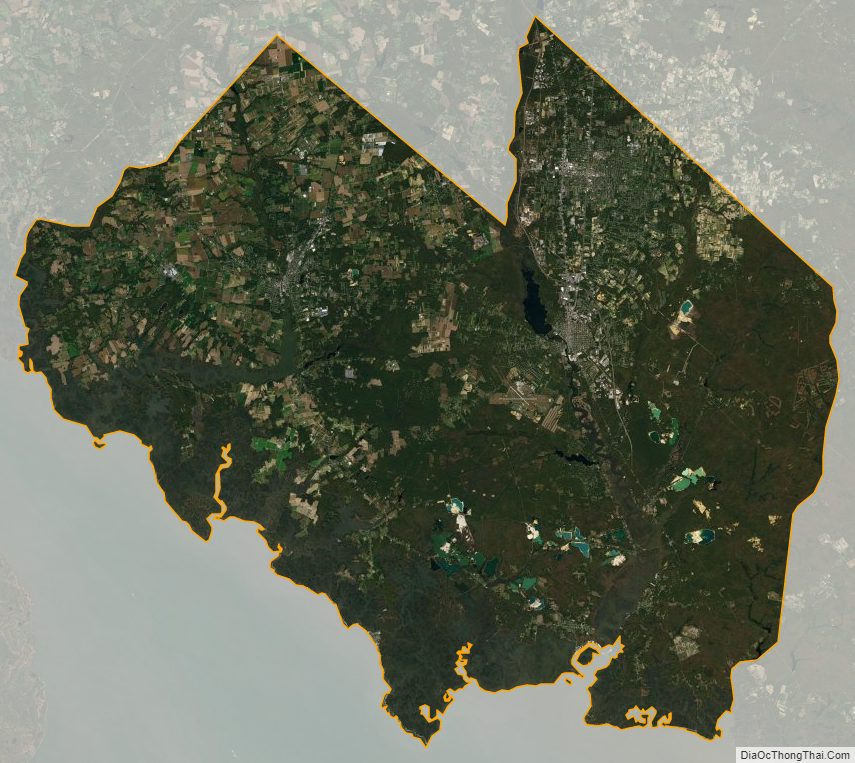
Cumberland County Satellite Map
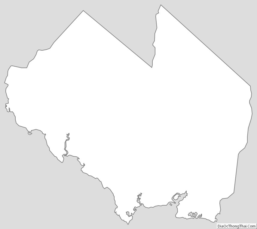
Cumberland County Outline Map
See also
Map of New Jersey State and its subdivision: Map of other states:- Alabama
- Alaska
- Arizona
- Arkansas
- California
- Colorado
- Connecticut
- Delaware
- District of Columbia
- Florida
- Georgia
- Hawaii
- Idaho
- Illinois
- Indiana
- Iowa
- Kansas
- Kentucky
- Louisiana
- Maine
- Maryland
- Massachusetts
- Michigan
- Minnesota
- Mississippi
- Missouri
- Montana
- Nebraska
- Nevada
- New Hampshire
- New Jersey
- New Mexico
- New York
- North Carolina
- North Dakota
- Ohio
- Oklahoma
- Oregon
- Pennsylvania
- Rhode Island
- South Carolina
- South Dakota
- Tennessee
- Texas
- Utah
- Vermont
- Virginia
- Washington
- West Virginia
- Wisconsin
- Wyoming