Custer County is a county located in the U.S. state of Colorado. As of the 2020 census, the population was 4,704. The county seat is Westcliffe.
| Name: | Custer County |
|---|---|
| FIPS code: | 08-027 |
| State: | Colorado |
| Founded: | March 9, 1877 |
| Named for: | George Armstrong Custer |
| Seat: | Westcliffe |
| Largest town: | Silver Cliff |
| Total Area: | 740 sq mi (1,900 km²) |
| Land Area: | 739 sq mi (1,910 km²) |
| Total Population: | 5,045 |
| Population Density: | 6.4/sq mi (2.5/km²) |
| Time zone: | UTC−7 (Mountain) |
| Summer Time Zone (DST): | UTC−6 (MDT) |
| Website: | custercountygov.com |
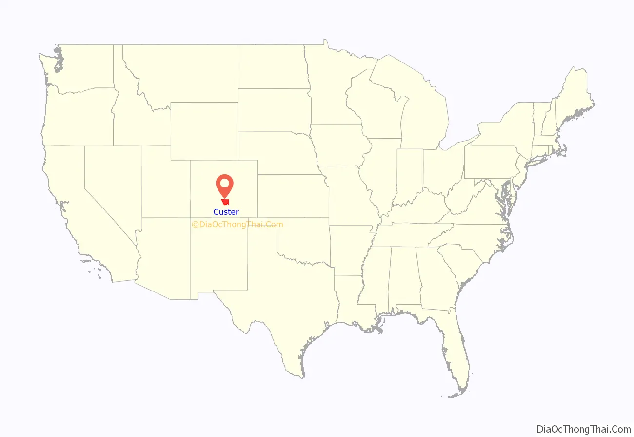
Custer County location map. Where is Custer County?
History
Custer County was created by the Colorado legislature on March 9, 1877, out of the southern half of Fremont County. It was named in honor of Lt. Colonel George Armstrong Custer, who had died the previous year. Originally set in Ula, the county seat moved to Rosita in 1878, and to Silver Cliff in 1886 before settling in Westcliffe in 1928.
The county was the site of a silver rush during the 1870s. Thousands of men poured into the county during this time in the hunt for silver. Some of the notable mines include the Geyser Mine (on the north edge of the town of Silver Cliff), the Bassick Mine (near the ghost town of Querida) and the Bull Domingo (north of Silver Cliff).
During the late 19th century a railroad line was connected through the Grape Creek Canyon but was permanently closed after a few disastrous floods. The old railhouse has been turned into a historical landmark in the town of Westcliffe.
After the mines were exhausted, the population dropped considerably and was replaced by cattle ranchers. An extensive system of irrigation ditches was built throughout the valley. Ranching in the Wet Mountain Valley continues to this day.
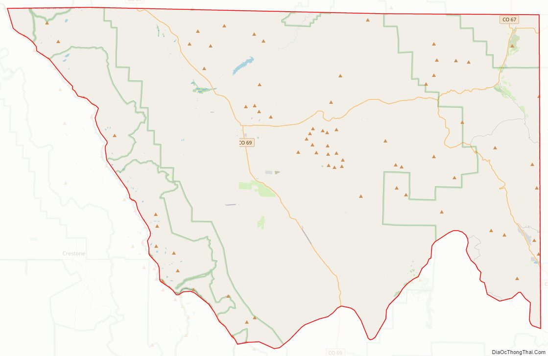
Custer County Road Map

Geography
According to the U.S. Census Bureau, the county has a total area of 740 square miles (1,900 km), of which 739 square miles (1,910 km) is land and 1.3 square miles (3.4 km) (0.2%) is water.
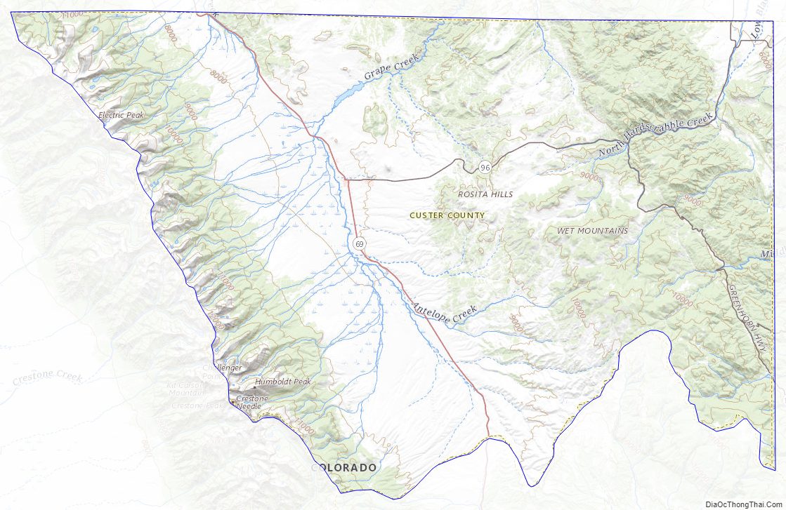
The county is very rugged and would be virtually inaccessible without roads. The lowest point of the county is around 6,000 feet (1,800 m) in elevation, but most of the county is rugged and mountainous. The county seat of Westcliffe is about 7,800 feet (2,400 m) and along with nearby town Silver Cliff lies in the Wet Mountain Valley which sits at the base of the Sangre de Cristo Mountains. The peaks of the Sangre de Cristo Mountains to the west reach heights in excess of 14,000 feet (4,300 m) with Crestone Peak being the highest at 14,294 feet (4,357 m) and 7th highest fourteener in Colorado.
A large percentage of the county is National Forest land in the Sangre de Cristo Mountains on the west side and in the Wet Mountains on the east. The only lake of size is the DeWeese Reservoir in the north end of the Wet Mountain Valley.
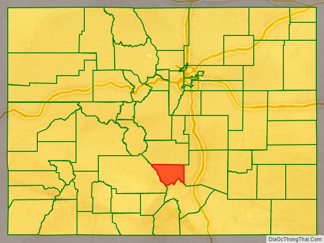
Adjacent counties
- Fremont County – north
- Pueblo County – east
- Huerfano County – southeast
- Saguache County – west
Major Highways
- State Highway 67
- State Highway 69
- State Highway 78
- State Highway 96
- State Highway 165
National protected areas
- San Isabel National Forest
- Sangre de Cristo Wilderness
- Frontier Pathways National Scenic and Historic Byway
Bicycle trails
- TransAmerica Trail Bicycle Route
- Western Express Bicycle Route
Custer County Topographic Map
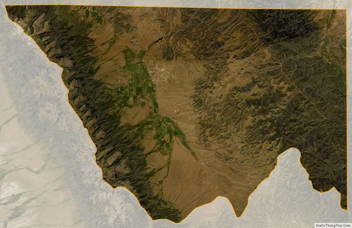
Custer County Satellite Map
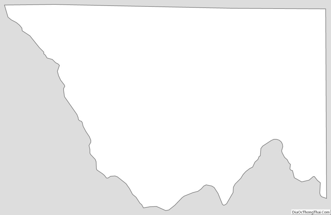
Custer County Outline Map
See also
Map of Colorado State and its subdivision:- Adams
- Alamosa
- Arapahoe
- Archuleta
- Baca
- Bent
- Boulder
- Broomfield
- Chaffee
- Cheyenne
- Clear Creek
- Conejos
- Costilla
- Crowley
- Custer
- Delta
- Denver
- Dolores
- Douglas
- Eagle
- El Paso
- Elbert
- Fremont
- Garfield
- Gilpin
- Grand
- Gunnison
- Hinsdale
- Huerfano
- Jackson
- Jefferson
- Kiowa
- Kit Carson
- La Plata
- Lake
- Larimer
- Las Animas
- Lincoln
- Logan
- Mesa
- Mineral
- Moffat
- Montezuma
- Montrose
- Morgan
- Otero
- Ouray
- Park
- Phillips
- Pitkin
- Prowers
- Pueblo
- Rio Blanco
- Rio Grande
- Routt
- Saguache
- San Juan
- San Miguel
- Sedgwick
- Summit
- Teller
- Washington
- Weld
- Yuma
- Alabama
- Alaska
- Arizona
- Arkansas
- California
- Colorado
- Connecticut
- Delaware
- District of Columbia
- Florida
- Georgia
- Hawaii
- Idaho
- Illinois
- Indiana
- Iowa
- Kansas
- Kentucky
- Louisiana
- Maine
- Maryland
- Massachusetts
- Michigan
- Minnesota
- Mississippi
- Missouri
- Montana
- Nebraska
- Nevada
- New Hampshire
- New Jersey
- New Mexico
- New York
- North Carolina
- North Dakota
- Ohio
- Oklahoma
- Oregon
- Pennsylvania
- Rhode Island
- South Carolina
- South Dakota
- Tennessee
- Texas
- Utah
- Vermont
- Virginia
- Washington
- West Virginia
- Wisconsin
- Wyoming