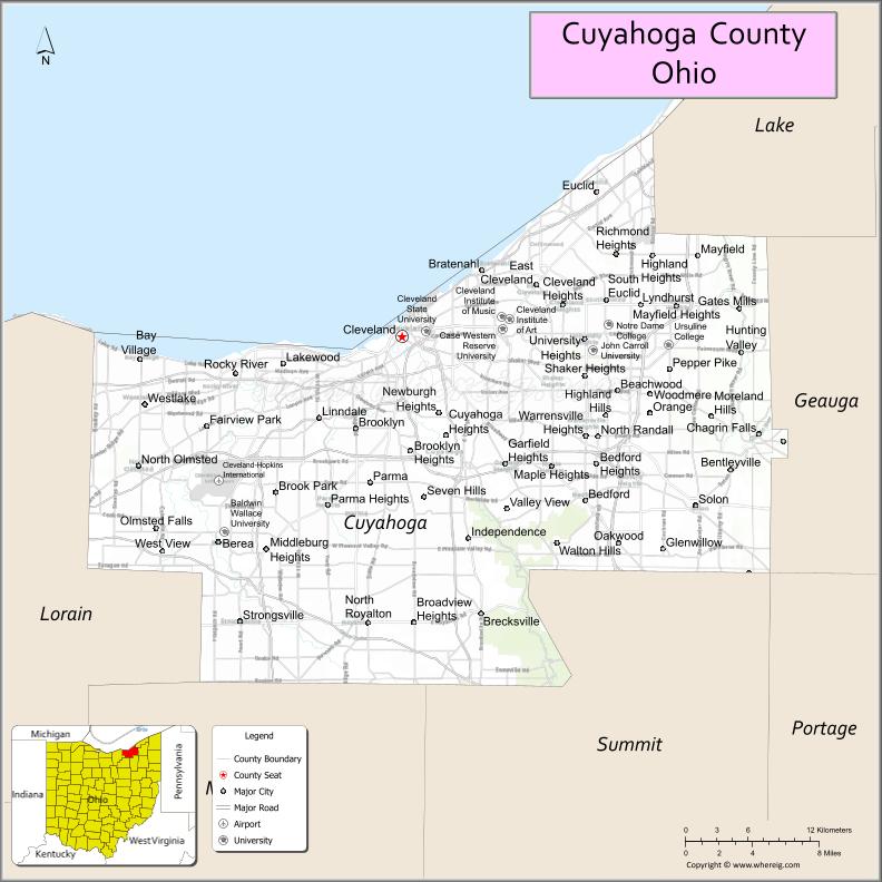
Cuyahoga County (/ˌkaɪ.əˈhɒɡə/ or /ˌkaɪ.əˈhoʊɡə/) is a large urban county located in the northeastern part of the U.S. state of Ohio. It is situated on the southern shore of Lake Erie, across the U.S.-Canada maritime border. As of the 2020 census, its population was 1,264,817, making it the second-most-populous county in the state.
The county seat and largest city is Cleveland. The county is bisected by the Cuyahoga River, after which it was named. “Cuyahoga” is an Iroquoian word meaning “crooked river”. Cuyahoga County is the core of the Greater Cleveland Metropolitan Area and of the Cleveland–Akron–Canton combined statistical area.
| Name: | Cuyahoga County |
|---|---|
| FIPS code: | 39-035 |
| State: | Ohio |
| Founded: | May 1, 1810 |
| Named for: | Cuyahoga River |
| Seat: | Cleveland |
| Largest city: | Cleveland |
| Total Area: | 1,246 sq mi (3,230 km²) |
| Land Area: | 457 sq mi (1,180 km²) |
| Total Population: | 1,264,817 |
| Population Density: | 1,000/sq mi (390/km²) |
| Time zone: | UTC−5 (EST) |
| Summer Time Zone (DST): | UTC−4 (EDT) |
| Website: | www.cuyahogacounty.us |
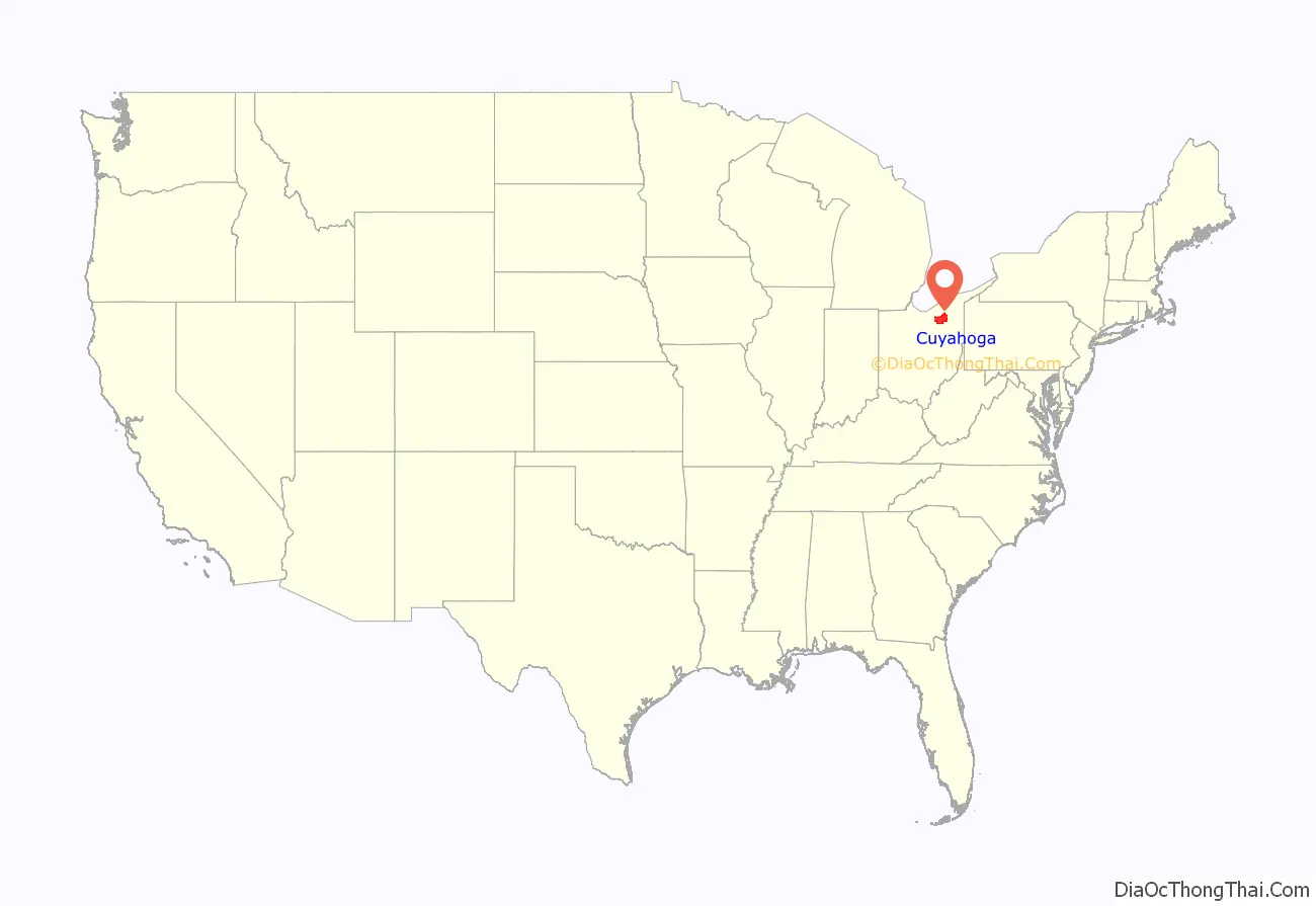
Cuyahoga County location map. Where is Cuyahoga County?
History
The land that became Cuyahoga County was previously part of the French colony of Canada (New France), which was ceded in 1763 to Great Britain and renamed Province of Quebec. In the early 1790s, the land became part of the Connecticut Western Reserve in the Northwest Territory, and it was purchased by the Connecticut Land Company in 1795. Cleveland was established one year later by General Moses Cleaveland near the mouth of the Cuyahoga River.
Cuyahoga County was created on June 7, 1807, and organized on May 1, 1810. Cleveland (then known as “Cleaveland”) was selected as the county seat in 1809. The county was later reduced in size by the creation of Huron, Lake, and Lorain counties.
In 1831, former U.S. President James A. Garfield was born in what was at the time Cuyahoga County’s Orange Township.
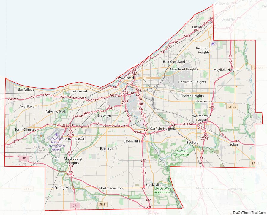
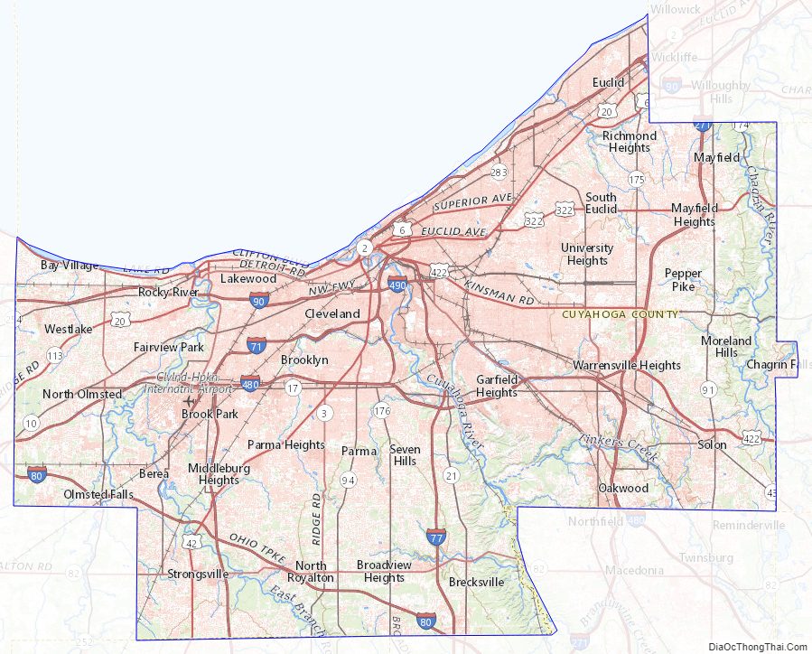
Cuyahoga County Road Map
Geography
According to the United States Census Bureau, the county has an area of 1,246 sq mi (3,230 km), of which 457 sq mi (1,180 km) are land and 788 sq mi (2,040 km) (63%) are water. It is the second-largest county in Ohio by area. A portion of Cuyahoga Valley National Park is in the county’s southeastern section.
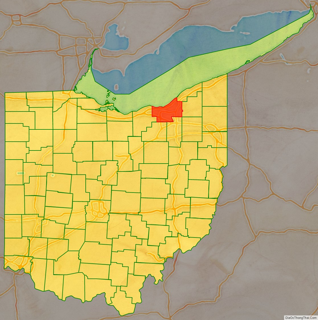
Adjacent counties
- Lake County (northeast)
- Geauga County (east)
- Summit County (southeast)
- Medina County (southwest)
- Lorain County (west)
- Portage County (southeast)
Cuyahoga County Topographic Map
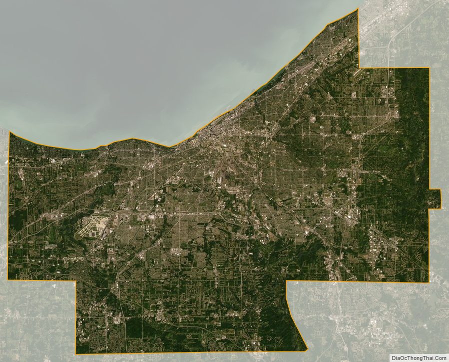
Cuyahoga County Satellite Map
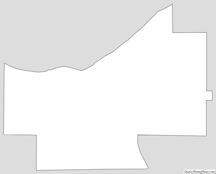
Cuyahoga County Outline Map
See also
Map of Ohio State and its subdivision:- Adams
- Allen
- Ashland
- Ashtabula
- Athens
- Auglaize
- Belmont
- Brown
- Butler
- Carroll
- Champaign
- Clark
- Clermont
- Clinton
- Columbiana
- Coshocton
- Crawford
- Cuyahoga
- Darke
- Defiance
- Delaware
- Erie
- Fairfield
- Fayette
- Franklin
- Fulton
- Gallia
- Geauga
- Greene
- Guernsey
- Hamilton
- Hancock
- Hardin
- Harrison
- Henry
- Highland
- Hocking
- Holmes
- Huron
- Jackson
- Jefferson
- Knox
- Lake
- Lake Erie
- Lawrence
- Licking
- Logan
- Lorain
- Lucas
- Madison
- Mahoning
- Marion
- Medina
- Meigs
- Mercer
- Miami
- Monroe
- Montgomery
- Morgan
- Morrow
- Muskingum
- Noble
- Ottawa
- Paulding
- Perry
- Pickaway
- Pike
- Portage
- Preble
- Putnam
- Richland
- Ross
- Sandusky
- Scioto
- Seneca
- Shelby
- Stark
- Summit
- Trumbull
- Tuscarawas
- Union
- Van Wert
- Vinton
- Warren
- Washington
- Wayne
- Williams
- Wood
- Wyandot
- Alabama
- Alaska
- Arizona
- Arkansas
- California
- Colorado
- Connecticut
- Delaware
- District of Columbia
- Florida
- Georgia
- Hawaii
- Idaho
- Illinois
- Indiana
- Iowa
- Kansas
- Kentucky
- Louisiana
- Maine
- Maryland
- Massachusetts
- Michigan
- Minnesota
- Mississippi
- Missouri
- Montana
- Nebraska
- Nevada
- New Hampshire
- New Jersey
- New Mexico
- New York
- North Carolina
- North Dakota
- Ohio
- Oklahoma
- Oregon
- Pennsylvania
- Rhode Island
- South Carolina
- South Dakota
- Tennessee
- Texas
- Utah
- Vermont
- Virginia
- Washington
- West Virginia
- Wisconsin
- Wyoming