Dauphin County (/ˈdɔːfɪn/; Pennsylvania Dutch: Daffin Kaundi) is a county in the Commonwealth of Pennsylvania. As of the 2020 census, the population was 286,401. The county seat and the largest city is Harrisburg, Pennsylvania’s state capital and ninth largest city. The county was created on March 4, 1785, from part of Lancaster County and was named after Louis Joseph, Dauphin of France, the first son of King Louis XVI.
Dauphin County is included in the Harrisburg–Carlisle Metropolitan Statistical Area.
Located within the county is Three Mile Island Nuclear Generating Station, site of the 1979 nuclear core meltdown. The nuclear power plant closed in 2019.
| Name: | Dauphin County |
|---|---|
| FIPS code: | 42-043 |
| State: | Pennsylvania |
| Founded: | March 4, 1785 |
| Named for: | Louis Joseph, Dauphin of France |
| Seat: | Harrisburg |
| Largest city: | Harrisburg |
| Total Area: | 558 sq mi (1,450 km²) |
| Land Area: | 525 sq mi (1,360 km²) |
| Total Population: | 287,400 |
| Time zone: | UTC−5 (Eastern) |
| Summer Time Zone (DST): | UTC−4 (EDT) |
| Website: | www.dauphincounty.org |
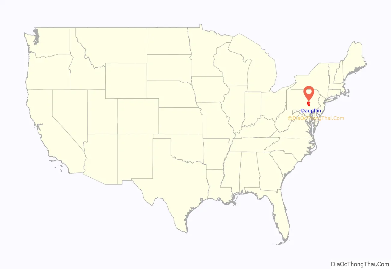
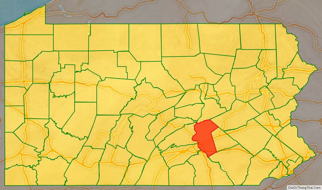
Dauphin County location map. Where is Dauphin County?
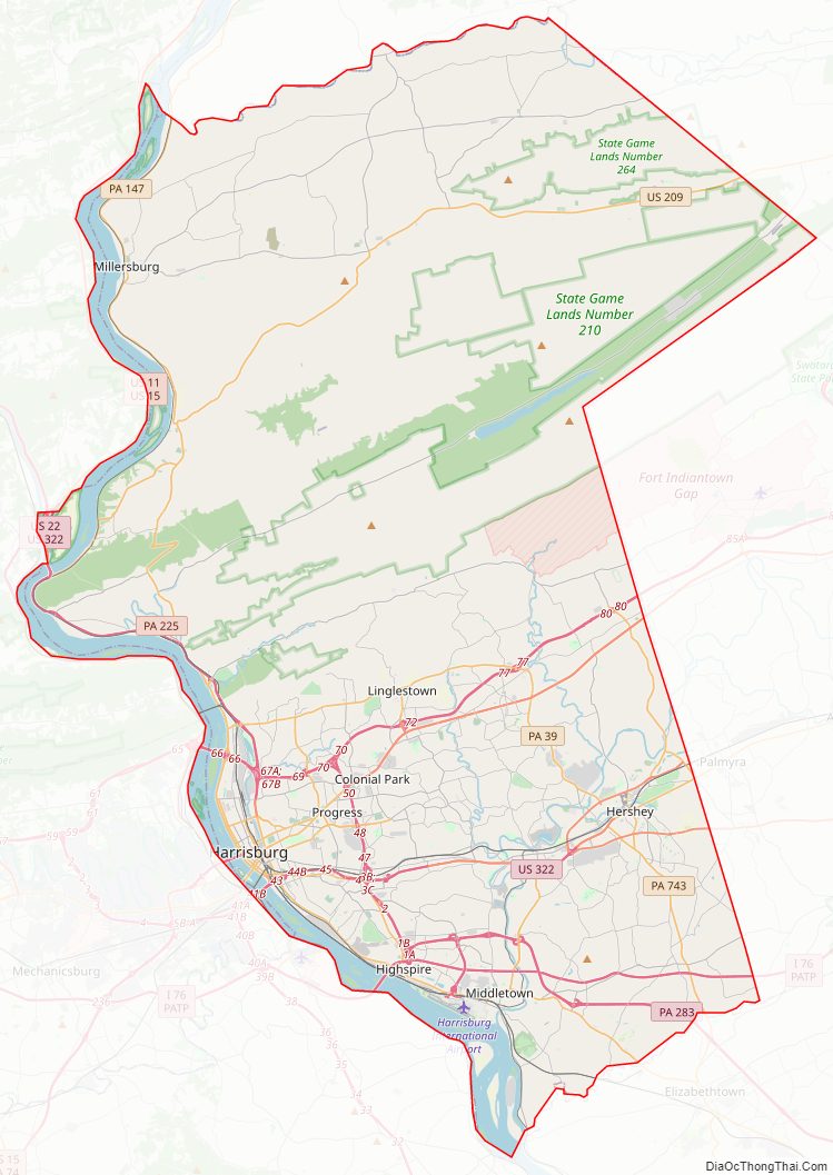
Dauphin County Road Map
Geography
According to the U.S. Census Bureau, the county has a total area of 558 square miles (1,450 km), of which 525 square miles (1,360 km) is land and 33 square miles (85 km) (5.9%) is water. The county is bound to its western border by the Susquehanna River (with the exception of a small peninsula next to Duncannon). The area code is 717 with an overlay of 223.
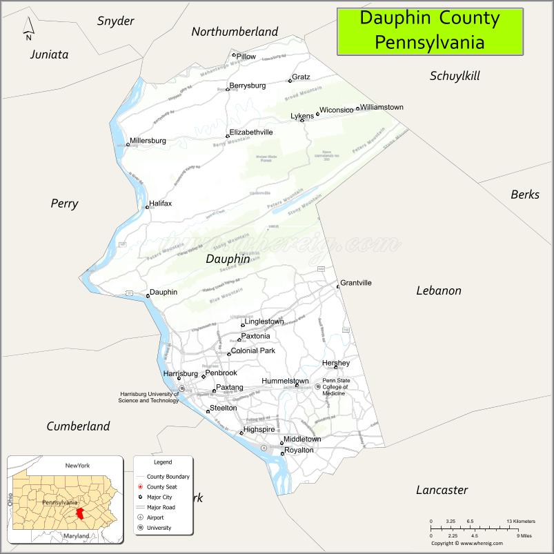
Adjacent counties
- Northumberland County (north)
- Schuylkill County (northeast)
- Lebanon County (east)
- Lancaster County (south)
- York County (southwest)
- Cumberland County (west)
- Perry County (west)
- Juniata County (northwest)
Major roads and highways
- I-76 / Penna Turnpike
- I-81
- I-83
- I-283
- US 11 / US 15
- US 22
- US 209
- US 322
- US 422
- PA 25
- PA 39
- PA 147
- PA 225
- PA 230
- PA 283
- PA 325
- PA 341
- PA 441
- PA 443
- PA 743
- PA 849
- SR 3032
Climate
Most of the county by area has a humid continental climate (Dfa except for some Dfb in highlands.) The inclusion of temperature numbers for the past decade shows some lower-lying areas, including Harrisburg, to have a humid subtropical climate (Cfa.) The hardiness zone ranges from 6a to 7a.
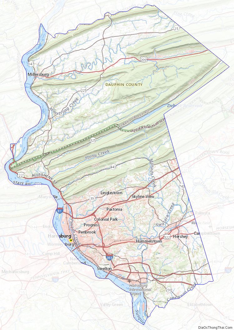
Dauphin County Topographic Map
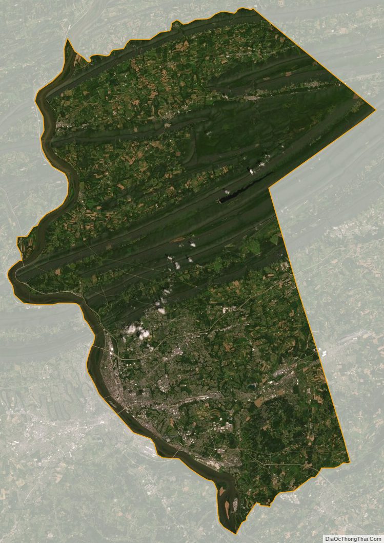
Dauphin County Satellite Map
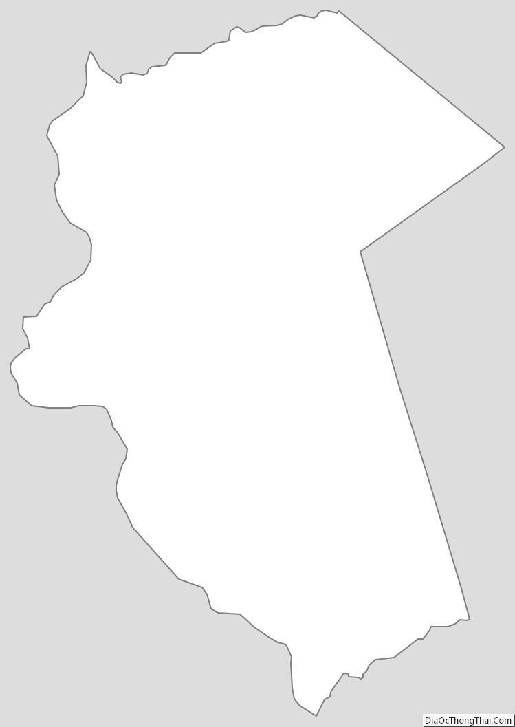
Dauphin County Outline Map
See also
Map of Pennsylvania State and its subdivision:- Adams
- Allegheny
- Armstrong
- Beaver
- Bedford
- Berks
- Blair
- Bradford
- Bucks
- Butler
- Cambria
- Cameron
- Carbon
- Centre
- Chester
- Clarion
- Clearfield
- Clinton
- Columbia
- Crawford
- Cumberland
- Dauphin
- Delaware
- Elk
- Erie
- Fayette
- Forest
- Franklin
- Fulton
- Greene
- Huntingdon
- Indiana
- Jefferson
- Juniata
- Lackawanna
- Lancaster
- Lawrence
- Lebanon
- Lehigh
- Luzerne
- Lycoming
- Mc Kean
- Mercer
- Mifflin
- Monroe
- Montgomery
- Montour
- Northampton
- Northumberland
- Perry
- Philadelphia
- Pike
- Potter
- Schuylkill
- Snyder
- Somerset
- Sullivan
- Susquehanna
- Tioga
- Union
- Venango
- Warren
- Washington
- Wayne
- Westmoreland
- Wyoming
- York
- Alabama
- Alaska
- Arizona
- Arkansas
- California
- Colorado
- Connecticut
- Delaware
- District of Columbia
- Florida
- Georgia
- Hawaii
- Idaho
- Illinois
- Indiana
- Iowa
- Kansas
- Kentucky
- Louisiana
- Maine
- Maryland
- Massachusetts
- Michigan
- Minnesota
- Mississippi
- Missouri
- Montana
- Nebraska
- Nevada
- New Hampshire
- New Jersey
- New Mexico
- New York
- North Carolina
- North Dakota
- Ohio
- Oklahoma
- Oregon
- Pennsylvania
- Rhode Island
- South Carolina
- South Dakota
- Tennessee
- Texas
- Utah
- Vermont
- Virginia
- Washington
- West Virginia
- Wisconsin
- Wyoming