Day County is a county in the U.S. state of South Dakota. As of the 2020 census, the population was 5,449. Its county seat is Webster. The county is named for Merritt H. Day, pioneer and 1879 Dakota Territory legislator.
| Name: | Day County |
|---|---|
| FIPS code: | 46-037 |
| State: | South Dakota |
| Founded: | 1880 |
| Named for: | Merritt H. Day |
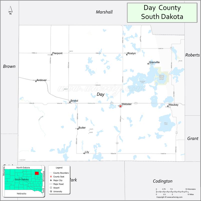
| Seat: | Webster |
| Largest city: | Webster |
| Total Area: | 1,091 sq mi (2,830 km²) |
| Land Area: | 1,028 sq mi (2,660 km²) |
| Total Population: | 5,449 |
| Population Density: | 5.0/sq mi (1.9/km²) |
| Time zone: | UTC−6 (Central) |
| Summer Time Zone (DST): | UTC−5 (CDT) |
| Website: | day.sdcounties.org |
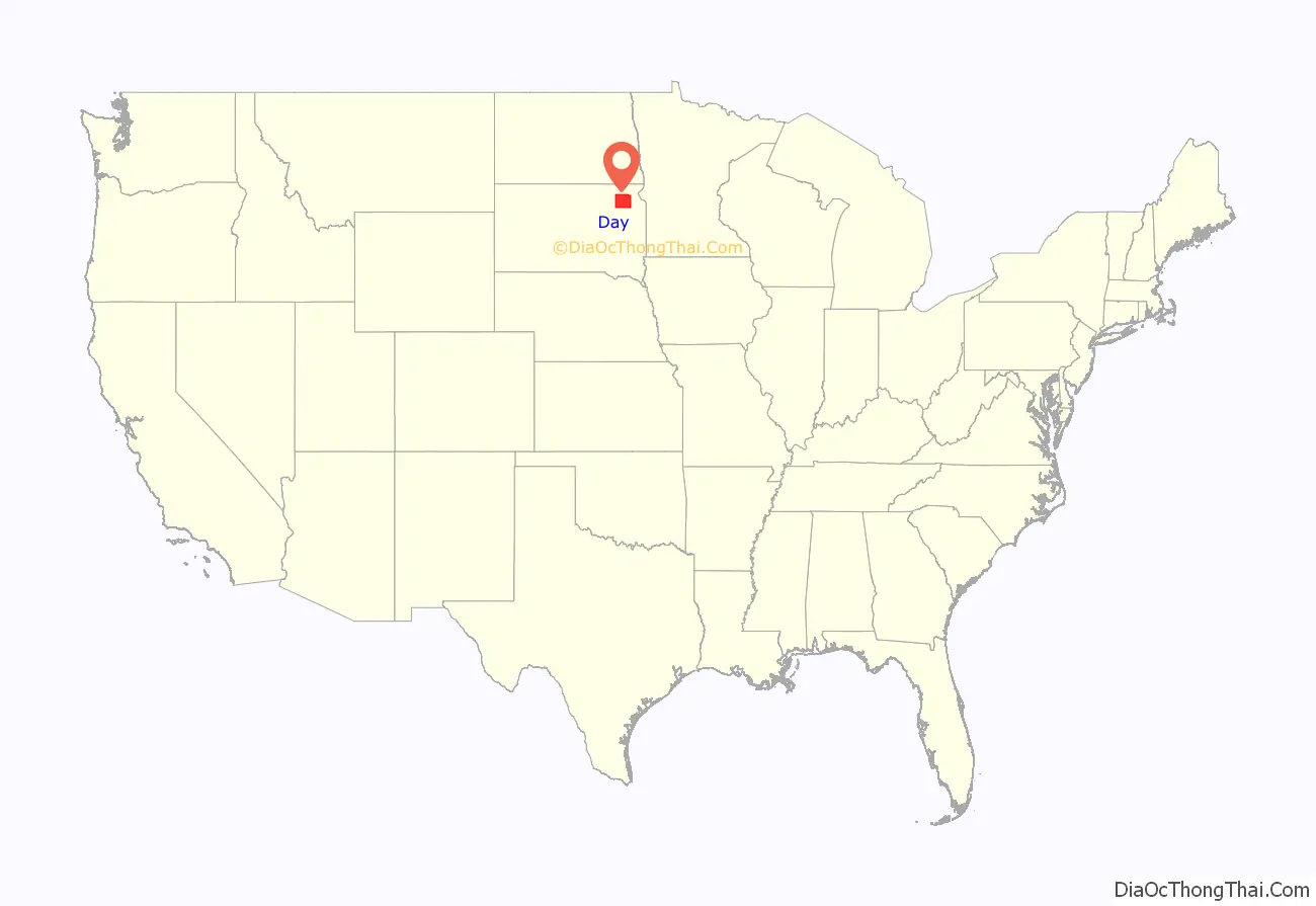
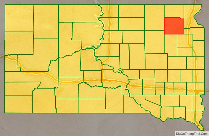
Day County location map. Where is Day County?
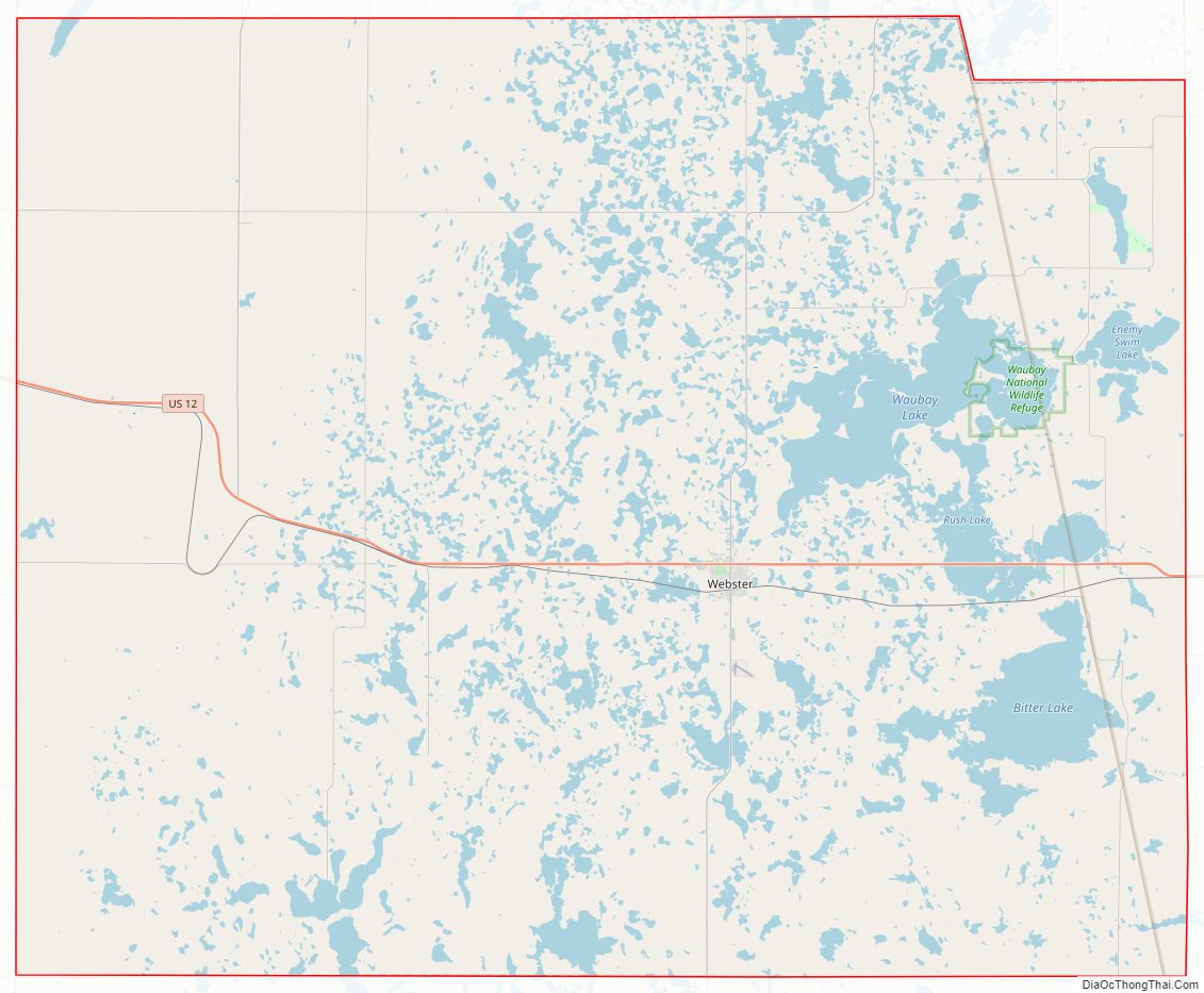
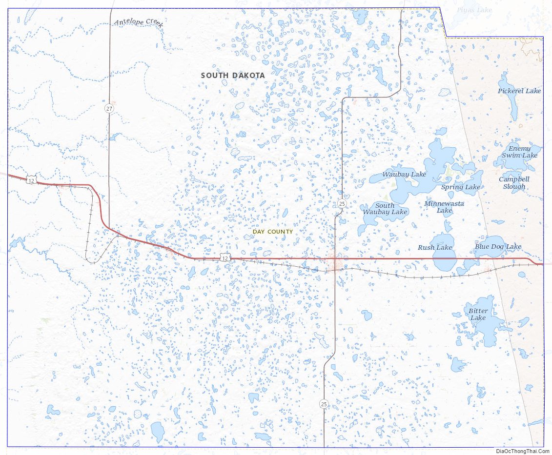
Day County Road Map
Geography
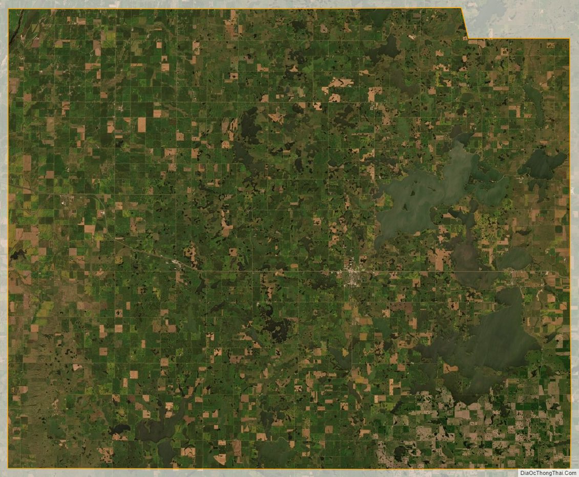
The terrain of Day County consists of rolling hills, partly devoted to agriculture. It is dotted with numerous lakes and ponds, especially its eastern portion. The terrain slopes to the west; its highest point is the northeast corner, at 2,014′ (614m) ASL. The county has a total area of 1,091 square miles (2,830 km), of which 1,028 square miles (2,660 km) is land and 63 square miles (160 km) (5.8%) is water.
Lakes
- Amsden
- Antelope
- Bitter
- Blue Dog
- Enemy Swim
- Horseshoe
- Lynn
- Minnewaste
- Pickerel Lake
- Reetz
- Rush
- Sweetwater
- Waubay
Major highways
- U.S. Highway 12
- South Dakota Highway 25
- South Dakota Highway 27
Adjacent counties
- Marshall County – north
- Roberts County – east
- Grant County – southeast
- Codington County – southeast
- Clark County – south
- Spink County – southwest
- Brown County – west
Protected areas
- Buchner Slough State Public Shooting Area
- Holmquist Slough State Public Shooting Area
- Lily State Public Shooting Area
- Myland Pass State Public Shooting Area
- Nelson Slough State Public Shooting Area
- Pickerel Lake State Recreation Area
- Pierpont Lake Recreation Area
- Waubay National Wildlife Refuge
Day County Topographic Map
Day County Satellite Map
Day County Outline Map

See also
Map of South Dakota State and its subdivision:- Aurora
- Beadle
- Bennett
- Bon Homme
- Brookings
- Brown
- Brule
- Buffalo
- Butte
- Campbell
- Charles Mix
- Clark
- Clay
- Codington
- Corson
- Custer
- Davison
- Day
- Deuel
- Dewey
- Douglas
- Edmunds
- Fall River
- Faulk
- Grant
- Gregory
- Haakon
- Hamlin
- Hand
- Hanson
- Harding
- Hughes
- Hutchinson
- Hyde
- Jackson
- Jerauld
- Jones
- Kingsbury
- Lake
- Lawrence
- Lincoln
- Lyman
- Marshall
- McCook
- McPherson
- Meade
- Mellette
- Miner
- Minnehaha
- Moody
- Pennington
- Perkins
- Potter
- Roberts
- Sanborn
- Shannon
- Spink
- Stanley
- Sully
- Todd
- Tripp
- Turner
- Union
- Walworth
- Yankton
- Ziebach
- Alabama
- Alaska
- Arizona
- Arkansas
- California
- Colorado
- Connecticut
- Delaware
- District of Columbia
- Florida
- Georgia
- Hawaii
- Idaho
- Illinois
- Indiana
- Iowa
- Kansas
- Kentucky
- Louisiana
- Maine
- Maryland
- Massachusetts
- Michigan
- Minnesota
- Mississippi
- Missouri
- Montana
- Nebraska
- Nevada
- New Hampshire
- New Jersey
- New Mexico
- New York
- North Carolina
- North Dakota
- Ohio
- Oklahoma
- Oregon
- Pennsylvania
- Rhode Island
- South Carolina
- South Dakota
- Tennessee
- Texas
- Utah
- Vermont
- Virginia
- Washington
- West Virginia
- Wisconsin
- Wyoming