DeKalb County is a county located in the northeastern part of the U.S. state of Alabama. As of the 2020 census, the population was 71,608. Its county seat is Fort Payne, and it is named after Major General Baron Johan DeKalb. DeKalb County is part of the Huntsville-Decatur-Albertville, AL Combined Statistical Area.
| Name: | DeKalb County |
|---|---|
| FIPS code: | 01-049 |
| State: | Alabama |
| Founded: | January 9, 1836 |
| Named for: | Johan DeKalb |
| Seat: | Fort Payne |
| Largest city: | Fort Payne |
| Total Area: | 779 sq mi (2,020 km²) |
| Land Area: | 777 sq mi (2,010 km²) |
| Total Population: | 71,608 |
| Population Density: | 92/sq mi (35/km²) |
| Time zone: | UTC−6 (Central) |
| Summer Time Zone (DST): | UTC−5 (CDT) |
| Website: | www.dekalbcountyal.us |
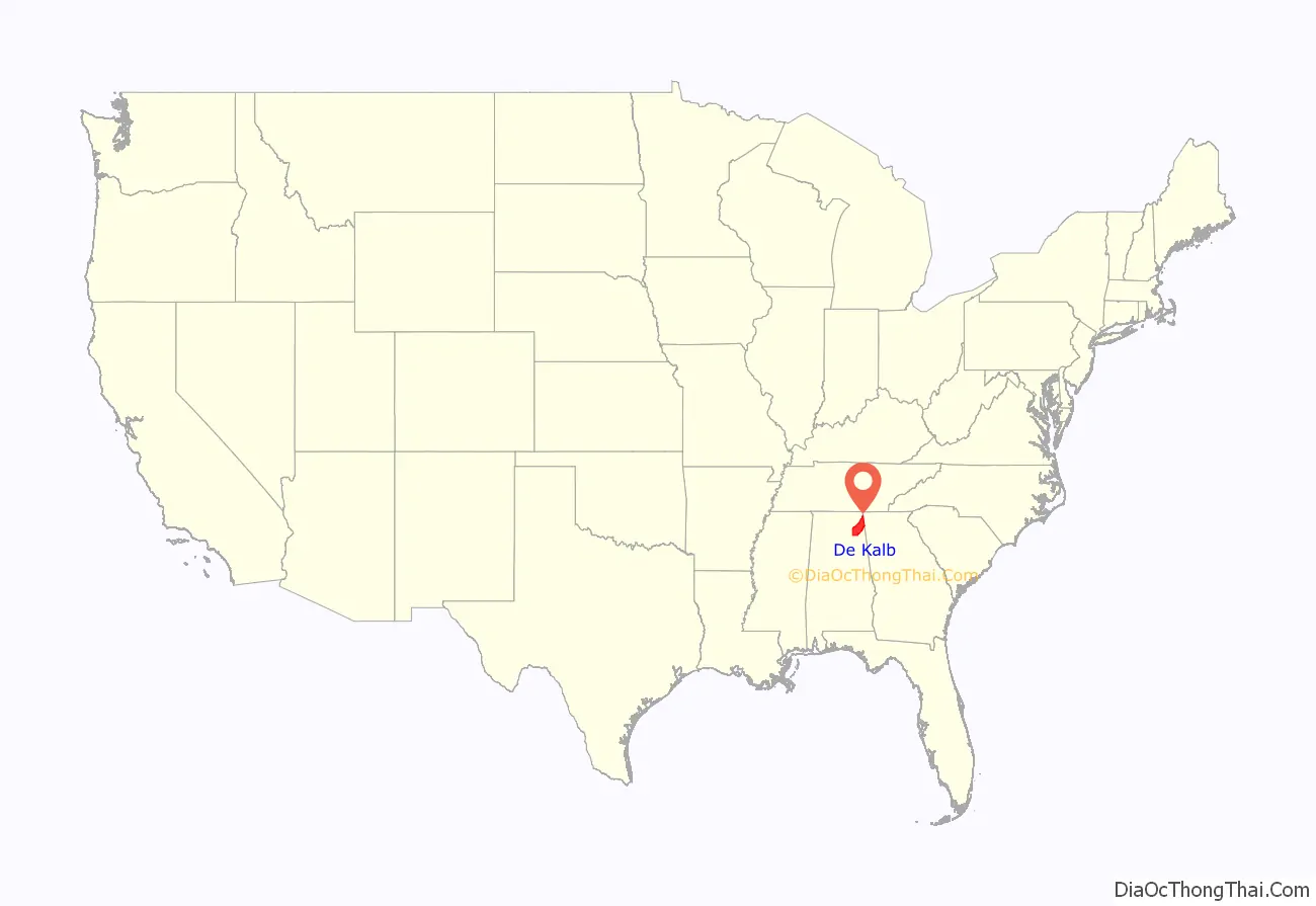
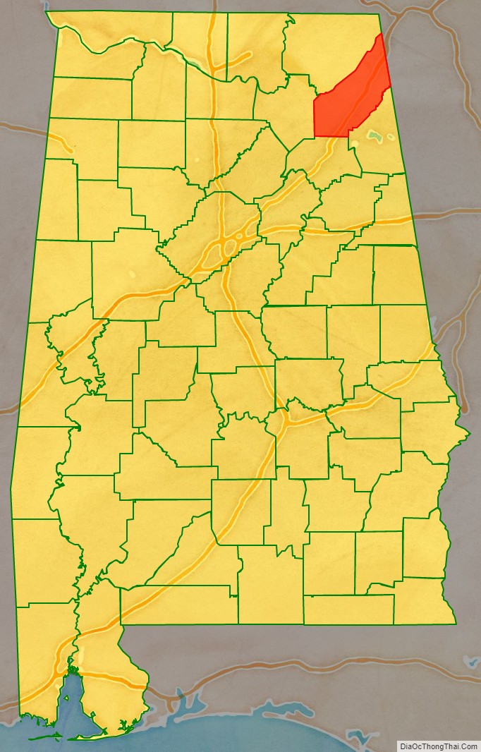
DeKalb County location map. Where is DeKalb County?
History
DeKalb County was created by the Alabama legislature on January 9, 1836, from land ceded under duress to the Federal government by the Cherokee Nation prior to their forced removal to Indian Territory west of the Mississippi River.
The county was named for Major General Baron Johann de Kalb, a hero of the American Revolution.
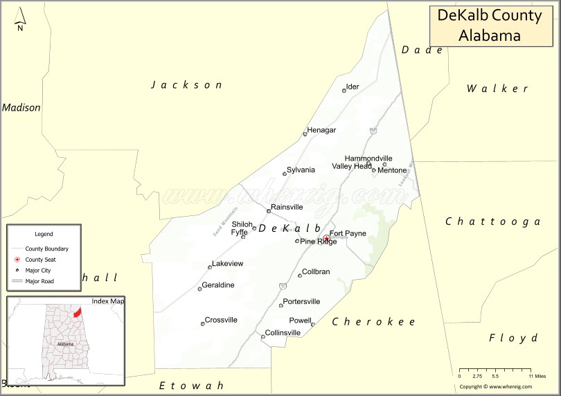
The city of Fort Payne, now the county seat, developed around a fort of the same name, built in the 1830s to intern Cherokee of the region prior to their removal.
In the early 19th century, Sequoyah, the Cherokee man who independently created the Cherokee syllabary, a written system for his language, lived in this area. He had been born in a Cherokee town in Tennessee and migrated here in the early 1800s. His work enabled the Cherokee to publish the first Native American newspaper, The Phoenix, which they produced in Cherokee and English.
On the whole, DeKalb County is a dry county in terms of alcohol sales and consumption. In 2005, the city of Fort Payne passed a law to authorize the legal sale of alcohol. Collinsville and Henagar later also allowed alcohol sales.
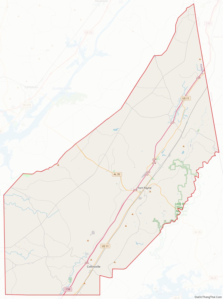
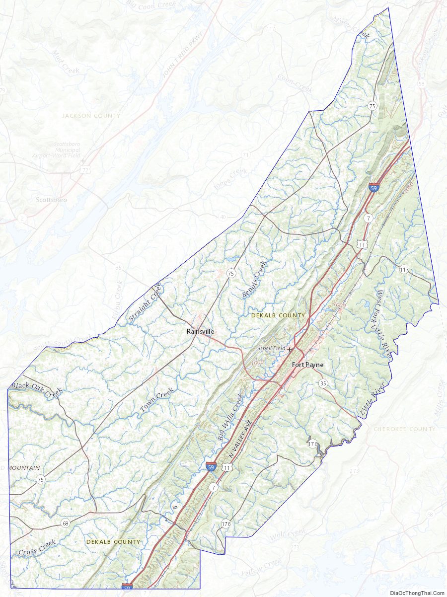
DeKalb County Road Map
Geography
According to the United States Census Bureau, the county has a total area of 779 square miles (2,020 km), of which 777 square miles (2,010 km) is land and 1.6 square miles (4.1 km) (0.2%) is water.
Adjacent counties
- Jackson County – north
- Dade County, Georgia – northeast (EST)
- Walker County, Georgia – east (EST)
- Chattooga County, Georgia – east (EST)
- Cherokee County – southeast
- Etowah County – south
- Marshall County – west
National protected area
- Little River Canyon National Preserve (part)
DeKalb County Topographic Map
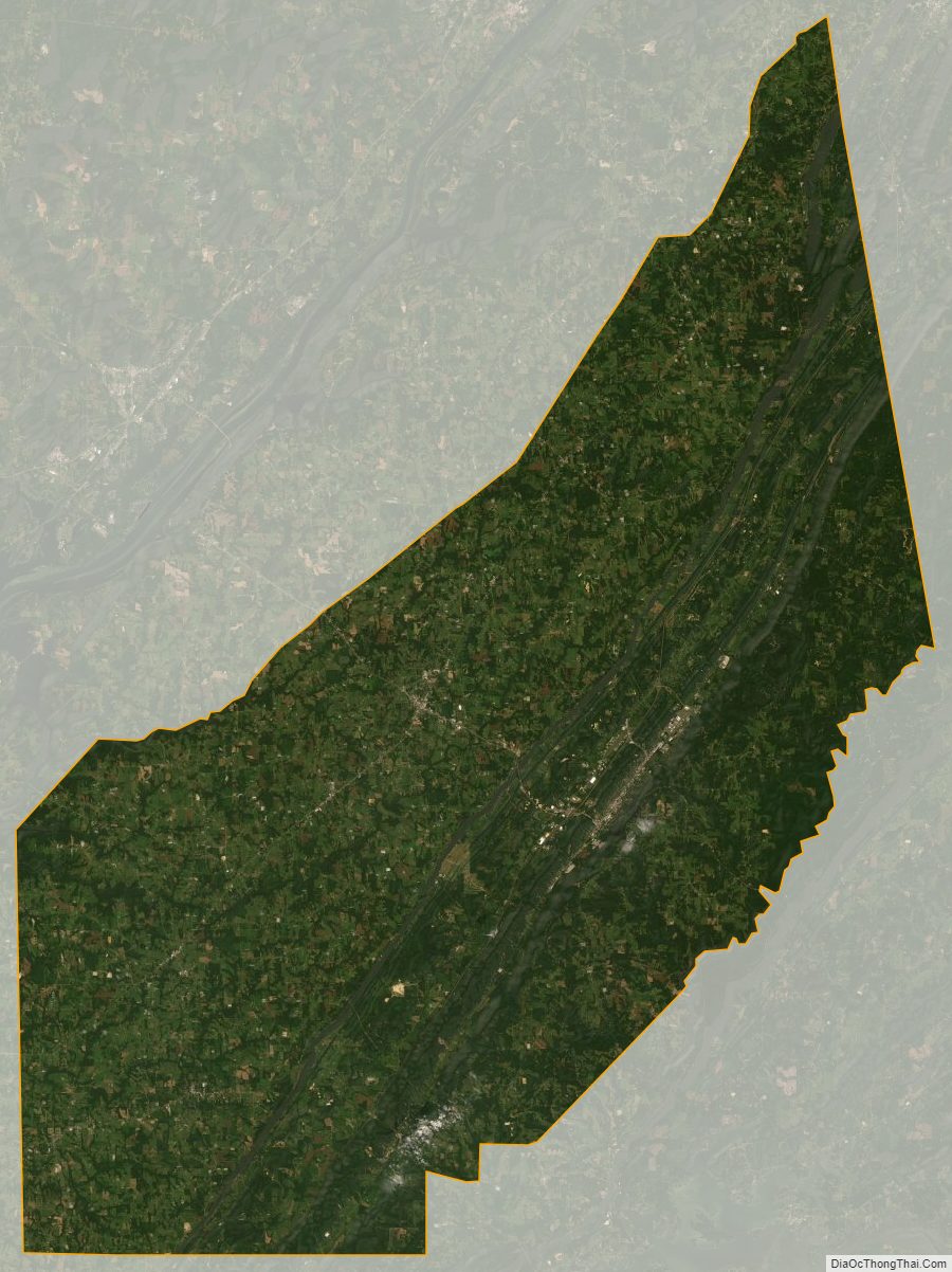
DeKalb County Satellite Map
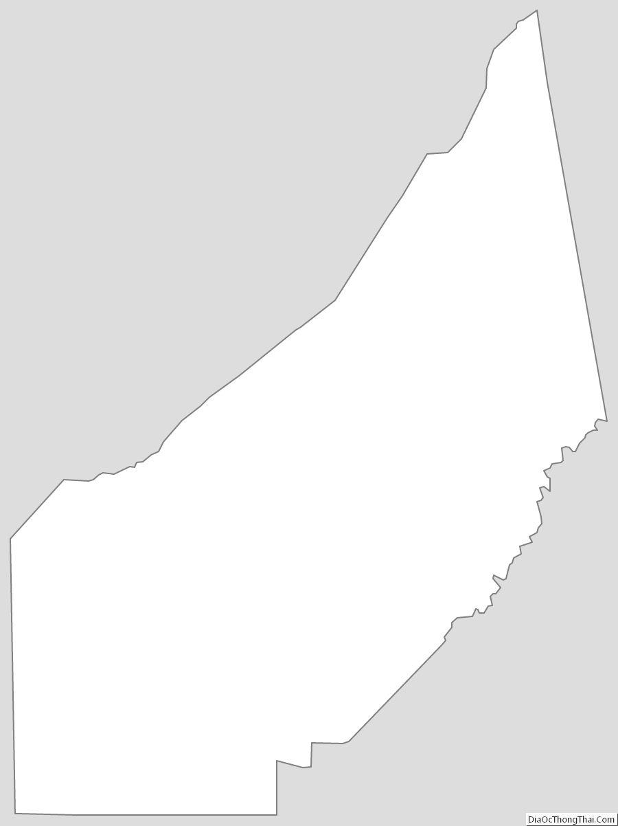
DeKalb County Outline Map
See also
Map of Alabama State and its subdivision:- Autauga
- Baldwin
- Barbour
- Bibb
- Blount
- Bullock
- Butler
- Calhoun
- Chambers
- Cherokee
- Chilton
- Choctaw
- Clarke
- Clay
- Cleburne
- Coffee
- Colbert
- Conecuh
- Coosa
- Covington
- Crenshaw
- Cullman
- Dale
- Dallas
- De Kalb
- Elmore
- Escambia
- Etowah
- Fayette
- Franklin
- Geneva
- Greene
- Hale
- Henry
- Houston
- Jackson
- Jefferson
- Lamar
- Lauderdale
- Lawrence
- Lee
- Limestone
- Lowndes
- Macon
- Madison
- Marengo
- Marion
- Marshall
- Mobile
- Monroe
- Montgomery
- Morgan
- Perry
- Pickens
- Pike
- Randolph
- Russell
- Saint Clair
- Shelby
- Sumter
- Talladega
- Tallapoosa
- Tuscaloosa
- Walker
- Washington
- Wilcox
- Winston
- Alabama
- Alaska
- Arizona
- Arkansas
- California
- Colorado
- Connecticut
- Delaware
- District of Columbia
- Florida
- Georgia
- Hawaii
- Idaho
- Illinois
- Indiana
- Iowa
- Kansas
- Kentucky
- Louisiana
- Maine
- Maryland
- Massachusetts
- Michigan
- Minnesota
- Mississippi
- Missouri
- Montana
- Nebraska
- Nevada
- New Hampshire
- New Jersey
- New Mexico
- New York
- North Carolina
- North Dakota
- Ohio
- Oklahoma
- Oregon
- Pennsylvania
- Rhode Island
- South Carolina
- South Dakota
- Tennessee
- Texas
- Utah
- Vermont
- Virginia
- Washington
- West Virginia
- Wisconsin
- Wyoming