DeKalb County is a county in the U.S. state of Indiana. As of the 2020 United States Census, the population was 43,265. The county seat is Auburn.
| Name: | DeKalb County |
|---|---|
| FIPS code: | 18-033 |
| State: | Indiana |
| Founded: | 7 February 1835 (authorized) 1837 (organized) |
| Named for: | Johann, Baron de Kalb |
| Seat: | Auburn |
| Largest city: | Auburn |
| Total Area: | 363.85 sq mi (942.4 km²) |
| Land Area: | 362.82 sq mi (939.7 km²) |
| Total Population: | 43,265 |
| Population Density: | 119.1/sq mi (46.0/km²) |
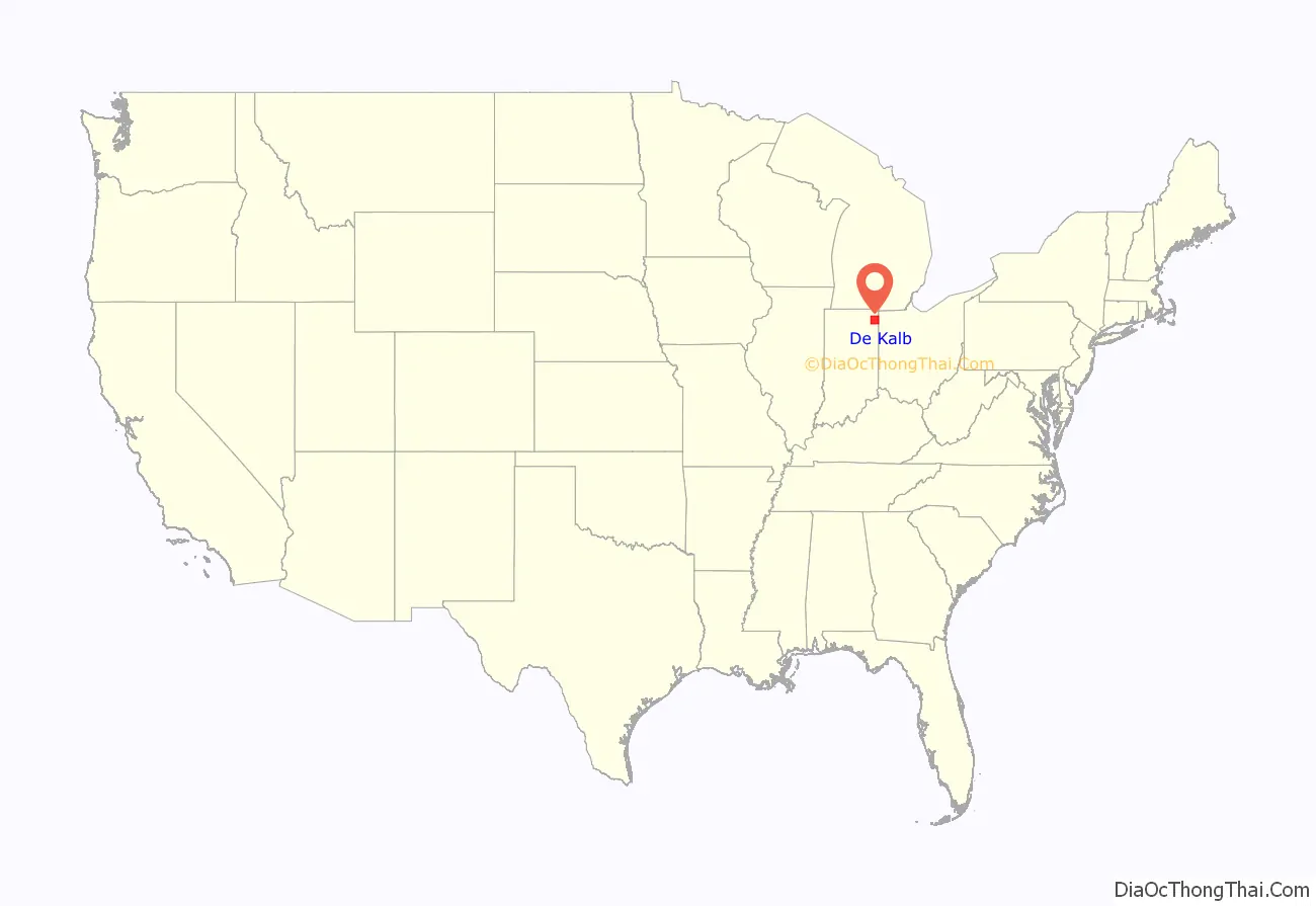
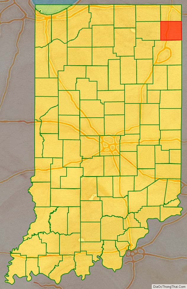
DeKalb County location map. Where is DeKalb County?
History
On 7 February 1835, the Indiana State Legislature passed an omnibus bill that authorized the creation of thirteen counties in northeast Indiana on previously unorganized land (including the recent Wabash New Purchase). The organization of the county’s government commenced in 1837. It was named for General Johann de Kalb, a Continental Army officer from Bavaria, who was killed at the Battle of Camden in South Carolina. The first settlers in the future DeKalb County were from New England, settling what was then known as the Northwest Territory. These people were “Yankee” migrants, descended from the English Puritans who settled New England in the colonial era. In the 1870s immigrants from Ireland and Germany began arriving in DeKalb County, in large numbers.
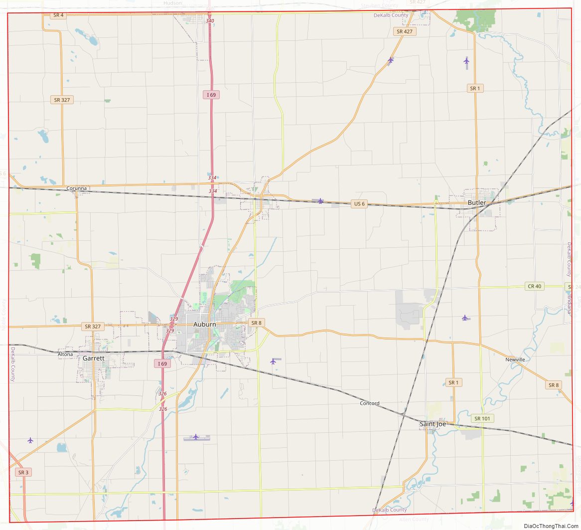
DeKalb County Road Map
Geography
DeKalb County lies on the east side of Indiana; its east border abuts the western border of Ohio. Its low, rolling terrain is entirely devoted to agriculture or urban development. Its highest point (1,060 feet/320 meters ASL) is a small rise in the NW portion of the county, 2 miles (3.2 km) west of Fairfield Center. The Saint Joseph River flows southwestward through the SE portion of the county, while the western part of the county is drained by Cedar Creek.
According to the 2010 census, the county has a total area of 363.85 square miles (942.4 km), of which 362.82 square miles (939.7 km) (or 99.72%) is land and 1.03 square miles (2.7 km) (or 0.28%) is water.
Adjacent counties
- LaGrange County – northwest
- Steuben County – north
- Williams County, Ohio – northeast
- Defiance County, Ohio – southeast
- Allen County – south
- Noble County – west
Cities and towns
Unincorporated communities
- Artic
- Auburn Junction
- Butler Center
- Cedar
- Concord
- Fairfield Center
- Hopewell
- Moore
- New Era
- Newville
- Orangeville
- Saint Johns
- Sedan
- Spencerville
- Stafford Center
- Summit
- Taylor Corner
Townships
- Butler
- Concord
- Fairfield
- Franklin
- Grant
- Jackson
- Keyser
- Newville
- Richland
- Smithfield
- Spencer
- Stafford
- Troy
- Union
- Wilmington
Major highways
- Interstate 69
- U.S. Route 6
- State Road 1
- State Road 3
- State Road 4
- State Road 8
- State Road 101
- State Road 205
- State Road 327
- State Road 427
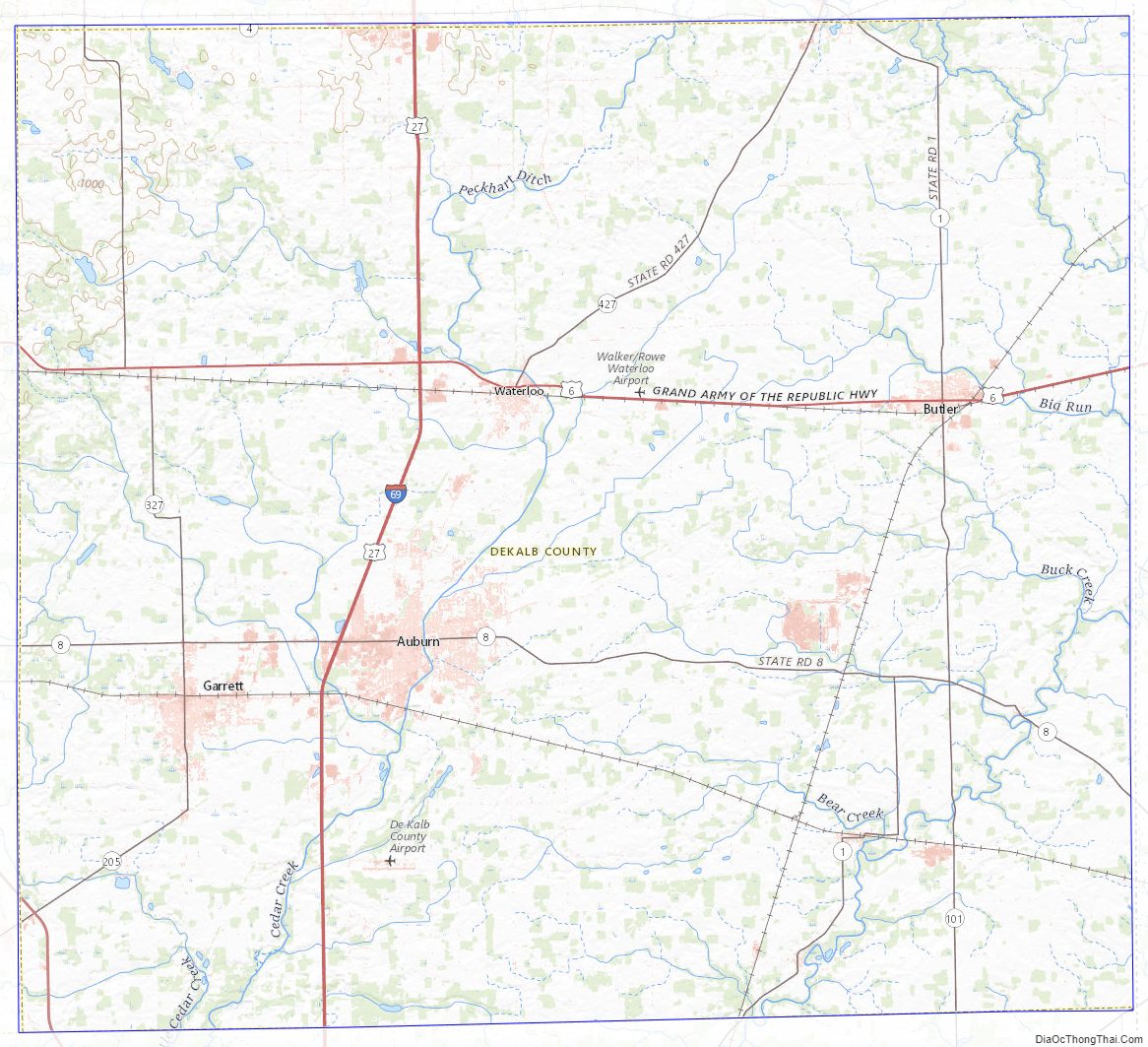
DeKalb County Topographic Map
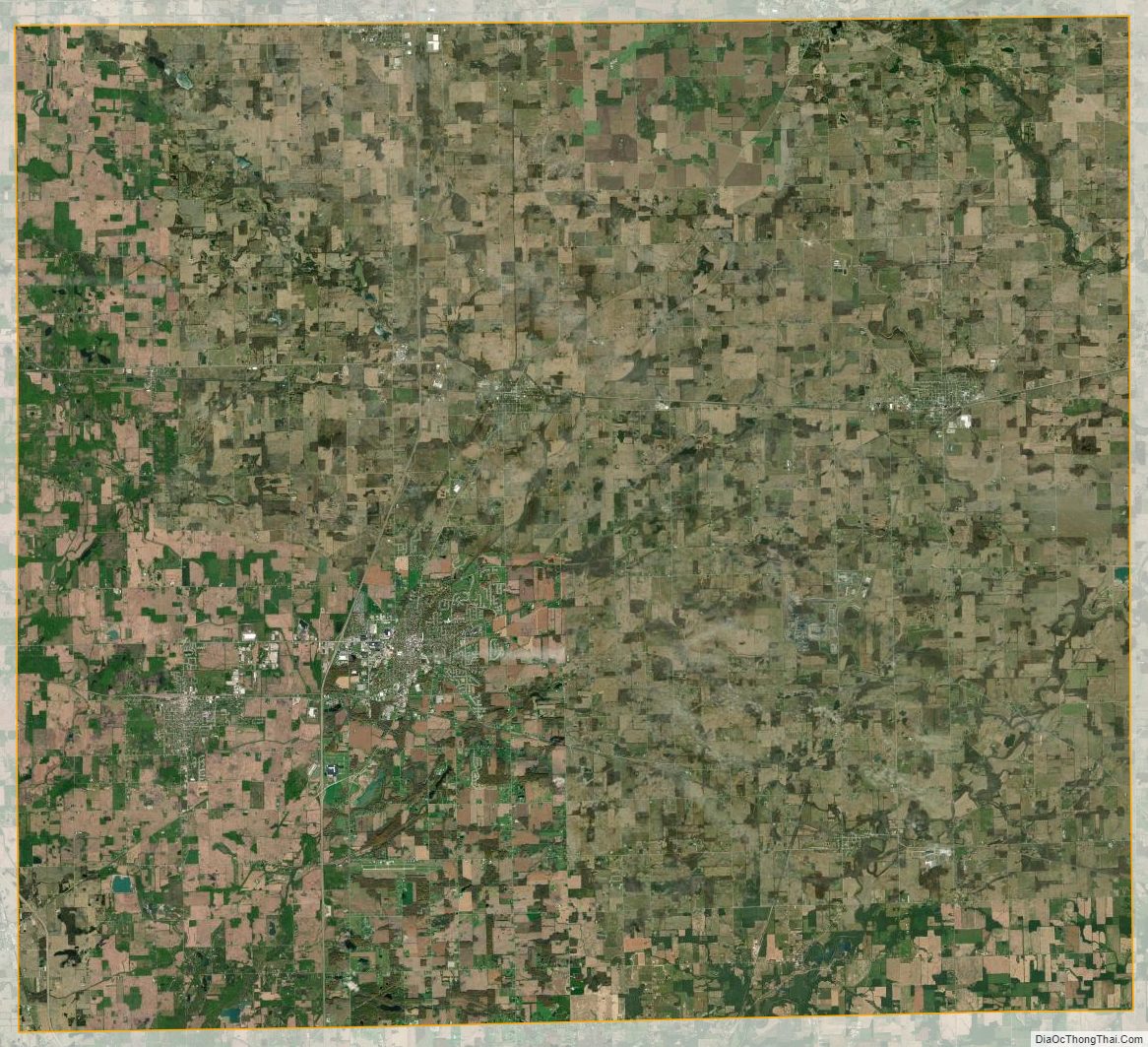
DeKalb County Satellite Map
DeKalb County Outline Map

See also
Map of Indiana State and its subdivision:- Adams
- Allen
- Bartholomew
- Benton
- Blackford
- Boone
- Brown
- Carroll
- Cass
- Clark
- Clay
- Clinton
- Crawford
- Daviess
- De Kalb
- Dearborn
- Decatur
- Delaware
- Dubois
- Elkhart
- Fayette
- Floyd
- Fountain
- Franklin
- Fulton
- Gibson
- Grant
- Greene
- Hamilton
- Hancock
- Harrison
- Hendricks
- Henry
- Howard
- Huntington
- Jackson
- Jasper
- Jay
- Jefferson
- Jennings
- Johnson
- Knox
- Kosciusko
- LaGrange
- Lake
- Lake Michigan
- LaPorte
- Lawrence
- Madison
- Marion
- Marshall
- Martin
- Miami
- Monroe
- Montgomery
- Morgan
- Newton
- Noble
- Ohio
- Orange
- Owen
- Parke
- Perry
- Pike
- Porter
- Posey
- Pulaski
- Putnam
- Randolph
- Ripley
- Rush
- Saint Joseph
- Scott
- Shelby
- Spencer
- Starke
- Steuben
- Sullivan
- Switzerland
- Tippecanoe
- Tipton
- Union
- Vanderburgh
- Vermillion
- Vigo
- Wabash
- Warren
- Warrick
- Washington
- Wayne
- Wells
- White
- Whitley
- Alabama
- Alaska
- Arizona
- Arkansas
- California
- Colorado
- Connecticut
- Delaware
- District of Columbia
- Florida
- Georgia
- Hawaii
- Idaho
- Illinois
- Indiana
- Iowa
- Kansas
- Kentucky
- Louisiana
- Maine
- Maryland
- Massachusetts
- Michigan
- Minnesota
- Mississippi
- Missouri
- Montana
- Nebraska
- Nevada
- New Hampshire
- New Jersey
- New Mexico
- New York
- North Carolina
- North Dakota
- Ohio
- Oklahoma
- Oregon
- Pennsylvania
- Rhode Island
- South Carolina
- South Dakota
- Tennessee
- Texas
- Utah
- Vermont
- Virginia
- Washington
- West Virginia
- Wisconsin
- Wyoming