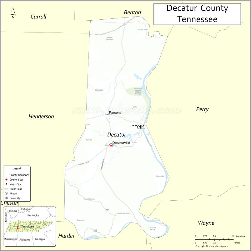
Decatur County is a county located in the U.S. state of Tennessee. As of the 2020 census, the population was 11,435. Its county seat is Decaturville.
| Name: | Decatur County |
|---|---|
| FIPS code: | 47-039 |
| State: | Tennessee |
| Founded: | November 1845 |
| Named for: | Stephen Decatur |
| Seat: | Decaturville |
| Largest city: | Parsons |
| Total Area: | 345 sq mi (890 km²) |
| Land Area: | 334 sq mi (870 km²) |
| Total Population: | 11,435 |
| Population Density: | 35/sq mi (14/km²) |
| Time zone: | UTC−6 (Central) |
| Summer Time Zone (DST): | UTC−5 (CDT) |
| Website: | decaturcountytn.org |
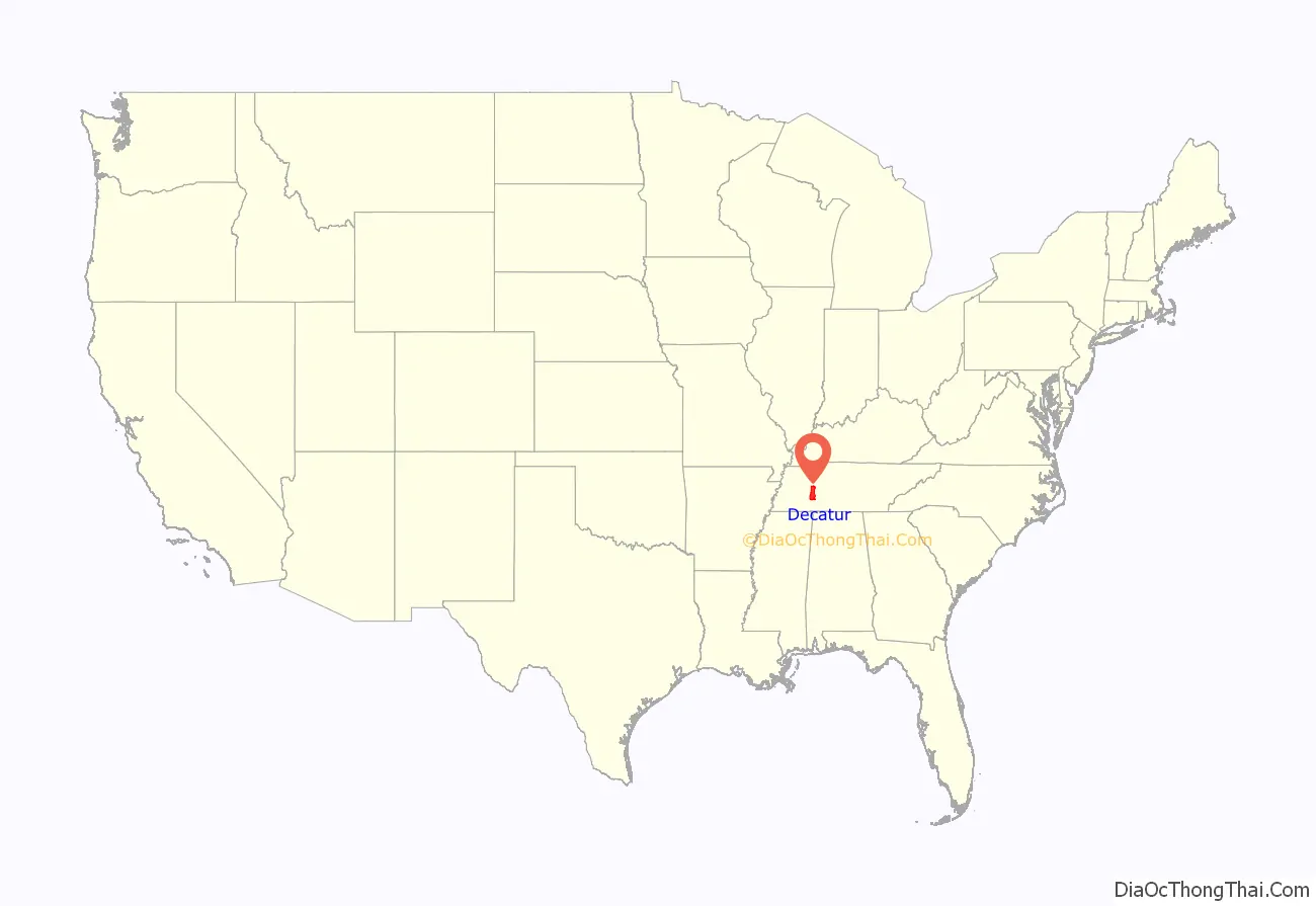
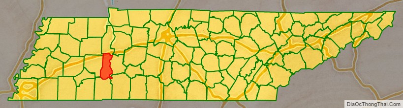
Decatur County location map. Where is Decatur County?
History
This county is named after naval hero Stephen Decatur, Jr., who gained national recognition in the First Barbary War, the Second Barbary War, and the War of 1812 by his leadership and achievements at sea. The county was created in November 1845 from the part of Perry County west of the Tennessee River in response to a petition by citizens on the west side of the river who lacked easy access to the county seat on the east side.
In 2015, the Decatur County clerk of court and the entire staff of that office resigned, to express conscientious objection to the United States Supreme Court’s ruling in Obergefell v. Hodges, which would oblige the office to issue marriage licenses to same-sex couples.
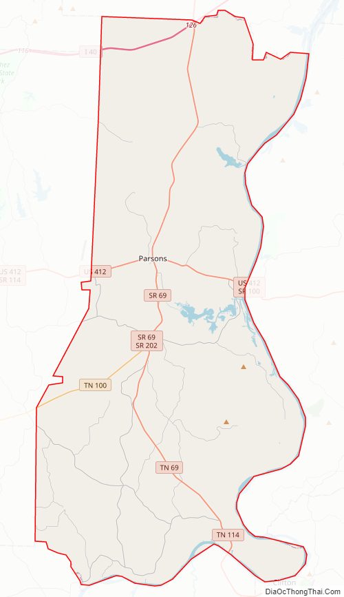
Decatur County Road Map
Geography
According to the U.S. Census Bureau, the county has a total area of 345 square miles (890 km), of which 334 square miles (870 km) is land and 11 square miles (28 km) (3.2%) is water.
Adjacent counties
- Benton County (north)
- Perry County (east)
- Wayne County (southeast)
- Hardin County (south)
- Henderson County (west)
- Carroll County (northwest)
National protected area
- Tennessee National Wildlife Refuge (part)
State protected area
- Carroll Cabin Barrens State Natural Area
- Cypress Pond Refuge
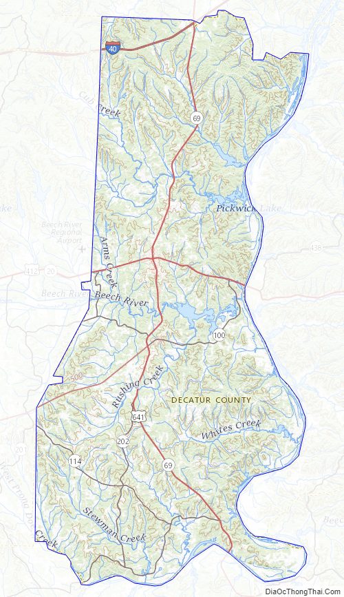
Decatur County Topographic Map
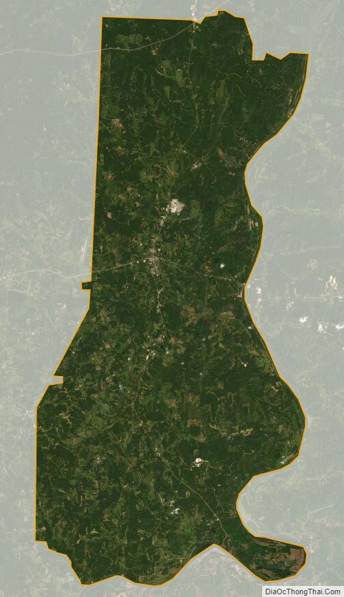
Decatur County Satellite Map
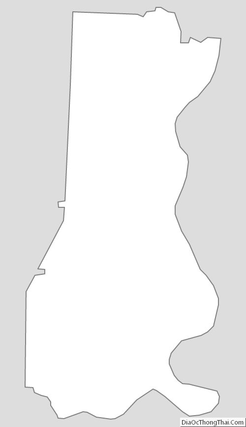
Decatur County Outline Map
See also
Map of Tennessee State and its subdivision:- Anderson
- Bedford
- Benton
- Bledsoe
- Blount
- Bradley
- Campbell
- Cannon
- Carroll
- Carter
- Cheatham
- Chester
- Claiborne
- Clay
- Cocke
- Coffee
- Crockett
- Cumberland
- Davidson
- Decatur
- DeKalb
- Dickson
- Dyer
- Fayette
- Fentress
- Franklin
- Gibson
- Giles
- Grainger
- Greene
- Grundy
- Hamblen
- Hamilton
- Hancock
- Hardeman
- Hardin
- Hawkins
- Haywood
- Henderson
- Henry
- Hickman
- Houston
- Humphreys
- Jackson
- Jefferson
- Johnson
- Knox
- Lake
- Lauderdale
- Lawrence
- Lewis
- Lincoln
- Loudon
- Macon
- Madison
- Marion
- Marshall
- Maury
- McMinn
- McNairy
- Meigs
- Monroe
- Montgomery
- Moore
- Morgan
- Obion
- Overton
- Perry
- Pickett
- Polk
- Putnam
- Rhea
- Roane
- Robertson
- Rutherford
- Scott
- Sequatchie
- Sevier
- Shelby
- Smith
- Stewart
- Sullivan
- Sumner
- Tipton
- Trousdale
- Unicoi
- Union
- Van Buren
- Warren
- Washington
- Wayne
- Weakley
- White
- Williamson
- Wilson
- Alabama
- Alaska
- Arizona
- Arkansas
- California
- Colorado
- Connecticut
- Delaware
- District of Columbia
- Florida
- Georgia
- Hawaii
- Idaho
- Illinois
- Indiana
- Iowa
- Kansas
- Kentucky
- Louisiana
- Maine
- Maryland
- Massachusetts
- Michigan
- Minnesota
- Mississippi
- Missouri
- Montana
- Nebraska
- Nevada
- New Hampshire
- New Jersey
- New Mexico
- New York
- North Carolina
- North Dakota
- Ohio
- Oklahoma
- Oregon
- Pennsylvania
- Rhode Island
- South Carolina
- South Dakota
- Tennessee
- Texas
- Utah
- Vermont
- Virginia
- Washington
- West Virginia
- Wisconsin
- Wyoming