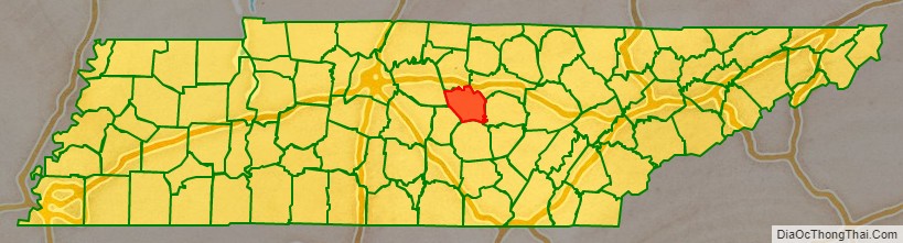
DeKalb County is a county located in the U.S. state of Tennessee. As of the 2020 census, the population was 20,080. Its county seat is Smithville. The county was created by the General Assembly of Tennessee on December 2, 1837, and was named for Revolutionary War hero Major General Johann de Kalb.
| Name: | DeKalb County |
|---|---|
| FIPS code: | 47-041 |
| State: | Tennessee |
| Founded: | 1837 |
| Named for: | Johann de Kalb |
| Seat: | Smithville |
| Largest city: | Smithville |
| Total Area: | 329 sq mi (850 km²) |
| Land Area: | 304 sq mi (790 km²) |
| Total Population: | 20,080 |
| Population Density: | 62/sq mi (24/km²) |
| Time zone: | UTC−6 (Central) |
| Summer Time Zone (DST): | UTC−5 (CDT) |
| Website: | dekalbtennessee.com |
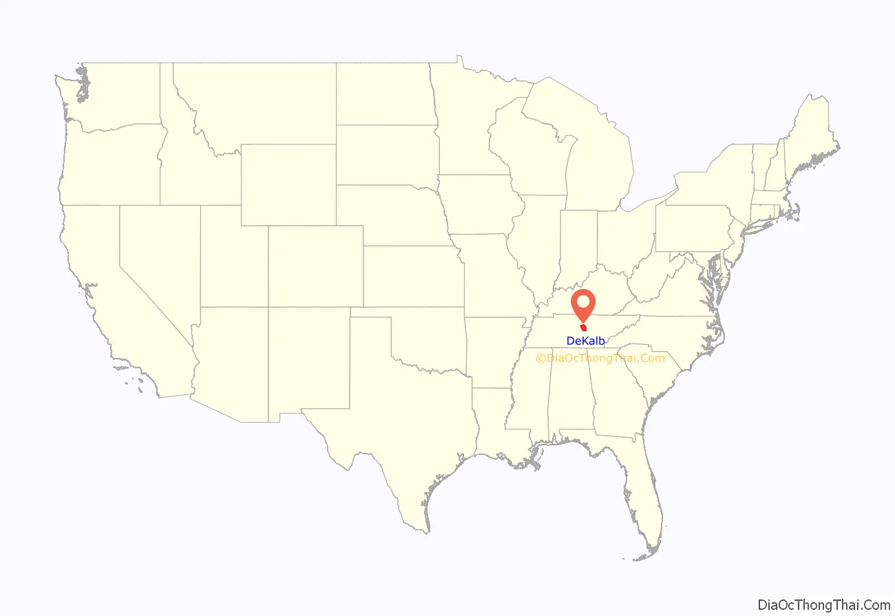
DeKalb County location map. Where is DeKalb County?
History
DeKalb County was formed in 1837 from land in Cannon, Warren and White counties. Historian Will T. Hale believes that the first settlers in the county were at Liberty and came from Maryland in 1797. If so, Addison Puckett was the first settler. She may have come over the Cumberland Mountains, although some sources claim she came down the Ohio, up the Cumberland to Nashville, and then overland about 69 miles (111 km) to Liberty.
DeKalb County was the site of several saltpeter mines, the main ingredient of gunpowder, and was obtained by leaching the earth from several local caves. Overall Cave was named for Abraham Overall who moved from Luray, Virginia, and settled near the present site of Liberty in 1805. He reportedly had many slaves and owned a large plantation on which Overall Cave is located. Two saltpeter leaching vats in the cave may date from the War of 1812, although this area was mined again during the Civil War. Other caves in DeKalb County that were mined for saltpeter include Avant Cave, located near Dowelltown, Indian Grave Point Cave, located in the Dry Creek Valley, and Temperance Saltpeter Cave, located near Temperance Hall.
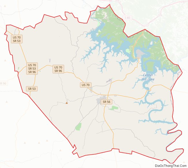
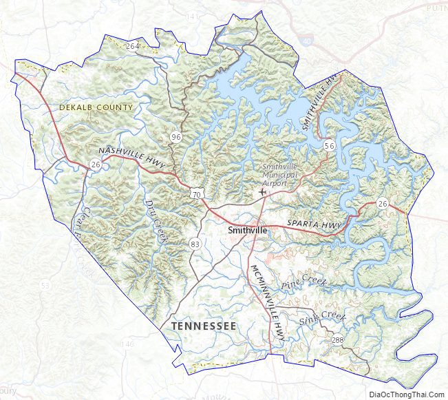
DeKalb County Road Map
Geography
According to the U.S. Census Bureau, the county has a total area of 329 square miles (850 km), of which 304 square miles (790 km) is land and 25 square miles (65 km) (7.5%) is water.
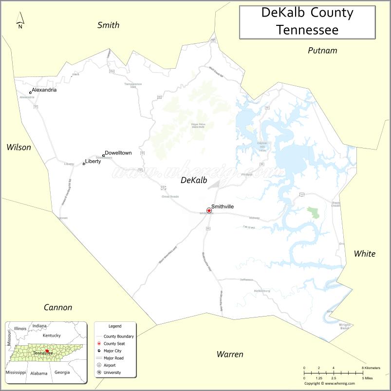
Adjacent counties
- Putnam County (northeast)
- White County (east)
- Warren County (south)
- Cannon County (southwest)
- Wilson County (west)
- Smith County (northwest)
State protected areas
- Edgar Evins State Park
- Pea Ridge Wildlife Management Area
DeKalb County Topographic Map
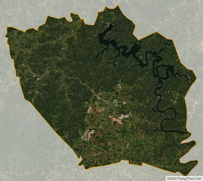
DeKalb County Satellite Map
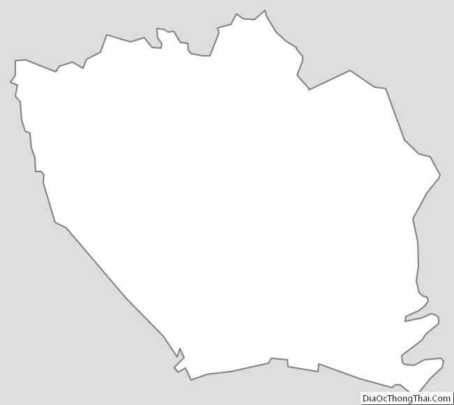
DeKalb County Outline Map
See also
Map of Tennessee State and its subdivision:- Anderson
- Bedford
- Benton
- Bledsoe
- Blount
- Bradley
- Campbell
- Cannon
- Carroll
- Carter
- Cheatham
- Chester
- Claiborne
- Clay
- Cocke
- Coffee
- Crockett
- Cumberland
- Davidson
- Decatur
- DeKalb
- Dickson
- Dyer
- Fayette
- Fentress
- Franklin
- Gibson
- Giles
- Grainger
- Greene
- Grundy
- Hamblen
- Hamilton
- Hancock
- Hardeman
- Hardin
- Hawkins
- Haywood
- Henderson
- Henry
- Hickman
- Houston
- Humphreys
- Jackson
- Jefferson
- Johnson
- Knox
- Lake
- Lauderdale
- Lawrence
- Lewis
- Lincoln
- Loudon
- Macon
- Madison
- Marion
- Marshall
- Maury
- McMinn
- McNairy
- Meigs
- Monroe
- Montgomery
- Moore
- Morgan
- Obion
- Overton
- Perry
- Pickett
- Polk
- Putnam
- Rhea
- Roane
- Robertson
- Rutherford
- Scott
- Sequatchie
- Sevier
- Shelby
- Smith
- Stewart
- Sullivan
- Sumner
- Tipton
- Trousdale
- Unicoi
- Union
- Van Buren
- Warren
- Washington
- Wayne
- Weakley
- White
- Williamson
- Wilson
- Alabama
- Alaska
- Arizona
- Arkansas
- California
- Colorado
- Connecticut
- Delaware
- District of Columbia
- Florida
- Georgia
- Hawaii
- Idaho
- Illinois
- Indiana
- Iowa
- Kansas
- Kentucky
- Louisiana
- Maine
- Maryland
- Massachusetts
- Michigan
- Minnesota
- Mississippi
- Missouri
- Montana
- Nebraska
- Nevada
- New Hampshire
- New Jersey
- New Mexico
- New York
- North Carolina
- North Dakota
- Ohio
- Oklahoma
- Oregon
- Pennsylvania
- Rhode Island
- South Carolina
- South Dakota
- Tennessee
- Texas
- Utah
- Vermont
- Virginia
- Washington
- West Virginia
- Wisconsin
- Wyoming