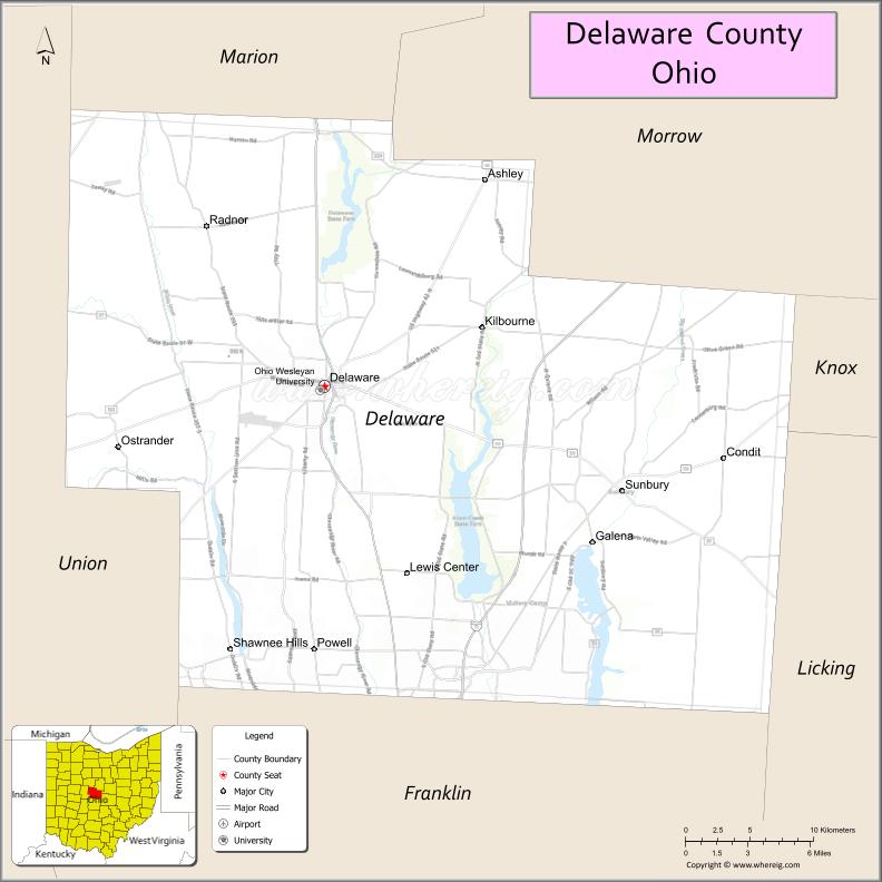
Delaware County is a county located in the central portion of the U.S. state of Ohio. It is a frequent placeholder on the List of highest-income counties in the United States. As of the 2020 census, the population was 214,124. Its county seat and largest city is Delaware. The county was formed in 1808 from Franklin County, Ohio. Both the county and its seat are named after the Delaware Indian tribe. Delaware County was listed as the 35th wealthiest county in the United States in 2020. Delaware County is included in the Columbus, Ohio, metropolitan area. U.S. President Rutherford B. Hayes was born and raised in Delaware County. It is also home to the Columbus Zoo and Aquarium.
| Name: | Delaware County |
|---|---|
| FIPS code: | 39-041 |
| State: | Ohio |
| Founded: | February 10, 1808 |
| Named for: | the Delaware Indians |
| Seat: | Delaware |
| Largest city: | Delaware* |
| Total Area: | 457 sq mi (1,180 km²) |
| Land Area: | 443 sq mi (1,150 km²) |
| Total Population: | 214,124 |
| Population Density: | 470/sq mi (180/km²) |
| Time zone: | UTC−5 (Eastern) |
| Summer Time Zone (DST): | UTC−4 (EDT) |
| Website: | www.co.delaware.oh.us |
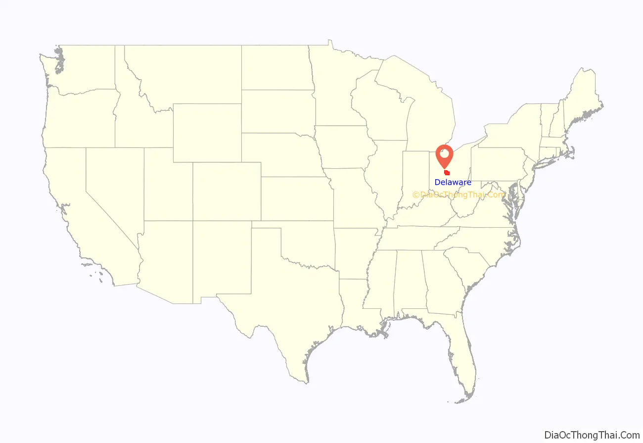
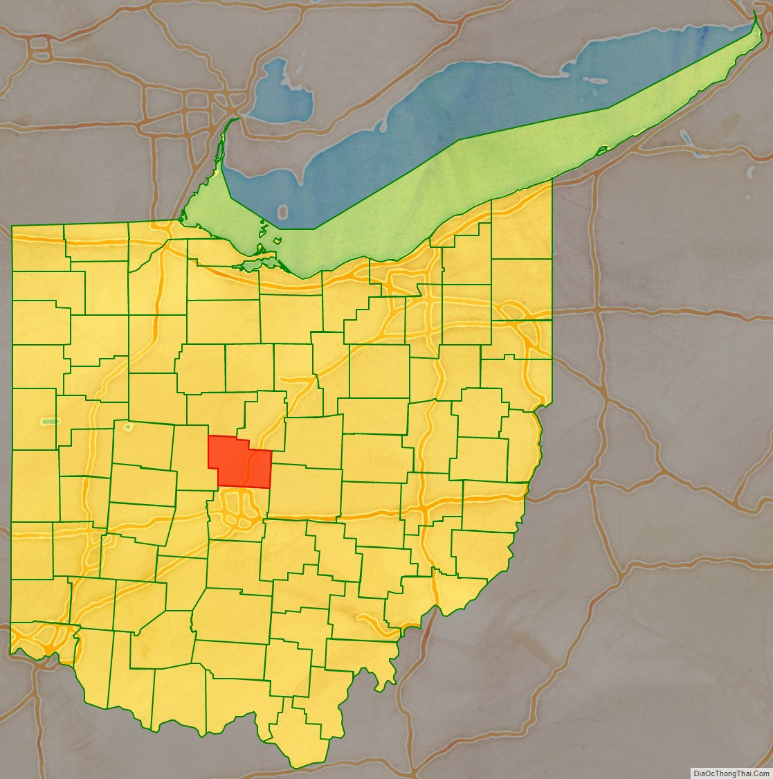
Delaware County location map. Where is Delaware County?
History
The area including Delaware County was once home to numerous Native American tribes. In 1804, Colonel Moses Byxbe and Henry Baldwin, among others, migrated to central Ohio from Berkshire County, Massachusetts, and built a town on the west bank of the Olentangy River. On February 10, 1808, the Ohio government authorized the creation of Delaware County. Following the War of 1812, settlers began to arrive in the county and settled down in Delaware. The town was incorporated in 1816, being the first incorporated town in the county. Powell, originally named Middlebury, was founded in 1801, but was not incorporated until 1947. Sunbury was founded in 1816. Ohio Wesleyan University, a liberal arts college, was founded by Methodists in 1842.
Delaware County had Northern sympathies during the Civil War, and abolitionists brought the Underground Railroad through the area. A local road, Africa Road, derives its name from the era. Camp Delaware was one of the few Civil War camps that deployed African American soldiers. The Civil War played an important part in Delaware County’s growth, bringing railroad business and technology. By 1900, Delaware had its first electric streetway, and an electric interurban railroad connecting Marion and Columbus ran through the county. The Little Brown Jug race was founded in 1946, and is one of the races in the Triple Crown of Harness Racing for Pacers.
In 2008, Forbes magazine ranked Delaware County as the fifth best place in the United States to raise a family and the second best in Ohio, behind Geauga County. in 2020 Delaware was rated the best county to live in Ohio and 24th in the United States by Niche, 17th healthiest county by US News, and 24th best counties to live in by 247WallSt.
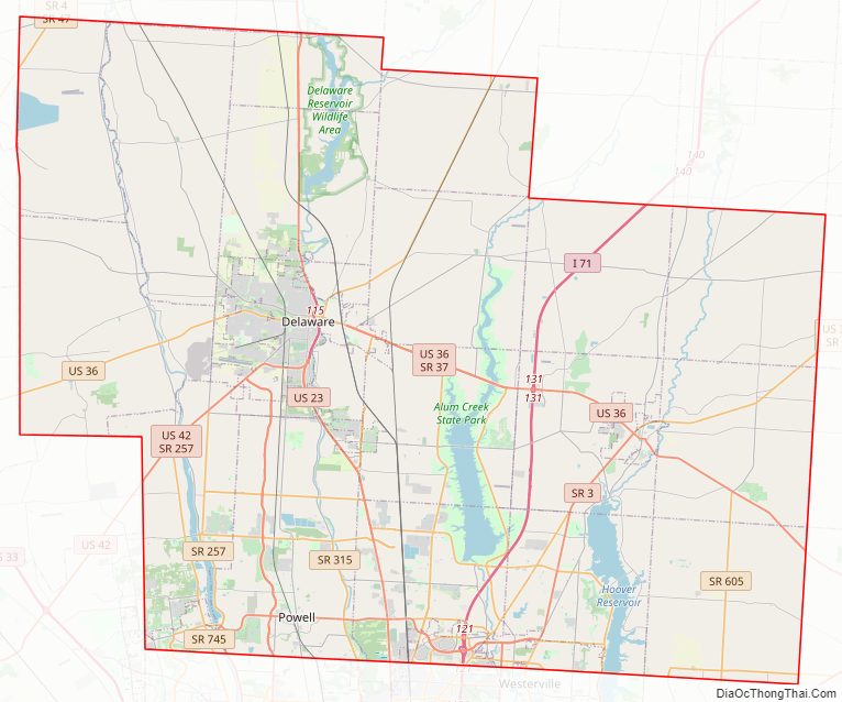
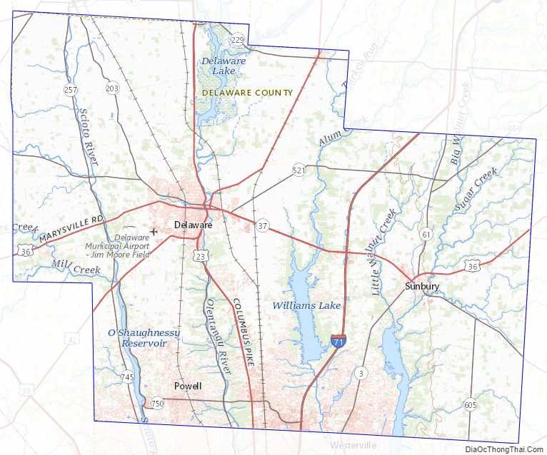
Delaware County Road Map
Geography
According to the United States Census Bureau, the county has a total area of 457 square miles (1,180 km), of which 443 square miles (1,150 km) is land and 14 square miles (36 km) (3.1%) is water. The county has an even terrain and a fertile soil.
Adjacent counties
- Morrow County (north)
- Knox County (northeast)
- Licking County (east)
- Franklin County (south)
- Union County (west)
- Marion County (northwest)
Lakes and rivers
The major rivers of the county are the Scioto River, Olentangy River, Alum Creek, and the Big Walnut Creek. These waterways run from north to south across the county. The Alum Creek Lake and the Delaware Lake are reservoirs created on Alum Creek and the Olentangy River, respectively.
Delaware County Topographic Map
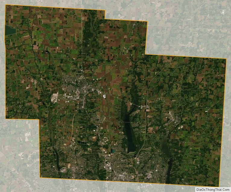
Delaware County Satellite Map
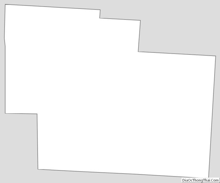
Delaware County Outline Map
See also
Map of Ohio State and its subdivision:- Adams
- Allen
- Ashland
- Ashtabula
- Athens
- Auglaize
- Belmont
- Brown
- Butler
- Carroll
- Champaign
- Clark
- Clermont
- Clinton
- Columbiana
- Coshocton
- Crawford
- Cuyahoga
- Darke
- Defiance
- Delaware
- Erie
- Fairfield
- Fayette
- Franklin
- Fulton
- Gallia
- Geauga
- Greene
- Guernsey
- Hamilton
- Hancock
- Hardin
- Harrison
- Henry
- Highland
- Hocking
- Holmes
- Huron
- Jackson
- Jefferson
- Knox
- Lake
- Lake Erie
- Lawrence
- Licking
- Logan
- Lorain
- Lucas
- Madison
- Mahoning
- Marion
- Medina
- Meigs
- Mercer
- Miami
- Monroe
- Montgomery
- Morgan
- Morrow
- Muskingum
- Noble
- Ottawa
- Paulding
- Perry
- Pickaway
- Pike
- Portage
- Preble
- Putnam
- Richland
- Ross
- Sandusky
- Scioto
- Seneca
- Shelby
- Stark
- Summit
- Trumbull
- Tuscarawas
- Union
- Van Wert
- Vinton
- Warren
- Washington
- Wayne
- Williams
- Wood
- Wyandot
- Alabama
- Alaska
- Arizona
- Arkansas
- California
- Colorado
- Connecticut
- Delaware
- District of Columbia
- Florida
- Georgia
- Hawaii
- Idaho
- Illinois
- Indiana
- Iowa
- Kansas
- Kentucky
- Louisiana
- Maine
- Maryland
- Massachusetts
- Michigan
- Minnesota
- Mississippi
- Missouri
- Montana
- Nebraska
- Nevada
- New Hampshire
- New Jersey
- New Mexico
- New York
- North Carolina
- North Dakota
- Ohio
- Oklahoma
- Oregon
- Pennsylvania
- Rhode Island
- South Carolina
- South Dakota
- Tennessee
- Texas
- Utah
- Vermont
- Virginia
- Washington
- West Virginia
- Wisconsin
- Wyoming