Dimmit County (/ˈdɪmɪt/ DIM-it) is a county located in the U.S. state of Texas. As of the 2020 census, its population was 8,615. The county seat is Carrizo Springs. The county was founded in 1858 and later organized in 1880. It is named after Philip Dimmitt, a major figure in the Texas Revolution. The spelling of the county name and the individual’s name differ because of a spelling error in the bill creating the county name.
| Name: | Dimmit County |
|---|---|
| FIPS code: | 48-127 |
| State: | Texas |
| Founded: | 1858 |
| Named for: | Philip Dimmitt |
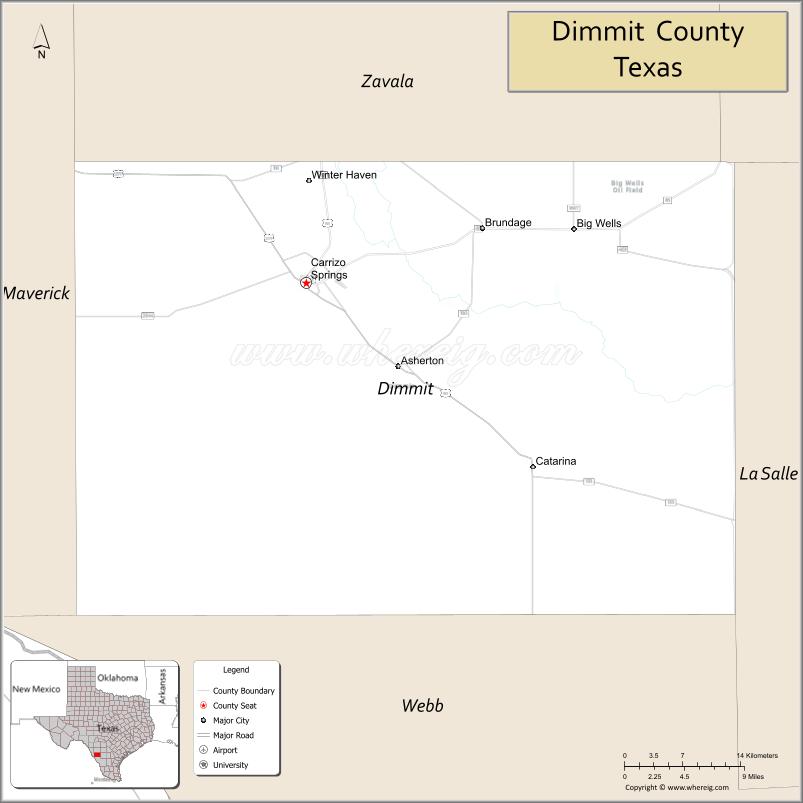
| Seat: | Carrizo Springs |
| Largest city: | Carrizo Springs |
| Total Area: | 1,335 sq mi (3,460 km²) |
| Land Area: | 1,329 sq mi (3,440 km²) |
| Total Population: | 8,615 |
| Population Density: | 6.5/sq mi (2.5/km²) |
| Time zone: | UTC−6 (Central) |
| Summer Time Zone (DST): | UTC−5 (CDT) |
| Website: | www.dimmitcounty.org |
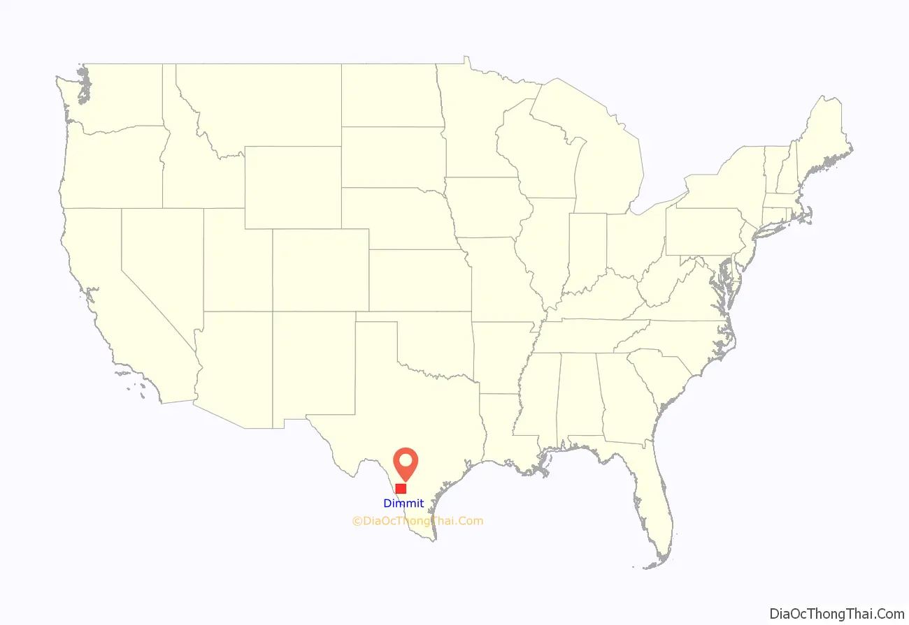
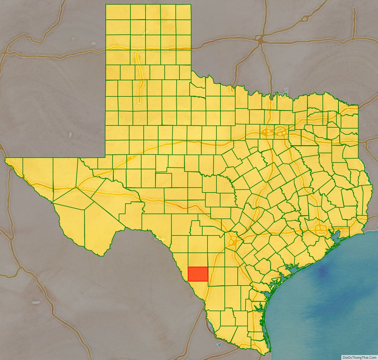
Dimmit County location map. Where is Dimmit County?
History
Native Americans
Paleo-Indians artifacts indicate these people lived in Dimmit County as far back as 9200 BC. The archaic period (6000 BC to AD 1000) up to the arrival of the Spanish brought increased hunter-gatherers to the area. These Indians subsisted mostly on game, wild fruits, seeds, and roots. They carved tools from wood and stone, wove baskets, and sewed rabbitskin robes. They also made pottery and hunted with bows and arrows. Their most effective weapon was the atlatl, a throwing stick that greatly increased the deadliness of their spears. Coahuiltecan Indians native to now-Dimmit County were later squeezed out by Apache and Comanche. Hostile tribes harassed settlers, forcing some to pull up stakes. Texas Rangers and local volunteers, as well as disease, ran the Indians out of the county by 1877.
The Wild Horse Desert
The area between the Rio Grande and the Nueces River, which included the county, became disputed territory known as the Wild Horse Desert, where neither the Republic of Texas nor the Mexican government had clear control. Ownership was in dispute until the Mexican–American War. The area became filled with lawless characters, who deterred settlers in the area. An agreement signed between Mexico and the United States in the 1930s put the liability of payments to the descendants of the original land grants on Mexico.
County established and settlements
Dimmit County was officially established in 1858 from parts of Bexar, Webb, Maverick, and Uvalde Counties. The county was organized in 1880. Carrizo Springs became the county seat.
Early settlers found Dimmit County to be an abundant grassland with mesquite, oak, and ash trees and wildlife that included buffalo, deer, turkeys, feral horses (mustangs), panthers, and javelinas. Artesian springs, bubbling up from a vast reservoir of underground water, fed into running streams that harbored giant catfish, crawfish, and mussels. Explorers found the area a good place to hunt mustangs, and to feed and water cattle.
Pioneering cattleman Levi English settled Carrizo Springs in 1865 with a group of 15 families from Atascosa County. Within two years, they were joined by a second group of settlers from Goliad County. Early dwellings were crude adobe structures or dugouts. In 1880, Levi English donated land for a county courthouse, schools, and churches in the town.
Lawlessness, banditry, and in particular, cattle rustling from both sides of the Mexican border, pervaded until the 1880s. Marshal J. King Fisher, managed to bring about a reduction in the lawlessness. King also staunchly enforced the “dry county” law once the residents voted to outlaw the sale of alcohol.
Dimmit County’s first producing oil well was drilled in 1943. In 1980, Dimmit County farmers earned about $20 million for their crops, while about $60 million in oil and gas were produced.
Formation of the 1914 White Man’s Primary Association was designed to exclude Mexican Americans from any meaningful participation in county politics. In the 1944 Smith v. Allwright case, the United States Supreme Court found the White Primary to be unconstitutional.
Water
D.C. Frazier drilled the first artesian well, which produced gallons of water a minute, near Carrizo Springs in 1884. By 1900, about 25 artesian wells were flowing in the Carrizo Springs area, but most of the water was wasted, and very little was used for irrigation. Colonel J.S. Taylor introduced large-scale Bermuda onion and strawberry farming to the area, and was the first to use irrigation on a large scale in Dimmit County. In 1899, Taylor built a 30 ft dam across the Nueces River to irrigate 2,000 acres (8.1 km) of farmland. He also drilled a deep artesian well. By 1910, Taylor’s methods were being imitated by a number of other developers and vegetable farmers. Irrigation helped make Dimmit County part of the Texas Winter Garden region. By the 1920s, however, artesian water began to dry up. The necessity of installing expensive pumps drove many farmers out of business. By 1934, the United States Department of the Interior concluded that the existing water supply would not support substantial additional development. By 1965, only about 15,000 acres (61 km) were being irrigated. Much of the land reverted to rangeland.
Oil
The Big Wells oil field, east of Big Wells, was discovered in 1969. The field produces from the Cretaceous San Miguel Formation sandstone underlying the Olmos Formation sandstone. The field extends north into Zavala.
The Eagle Ford oil field was reported to be under development in 2011, with 3,000 wells projected to extract oil by hydraulic fracturing from tight shale formations. The oil play has improved business activity in the county, but raised fears regarding the adequacy of water supplies, as fracking requires injection of large quantities of water under pressure into wells to break surrounding rock.
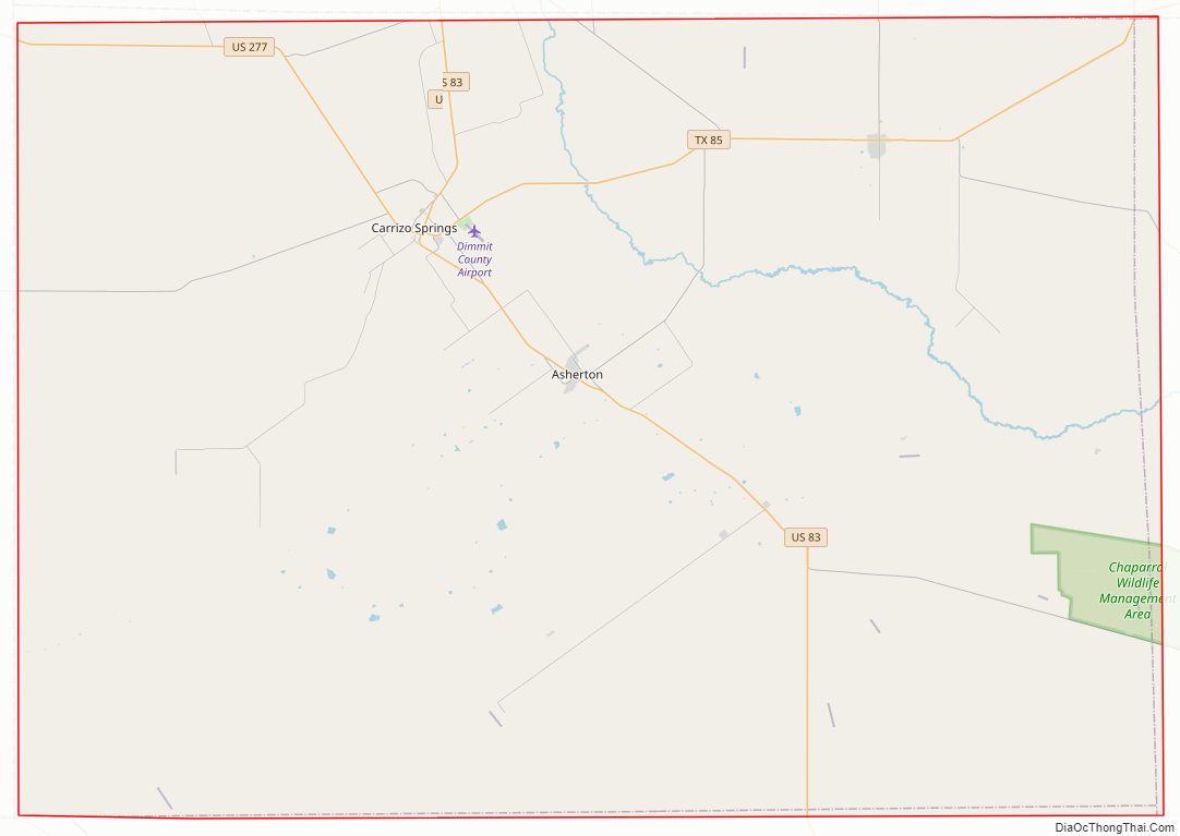
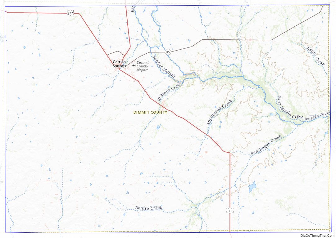
Dimmit County Road Map
Geography
According to the U.S. Census Bureau, the county has a total area of 1,335 sq mi (3,460 km), of which { 5.6 square miles (15 km) (0.4%) are covered by water.
Major highways
- U.S. Highway 83
- U.S. Highway 277
- State Highway 85
Adjacent counties
- Zavala County (north)
- Frio County (northeast)
- La Salle County (east)
- Webb County (south)
- Maverick County (west)
Dimmit County Topographic Map
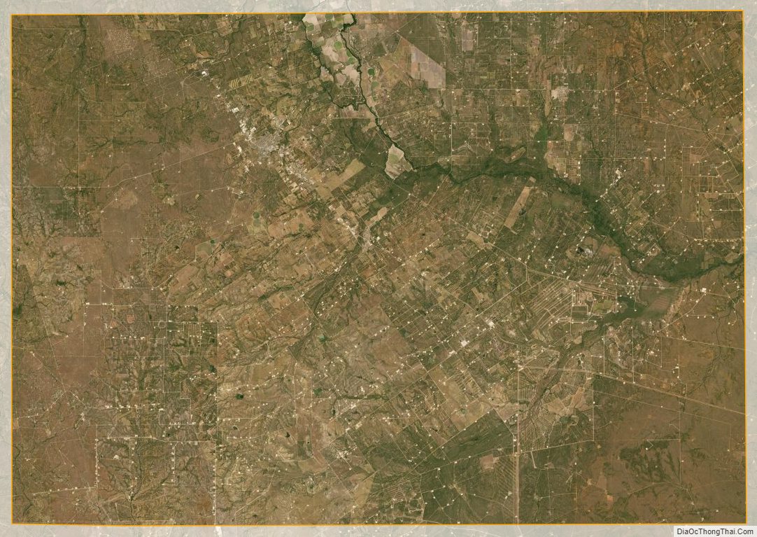
Dimmit County Satellite Map
Dimmit County Outline Map

See also
Map of Texas State and its subdivision:- Anderson
- Andrews
- Angelina
- Aransas
- Archer
- Armstrong
- Atascosa
- Austin
- Bailey
- Bandera
- Bastrop
- Baylor
- Bee
- Bell
- Bexar
- Blanco
- Borden
- Bosque
- Bowie
- Brazoria
- Brazos
- Brewster
- Briscoe
- Brooks
- Brown
- Burleson
- Burnet
- Caldwell
- Calhoun
- Callahan
- Cameron
- Camp
- Carson
- Cass
- Castro
- Chambers
- Cherokee
- Childress
- Clay
- Cochran
- Coke
- Coleman
- Collin
- Collingsworth
- Colorado
- Comal
- Comanche
- Concho
- Cooke
- Coryell
- Cottle
- Crane
- Crockett
- Crosby
- Culberson
- Dallam
- Dallas
- Dawson
- Deaf Smith
- Delta
- Denton
- Dewitt
- Dickens
- Dimmit
- Donley
- Duval
- Eastland
- Ector
- Edwards
- El Paso
- Ellis
- Erath
- Falls
- Fannin
- Fayette
- Fisher
- Floyd
- Foard
- Fort Bend
- Franklin
- Freestone
- Frio
- Gaines
- Galveston
- Garza
- Gillespie
- Glasscock
- Goliad
- Gonzales
- Gray
- Grayson
- Gregg
- Grimes
- Guadalupe
- Hale
- Hall
- Hamilton
- Hansford
- Hardeman
- Hardin
- Harris
- Harrison
- Hartley
- Haskell
- Hays
- Hemphill
- Henderson
- Hidalgo
- Hill
- Hockley
- Hood
- Hopkins
- Houston
- Howard
- Hudspeth
- Hunt
- Hutchinson
- Irion
- Jack
- Jackson
- Jasper
- Jeff Davis
- Jefferson
- Jim Hogg
- Jim Wells
- Johnson
- Jones
- Karnes
- Kaufman
- Kendall
- Kenedy
- Kent
- Kerr
- Kimble
- King
- Kinney
- Kleberg
- Knox
- La Salle
- Lamar
- Lamb
- Lampasas
- Lavaca
- Lee
- Leon
- Liberty
- Limestone
- Lipscomb
- Live Oak
- Llano
- Loving
- Lubbock
- Lynn
- Madison
- Marion
- Martin
- Mason
- Matagorda
- Maverick
- McCulloch
- McLennan
- McMullen
- Medina
- Menard
- Midland
- Milam
- Mills
- Mitchell
- Montague
- Montgomery
- Moore
- Morris
- Motley
- Nacogdoches
- Navarro
- Newton
- Nolan
- Nueces
- Ochiltree
- Oldham
- Orange
- Palo Pinto
- Panola
- Parker
- Parmer
- Pecos
- Polk
- Potter
- Presidio
- Rains
- Randall
- Reagan
- Real
- Red River
- Reeves
- Refugio
- Roberts
- Robertson
- Rockwall
- Runnels
- Rusk
- Sabine
- San Augustine
- San Jacinto
- San Patricio
- San Saba
- Schleicher
- Scurry
- Shackelford
- Shelby
- Sherman
- Smith
- Somervell
- Starr
- Stephens
- Sterling
- Stonewall
- Sutton
- Swisher
- Tarrant
- Taylor
- Terrell
- Terry
- Throckmorton
- Titus
- Tom Green
- Travis
- Trinity
- Tyler
- Upshur
- Upton
- Uvalde
- Val Verde
- Van Zandt
- Victoria
- Walker
- Waller
- Ward
- Washington
- Webb
- Wharton
- Wheeler
- Wichita
- Wilbarger
- Willacy
- Williamson
- Wilson
- Winkler
- Wise
- Wood
- Yoakum
- Young
- Zapata
- Zavala
- Alabama
- Alaska
- Arizona
- Arkansas
- California
- Colorado
- Connecticut
- Delaware
- District of Columbia
- Florida
- Georgia
- Hawaii
- Idaho
- Illinois
- Indiana
- Iowa
- Kansas
- Kentucky
- Louisiana
- Maine
- Maryland
- Massachusetts
- Michigan
- Minnesota
- Mississippi
- Missouri
- Montana
- Nebraska
- Nevada
- New Hampshire
- New Jersey
- New Mexico
- New York
- North Carolina
- North Dakota
- Ohio
- Oklahoma
- Oregon
- Pennsylvania
- Rhode Island
- South Carolina
- South Dakota
- Tennessee
- Texas
- Utah
- Vermont
- Virginia
- Washington
- West Virginia
- Wisconsin
- Wyoming