Dorchester County is a county located in the U.S. state of South Carolina. As of the 2020 census, the population was 161,540. Its county seat is St. George.
Dorchester County is included in the Charleston–North Charleston, SC Metropolitan Statistical Area.
| Name: | Dorchester County |
|---|---|
| FIPS code: | 45-035 |
| State: | South Carolina |
| Founded: | 1897 |
| Named for: | Dorchester, Massachusetts |
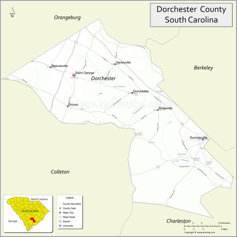
| Seat: | St. George |
| Largest city: | North Charleston |
| Total Area: | 576 sq mi (1,490 km²) |
| Land Area: | 573 sq mi (1,480 km²) |
| Total Population: | 163,327 |
| Population Density: | 285/sq mi (110/km²) |
| Time zone: | UTC−5 (Eastern) |
| Summer Time Zone (DST): | UTC−4 (EDT) |
| Website: | www.dorchestercountysc.gov |
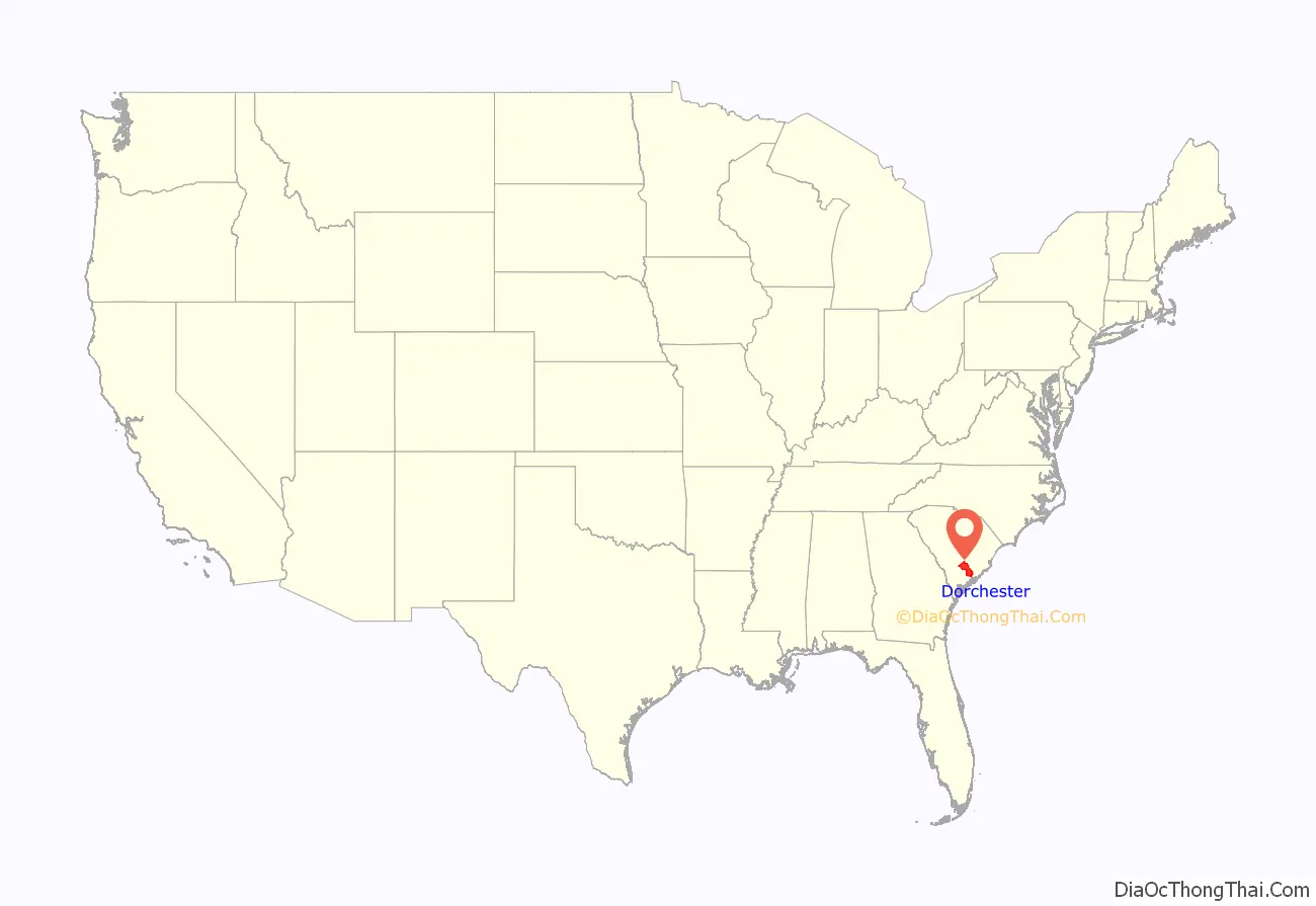
Dorchester County location map. Where is Dorchester County?
History
Dorchester County is named for its first settlement area, which was established by Congregationalists in 1696. These settlers applied the name “Dorchester” after their last residence in Dorchester, Massachusetts.
Dorchester was not established as a separate county until 1897. However, when it was separately established, it came from parts of the neighboring Colleton and Berkeley counties.
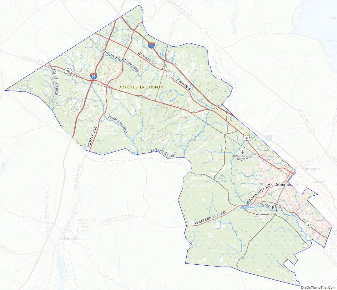
Dorchester County Road Map
Geography
According to the U.S. Census Bureau, the county has a total area of 576 square miles (1,490 km), of which 573 square miles (1,480 km) is land and 2.6 square miles (6.7 km) (0.4%) is water.
State and local protected areas/sites
- Colonial Dorchester State Historic Site
- Edisto River Wildlife Management Area
- Givhans Ferry State Park (part)
- Middleton Place
Major water bodies
- Ashley River
- Four Hole Swamp
- Edisto River
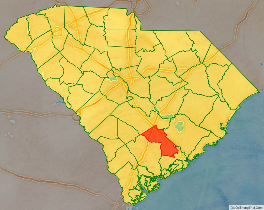
Adjacent counties
- Bamberg County – west
- Berkeley County – east
- Charleston County – southeast
- Colleton County – southwest
- Orangeburg County – northwest
Major highways
- I-26
- I-95
- US 15
- US 17
- US 17 Alt.
- US 17 Alt. Truck
- US 78
- US 178
- SC 27
- SC 61
- SC 61 Conn.
- SC 165
- SC 453
- SC 642
Major infrastructure
- Summerville Airport
Dorchester County Topographic Map
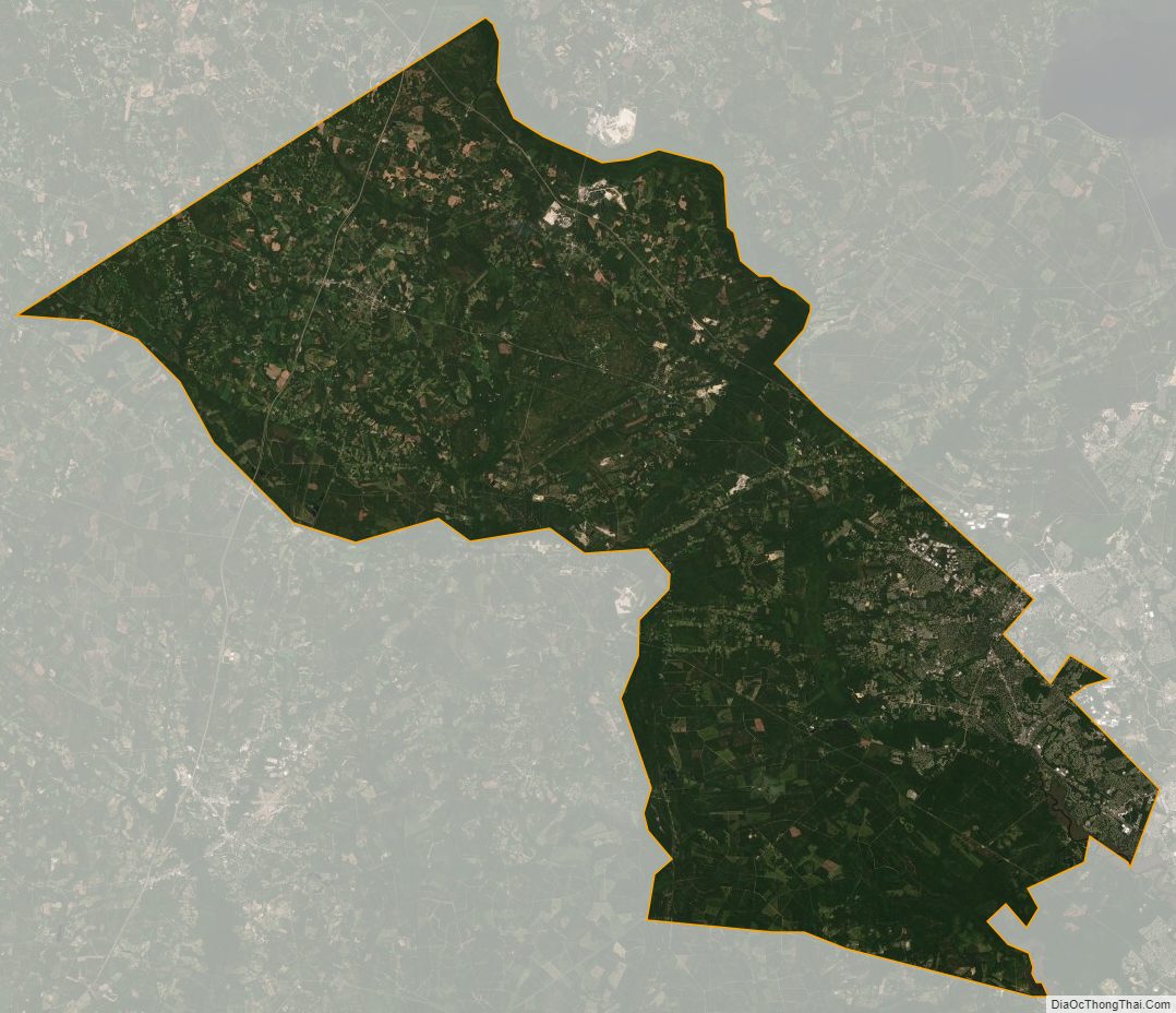
Dorchester County Satellite Map
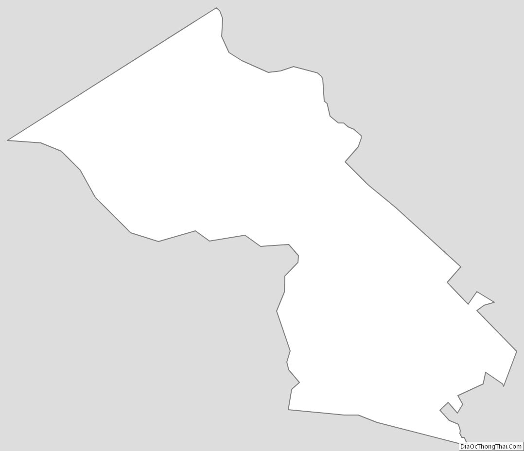
Dorchester County Outline Map
See also
Map of South Carolina State and its subdivision:- Abbeville
- Aiken
- Allendale
- Anderson
- Bamberg
- Barnwell
- Beaufort
- Berkeley
- Calhoun
- Charleston
- Cherokee
- Chester
- Chesterfield
- Clarendon
- Colleton
- Darlington
- Dillon
- Dorchester
- Edgefield
- Fairfield
- Florence
- Georgetown
- Greenville
- Greenwood
- Hampton
- Horry
- Jasper
- Kershaw
- Lancaster
- Laurens
- Lee
- Lexington
- Marion
- Marlboro
- McCormick
- Newberry
- Oconee
- Orangeburg
- Pickens
- Richland
- Saluda
- Spartanburg
- Sumter
- Union
- Williamsburg
- York
- Alabama
- Alaska
- Arizona
- Arkansas
- California
- Colorado
- Connecticut
- Delaware
- District of Columbia
- Florida
- Georgia
- Hawaii
- Idaho
- Illinois
- Indiana
- Iowa
- Kansas
- Kentucky
- Louisiana
- Maine
- Maryland
- Massachusetts
- Michigan
- Minnesota
- Mississippi
- Missouri
- Montana
- Nebraska
- Nevada
- New Hampshire
- New Jersey
- New Mexico
- New York
- North Carolina
- North Dakota
- Ohio
- Oklahoma
- Oregon
- Pennsylvania
- Rhode Island
- South Carolina
- South Dakota
- Tennessee
- Texas
- Utah
- Vermont
- Virginia
- Washington
- West Virginia
- Wisconsin
- Wyoming