| Name: | Douglas County |
|---|---|
| FIPS code: | 08-035 |
| State: | Colorado |
| Founded: | November 1, 1861 |
| Named for: | Stephen A. Douglas |
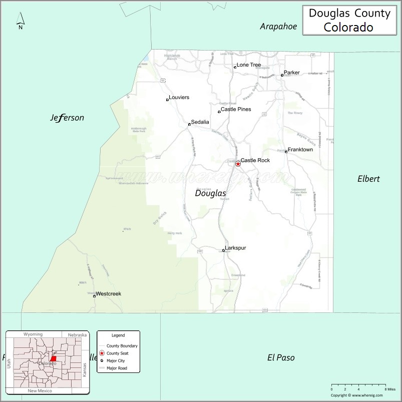
| Seat: | Castle Rock |
| Total Area: | 843 sq mi (2,180 km²) |
| Land Area: | 840 sq mi (2,200 km²) |
| Total Population: | 368,990 |
| Population Density: | 426/sq mi (164/km²) |
| Time zone: | UTC−7 (Mountain) |
| Summer Time Zone (DST): | UTC−6 (MDT) |
| Website: | www.douglas.co.us |
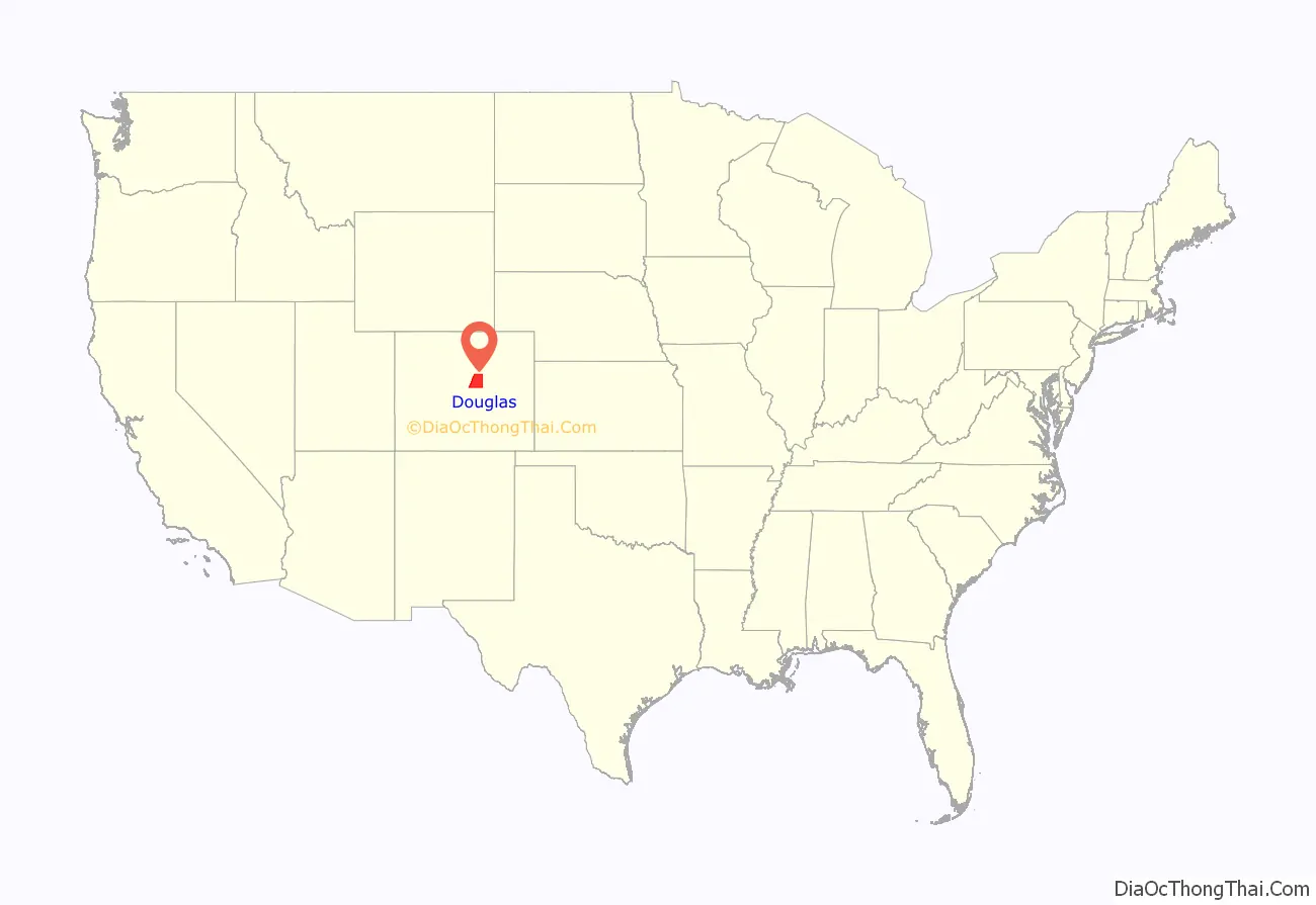
Douglas County location map. Where is Douglas County?
History
Douglas County was one of the original 17 counties created in the Colorado Territory by the Colorado Territorial Legislature on November 1, 1861. The county was named in honor of U.S. Senator Stephen A. Douglas of Illinois, who died five months before the county was created. The county seat was originally Franktown, but was moved to California Ranch in 1863, and then to Castle Rock in 1874. Although the county’s boundaries originally extended eastward to the Kansas state border, in 1874, most of the eastern portion of the county became part of Elbert County.
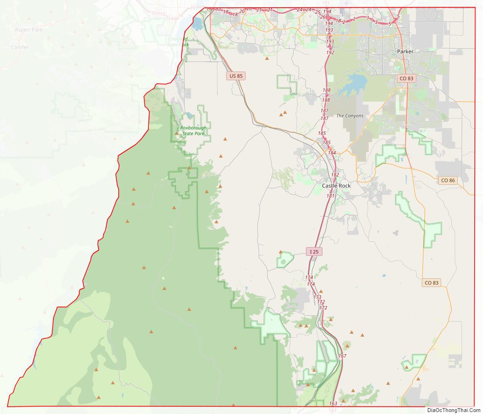
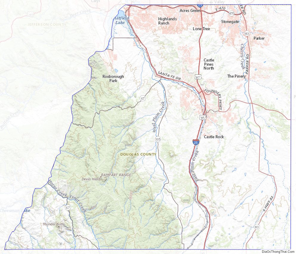
Douglas County Road Map
Geography
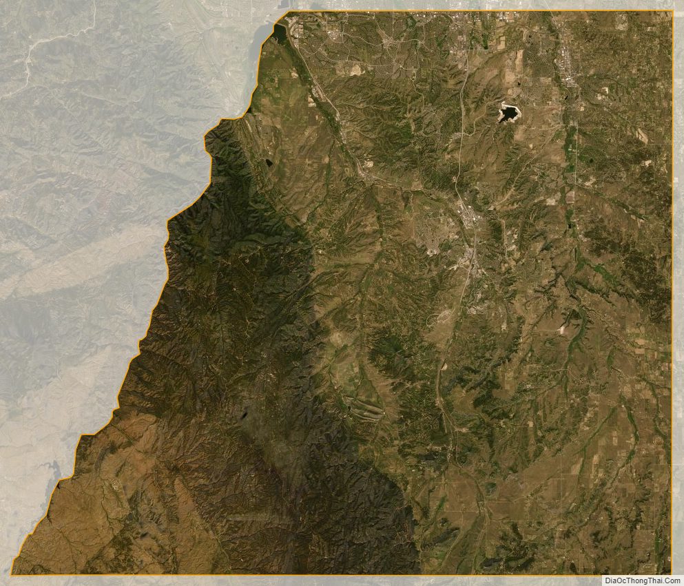
According to the U.S. Census Bureau, the county has a total area of 844 square miles (2,190 km), of which 841 square miles (2,180 km) are land and 2.6 square miles (6.7 km) (0.3%) are covered by water.
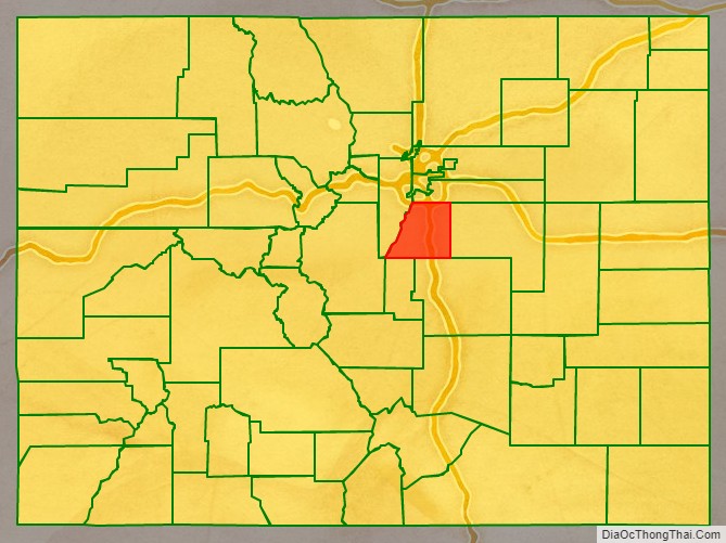
Adjacent counties
- Jefferson County, Colorado – west
- Arapahoe County, Colorado – north
- Elbert County, Colorado – east
- El Paso County, Colorado – south
- Teller County, Colorado – southwest
Major highways
- Interstate 25
- U.S. Highway 85
- U.S. Highway 87
- State Highway 67
- State Highway 83
- State Highway 86
- State Highway 105
- State Highway 121
- State Highway 470
- E-470 tollway
Parks and recreational areas
Three state parks fall within Douglas County: Castlewood Canyon State Park, Chatfield State Park and Roxborough State Park. Parts of the county lie within the Pike National Forest and were crossed by the historic South Platte Trail.
Recreation trails in the county include:
- American Discovery Trail
- Colorado Trail
- Devils Head National Recreation Trail
- Highline Canal National Recreation Trail
- Platte River Greenway National Recreation Trail
- Ridgeline Open Space Trail
- Bluffs Regional Park Trail
The Rueter–Hess Reservoir, when filled, may provide significant recreation, including fishing, hiking, and nonmotorized boating. If filled to capacity, surface size would be 1,140 acres, making this a fairly significant reservoir in Colorado and Douglas County’s largest body of water.
The Prairie Canyon Ranch, at 4620 CO-83, about 10 miles (16 km) south of Franktown, is a Douglas County Open Space. It is a working cattle ranch on 978 acres (3.96 km), open to the public on special events.
Douglas County Topographic Map
Douglas County Satellite Map
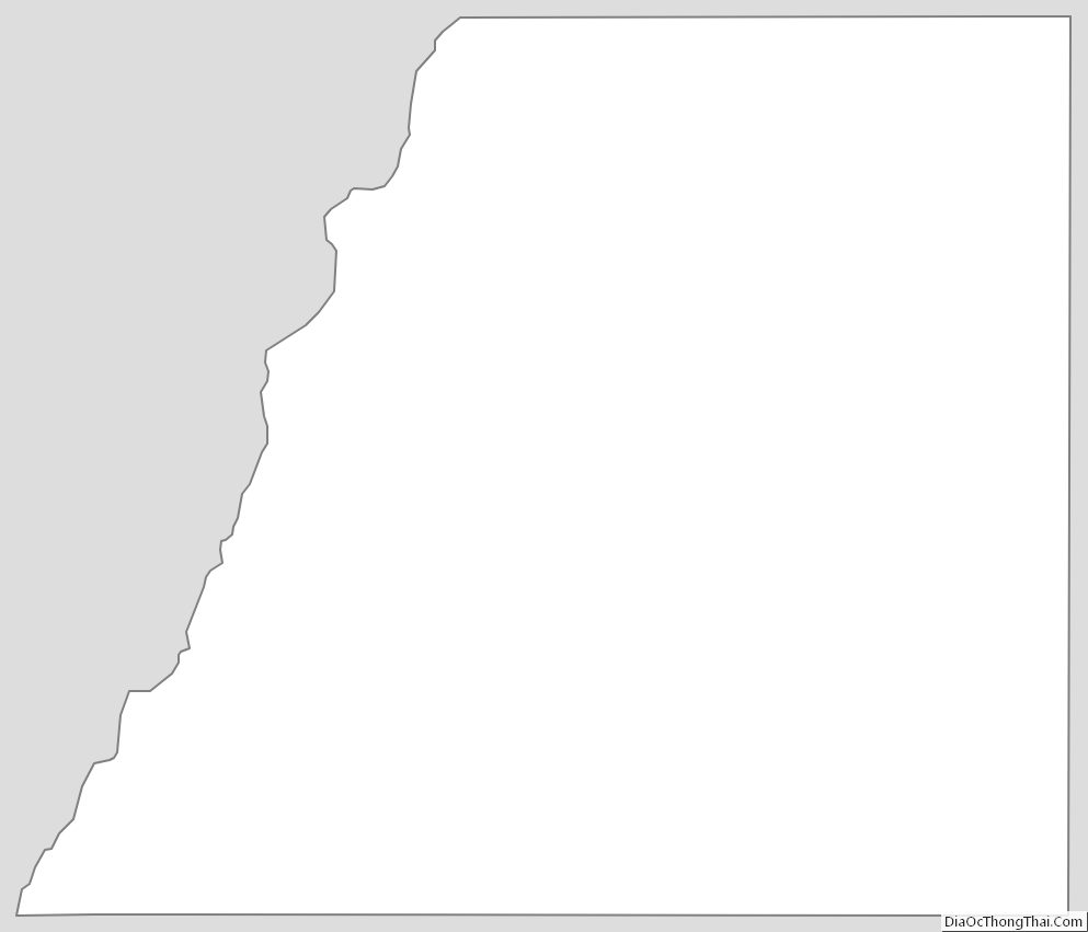
Douglas County Outline Map
See also
Map of Colorado State and its subdivision:- Adams
- Alamosa
- Arapahoe
- Archuleta
- Baca
- Bent
- Boulder
- Broomfield
- Chaffee
- Cheyenne
- Clear Creek
- Conejos
- Costilla
- Crowley
- Custer
- Delta
- Denver
- Dolores
- Douglas
- Eagle
- El Paso
- Elbert
- Fremont
- Garfield
- Gilpin
- Grand
- Gunnison
- Hinsdale
- Huerfano
- Jackson
- Jefferson
- Kiowa
- Kit Carson
- La Plata
- Lake
- Larimer
- Las Animas
- Lincoln
- Logan
- Mesa
- Mineral
- Moffat
- Montezuma
- Montrose
- Morgan
- Otero
- Ouray
- Park
- Phillips
- Pitkin
- Prowers
- Pueblo
- Rio Blanco
- Rio Grande
- Routt
- Saguache
- San Juan
- San Miguel
- Sedgwick
- Summit
- Teller
- Washington
- Weld
- Yuma
- Alabama
- Alaska
- Arizona
- Arkansas
- California
- Colorado
- Connecticut
- Delaware
- District of Columbia
- Florida
- Georgia
- Hawaii
- Idaho
- Illinois
- Indiana
- Iowa
- Kansas
- Kentucky
- Louisiana
- Maine
- Maryland
- Massachusetts
- Michigan
- Minnesota
- Mississippi
- Missouri
- Montana
- Nebraska
- Nevada
- New Hampshire
- New Jersey
- New Mexico
- New York
- North Carolina
- North Dakota
- Ohio
- Oklahoma
- Oregon
- Pennsylvania
- Rhode Island
- South Carolina
- South Dakota
- Tennessee
- Texas
- Utah
- Vermont
- Virginia
- Washington
- West Virginia
- Wisconsin
- Wyoming