| Name: | Douglas County |
|---|---|
| FIPS code: | 41-019 |
| State: | Oregon |
| Founded: | January 7, 1852 |
| Named for: | Stephen A. Douglas |
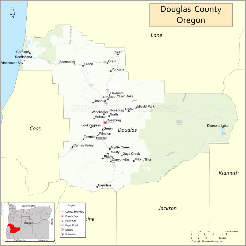
| Seat: | Roseburg |
| Largest city: | Roseburg |
| Total Area: | 5,134 sq mi (13,300 km²) |
| Land Area: | 5,036 sq mi (13,040 km²) |
| Total Population: | 111,201 |
| Population Density: | 21/sq mi (8/km²) |
| Time zone: | UTC−8 (Pacific) |
| Summer Time Zone (DST): | UTC−7 (PDT) |
| Website: | www.co.douglas.or.us |
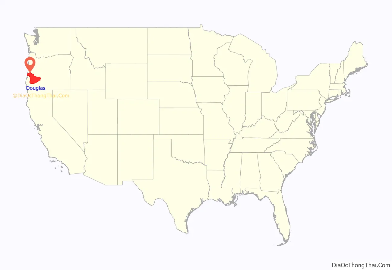
Douglas County location map. Where is Douglas County?

History
The area originally was inhabited by the Umpqua Indians, a grouping of natives who spoke a variety of Penutian and Athabaskan languages. Following the Rogue River Indian War in 1856, most of the remaining natives were moved by the government to the Grand Ronde Indian Reservation. However, seven families of Umpqua hid in the hills, eluding capture for many decades. They are now federally recognized as the Cow Creek Band of Umpqua Tribe of Indians. The tribe manages a small reservation in Canyonville, Oregon, and has a Casino/Hotel named Seven Feathers to represent the seven families who refused forced removal to the Grand Ronde Reservation.
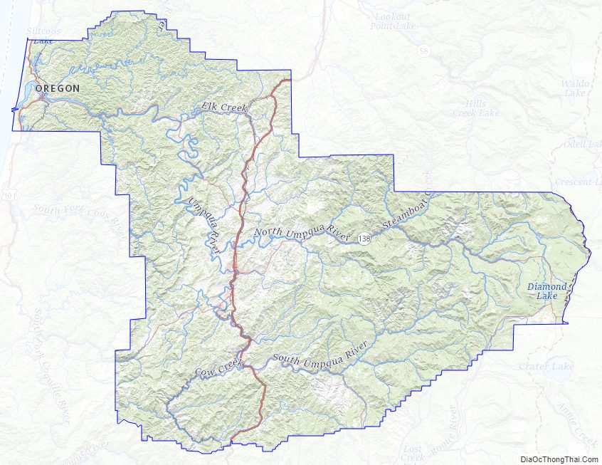
Douglas County was created on January 7, 1852, from the portion of Umpqua County which lay east of the Coast Range summit. In 1856 the Camas Valley was annexed to Douglas County from Coos County. In 1862, the rest of Umpqua county was absorbed into Douglas County, some say due to the loss of population following the end of the early gold boom, while others attribute the absorption to politics. Further boundary adjustments were made with Jackson and Lane Counties in 1915. The borders of Douglas County are largely defined by the Umpqua River watershed.
In 2017, after the defeat of a referendum, the Douglas County Library System ceased operations and all public libraries in the county were closed. Subsequently, 10 of the cities reopened their libraries to continue serving their communities.
Douglas County Road Map
Geography
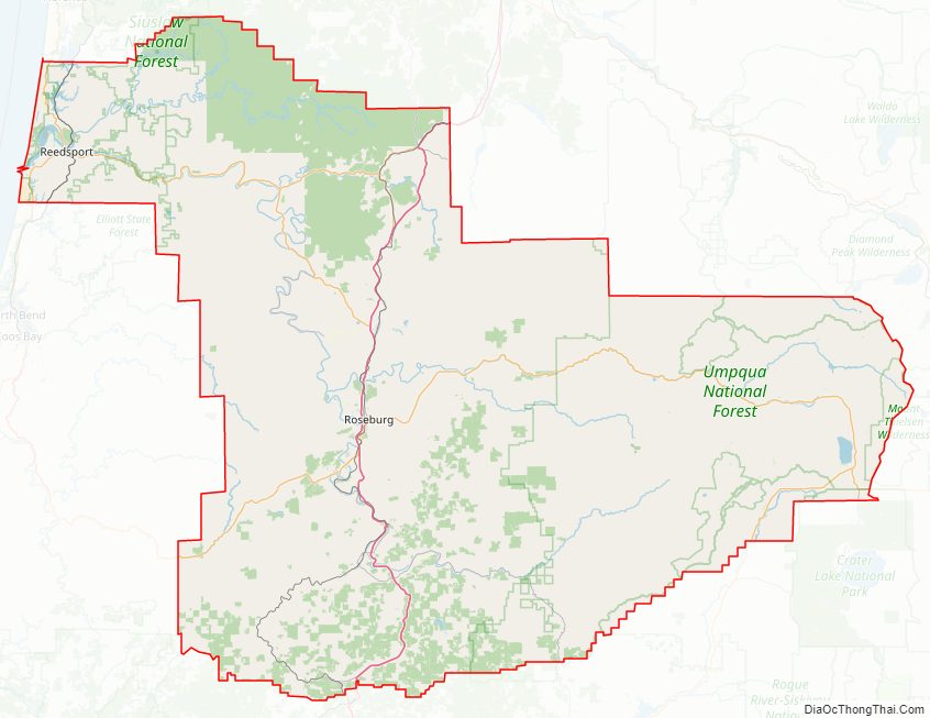
According to the United States Census Bureau, the county has a total area of 5,134 square miles (13,300 km), of which 5,036 square miles (13,040 km) is land and 98 square miles (250 km) (1.9%) is water. It is the fifth-largest county in Oregon by area. A portion of the Umpqua National Forest is in Douglas County. Douglas County is one of two Oregon counties that extend from the Pacific Ocean to the Cascade Range. (The other is Lane County.)
National protected areas
- Crater Lake National Park (part)
- Rogue River-Siskiyou National Forest (part)
- Siuslaw National Forest (part)
- Umpqua National Forest (part)
- Willamette National Forest (part)
Adjacent counties
- Lane County (north)
- Klamath County (east)
- Jackson County (south)
- Josephine County (south)
- Curry County (southwest)
- Coos County (west)
Douglas County Topographic Map
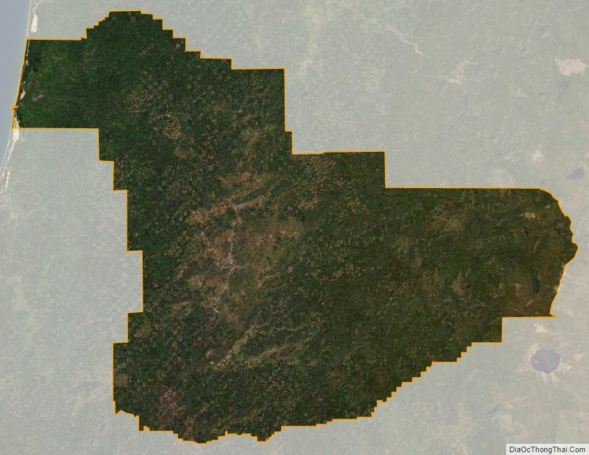
Douglas County Satellite Map
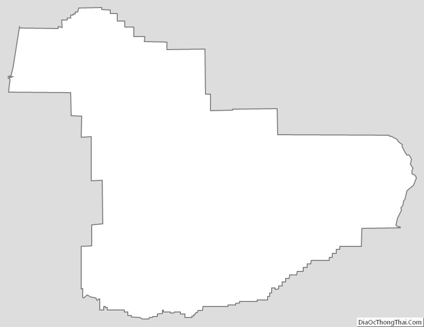
Douglas County Outline Map
See also
Map of Oregon State and its subdivision: Map of other states:- Alabama
- Alaska
- Arizona
- Arkansas
- California
- Colorado
- Connecticut
- Delaware
- District of Columbia
- Florida
- Georgia
- Hawaii
- Idaho
- Illinois
- Indiana
- Iowa
- Kansas
- Kentucky
- Louisiana
- Maine
- Maryland
- Massachusetts
- Michigan
- Minnesota
- Mississippi
- Missouri
- Montana
- Nebraska
- Nevada
- New Hampshire
- New Jersey
- New Mexico
- New York
- North Carolina
- North Dakota
- Ohio
- Oklahoma
- Oregon
- Pennsylvania
- Rhode Island
- South Carolina
- South Dakota
- Tennessee
- Texas
- Utah
- Vermont
- Virginia
- Washington
- West Virginia
- Wisconsin
- Wyoming