Durham County is a county located in the U.S. state of North Carolina. As of the 2020 census, the population was 324,833, making it the sixth-most populous county in North Carolina. Its county seat is Durham, which is the only incorporated municipality predominantly in the county, though very small portions of cities and towns mostly in neighboring counties also extend into Durham County. The central and southern parts of Durham County are highly urban, consisting of the city as well as several unincorporated suburbs. Southeastern Durham County is dominated by the Research Triangle Park, most of which is in Durham County. The northern third of Durham County is rural in nature.
Durham County is the core of the Durham-Chapel Hill, NC Metropolitan Statistical Area, which is also included in the Raleigh-Durham-Cary, NC Combined Statistical Area, which had a population of 2,106,463 in 2020.
| Name: | Durham County |
|---|---|
| FIPS code: | 37-063 |
| State: | North Carolina |
| Founded: | 1881 |
| Named for: | Bartlett Snipes Durham |
| Seat: | Durham |
| Largest city: | Durham |
| Total Area: | 298 sq mi (770 km²) |
| Land Area: | 286 sq mi (740 km²) |
| Total Population: | 324,833 |
| Population Density: | 1,140.3/sq mi (440.3/km²) |
| Time zone: | UTC−5 (Eastern) |
| Summer Time Zone (DST): | UTC−4 (EDT) |
| Website: | www.dconc.gov |
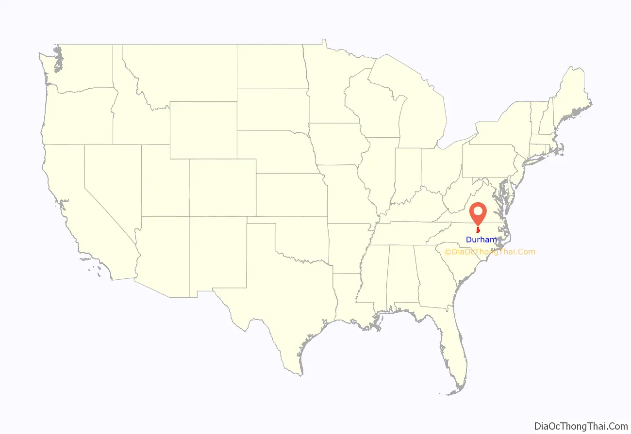
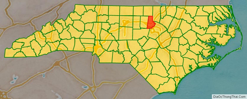
Durham County location map. Where is Durham County?
History
The county was formed on April 17, 1881, from parts of Orange County and Wake County, taking the name of its own county seat. In 1911, parts of Cedar Fork Township of Wake County were transferred to Durham County and became Carr Township.
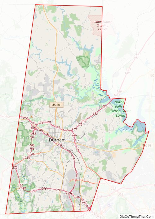
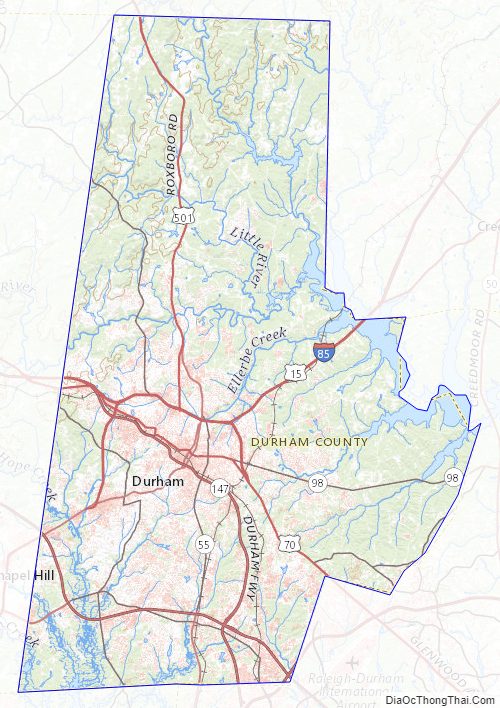
Durham County Road Map
Geography
According to the U.S. Census Bureau, the county has a total area of 298 square miles (770 km), of which 286 square miles (740 km) is land and 12 square miles (31 km) (4.0%) is water.
State and local protected areas/sites
- Bennett Place State Historic Site
- Duke Homestead and Tobacco Factory
- East Durham Historic District
- Eno River State Park (part)
- Falls Lake State Recreation Area (part)
- Historic Stagville
- Hollow Rock Nature Park (part)
- Horton Grove Nature Preserve
- Little River Regional Park and Natural Area (part)
- Mason Farm Biological Reserve (part)
- Rolling View State Recreation Area (part)
Major water bodies
- Crabtree Creek (Neuse River tributary)
- Ellerbe Creek
- Eno River
- Falls Lake
- Flat River
- Jordan Lake
- Lake Michie
- Little River (Eno River tributary)
- New Hope Creek
- Stirrup Iron Creek
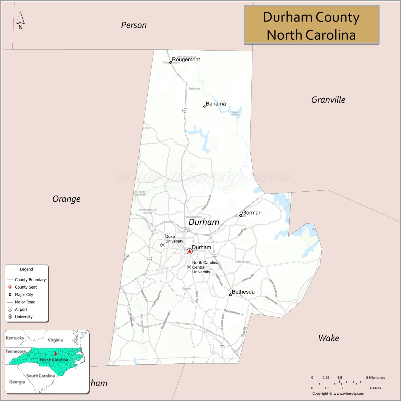
Adjacent counties
- Person County – north
- Granville County – northeast
- Wake County – east-southeast
- Chatham County – south
- Orange County – west
Major highways
- I-40
- I-85
- I-540 / NC 540 Toll
- I-885 / NC 885 Toll
- US 15
- US 15 Bus.
- US 70
- US 70 Bus. (Durham)
- US 70 Bus. (To Orange County)
- US 501
- NC 54
- NC 55
- NC 98
- NC 147
- NC 157
- NC 751
- NC 751 Truck (Truck Route)
Major infrastructure
- Durham Station
Durham County Topographic Map
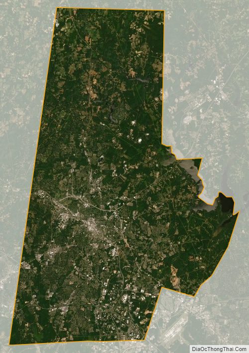
Durham County Satellite Map
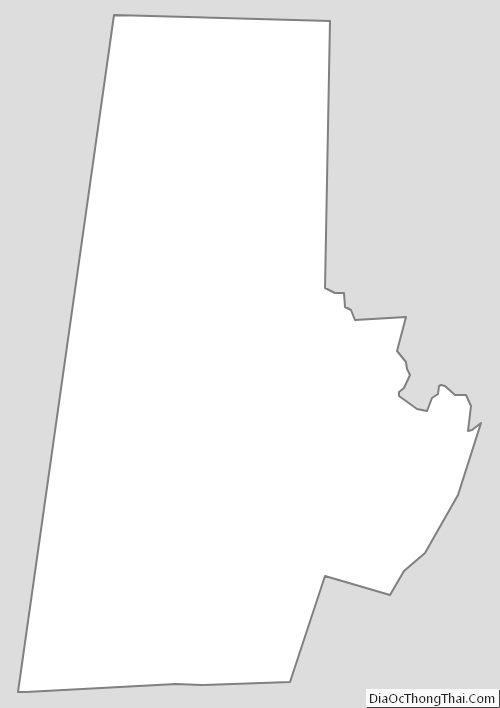
Durham County Outline Map
See also
Map of North Carolina State and its subdivision:- Alamance
- Alexander
- Alleghany
- Anson
- Ashe
- Avery
- Beaufort
- Bertie
- Bladen
- Brunswick
- Buncombe
- Burke
- Cabarrus
- Caldwell
- Camden
- Carteret
- Caswell
- Catawba
- Chatham
- Cherokee
- Chowan
- Clay
- Cleveland
- Columbus
- Craven
- Cumberland
- Currituck
- Dare
- Davidson
- Davie
- Duplin
- Durham
- Edgecombe
- Forsyth
- Franklin
- Gaston
- Gates
- Graham
- Granville
- Greene
- Guilford
- Halifax
- Harnett
- Haywood
- Henderson
- Hertford
- Hoke
- Hyde
- Iredell
- Jackson
- Johnston
- Jones
- Lee
- Lenoir
- Lincoln
- Macon
- Madison
- Martin
- McDowell
- Mecklenburg
- Mitchell
- Montgomery
- Moore
- Nash
- New Hanover
- Northampton
- Onslow
- Orange
- Pamlico
- Pasquotank
- Pender
- Perquimans
- Person
- Pitt
- Polk
- Randolph
- Richmond
- Robeson
- Rockingham
- Rowan
- Rutherford
- Sampson
- Scotland
- Stanly
- Stokes
- Surry
- Swain
- Transylvania
- Tyrrell
- Union
- Vance
- Wake
- Warren
- Washington
- Watauga
- Wayne
- Wilkes
- Wilson
- Yadkin
- Yancey
- Alabama
- Alaska
- Arizona
- Arkansas
- California
- Colorado
- Connecticut
- Delaware
- District of Columbia
- Florida
- Georgia
- Hawaii
- Idaho
- Illinois
- Indiana
- Iowa
- Kansas
- Kentucky
- Louisiana
- Maine
- Maryland
- Massachusetts
- Michigan
- Minnesota
- Mississippi
- Missouri
- Montana
- Nebraska
- Nevada
- New Hampshire
- New Jersey
- New Mexico
- New York
- North Carolina
- North Dakota
- Ohio
- Oklahoma
- Oregon
- Pennsylvania
- Rhode Island
- South Carolina
- South Dakota
- Tennessee
- Texas
- Utah
- Vermont
- Virginia
- Washington
- West Virginia
- Wisconsin
- Wyoming