Duval County is in the northeastern part of the U.S. state of Florida. As of the 2020 census, the population was 995,567, up from 864,263 in 2010. Its county seat is Jacksonville, with which the Duval County government has been consolidated since 1968. Duval County was established in 1822, and is named for William Pope Duval, Governor of Florida Territory from 1822 to 1834. Duval County is the central county of the Jacksonville Metropolitan Statistical Area.
| Name: | Duval County |
|---|---|
| FIPS code: | 12-031 |
| State: | Florida |
| Founded: | August 12, 1822 |
| Named for: | William Pope Duval |
| Seat: | Jacksonville |
| Largest city: | Jacksonville |
| Total Area: | 918 sq mi (2,380 km²) |
| Land Area: | 762 sq mi (1,970 km²) |
| Total Population: | 995,567 |
| Population Density: | 1,231/sq mi (475/km²) |
| Time zone: | UTC−5 (Eastern) |
| Summer Time Zone (DST): | UTC−4 (EDT) |
| Website: | coj.net |
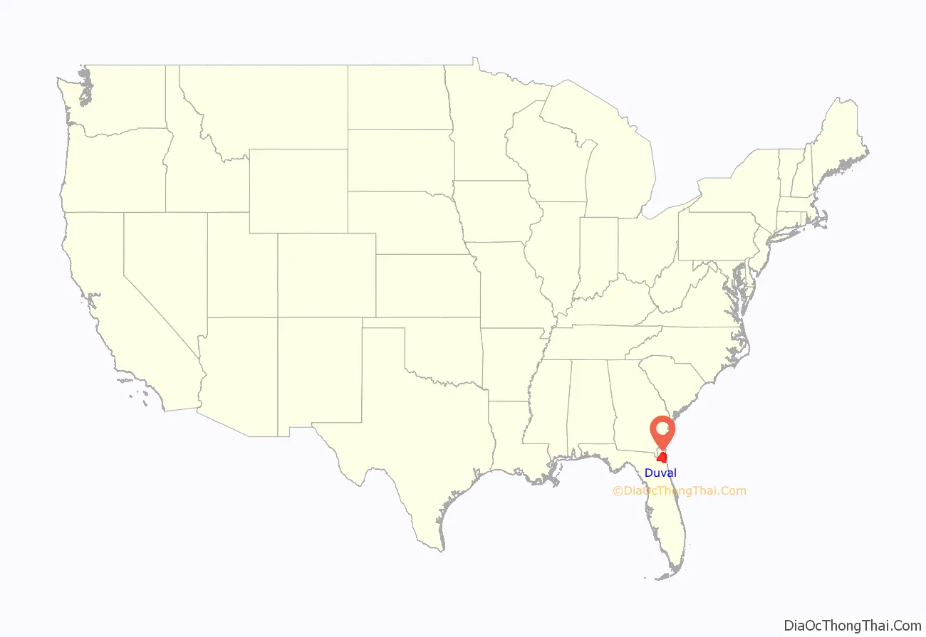
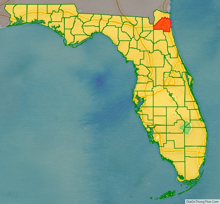
Duval County location map. Where is Duval County?
History
This area had been settled by varying cultures of indigenous peoples for thousands of years before European contact. Within the Timucuan Ecological and Historic Preserve in Jacksonville, archeologists have excavated remains of some of the oldest pottery in the United States, dating to 2500 BCE. Prior to European contact, the area was inhabited by the Mocama, a Timucuan-speaking group who lived throughout the coastal areas of northern Florida. At the time Europeans arrived, much of what is now Duval County was controlled by the Saturiwa, one of the region’s most powerful tribes. The area that became Duval County was home to the 16th-century French colony of Fort Caroline, and saw increased European settlement in the 18th century with the establishment of Cowford, later renamed Jacksonville.
Duval County was created in 1822 from St. Johns County. It was named for William Pope Duval, Governor of Florida Territory from 1822 to 1834. When Duval County was created, it covered a massive area, from the Suwannee River on the west to the Atlantic Ocean on the east, north of a line from the mouth of the Suwannee River to Jacksonville on the St. Johns River. Alachua and Nassau counties were created out of parts of Duval County in 1824. Clay County was created from part of Duval County in 1858. Part of St. Johns County south and east of the lower reaches of the St. Johns River was transferred to Duval County in the 1840s.
Portrait of William Pope Duval
Duval County Courthouse in 1894
Jacksonville in 1909
Bryan Simpson United States Courthouse in 2008.
Jacksonville Beach in 2018.
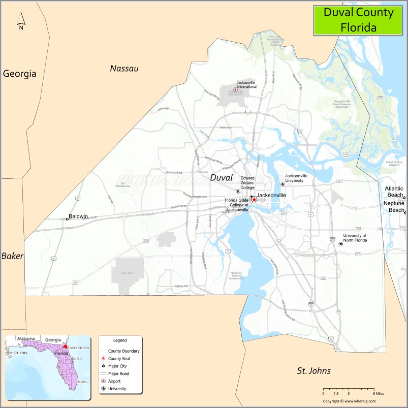
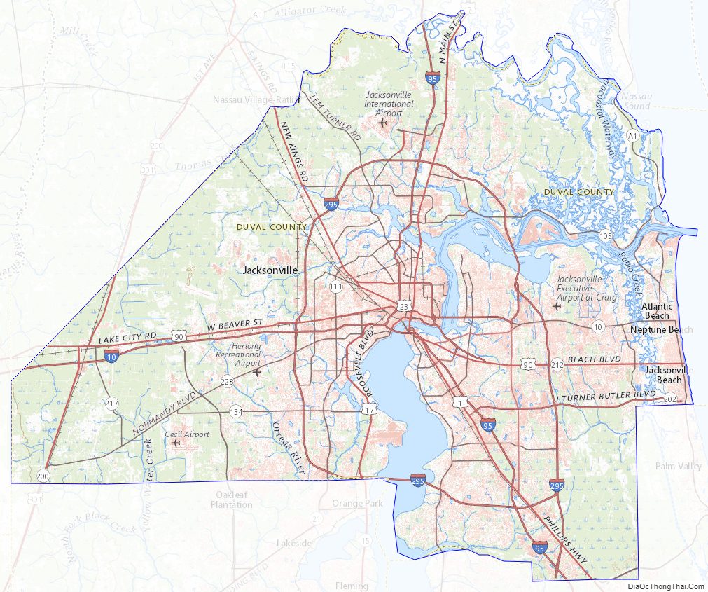
Duval County Road Map
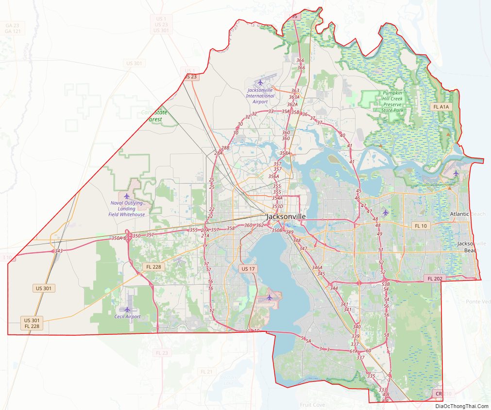
Geography
According to the U.S. Census Bureau, the county has an area of 918 square miles (2,380 km), of which 762 square miles (1,970 km) is land and 156 square miles (400 km) (17.0%) is water. The topography is coastal plain; however there are some rolling hills.
National protected areas
- Fort Caroline National Memorial
- Timucuan Ecological and Historic Preserve
Adjacent counties
- Nassau County – north and northwest
- St. Johns County – southeast
- Clay County – southwest
- Baker County – west
Duval County Topographic Map
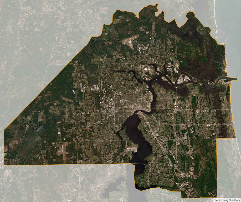
Duval County Satellite Map
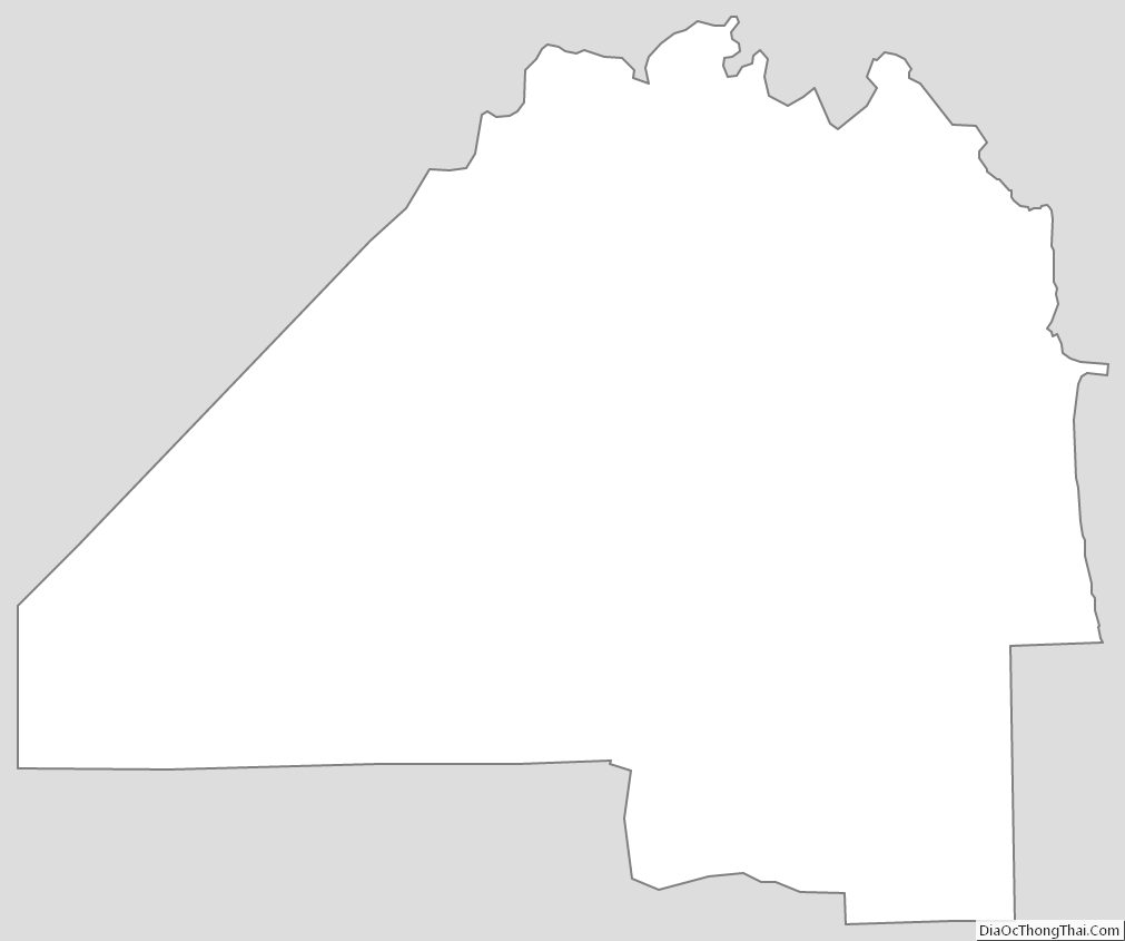
Duval County Outline Map
See also
Map of Florida State and its subdivision:- Alachua
- Baker
- Bay
- Bradford
- Brevard
- Broward
- Calhoun
- Charlotte
- Citrus
- Clay
- Collier
- Columbia
- Desoto
- Dixie
- Duval
- Escambia
- Flagler
- Franklin
- Gadsden
- Gilchrist
- Glades
- Gulf
- Hamilton
- Hardee
- Hendry
- Hernando
- Highlands
- Hillsborough
- Holmes
- Indian River
- Jackson
- Jefferson
- Lafayette
- Lake
- Lee
- Leon
- Levy
- Liberty
- Madison
- Manatee
- Marion
- Martin
- Miami-Dade
- Monroe
- Nassau
- Okaloosa
- Okeechobee
- Orange
- Osceola
- Palm Beach
- Pasco
- Pinellas
- Polk
- Putnam
- Saint Johns
- Saint Lucie
- Santa Rosa
- Sarasota
- Seminole
- Sumter
- Suwannee
- Taylor
- Union
- Volusia
- Wakulla
- Walton
- Washington
- Alabama
- Alaska
- Arizona
- Arkansas
- California
- Colorado
- Connecticut
- Delaware
- District of Columbia
- Florida
- Georgia
- Hawaii
- Idaho
- Illinois
- Indiana
- Iowa
- Kansas
- Kentucky
- Louisiana
- Maine
- Maryland
- Massachusetts
- Michigan
- Minnesota
- Mississippi
- Missouri
- Montana
- Nebraska
- Nevada
- New Hampshire
- New Jersey
- New Mexico
- New York
- North Carolina
- North Dakota
- Ohio
- Oklahoma
- Oregon
- Pennsylvania
- Rhode Island
- South Carolina
- South Dakota
- Tennessee
- Texas
- Utah
- Vermont
- Virginia
- Washington
- West Virginia
- Wisconsin
- Wyoming