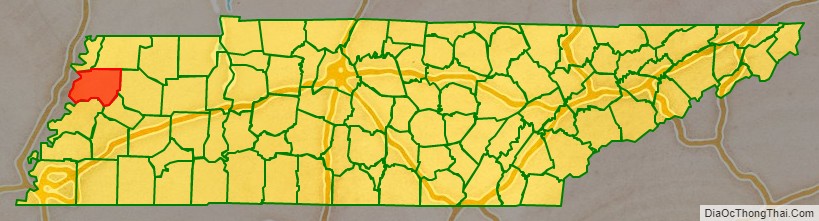
Dyer County is a county located in the westernmost part of the U.S. state of Tennessee. As of the 2020 census, the population was 36,801. The county seat is Dyersburg. Dyer County comprises the Dyersburg, TN Micropolitan Statistical Area.
| Name: | Dyer County |
|---|---|
| FIPS code: | 47-045 |
| State: | Tennessee |
| Founded: | 1823 |
| Named for: | Robert Henry Dyer, state legislator |
| Seat: | Dyersburg |
| Largest city: | Dyersburg |
| Total Area: | 527 sq mi (1,360 km²) |
| Land Area: | 512 sq mi (1,330 km²) |
| Total Population: | 36,801 |
| Population Density: | 75/sq mi (29/km²) |
| Time zone: | UTC−6 (Central) |
| Summer Time Zone (DST): | UTC−5 (CDT) |
| Website: | dyercounty.com |
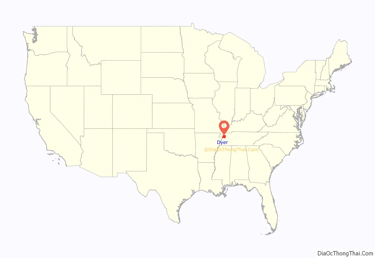
Dyer County location map. Where is Dyer County?
History
19th century
Dyer County was founded by a Private Act of Tennessee, passed on October 16, 1823. The area was part of the territory in Tennessee that was previously legally recognized as belonging to the Chickasaw Native Americans as “Indian Lands”.
The county was named for Robert Henry Dyer (circa 1774–1826). Dyer had been an army officer in the Creek War and War of 1812, and a cavalry colonel in the First Seminole War of 1818 before becoming a state senator. He was instrumental in the formation of the counties of Dyer and Madison County, Tennessee.
Around 1823, Louis Philippe I stopped briefly near the mouth of the Obion River and killed a bald eagle.
In 1869, three, possibly five, white men were lynched under suspicion of horse thievery.
In Mark Twain’s Life on the Mississippi, Twain reported seeing a steamboat at the mouth of the Obion River bearing his name. He notes this is the first time he encountered something named after him.
20th century
On February 1, 1916, a black man named Julius Morgan was accused of raping a white woman in Dyer County. In order to avoid a lynching at the hands of a local mob, Sheriff C.C. Dawson had Morgan sent to the jail in Jackson for safety, and again to jails in Union City and Nashville. His attorneys were able to secure a change in venue to Memphis for his trial. He was convicted and sentenced to death. On July 13, 1916, Morgan was the first person to be executed by electrocution in Tennessee.
21st century
On April 2, 2006 a severe weather system passed through Dyer County, producing tornadoes that killed 16 in the county and 24 in Tennessee.
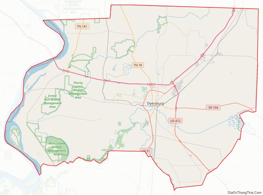
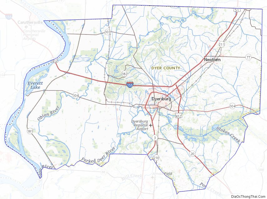
Dyer County Road Map
Geography
According to the U.S. Census Bureau, the county has a total area of 527 square miles (1,360 km), of which 512 square miles (1,330 km) is land and 14 square miles (36 km) (2.7%) is water.
The county is drained by the Mississippi River, which forms its western boundary. The confluences of the Forked Deer River into the Obion River, and the Obion into the Mississippi are located in the county. It is in the part of Tennessee called the “Mississippi bottomland” or the Mississippi Alluvial Valley.
Dyer County is bisected by U.S. Route 51, the older major highway connecting Memphis with Chicago from south to north. When upgraded to interstate standards, this road will become Interstate 69. To the west, Dyer County is connected to Missouri by Interstate 155 over the Mississippi River, providing the only highway connection, other than those at Memphis, between Tennessee and the states to the west of the river.
Adjacent counties
- Lake County (north)
- Obion County (northeast)
- Gibson County (east)
- Crockett County (southeast)
- Lauderdale County (south)
- Mississippi County, Arkansas (southwest)
- Pemiscot County, Missouri (northwest)
Major highways
- I-69
- I-155
- US 51
- US 412
- SR 77
- SR 78
- SR 89
- SR 103
- SR 104
- SR 105
- SR 181
- SR 182
- SR 210
- SR 211
Dyer County Topographic Map
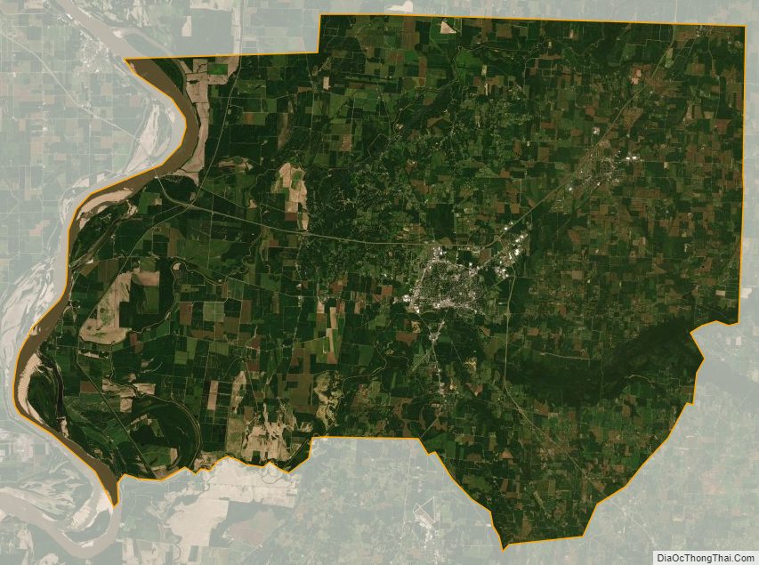
Dyer County Satellite Map
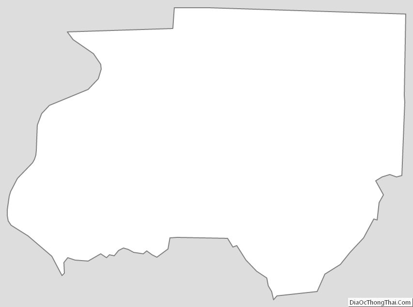
Dyer County Outline Map
See also
Map of Tennessee State and its subdivision:- Anderson
- Bedford
- Benton
- Bledsoe
- Blount
- Bradley
- Campbell
- Cannon
- Carroll
- Carter
- Cheatham
- Chester
- Claiborne
- Clay
- Cocke
- Coffee
- Crockett
- Cumberland
- Davidson
- Decatur
- DeKalb
- Dickson
- Dyer
- Fayette
- Fentress
- Franklin
- Gibson
- Giles
- Grainger
- Greene
- Grundy
- Hamblen
- Hamilton
- Hancock
- Hardeman
- Hardin
- Hawkins
- Haywood
- Henderson
- Henry
- Hickman
- Houston
- Humphreys
- Jackson
- Jefferson
- Johnson
- Knox
- Lake
- Lauderdale
- Lawrence
- Lewis
- Lincoln
- Loudon
- Macon
- Madison
- Marion
- Marshall
- Maury
- McMinn
- McNairy
- Meigs
- Monroe
- Montgomery
- Moore
- Morgan
- Obion
- Overton
- Perry
- Pickett
- Polk
- Putnam
- Rhea
- Roane
- Robertson
- Rutherford
- Scott
- Sequatchie
- Sevier
- Shelby
- Smith
- Stewart
- Sullivan
- Sumner
- Tipton
- Trousdale
- Unicoi
- Union
- Van Buren
- Warren
- Washington
- Wayne
- Weakley
- White
- Williamson
- Wilson
- Alabama
- Alaska
- Arizona
- Arkansas
- California
- Colorado
- Connecticut
- Delaware
- District of Columbia
- Florida
- Georgia
- Hawaii
- Idaho
- Illinois
- Indiana
- Iowa
- Kansas
- Kentucky
- Louisiana
- Maine
- Maryland
- Massachusetts
- Michigan
- Minnesota
- Mississippi
- Missouri
- Montana
- Nebraska
- Nevada
- New Hampshire
- New Jersey
- New Mexico
- New York
- North Carolina
- North Dakota
- Ohio
- Oklahoma
- Oregon
- Pennsylvania
- Rhode Island
- South Carolina
- South Dakota
- Tennessee
- Texas
- Utah
- Vermont
- Virginia
- Washington
- West Virginia
- Wisconsin
- Wyoming