Eaton County is a county in the U.S. state of Michigan. As of the 2020 United States Census, the population was 109,175. The county seat is Charlotte. The county was organized in 1837 and was named for John Eaton, who was Secretary of War under U.S. President Andrew Jackson, making it one of Michigan’s Cabinet counties. Eaton County is included in the Lansing–East Lansing, Metropolitan Statistical area in Central Michigan.
| Name: | Eaton County |
|---|---|
| FIPS code: | 26-045 |
| State: | Michigan |
| Founded: | 1837 |
| Named for: | John Eaton |
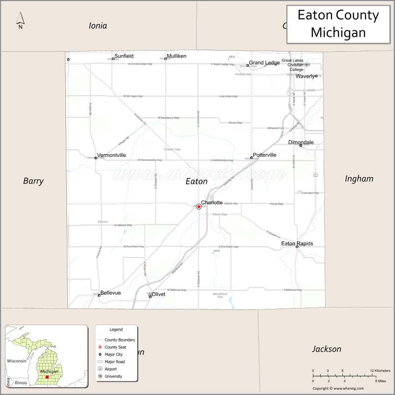
| Seat: | Charlotte |
| Largest city: | Charlotte |
| Total Area: | 579 sq mi (1,500 km²) |
| Land Area: | 575 sq mi (1,490 km²) |
| Total Population: | 109,175 |
| Population Density: | 187/sq mi (72/km²) |
| Time zone: | UTC−5 (Eastern) |
| Summer Time Zone (DST): | UTC−4 (EDT) |
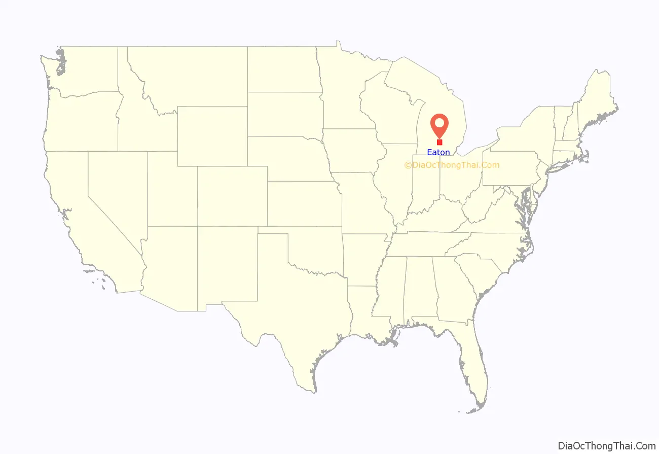
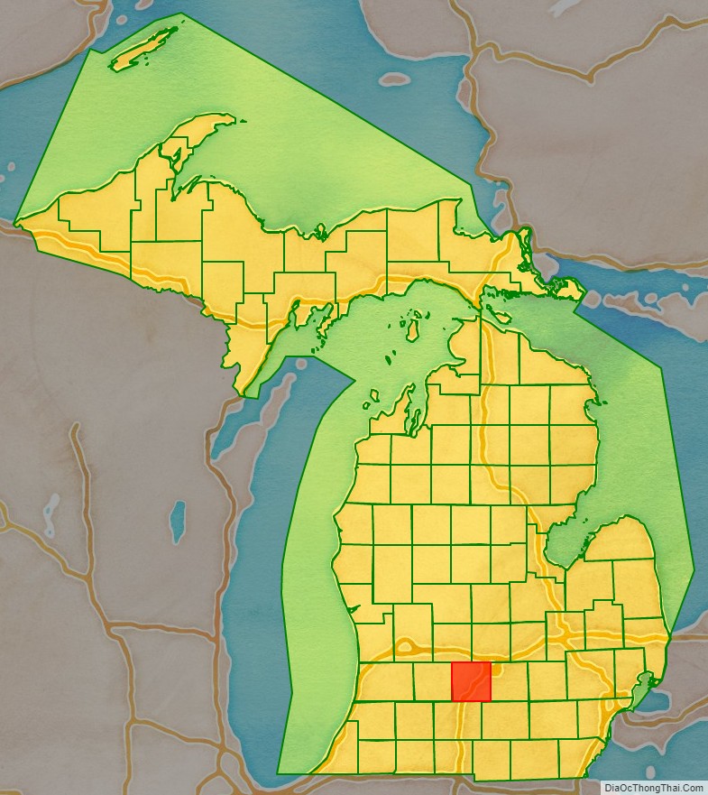
Eaton County location map. Where is Eaton County?
History
Eaton County was formed in 1837 from open territory. It was named after John H. Eaton, an American Secretary of War. The county is one of the so-called Cabinet counties because it was named after a member of the cabinet of US President Andrew Jackson.
Eaton County was created by the Michigan Territorial Legislature on October 29, 1829: “That as much of the country as is included within the following limits, viz., north of the base line and south of the line between townships four and five north of the base line, and east of the line between ranges six and seven west of the meridian, and west of the line between ranges two and three west of the meridian, be and the same is set off into a separate county, and the name thereof shall be Eaton.” The county was named in honor of Gen. John H. Eaton, secretary of war in the cabinet of President Andrew Jackson. The following week (November 4), the legislature added this directive: “That the county of Eaton shall be attached to and compose a part of the county of St. Joseph.” On November 5, they also added an act to direct that the counties of Eaton, Branch and Calhoun, and all the country north attached to Eaton be set off into a township by the name of Eaton, and it was ordered that the first town meeting should be held at the house of Jabez Bronson, who lived on the site of the present village of Bronson in Branch county. This was no hardship, for there was not at that time a single white settler within the bounds of Eaton county.
The following summer (July 30, 1830), the Territorial Legislature changed Eaton’s assignment, attaching it to Kalamazoo for administrative, revenue, and judicial purposes. Then on March 17, 1835, it directed: “That the county of Eaton shall be a township of Belleville,’ and the first township meeting shall be held at such place as the sheriff of Calhoun county shall appoint in said county of Eaton, and shall be attached to the county of Eaton for all judicial purposes.”
By 1837 the Territory had been admitted to the Union as a State. On December 29 of that year, the new state legislature created Eaton County as an independent entity: “That the county of Eaton be and the same is hereby organized, and the inhabitants thereof entitled to all the rights and privileges to which by law the inhabitants of other counties of this state are entitled.”
While the name “Belleville” was given to the first organized township, including the whole county, it does not appear to have been used in any official documents. The second place where the name of the township is mentioned in a legislative enactment is on March 17 in the session laws of 1837, where it appears under the name of “Bellevue.” Official business has always been transacted under the latter name, and yet there is no known law showing that the name has ever been legally changed from “Belleville.”
The first division of the town of Bellevue occurred on March 11, 1837, when Eaton and Vermontville were organized. The four northwestern townships, now Vermontville, Chester, Roxand and Sunfield, were set off as a township and named Vermontville; while the four southeastern townships, now Eaton, Eaton Rapids, Hamlin, and Brookfield were organized as the township of Eaton.
This left the four northeastern towns, Benton, Oneida, Delta, and Windsor, and the four remaining towns, Bellevue, Kalamo, Carmel, and Walton, cornering at the geographical center of the county in a single organized township known as Bellevue. But on March 6, 1838, the northeast quarter of the county was detached from Bellevue and was formed as the town of Oneida.
In 1832, a surveyor, George W. Barnes, bought a homestead in central Eaton County; that area is now contained in Charlotte. On March 21, 1833, he applied to Territorial Governor George B. Porter for a commission to be appointed to locate the county seat: “That in the month of may last he put up in three public places in the county of Kalamazoo notices that application would be made to the governor of the territory of Michigan to appoint commissioners to locate a seat of justice for Eaton County, agreeably to the law in such cases made and provided.” Accordingly, three locals (Charles C. Hascall, Stillman Blanchard, John W. Strong) were named on April 29. On June 5 they reported to the Governor that they met “at Prairie Ronde [Round] in the county of Kalamazoo on the 27th day of May, 1833, and on June 4, located the county seat on land which is owned by George W. Barnes. The point selected for the seat of justice in this county is on a beautiful prairie, about one mile square, near two and a half miles south of the center of the county, and about one mile north of the Battle creek, the nearest point to the center of the county where water can be obtained for hydraulic purposes.”
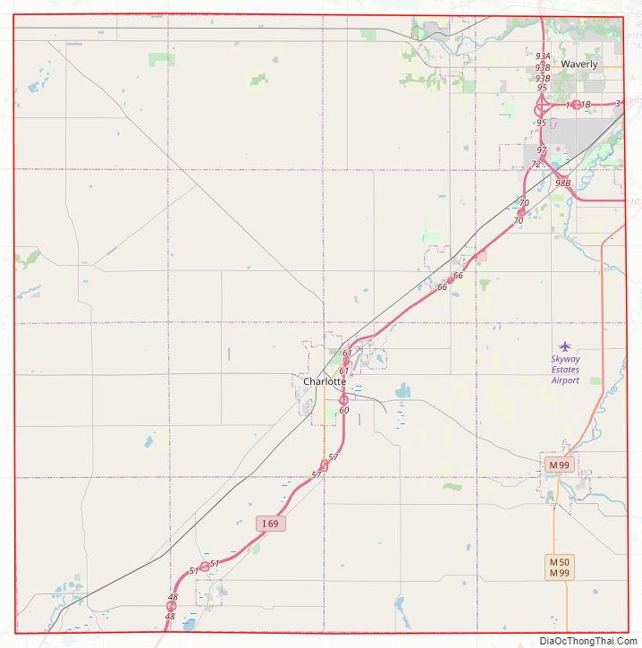
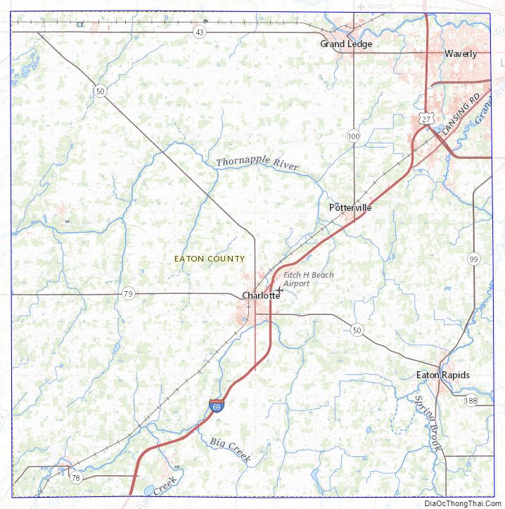
Eaton County Road Map
Geography
According to the US Census Bureau, the county has a total area of 579 square miles (1,500 km), of which 575 square miles (1,490 km) is land and 4.3 square miles (11 km) (0.7%) is water.
Rivers
- Battle Creek River
- Grand River
- Thornapple River
Adjacent counties
- Clinton County – northeast
- Ingham County – east
- Jackson County – southeast
- Calhoun County – south
- Barry County – west
- Ionia County – northwest
Eaton County Topographic Map
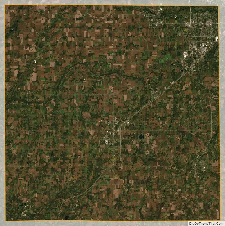
Eaton County Satellite Map
Eaton County Outline Map

See also
Map of Michigan State and its subdivision:- Alcona
- Alger
- Allegan
- Alpena
- Antrim
- Arenac
- Baraga
- Barry
- Bay
- Benzie
- Berrien
- Branch
- Calhoun
- Cass
- Charlevoix
- Cheboygan
- Chippewa
- Clare
- Clinton
- Crawford
- Delta
- Dickinson
- Eaton
- Emmet
- Genesee
- Gladwin
- Gogebic
- Grand Traverse
- Gratiot
- Hillsdale
- Houghton
- Huron
- Ingham
- Ionia
- Iosco
- Iron
- Isabella
- Jackson
- Kalamazoo
- Kalkaska
- Kent
- Keweenaw
- Lake
- Lake Hurron
- Lake Michigan
- Lake St. Clair
- Lake Superior
- Lapeer
- Leelanau
- Lenawee
- Livingston
- Luce
- Mackinac
- Macomb
- Manistee
- Marquette
- Mason
- Mecosta
- Menominee
- Midland
- Missaukee
- Monroe
- Montcalm
- Montmorency
- Muskegon
- Newaygo
- Oakland
- Oceana
- Ogemaw
- Ontonagon
- Osceola
- Oscoda
- Otsego
- Ottawa
- Presque Isle
- Roscommon
- Saginaw
- Saint Clair
- Saint Joseph
- Sanilac
- Schoolcraft
- Shiawassee
- Tuscola
- Van Buren
- Washtenaw
- Wayne
- Wexford
- Alabama
- Alaska
- Arizona
- Arkansas
- California
- Colorado
- Connecticut
- Delaware
- District of Columbia
- Florida
- Georgia
- Hawaii
- Idaho
- Illinois
- Indiana
- Iowa
- Kansas
- Kentucky
- Louisiana
- Maine
- Maryland
- Massachusetts
- Michigan
- Minnesota
- Mississippi
- Missouri
- Montana
- Nebraska
- Nevada
- New Hampshire
- New Jersey
- New Mexico
- New York
- North Carolina
- North Dakota
- Ohio
- Oklahoma
- Oregon
- Pennsylvania
- Rhode Island
- South Carolina
- South Dakota
- Tennessee
- Texas
- Utah
- Vermont
- Virginia
- Washington
- West Virginia
- Wisconsin
- Wyoming