| Name: | Edwards County |
|---|---|
| FIPS code: | 48-137 |
| State: | Texas |
| Founded: | 1883 |
| Named for: | Haden Edwards |
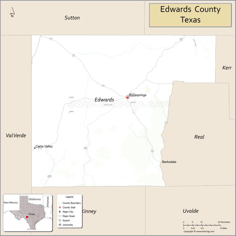
| Seat: | Rocksprings |
| Largest town: | Rocksprings |
| Total Area: | 2,120 sq mi (5,500 km²) |
| Land Area: | 2,118 sq mi (5,490 km²) |
| Total Population: | 1,422 |
| Population Density: | 0.67/sq mi (0.26/km²) |
| Time zone: | UTC−6 (Central) |
| Summer Time Zone (DST): | UTC−5 (CDT) |
| Website: | co.edwards.tx.us |
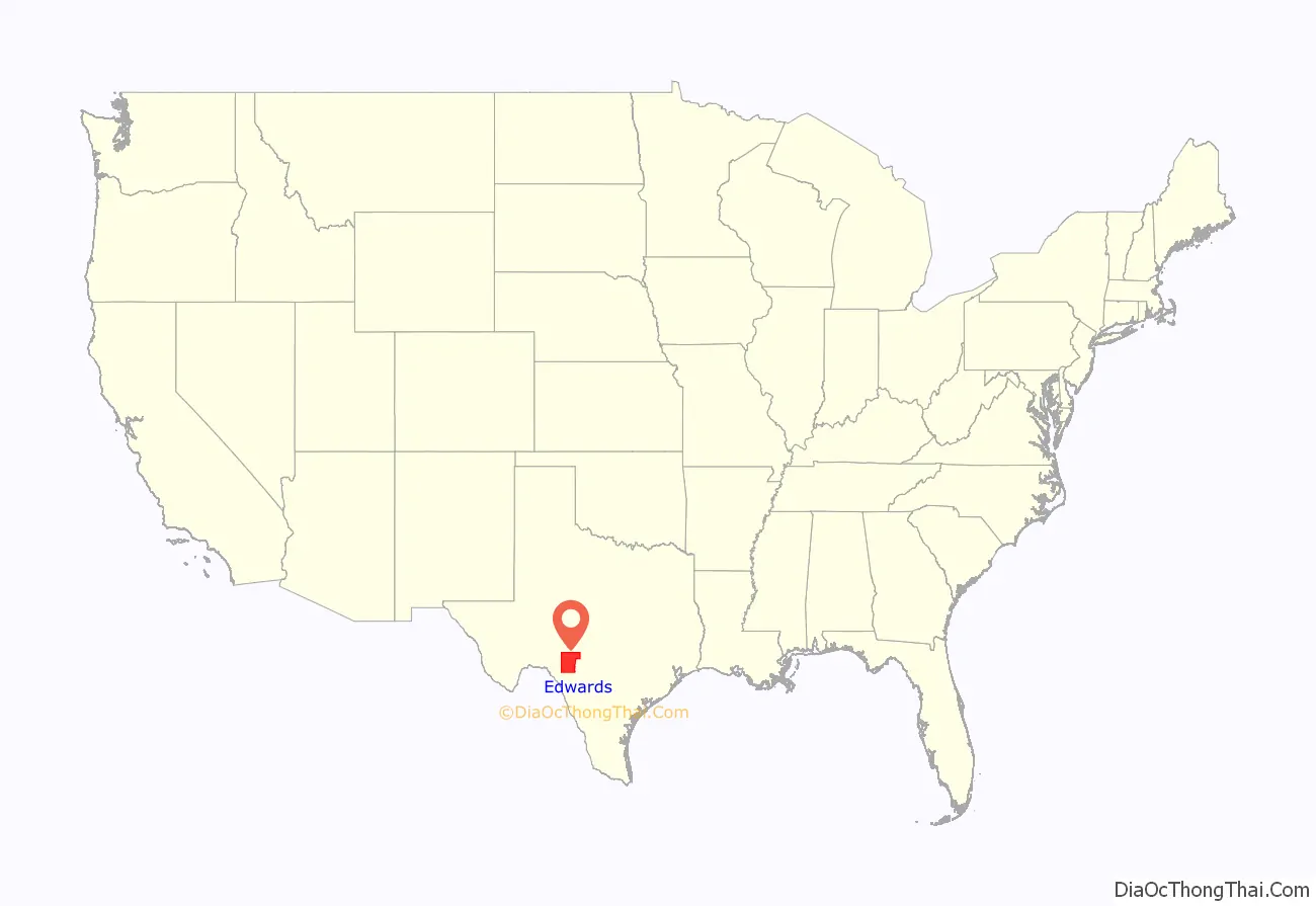
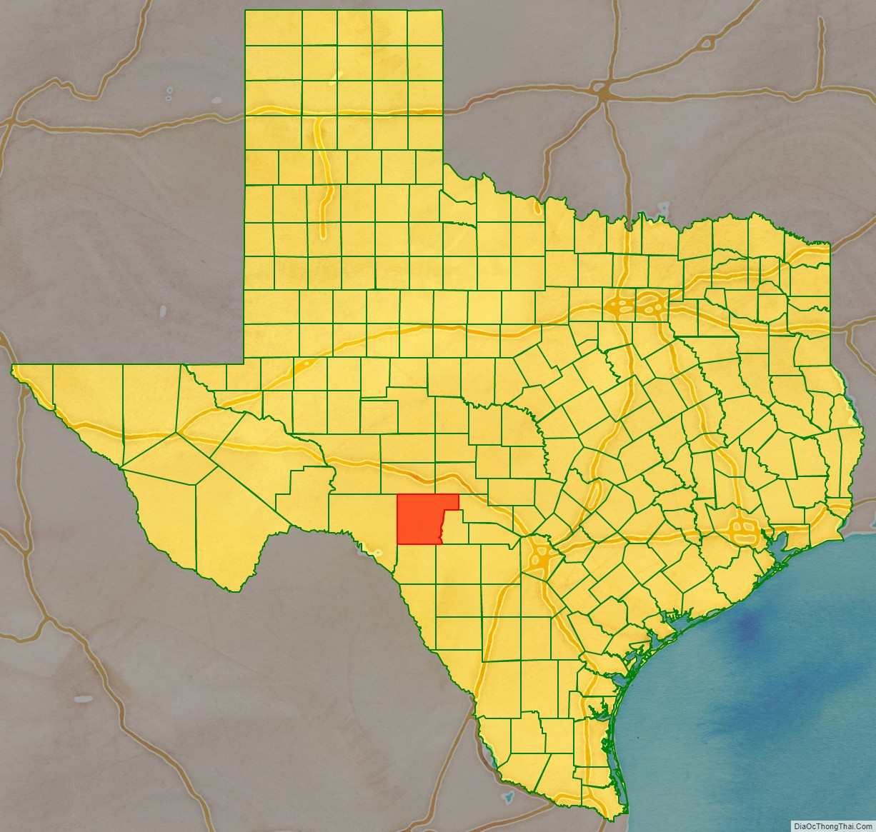
Edwards County location map. Where is Edwards County?
History
- The early inhabitants were Lipan Apache and Comanche.
- 1762 Looking for protection from Comanches, Lipan Apache chief El Gran Cabezón persuades Franciscans and the Spanish military to establish San Lorenzo de la Santa Cruz Mission on the Nueces River. The Mission was abandoned in 1771.
- 1825 Virginia born Haden Harrison Edwards joins forces with Stephen F. Austin and contracts with Coahuila y Tejas to move 800 families into east Texas. In 1826 Edwards announces the creation of the Republic of Fredonia near Nacogdoches, an early attempt to secede from Mexico. Stephen F. Austin joins forces with Mexico against Edwards. Haden Edwards flees in 1827 to Louisiana for his safety, returns to Texas, and spends the rest of his life in Nacogdoches.
- 1858 Edwards County is formed from Bexar County.
- 1871 Clint Smith, age 11, and brother Jeff Smith, age 9, are kidnapped by Indians near Rocksprings.
- 1882 W.J. Greer settles a sheep camp at Rocksprings.
- 1883 Edwards County is officially organized and named for Haden Harrison Edwards.
- 1884 Francis Winan cattle and sheep ranch at Rocksprings.
- 1885 A.O. Burr sets up farming at Rocksprings.
- 1891 County seat becomes Rocksprings. The County Courthouse is built by architects Ben Davey and Bruno Schort in the Romanesque Revival Style.
- 1898 Rocksprings Telephone Company is formed.
- 1913 Edwards loses land in its eastern section to Real County.
- 1927 A tornado hits Rocksprings.
- 1940 Rocksprings calls itself the “Top-o-the-World” in mohair production, which peaks that year.
- 1946 Oil is discovered in the county.
- 1991 Kickapoo Cavern State Park, 6,400 acres (26 km) in both Edwards and Kinney County opens to the public.
- 1992 Devil’s Sinkhole State Natural Area near Rockspring opens to the public. It is the home to the largest single-chambered cavern and third-deepest in the state.
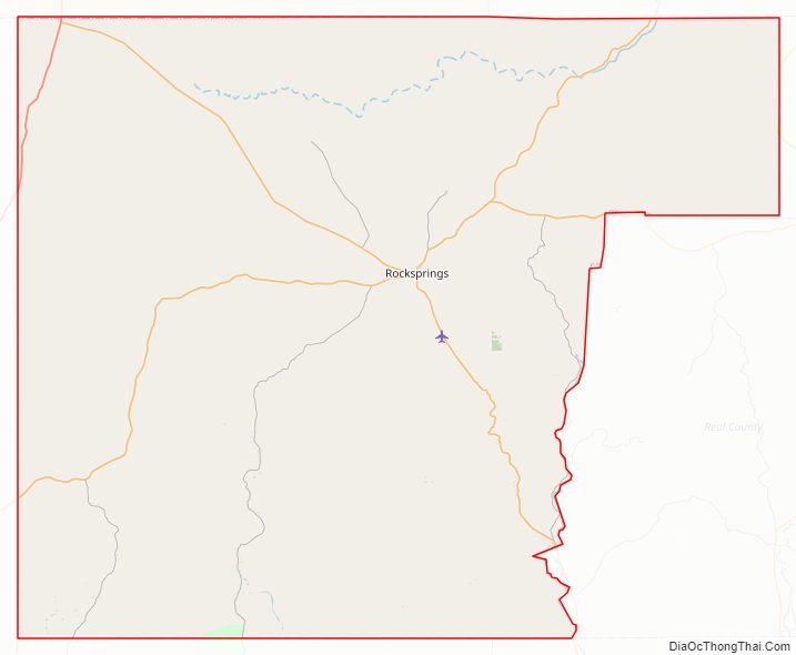
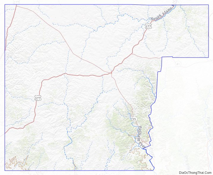
Edwards County Road Map
Geography
According to the U.S. Census Bureau the county has a total area of 2,120 square miles (5,500 km), of which 2,118 square miles (5,490 km) are land and 2.0 square miles (5.2 km) (0.09%) are covered by water.
Major highways
- U.S. Highway 277
- U.S. Highway 377
- State Highway 41
- State Highway 55
Adjacent counties
- Sutton County (north)
- Kimble County (northeast)
- Kerr County (east)
- Real County (southeast)
- Uvalde County (southeast)
- Kinney County (south)
- Val Verde County (west)
Edwards County Topographic Map
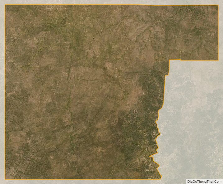
Edwards County Satellite Map
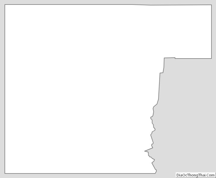
Edwards County Outline Map
See also
Map of Texas State and its subdivision:- Anderson
- Andrews
- Angelina
- Aransas
- Archer
- Armstrong
- Atascosa
- Austin
- Bailey
- Bandera
- Bastrop
- Baylor
- Bee
- Bell
- Bexar
- Blanco
- Borden
- Bosque
- Bowie
- Brazoria
- Brazos
- Brewster
- Briscoe
- Brooks
- Brown
- Burleson
- Burnet
- Caldwell
- Calhoun
- Callahan
- Cameron
- Camp
- Carson
- Cass
- Castro
- Chambers
- Cherokee
- Childress
- Clay
- Cochran
- Coke
- Coleman
- Collin
- Collingsworth
- Colorado
- Comal
- Comanche
- Concho
- Cooke
- Coryell
- Cottle
- Crane
- Crockett
- Crosby
- Culberson
- Dallam
- Dallas
- Dawson
- Deaf Smith
- Delta
- Denton
- Dewitt
- Dickens
- Dimmit
- Donley
- Duval
- Eastland
- Ector
- Edwards
- El Paso
- Ellis
- Erath
- Falls
- Fannin
- Fayette
- Fisher
- Floyd
- Foard
- Fort Bend
- Franklin
- Freestone
- Frio
- Gaines
- Galveston
- Garza
- Gillespie
- Glasscock
- Goliad
- Gonzales
- Gray
- Grayson
- Gregg
- Grimes
- Guadalupe
- Hale
- Hall
- Hamilton
- Hansford
- Hardeman
- Hardin
- Harris
- Harrison
- Hartley
- Haskell
- Hays
- Hemphill
- Henderson
- Hidalgo
- Hill
- Hockley
- Hood
- Hopkins
- Houston
- Howard
- Hudspeth
- Hunt
- Hutchinson
- Irion
- Jack
- Jackson
- Jasper
- Jeff Davis
- Jefferson
- Jim Hogg
- Jim Wells
- Johnson
- Jones
- Karnes
- Kaufman
- Kendall
- Kenedy
- Kent
- Kerr
- Kimble
- King
- Kinney
- Kleberg
- Knox
- La Salle
- Lamar
- Lamb
- Lampasas
- Lavaca
- Lee
- Leon
- Liberty
- Limestone
- Lipscomb
- Live Oak
- Llano
- Loving
- Lubbock
- Lynn
- Madison
- Marion
- Martin
- Mason
- Matagorda
- Maverick
- McCulloch
- McLennan
- McMullen
- Medina
- Menard
- Midland
- Milam
- Mills
- Mitchell
- Montague
- Montgomery
- Moore
- Morris
- Motley
- Nacogdoches
- Navarro
- Newton
- Nolan
- Nueces
- Ochiltree
- Oldham
- Orange
- Palo Pinto
- Panola
- Parker
- Parmer
- Pecos
- Polk
- Potter
- Presidio
- Rains
- Randall
- Reagan
- Real
- Red River
- Reeves
- Refugio
- Roberts
- Robertson
- Rockwall
- Runnels
- Rusk
- Sabine
- San Augustine
- San Jacinto
- San Patricio
- San Saba
- Schleicher
- Scurry
- Shackelford
- Shelby
- Sherman
- Smith
- Somervell
- Starr
- Stephens
- Sterling
- Stonewall
- Sutton
- Swisher
- Tarrant
- Taylor
- Terrell
- Terry
- Throckmorton
- Titus
- Tom Green
- Travis
- Trinity
- Tyler
- Upshur
- Upton
- Uvalde
- Val Verde
- Van Zandt
- Victoria
- Walker
- Waller
- Ward
- Washington
- Webb
- Wharton
- Wheeler
- Wichita
- Wilbarger
- Willacy
- Williamson
- Wilson
- Winkler
- Wise
- Wood
- Yoakum
- Young
- Zapata
- Zavala
- Alabama
- Alaska
- Arizona
- Arkansas
- California
- Colorado
- Connecticut
- Delaware
- District of Columbia
- Florida
- Georgia
- Hawaii
- Idaho
- Illinois
- Indiana
- Iowa
- Kansas
- Kentucky
- Louisiana
- Maine
- Maryland
- Massachusetts
- Michigan
- Minnesota
- Mississippi
- Missouri
- Montana
- Nebraska
- Nevada
- New Hampshire
- New Jersey
- New Mexico
- New York
- North Carolina
- North Dakota
- Ohio
- Oklahoma
- Oregon
- Pennsylvania
- Rhode Island
- South Carolina
- South Dakota
- Tennessee
- Texas
- Utah
- Vermont
- Virginia
- Washington
- West Virginia
- Wisconsin
- Wyoming