Elbert County is a county located in the U.S. state of Colorado. As of the 2020 census, the population was 26,062. The county seat is Kiowa and the largest town is Elizabeth.
Elbert County is included in the Denver–Aurora–Lakewood, CO Metropolitan Statistical Area.
| Name: | Elbert County |
|---|---|
| FIPS code: | 08-039 |
| State: | Colorado |
| Founded: | February 2, 1874 |
| Named for: | Samuel Hitt Elbert |
| Seat: | Kiowa |
| Largest town: | Elizabeth |
| Total Area: | 1,851 sq mi (4,790 km²) |
| Land Area: | 1,851 sq mi (4,790 km²) |
| Total Population: | 26,062 |
| Population Density: | 12/sq mi (5/km²) |
| Time zone: | UTC−7 (Mountain) |
| Summer Time Zone (DST): | UTC−6 (MDT) |
| Website: | www.elbertcounty-co.gov |
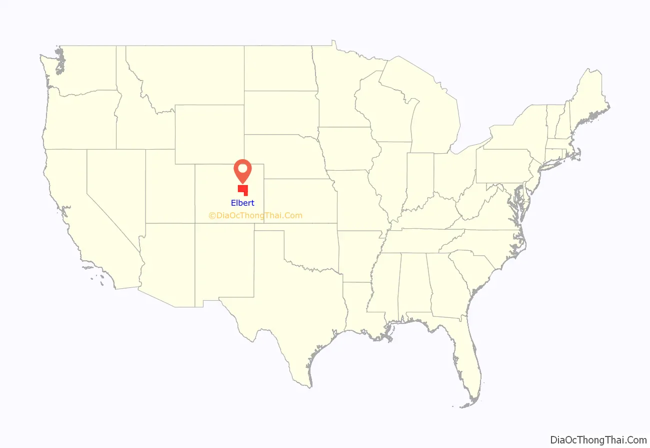
Elbert County location map. Where is Elbert County?
History
Elbert County was created on February 2, 1874, from the eastern portions of Douglas County. On February 6, 1874, the county was enlarged to include part of northern Greenwood County upon Greenwood’s dissolution, and originally extended south and east of its present boundaries to reach to the Kansas state line. The county was named for Samuel Hitt Elbert, the Governor of the Territory of Colorado when the county was formed. In 1889, Elbert County was reduced to its modern size when its eastern portions were taken to create Lincoln, Kit Carson, and Cheyenne counties.
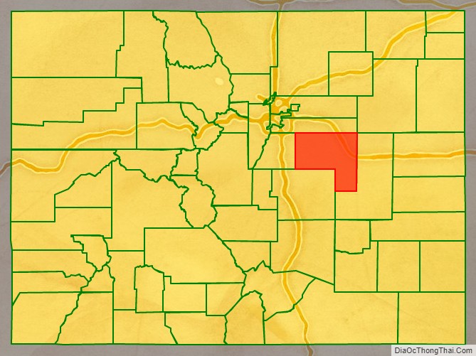
Elbert County Road Map
Geography
According to the U.S. Census Bureau, the county has a total area of 1,851 square miles (4,790 km), of which 1,851 square miles (4,790 km) is land and 0.2 square miles (0.52 km) (0.01%) is water.
Adjacent counties
- Arapahoe County – north
- Lincoln County – east
- El Paso County – south
- Douglas County – west
Major Highways
- Interstate 70
- I-70 BS
- I-70 BS
- U.S. Highway 24
- U.S. Highway 40
- U.S. Highway 287
- State Highway 86
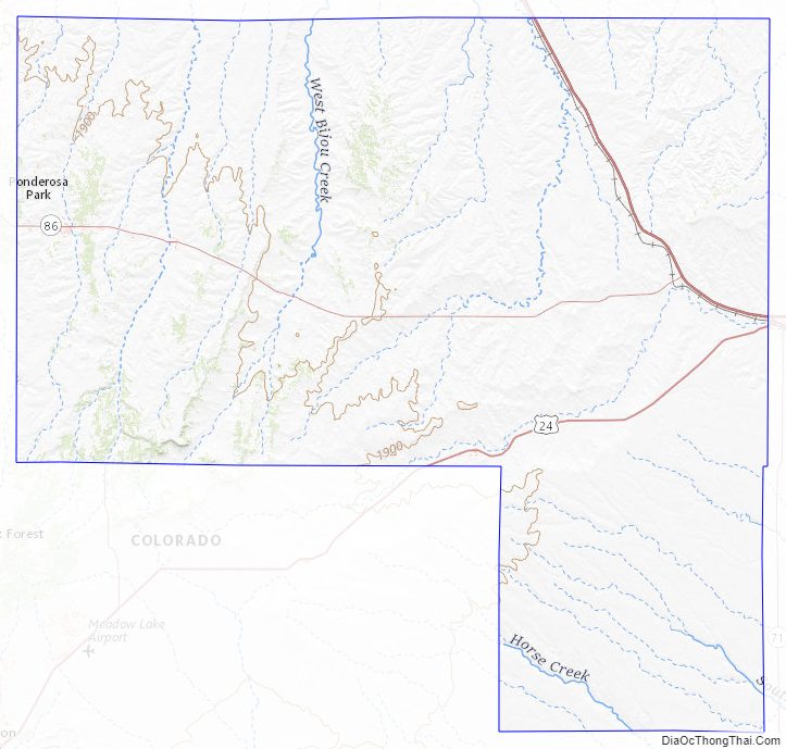
Elbert County Topographic Map
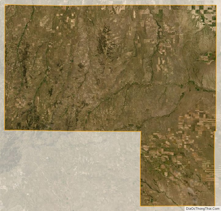
Elbert County Satellite Map
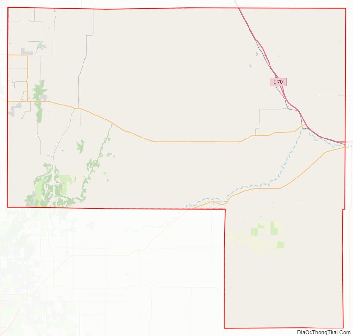
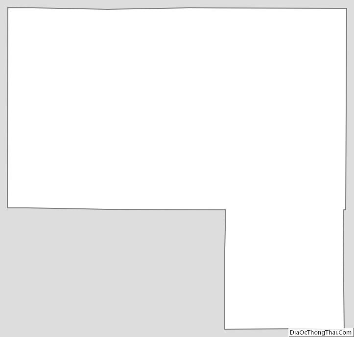
Elbert County Outline Map
See also
Map of Colorado State and its subdivision:- Adams
- Alamosa
- Arapahoe
- Archuleta
- Baca
- Bent
- Boulder
- Broomfield
- Chaffee
- Cheyenne
- Clear Creek
- Conejos
- Costilla
- Crowley
- Custer
- Delta
- Denver
- Dolores
- Douglas
- Eagle
- El Paso
- Elbert
- Fremont
- Garfield
- Gilpin
- Grand
- Gunnison
- Hinsdale
- Huerfano
- Jackson
- Jefferson
- Kiowa
- Kit Carson
- La Plata
- Lake
- Larimer
- Las Animas
- Lincoln
- Logan
- Mesa
- Mineral
- Moffat
- Montezuma
- Montrose
- Morgan
- Otero
- Ouray
- Park
- Phillips
- Pitkin
- Prowers
- Pueblo
- Rio Blanco
- Rio Grande
- Routt
- Saguache
- San Juan
- San Miguel
- Sedgwick
- Summit
- Teller
- Washington
- Weld
- Yuma
- Alabama
- Alaska
- Arizona
- Arkansas
- California
- Colorado
- Connecticut
- Delaware
- District of Columbia
- Florida
- Georgia
- Hawaii
- Idaho
- Illinois
- Indiana
- Iowa
- Kansas
- Kentucky
- Louisiana
- Maine
- Maryland
- Massachusetts
- Michigan
- Minnesota
- Mississippi
- Missouri
- Montana
- Nebraska
- Nevada
- New Hampshire
- New Jersey
- New Mexico
- New York
- North Carolina
- North Dakota
- Ohio
- Oklahoma
- Oregon
- Pennsylvania
- Rhode Island
- South Carolina
- South Dakota
- Tennessee
- Texas
- Utah
- Vermont
- Virginia
- Washington
- West Virginia
- Wisconsin
- Wyoming