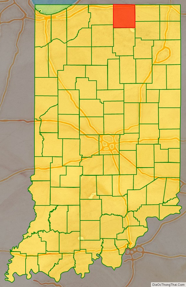
Elkhart County is a county located in the U.S. state of Indiana. As of 2020, the county’s population was 207,047. The county seat is Goshen. Elkhart County is part of the Elkhart–Goshen Metropolitan Statistical Area, which in turn is part of the South Bend-Elkhart-Mishawaka Combined Statistical Area. It is also considered part of the broader region of Northern Indiana known as Michiana, and is 20 miles (32 km) east of South Bend, Indiana, 110 miles (180 km) east of Chicago, Illinois, and 150 miles (240 km) north of Indianapolis, Indiana. The area is referred to by locals as the recreation vehicle (RV) capital of the world and is known for its sizable Amish and Old Order Mennonite population.
| Name: | Elkhart County |
|---|---|
| FIPS code: | 18-039 |
| State: | Indiana |
| Founded: | April 1, 1830 |
| Seat: | Goshen |
| Largest city: | Elkhart |
| Total Area: | 467.97 sq mi (1,212.0 km²) |
| Land Area: | 463.17 sq mi (1,199.6 km²) |
| Total Population: | 207,047 |
| Population Density: | 440/sq mi (170/km²) |
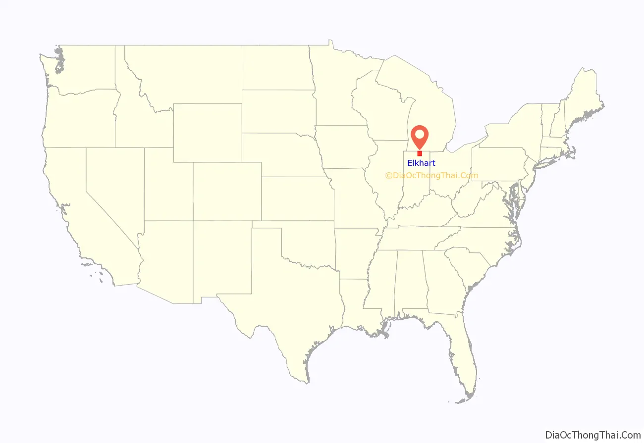
Elkhart County location map. Where is Elkhart County?
History
At the beginning of the nineteenth century, the area now within Elkhart County boundaries was mainly inhabited by the Potawatomi tribe. Pioneers began settling in the Elkhart Prairie in 1829 and in April 1830, Elkhart County was officially established with its original county seat in Dunlap. After reorganizing the county borders, the seat was moved to Goshen near the county’s geographical center.
Elkhart County was founded by immigrants from New England. These were old-stock “Yankee” immigrants, descended from the English Puritans who settled New England in the 1600s. The completion of the Erie Canal in 1821 sparked a surge in immigration from New England to northern Indiana, which had become a state five years earlier. The end of the Black Hawk War in 1832 increased the immigration surge of immigration, again coming from New England as a result of overpopulation combined with land shortages in that region. Some of these later settlers were from upstate New York, whose relatives had moved to that region from New England shortly after the American Revolutionary War. New Englanders and New England transplants from upstate New York were the vast majority of Elkhart County’s inhabitants during the first several decades of its history. These settlers were primarily members of the Congregational Church though due to the Second Great Awakening many of them had converted to Methodism and some had become Baptists before moving west. The Congregational Church subsequently has gone through many divisions, and some factions, including those in Elkhart County, are now known as the Church of Christ and the United Church of Christ. As a result of this heritage, most of Elkhart County supported the abolitionist movement before the American Civil War. Elkhart County provided substantial recruits for the Union Army. During the end of the nineteenth century, Irish and German migrants came to Elkhart County, although most did not come directly from Europe, but had stopped in other areas in the Midwest, such as Ohio.
Name
The origin of “Elkhart” is not known. Three theories have been proposed: a) the area was named after a native tribe (although no historical evidence has surfaced to prove the existence of such a tribe); b) the Island Park in Elkhart City has the shape of an elk’s heart. Although this theory is carried on the city’s website, simple logic throws shade on this possibility. c) The county was named after the Shawnee Indian chief Elkhart, cousin of the famous Chief Tecumseh, and father of princess Mishawaka (for whom neighboring Mishawaka is named).
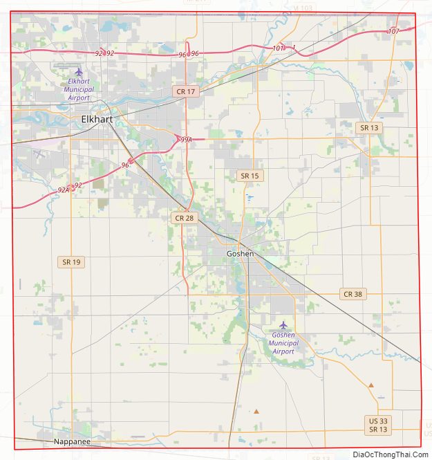
Elkhart County Road Map
Geography
According to the 2010 census, the county has a total area of 467.97 square miles (1,212.0 km), of which 463.17 square miles (1,199.6 km) (or 98.97%) is land and 4.80 square miles (12.4 km) (or 1.03%) is water. The county sits in mostly rural farmland with rolling hills in its northeast corner. Those hills were formed by glaciers and are part of the St. Lawrence Seaway Continental Divide.
The St. Joseph River, which flows from Michigan, across the Michigan border north of Bristol, is the main waterway in Elkhart County. The Elkhart River enters the county east of Millersburg and winds its way through Goshen and Dunlap to Island Park in Elkhart where it meets the St. Joseph. The Little Elkhart River flows into the county southeast of Middlebury and creates some scenic views in Bonneyville Mills County Park before emptying into the St. Joseph near Bristol. Numerous creeks wind their way through the countryside and several lakes, including Simonton Lake, dot the landscape.
Fifteen unincorporated communities also exist in the county. They are Benton, Bonneyville Mills, Dunlap, Foraker, Garden Village, Jimtown, Locke, Midway, New Paris, Nibbyville, Simonton Lake, Southwest, Vistula, and Waterford Mills.
Townships
Adjacent counties
- Cass County, Michigan (northwest)
- St. Joseph County, Michigan (northeast)
- LaGrange County (east)
- Noble County (southeast)
- Kosciusko County (south)
- Marshall County (southwest)
- St. Joseph County (west)
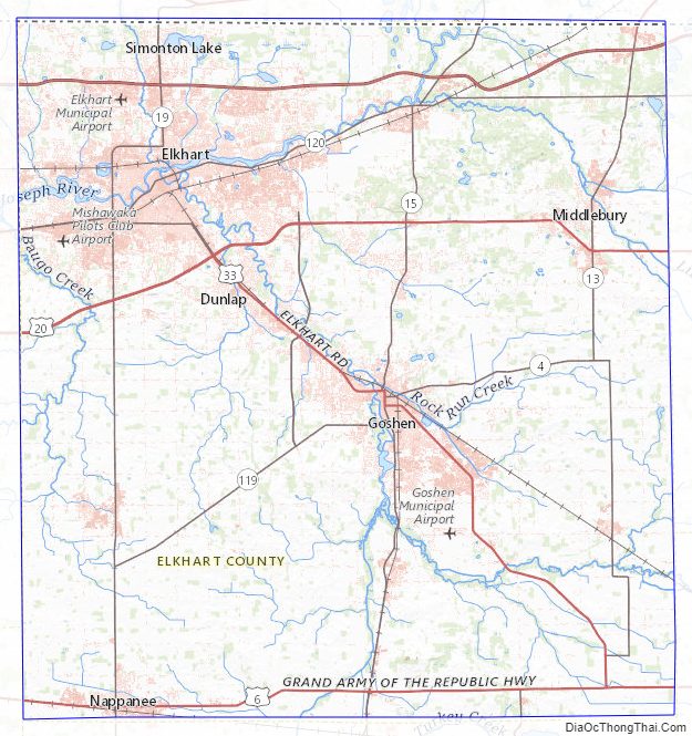
Elkhart County Topographic Map
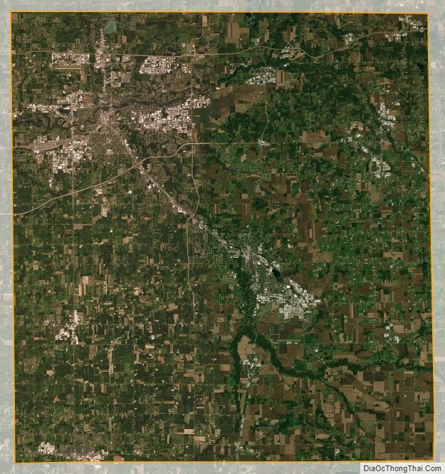
Elkhart County Satellite Map
Elkhart County Outline Map

See also
Map of Indiana State and its subdivision:- Adams
- Allen
- Bartholomew
- Benton
- Blackford
- Boone
- Brown
- Carroll
- Cass
- Clark
- Clay
- Clinton
- Crawford
- Daviess
- De Kalb
- Dearborn
- Decatur
- Delaware
- Dubois
- Elkhart
- Fayette
- Floyd
- Fountain
- Franklin
- Fulton
- Gibson
- Grant
- Greene
- Hamilton
- Hancock
- Harrison
- Hendricks
- Henry
- Howard
- Huntington
- Jackson
- Jasper
- Jay
- Jefferson
- Jennings
- Johnson
- Knox
- Kosciusko
- LaGrange
- Lake
- Lake Michigan
- LaPorte
- Lawrence
- Madison
- Marion
- Marshall
- Martin
- Miami
- Monroe
- Montgomery
- Morgan
- Newton
- Noble
- Ohio
- Orange
- Owen
- Parke
- Perry
- Pike
- Porter
- Posey
- Pulaski
- Putnam
- Randolph
- Ripley
- Rush
- Saint Joseph
- Scott
- Shelby
- Spencer
- Starke
- Steuben
- Sullivan
- Switzerland
- Tippecanoe
- Tipton
- Union
- Vanderburgh
- Vermillion
- Vigo
- Wabash
- Warren
- Warrick
- Washington
- Wayne
- Wells
- White
- Whitley
- Alabama
- Alaska
- Arizona
- Arkansas
- California
- Colorado
- Connecticut
- Delaware
- District of Columbia
- Florida
- Georgia
- Hawaii
- Idaho
- Illinois
- Indiana
- Iowa
- Kansas
- Kentucky
- Louisiana
- Maine
- Maryland
- Massachusetts
- Michigan
- Minnesota
- Mississippi
- Missouri
- Montana
- Nebraska
- Nevada
- New Hampshire
- New Jersey
- New Mexico
- New York
- North Carolina
- North Dakota
- Ohio
- Oklahoma
- Oregon
- Pennsylvania
- Rhode Island
- South Carolina
- South Dakota
- Tennessee
- Texas
- Utah
- Vermont
- Virginia
- Washington
- West Virginia
- Wisconsin
- Wyoming