Ellis County is a county located on the western border of the U.S. state of Oklahoma. As of the 2010 census, the population was 4,151, making it the fifth-least populous county in Oklahoma. Its county seat is Arnett.
The county was named for Albert H. Ellis, vice president of the 1906 Constitutional Convention.
| Name: | Ellis County |
|---|---|
| FIPS code: | 40-045 |
| State: | Oklahoma |
| Founded: | 1907 |
| Named for: | Albert H. Ellis |
| Seat: | Arnett |
| Largest town: | Shattuck |
| Total Area: | 1,232 sq mi (3,190 km²) |
| Land Area: | 1,232 sq mi (3,190 km²) |
| Total Population: | 4,151 |
| Population Density: | 3.4/sq mi (1.3/km²) |
| Time zone: | UTC−6 (Central) |
| Summer Time Zone (DST): | UTC−5 (CDT) |
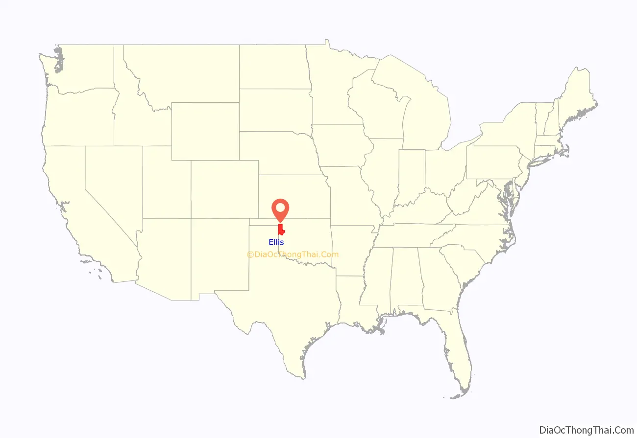
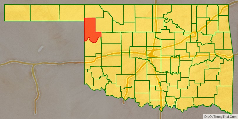
Ellis County location map. Where is Ellis County?
History
This area was used by indigenous tribes that included the Comanche, Kiowa, Apache, Cheyenne, and Arapaho. In 1820, an expedition led by Stephen Long passed through the area while exploring the Canadian River all the way to Fort Smith, Arkansas. Conflicts broke out between the Native Americans and the white settlers that were rapidly moving into Texas. In May 1858, the governor of Texas sent a force of Texas Rangers, militia and allied Indians (notably the Tonkawas), led by Captain John S. “Rip” Ford into Indian Territory. Ford’s command fought a battle known as either the Battle of Little Robe Creek or the Battle of Antelope Hills inside the present Ellis County. The battle was notable because it resulted in killing the Comanche chief, Iron Jacket, father of Peta Nocona and grandfather of Quanah Parker.
After the Civil War, roads and railroads turned the Ellis County area into a transportation corridor. A military road connected Fort Supply (Oklahoma) with Fort Elliott. During the 1880s, the Western Trail, a cattle trail between Texas and Kansas, intersected the military road near the present town of Fargo. The Southern Kansas Railway, later owned by the Atchison, Topeka and Santa Fe Railway, built a line in 1886-7 from Kiowa, Kansas that resulted in starting three Ellis County towns: Fargo, Gage, and Shattuck.
When Oklahoma Territory was created, the present Ellis County became part of Day County. After statehood, several county boundaries changed and resulted in the elimination of Day County. The northern part became Roger Mills County, while the southwestern part of Woodward County was added to the remainder of Day County to become Ellis County. An election for location of the county seat in June 1908, resulted in a runoff between the towns of Shattuck and Arnett. The latter won the runoff election and remains the county seat.
On April 9, 1947, an F5 tornado, the sixth deadliest ever recorded in the United States, tore through Ellis County. It began near White Deer, Texas and traveled northeast for 221 miles (356 km). The damage occurred mostly in rural areas, and the towns were largely spared. The storm killed six people in Ellis county itself.
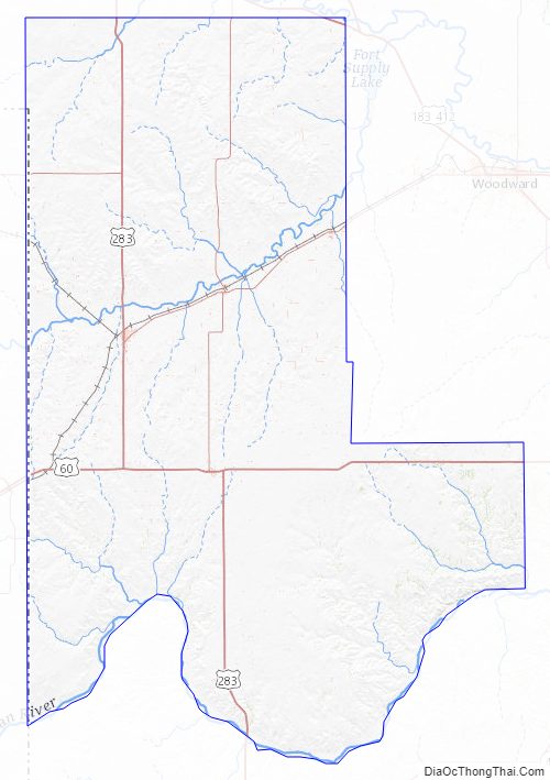
Ellis County Road Map
Geography
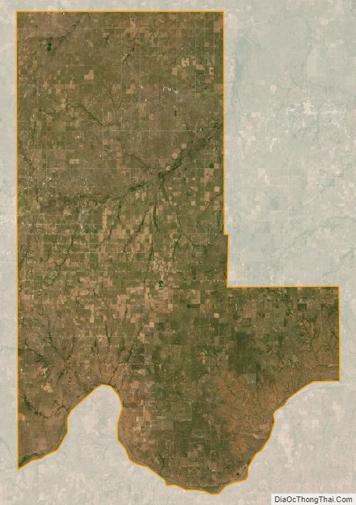
According to the U.S. Census Bureau, the county has a total area of 1,232 square miles (3,190 km), of which 1,232 square miles (3,190 km) is land and 0.4 square miles (1.0 km) (0.03%) is water. The county is mostly within the Great Plains physiographic region.
The major stream is Wolf Creek, a tributary of the North Canadian River. Other waterways are Little Robe, Commission and Hackberry Creeks, tributaries of the Canadian River, which forms the southern boundary of the county. The Ellis County Wildlife Management Area, with Lake Lloyd Vincent, are in the southwestern corner of the county. Packsaddle Wildlife Management Area is in the south central part of the county, along the Canadian River.
Major highways
- U.S. Highway 60
- U.S. Highway 270
- U.S. Highway 283
- U.S. Highway 412
- State Highway 3
- State Highway 15
- State Highway 46
- State Highway 51
Adjacent counties
- Harper County (north)
- Woodward County (east)
- Dewey County (southeast)
- Roger Mills County (south)
- Hemphill County, Texas (southwest)
- Lipscomb County, Texas (west)
- Beaver County (northwest)
Ellis County Topographic Map
Ellis County Satellite Map
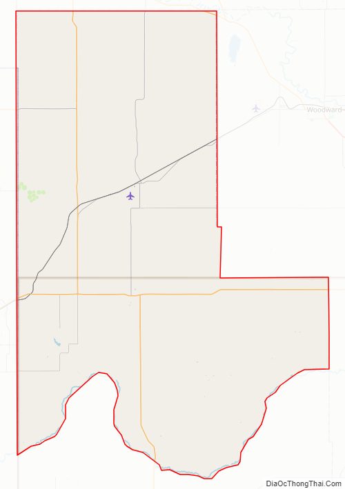
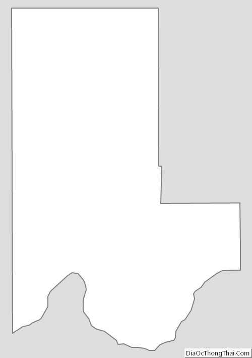
Ellis County Outline Map
See also
Map of Oklahoma State and its subdivision:- Adair
- Alfalfa
- Atoka
- Beaver
- Beckham
- Blaine
- Bryan
- Caddo
- Canadian
- Carter
- Cherokee
- Choctaw
- Cimarron
- Cleveland
- Coal
- Comanche
- Cotton
- Craig
- Creek
- Custer
- Delaware
- Dewey
- Ellis
- Garfield
- Garvin
- Grady
- Grant
- Greer
- Harmon
- Harper
- Haskell
- Hughes
- Jackson
- Jefferson
- Johnston
- Kay
- Kingfisher
- Kiowa
- Latimer
- Le Flore
- Lincoln
- Logan
- Love
- Major
- Marshall
- Mayes
- McClain
- McCurtain
- McIntosh
- Murray
- Muskogee
- Noble
- Nowata
- Okfuskee
- Oklahoma
- Okmulgee
- Osage
- Ottawa
- Pawnee
- Payne
- Pittsburg
- Pontotoc
- Pottawatomie
- Pushmataha
- Roger Mills
- Rogers
- Seminole
- Sequoyah
- Stephens
- Texas
- Tillman
- Tulsa
- Wagoner
- Washington
- Washita
- Woods
- Woodward
- Alabama
- Alaska
- Arizona
- Arkansas
- California
- Colorado
- Connecticut
- Delaware
- District of Columbia
- Florida
- Georgia
- Hawaii
- Idaho
- Illinois
- Indiana
- Iowa
- Kansas
- Kentucky
- Louisiana
- Maine
- Maryland
- Massachusetts
- Michigan
- Minnesota
- Mississippi
- Missouri
- Montana
- Nebraska
- Nevada
- New Hampshire
- New Jersey
- New Mexico
- New York
- North Carolina
- North Dakota
- Ohio
- Oklahoma
- Oregon
- Pennsylvania
- Rhode Island
- South Carolina
- South Dakota
- Tennessee
- Texas
- Utah
- Vermont
- Virginia
- Washington
- West Virginia
- Wisconsin
- Wyoming