Emanuel County is a county located in the U.S. state of Georgia. As of the 2020 census, the population was 22,768. The county seat is Swainsboro.
| Name: | Emanuel County |
|---|---|
| FIPS code: | 13-107 |
| State: | Georgia |
| Founded: | 1812 |
| Named for: | David Emanuel |
| Seat: | Swainsboro |
| Largest city: | Swainsboro |
| Total Area: | 690 sq mi (1,800 km²) |
| Land Area: | 681 sq mi (1,760 km²) |
| Total Population: | 22,768 |
| Population Density: | 33/sq mi (13/km²) |
| Time zone: | UTC−5 (Eastern) |
| Summer Time Zone (DST): | UTC−4 (EDT) |
| Website: | Emanuel County, Georgia |
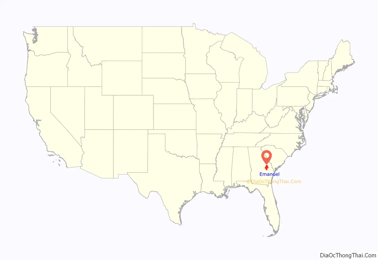
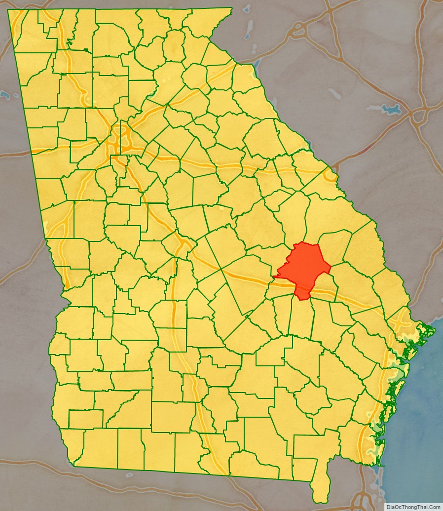
Emanuel County location map. Where is Emanuel County?
History
The county was created on December 10, 1812, by an act of the Georgia General Assembly from land originally in parts of Bulloch and Montgomery counties. Emanuel County is named in honor of former Governor of Georgia David Emanuel.
Portions of Johnson (1858), Jenkins (1905), Toombs (1905), Candler (1914), and Treutlen (1918) counties were taken from Emanuel’s original borders.
Courthouses
Emanuel County has had seven courthouses in its over 200 years of existence. In the county’s early years, the court met at Steven Rich’s home. Emanuel County’s first courthouse was erected in 1814 and burned in 1841. It wasn’t until 1854, the same time that the city of Swainsboro was formally incorporated, that the county was allowed to build a replacement. In a string of bad luck, this new courthouse burned in 1855 and was replaced by another courthouse, which burned in 1857. Emanuel County’s fourth courthouse burned in 1919 and was replaced by a three-story brick structure which, characteristically, burned in 1938. The next courthouse, a two-story marble structure, was built in 1940 and was the first courthouse in Emanuel County’s history not to be destroyed by fire. However, by the 1990s, the courthouse’s cramped and deteriorating condition caused several county offices to vacate the courthouse and move into vacant office space surrounding the courthouse square. The courthouse was demolished in the spring of 2000, leaving only the sheriff’s office annex. In the late 1990s, the Emanuel County commissioners purchased the former U.S. Post Office building, which was built in 1936, to serve as an interim courthouse. In 2000, the county commission acquired land adjacent to the old Post Office to build a new courthouse and sheriff’s office. Emanuel County’s current courthouse, a large, single story brick structure incorporating the old Post Office building, was completed in 2002, and a city square was built on the former courthouse site with the old sheriff’s office renovated to serve as the city’s visitors’ center as well as the office for Swainsboro-Emanuel County Chamber of Commerce.
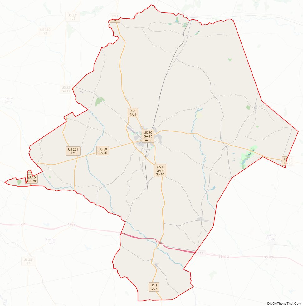
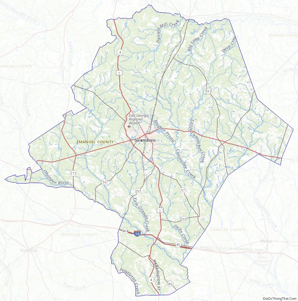
Emanuel County Road Map
Geography
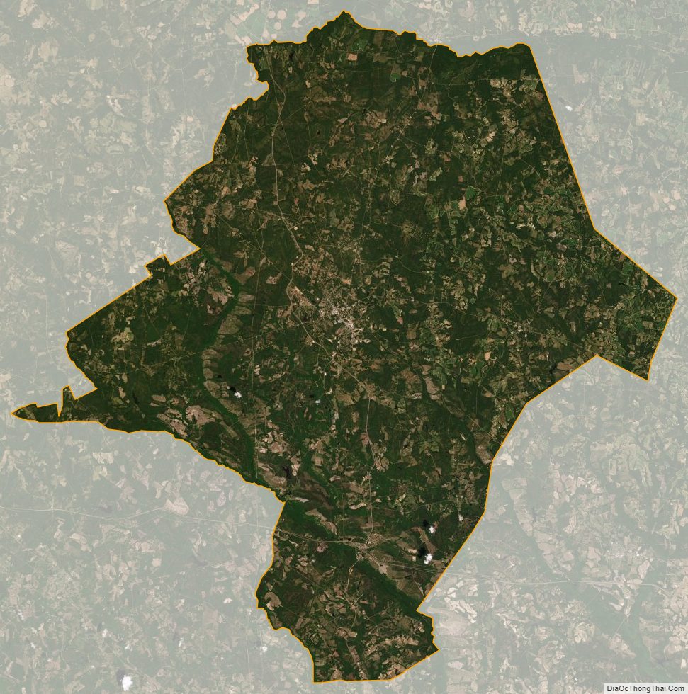
According to the U.S. Census Bureau, the county has a total area of 690 square miles (1,800 km), of which 681 square miles (1,760 km) is land and 9.6 square miles (25 km) (1.4%) is water.
The northern portion of Emanuel County, centered on Summertown and defined by a southern border heading from Garfield east-northeast and running north of Modoc, is located in the Upper Ogeechee River sub-basin of the Ogeechee River basin. The eastern portion of the county, east of Swainsboro, is located in the Canoochee River sub-basin of the same Ogeechee River basin. The western and southern portions of Emanuel County are located in the Ohoopee River sub-basin of the Altamaha River basin.
Major highways
- Interstate 16
- U.S. Route 1
U.S. Route 1 Business- U.S. Route 80
- U.S. Route 221
- State Route 4
- State Route 4 Business
- State Route 15
- State Route 23
- State Route 26
- State Route 46
- State Route 56
- State Route 57
- State Route 78
- State Route 86
- State Route 121
- State Route 171
- State Route 192
- State Route 297
- State Route 404 (unsigned designation for I-16)
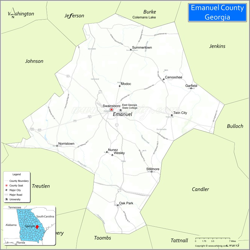
Adjacent counties
- Jefferson County – north
- Jenkins County – northeast
- Burke County – northeast
- Candler County – east
- Tattnall County – southeast
- Bulloch County – southeast
- Toombs County – south
- Laurens County – southwest
- Johnson County – west
- Treutlen County – west
Emanuel County Topographic Map
Emanuel County Satellite Map
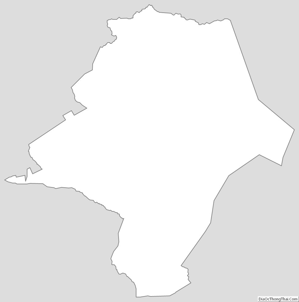
Emanuel County Outline Map
See also
Map of Georgia State and its subdivision:- Appling
- Atkinson
- Bacon
- Baker
- Baldwin
- Banks
- Barrow
- Bartow
- Ben Hill
- Berrien
- Bibb
- Bleckley
- Brantley
- Brooks
- Bryan
- Bulloch
- Burke
- Butts
- Calhoun
- Camden
- Candler
- Carroll
- Catoosa
- Charlton
- Chatham
- Chattahoochee
- Chattooga
- Cherokee
- Clarke
- Clay
- Clayton
- Clinch
- Cobb
- Coffee
- Colquitt
- Columbia
- Cook
- Coweta
- Crawford
- Crisp
- Dade
- Dawson
- Decatur
- DeKalb
- Dodge
- Dooly
- Dougherty
- Douglas
- Early
- Echols
- Effingham
- Elbert
- Emanuel
- Evans
- Fannin
- Fayette
- Floyd
- Forsyth
- Franklin
- Fulton
- Gilmer
- Glascock
- Glynn
- Gordon
- Grady
- Greene
- Gwinnett
- Habersham
- Hall
- Hancock
- Haralson
- Harris
- Hart
- Heard
- Henry
- Houston
- Irwin
- Jackson
- Jasper
- Jeff Davis
- Jefferson
- Jenkins
- Johnson
- Jones
- Lamar
- Lanier
- Laurens
- Lee
- Liberty
- Lincoln
- Long
- Lowndes
- Lumpkin
- Macon
- Madison
- Marion
- McDuffie
- McIntosh
- Meriwether
- Miller
- Mitchell
- Monroe
- Montgomery
- Morgan
- Murray
- Muscogee
- Newton
- Oconee
- Oglethorpe
- Paulding
- Peach
- Pickens
- Pierce
- Pike
- Polk
- Pulaski
- Putnam
- Quitman
- Rabun
- Randolph
- Richmond
- Rockdale
- Schley
- Screven
- Seminole
- Spalding
- Stephens
- Stewart
- Sumter
- Talbot
- Taliaferro
- Tattnall
- Taylor
- Telfair
- Terrell
- Thomas
- Tift
- Toombs
- Towns
- Treutlen
- Troup
- Turner
- Twiggs
- Union
- Upson
- Walker
- Walton
- Ware
- Warren
- Washington
- Wayne
- Webster
- Wheeler
- White
- Whitfield
- Wilcox
- Wilkes
- Wilkinson
- Worth
- Alabama
- Alaska
- Arizona
- Arkansas
- California
- Colorado
- Connecticut
- Delaware
- District of Columbia
- Florida
- Georgia
- Hawaii
- Idaho
- Illinois
- Indiana
- Iowa
- Kansas
- Kentucky
- Louisiana
- Maine
- Maryland
- Massachusetts
- Michigan
- Minnesota
- Mississippi
- Missouri
- Montana
- Nebraska
- Nevada
- New Hampshire
- New Jersey
- New Mexico
- New York
- North Carolina
- North Dakota
- Ohio
- Oklahoma
- Oregon
- Pennsylvania
- Rhode Island
- South Carolina
- South Dakota
- Tennessee
- Texas
- Utah
- Vermont
- Virginia
- Washington
- West Virginia
- Wisconsin
- Wyoming