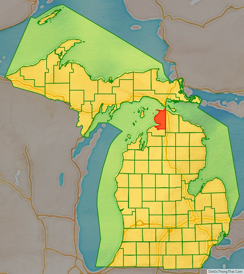
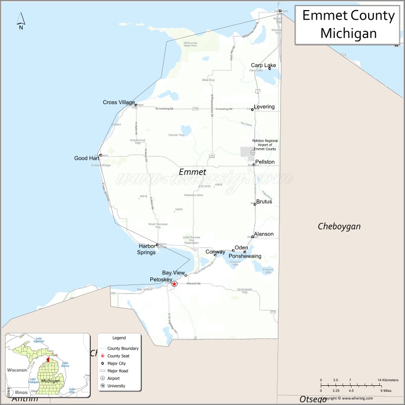
Emmet County is a county located in the U.S. state of Michigan. It is the northernmost county in the Lower Peninsula. As of the 2020 Census, the population was 34,112, making it the second-most populous county in Northern Michigan (behind Grand Traverse County). The county seat is Petoskey, which is also the county’s largest city.
Emmet County is located at the top of the Lower Peninsula of Michigan, bounded on the west by Lake Michigan and on the north by the Straits of Mackinac. Its rural areas are habitat for several endangered species. Long a center of occupation by the Odawa people, today the county is the base for the federally recognized Little Traverse Bay Bands of Odawa Indians.
| Name: | Emmet County |
|---|---|
| FIPS code: | 26-047 |
| State: | Michigan |
| Founded: | April 1, 1840 |
| Named for: | Robert Emmet |
| Seat: | Petoskey |
| Largest city: | Petoskey |
| Total Area: | 882 sq mi (2,280 km²) |
| Land Area: | 467 sq mi (1,210 km²) |
| Total Population: | 34,112 |
| Population Density: | 70/sq mi (30/km²) |
| Time zone: | UTC−5 (Eastern) |
| Summer Time Zone (DST): | UTC−4 (EDT) |
| Website: | www.emmetcounty.org |
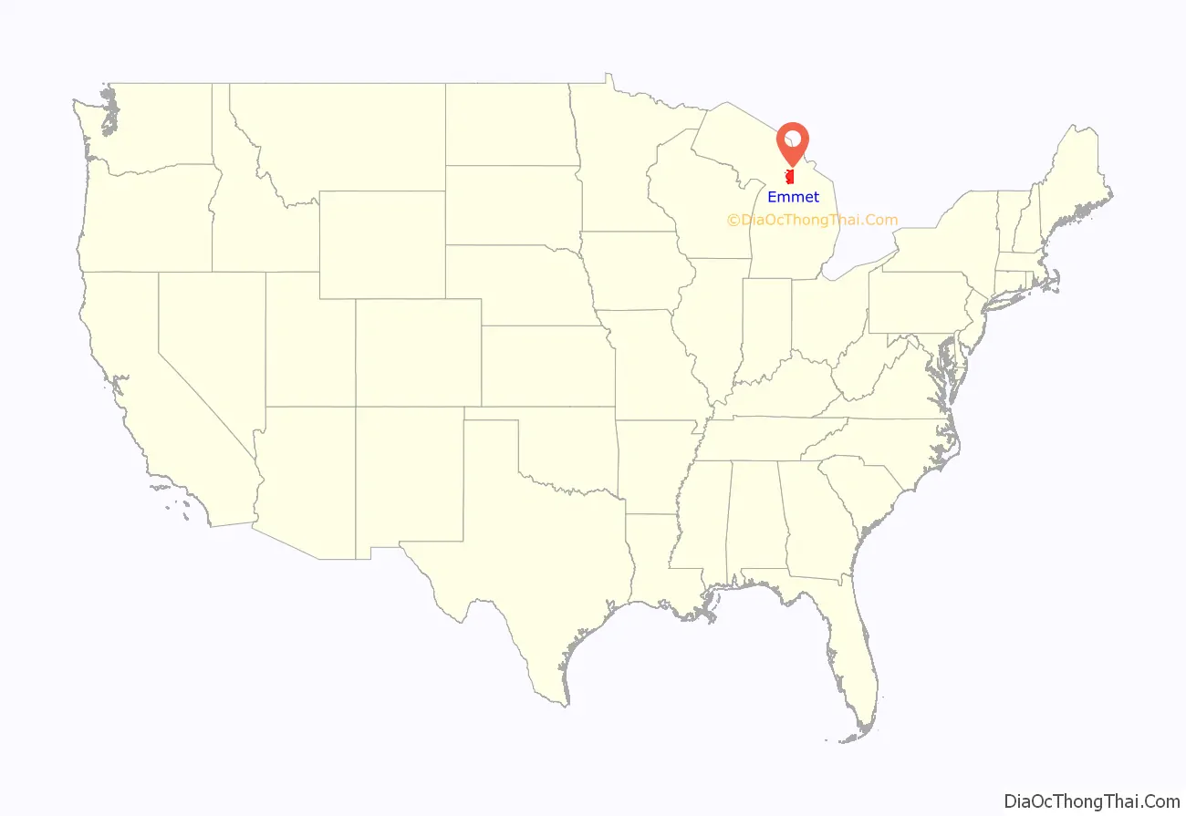
Emmet County location map. Where is Emmet County?
History
Native Americans and New France
Odawa history records that Emmet County was thickly populated by indigenous peoples called the Mush-co-desh, which means “the prairie tribe”. They had an agrarian society and were said to have “shaped the land by making the woodland into prairie as they abandoned their old worn out gardens which formed grassy plains”. Ottawa tradition claims that they slaughtered from forty to fifty thousand Mush-co-desh and drove the rest from the land after the Mush-co-desh insulted an Ottawa war party.
The Odawa were important prior to European colonization for their trading network throughout the Great Lakes area. The Odawa of on nearby L’Arbre Croche fished, hunted, and grew and gathered produce, including corn, squash, onions, cucumbers, turnips, cabbages, melon, and wild strawberries. The Odawa bartered with the French at Mackinac Island, a major fur-trading center where Lake Huron meets Lake Michigan. They traded food, bark, and canoes for good, like clothing and glass and porcelain beads. The canoes and food–including dried fish and meat and produce–supplied the fur traders who worked in the wilderness of the Great Lakes and the Upper Mississippi regions. They retained this influence into the 18th century, as French traders relied on them to take furs east from tribes they traded with to the north and west. When French explorers first came to this area, they claimed it as part of New France, based in today’s Quebec province.
The Ottawa and Ojibwe tribes were the principal inhabitants of this area, extending across to Manitoulin Island and the Bruce Peninsula of Ontario, Canada. The French established Fort Michilimackinac in about 1715. It was a trading post and the basis of a multicultural settlement that developed around it. Seasonally numerous Native Americans of various tribes would come to trade there.
Pierre du Jaunay, a Jesuit priest from France, served as a missionary at Michilimackinac beginning in 1735. From the Sainte-Anne log church, he served the French and later British residents, neighboring Native Americans, and visiting traders and explorers for almost 30 years. Du Jaunay split his time between the Sainte-Anne church and the Saint-Ignace at L’Arbre Croche mission in Cross Village, where he had a farm. He was assisted by several French priests and some Native American slaves.
British Control
During the Seven Years’ War (1754–63), British and French forces, together with Indian allies on each side, fought on the North American front in what became known in the British colonies as the French and Indian War. The British took control of Fort Michilimackinac in 1761 and continued to use it as a trading post. In 1763, Ojibwe warriors took the fort as a part of Pontiac’s Rebellion and held it for a year before the British retook it. The British abandoned the wooden fort in 1781 after building the limestone Fort Mackinac on nearby Mackinac Island.
US Control and white settlement under the Mormons
An Indian community on the lakeshore in the western part of the county continued to thrive after the British abandoned the fort. After the War of 1812, Mackinac Island and this area became part of the United States.
In the 1840s, Odawa villages lined the Lake Michigan shore from present-day Harbor Springs to Cross Village. By Act 119 of the Michigan Legislature approved 1 April 1840, a number of northern counties were delineated. Tonedagana County, a name derived from a Cross Village Odawa war chief, was delineated from Michilimackinac County but unorganized, so remained attached for judicial purposes. The area was mostly reserved for native tribes by treaty provisions with the US federal government until 1875.
The Michigan Legislature renamed Tonedagana County as Emmet County, after Robert Emmet, on 8 March 1843. In 1847, a group of Mormons settled on nearby Beaver Island and established a “kingdom” led by “King” James Jesse Strang. There were bitter disputes between Strang’s followers and other white settlers. Strang, seeking to strengthen his position, gained election to the Michigan State House of Representatives. In January 1853, he pushed through legislation titled, “An act to organize the County of Emmet”, which enlarged Emmet County by attaching the nearby Lake Michigan islands to the county, as well as a portion of Cheboygan County. It also annexed the old Charlevoix County, which was originally named Keskkauko County and was as yet unorganized, as a township of Emmet County. Due to Strang’s influence, Mormons came to dominate county government, causing an exodus of many non-Mormon settlers to neighboring areas. In 1855, the non-Mormon resistance succeeded in getting the Michigan Legislature to reorganize Emmet County. The islands, including Beaver Island and North and South Manitou Islands, were transferred into the separate Manitou County, which effectively eliminated Mormons from Emmet County government.
Further Political Divisions
On April 27, 1857, an election selected Little Traverse (now named Harbor Springs) as the county seat. However, at about this time, investors were trying to promote development at Mackinaw City. Due to their influence, in February 1858, the State Legislature passed an act establishing Mackinaw City as the county seat. The Emmet County Board of Supervisors protested that the county seat had already been established at Little Traverse, and in 1861 the act was repealed as unconstitutional. In a contested election in 1867, residents voted to move the county seat to Charlevoix, which was upheld by a Circuit Court decision in 1868. However, in 1869, Charlevoix County was split from Emmet County, resulting in the county seat being in another county. No provisions for official relocation were authorized, although Harbor Springs served as the unofficial county seat until April 1902. The present county seat of Petoskey was selected at that time in a county-wide election.
Charlevoix Township was organized in 1853 and included all of the nine townships in the southern half of the county. In the 1855 reorganization, four new townships were created by the State Legislature:
- La Croix Township (name changed to Cross Village Township in 1875)
- Little Traverse Township
- Bear Creek Township
- Old Fort Mackinac (later absorbed into other townships)
In 1855, county supervisors also established the townships of Arbour Croche and Utopia. (The former was a mangled spelling derived from the French L’Arbre Croche, the historic village later renamed as Harbor Springs.) The state had inadvertently drawn boundaries for Little Traverse and Bear Creek townships such that one area was included in both. The county supervisors’ Arbour Croche was defined as having the same boundaries as the state-defined Little Traverse Township, excluding the area overlapping with Bear Creek. Eventually the name Arbour Croche disappeared in favor of Little Traverse. The township of Utopia was later absorbed into other townships.
In 1877, six additional townships were organized:
- Bliss Township
- Friendship Township
- Littlefield Township
- Maple River Township
- Pleasantview Township
- Readmond Township
Center Township was added in 1878 and Carp Lake Township in 1879. Resort Township and Springvale Township, Michigan were formed in 1880, but were at that time part of Charlevoix County. Those townships, along with Bear Creek, experienced numerous boundary changes. The now defunct townships of Bear Lake and Spring Lake were created out of portions of these townships. In 1897, the portions of these townships remaining in Emmet County were absorbed into Bear Creek and Springvale townships.
Also organized in 1897 were West Traverse Township (from portions of Friendship and Little Traverse Townships) and Egleston Township (name changed to McKinley Township in 1903). In 1923, Wawatam Township was the last township organized in the county, when it was detached from Carp Lake Township.
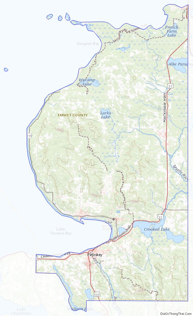
Emmet County Road Map
Geography
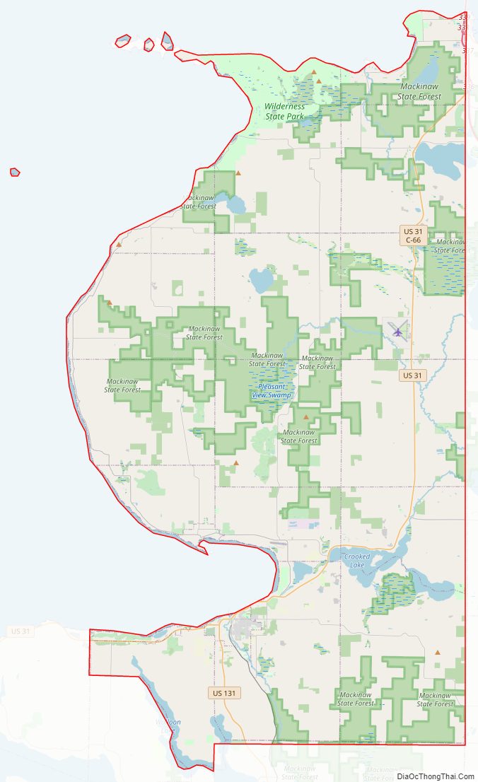
According to the US Census Bureau, the county has a total area of 882 square miles (2,280 km), of which 467 square miles (1,210 km) is land and 415 square miles (1,070 km) (47%) is water. The lower portion of the county forms Little Traverse Bay at the mouth of the bear River. Emmet County is considered to be part of Northern Michigan
Adjacent counties
By land
- Cheboygan County (east)
- Charlevoix County (south)
By water
- Charlevoix County (west)
- Mackinac County (north; accessed via Mackinac Bridge)
Emmet County Topographic Map
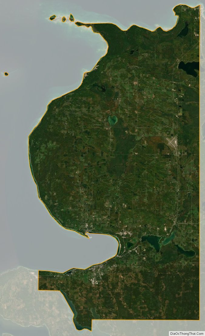
Emmet County Satellite Map
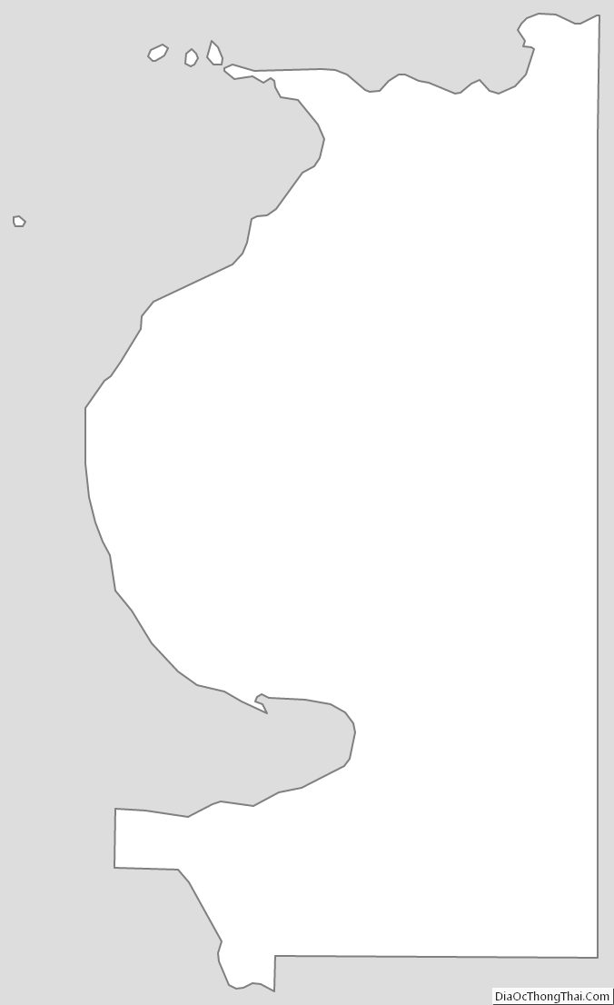
Emmet County Outline Map
See also
Map of Michigan State and its subdivision:- Alcona
- Alger
- Allegan
- Alpena
- Antrim
- Arenac
- Baraga
- Barry
- Bay
- Benzie
- Berrien
- Branch
- Calhoun
- Cass
- Charlevoix
- Cheboygan
- Chippewa
- Clare
- Clinton
- Crawford
- Delta
- Dickinson
- Eaton
- Emmet
- Genesee
- Gladwin
- Gogebic
- Grand Traverse
- Gratiot
- Hillsdale
- Houghton
- Huron
- Ingham
- Ionia
- Iosco
- Iron
- Isabella
- Jackson
- Kalamazoo
- Kalkaska
- Kent
- Keweenaw
- Lake
- Lake Hurron
- Lake Michigan
- Lake St. Clair
- Lake Superior
- Lapeer
- Leelanau
- Lenawee
- Livingston
- Luce
- Mackinac
- Macomb
- Manistee
- Marquette
- Mason
- Mecosta
- Menominee
- Midland
- Missaukee
- Monroe
- Montcalm
- Montmorency
- Muskegon
- Newaygo
- Oakland
- Oceana
- Ogemaw
- Ontonagon
- Osceola
- Oscoda
- Otsego
- Ottawa
- Presque Isle
- Roscommon
- Saginaw
- Saint Clair
- Saint Joseph
- Sanilac
- Schoolcraft
- Shiawassee
- Tuscola
- Van Buren
- Washtenaw
- Wayne
- Wexford
- Alabama
- Alaska
- Arizona
- Arkansas
- California
- Colorado
- Connecticut
- Delaware
- District of Columbia
- Florida
- Georgia
- Hawaii
- Idaho
- Illinois
- Indiana
- Iowa
- Kansas
- Kentucky
- Louisiana
- Maine
- Maryland
- Massachusetts
- Michigan
- Minnesota
- Mississippi
- Missouri
- Montana
- Nebraska
- Nevada
- New Hampshire
- New Jersey
- New Mexico
- New York
- North Carolina
- North Dakota
- Ohio
- Oklahoma
- Oregon
- Pennsylvania
- Rhode Island
- South Carolina
- South Dakota
- Tennessee
- Texas
- Utah
- Vermont
- Virginia
- Washington
- West Virginia
- Wisconsin
- Wyoming