Erath County (/ˈiːræθ/) is a county located in the U.S. state of Texas. According to the United States Census bureau its population was 42,545 in 2020. The county seat is Stephenville. The county is named for George Bernard Erath, an early surveyor and a soldier at the Battle of San Jacinto.
Erath County is included in the Stephenville, Texas, Micropolitan Statistical Area.
Erath County is the location of two of North America’s largest renewable natural gas plants. The largest is at Huckabay Ridge, near Stephenville. The second largest is located outside Dublin at Rio Leche Estates.
| Name: | Erath County |
|---|---|
| FIPS code: | 48-143 |
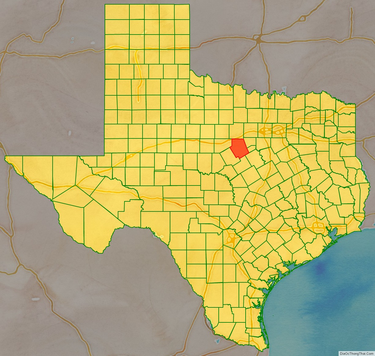
| State: | Texas |
| Founded: | 1856 |
| Named for: | George Bernard Erath |
| Seat: | Stephenville |
| Largest city: | Stephenville |
| Total Area: | 1,090 sq mi (2,800 km²) |
| Land Area: | 1,083 sq mi (2,800 km²) |
| Total Population: | 42,545 |
| Population Density: | 39/sq mi (15/km²) |
| Time zone: | UTC−6 (Central) |
| Summer Time Zone (DST): | UTC−5 (CDT) |
| Website: | www.co.erath.tx.us |
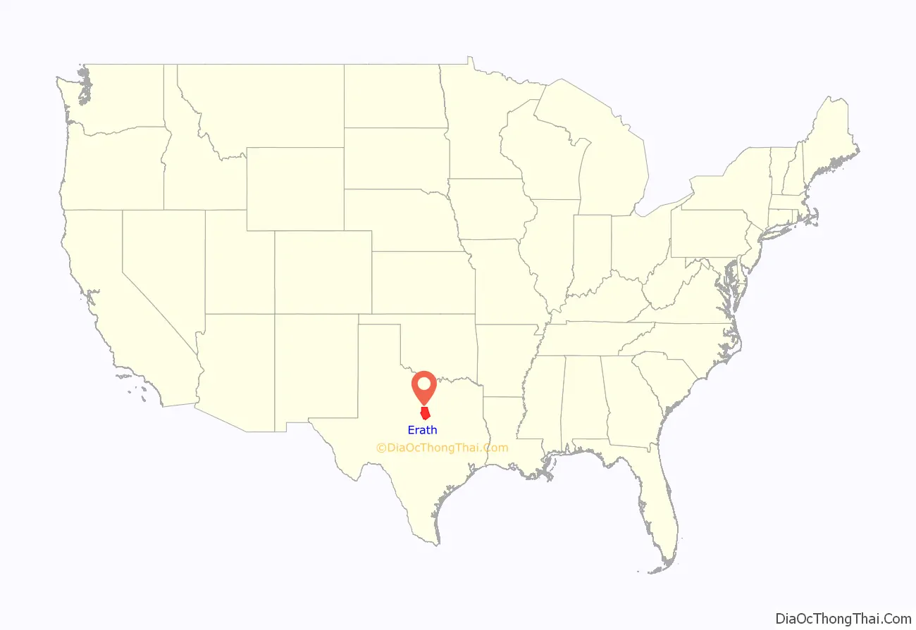
Erath County location map. Where is Erath County?
History
Native Americans
Caddo tribe Anadarko villages were scattered along the Trinity and Brazos Rivers. French explorer Jean-Baptiste Bénard de la Harpe developed camaraderie among the Anadarko in 1719 when he established Fort Saint Louis de los Cadodaquious. The Anadarko became entangled with the French battles with the Spanish and later the Anglos and suffered the consequences, including diseases from which they had no immunity. By 1860, these tribes moved to Oklahoma. Erath County falls into Comancheria and found itself raided by Comanches until their removal to Oklahoma after 1875.
County established and growth
Erath County was formed from Bosque and Coryell counties in 1856 and named for George Bernard Erath, one of the original surveyors of the area. In 1856, John M. Stephen offered to donate land for a townsite. It was named Stephenville after him and became the county seat.
Jones Barbee founded the community of Dublin in 1854. His children were the first citizens to be buried in Erath County in the community of Edna Hill, which is located in Southern Erath. Barbee Cemetery is named after him. Jones traveled with his wife and children across the country coming from North Carolina. He is the grandson of Christopher “Old Kit” Barbee who was the largest wealthiest landowner in North Carolina. He was the largest land donor for the University of North Carolina at Chapel Hill. Barbee served as board president; a bronze statue of him is in the university. Jones had many children who went on to populate the county with names still enduring today such as Barbee, White, Durham, and Brambeletts. Some of his great-grandchildren still reside in the community. His great-great-great-granddaughter, Carolina, lives on his land today in Edna Hill and is the 6th generation to continually live on his old homestead. Her children are the 7th generation to do so. The families of other early settlers still endure there today. Dublin later became famous as the early boyhood home of the PGA, U.S. Open and Masters golf champion Ben Hogan.
In 1855, thirty pioneers settled in the county led by surveyors George Erath (1813–1891) and Neil McLennan. The group included brothers William F. and John M. Stephen and a black family whose name and destiny is unknown.
Erath, an immigrant from Vienna, Austria, was a Texas Ranger and member of Billingsley’s Company C, 1st Regiment of Texas Volunteers, under the command of Col. Charles Burleson at the Battle of San Jacinto, and a member of the Confederate Home Guard. As a Freemason, he was a charter member and secretary of Bosque Lodge #92, from 1852 to 1855 – which changed its name to Waco #92 in 1857 and remains the oldest continuous organization in Waco, Texas.
Cotton became the major crop between 1875 and 1915, with the largest crop being in 1906. The industry was helped in 1879 when the Texas Central Railroad reached Dublin, and in 1889 when the Fort Worth and Rio Grande railroad was completed through Stephenville. This opened eastern markets for the county’s cotton crops. By 1910, soil erosion and the boll weevil caused diversity planning that led to dairy farms, fruit orchards, nurseries, peanuts, feed crops and poultry.
The community of Thurber was created by the Johnson Coal Company. From 1888 to 1921, the Texas Pacific Coal Company mined coal near Thurber, making it a leading coal producer in the state. Fifty-two percent of the miners were of Italian ancestry, creating the “Italian Hill” community just outside Thurber. The United Mine Workers in 1903 sent Joe Fenoglio to organize the Italian workers, thus beginning the Thurber Coal Miners Strike. In the 1970s, the area began bituminous coal production for fuel in the cement industry.
Tarleton State University was founded in 1893 as Stephenville College but was renamed in 1899 after the local rancher John Tarleton rescued the institution from financial difficulties.
On November 4, 2008, Erath County voters elected to allow the sale of beer and wine in the county for off-premises consumption.
Courthouse
Erath’s original 1866 wooden courthouse burned to the ground, destroying county documents along with it. A second stone courthouse was built in 1877 but eventually razed. The cornerstone for the current courthouse was laid in 1891. The architects James Riely Gordon and D. E. Laub designed the present three-story showcase Victorian structure. In addition to Erath, Gordon designed the Arizona State Capitol, and courthouses in Aransas, Bexar, Brazoria, Comal, Ellis, Fayette, Gonzales, Harrison, Hopkins, Lee, McLennan, Victoria and Wise counties. The building was completed in 1893, with limestone from the Leon River and red sandstone from Pecos County. The building’s centralized 95-foot tower has a bell tower and creates a chandeliered atrium from the first floor to the third. The interior is east Texas pine, with cast and wrought-iron stairways, and tessellated imported marble floors. It was renovated in 1988.
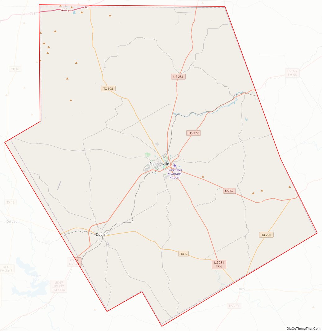
Erath County Road Map

Geography
According to the U.S. Census Bureau, the county has a total area of 1,090 square miles (2,800 km), of which 1,083 square miles (2,800 km) is land and 6.7 square miles (17 km) (0.6%) is water.
Major highways
- Interstate 20
- U.S. Highway 67
- U.S. Highway 281
- U.S. Highway 377
- State Highway 6
- State Highway 108
Adjacent counties
- Palo Pinto County (north)
- Hood County (northeast)
- Somervell County (east)
- Bosque County (southeast)
- Hamilton County (south)
- Comanche County (southwest)
- Eastland County (west)
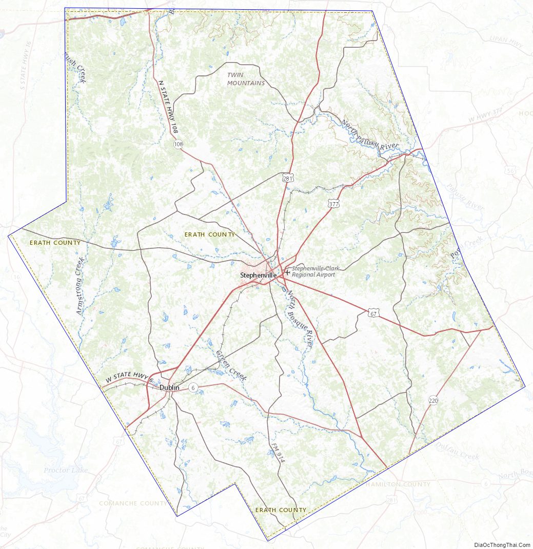
Erath County Topographic Map
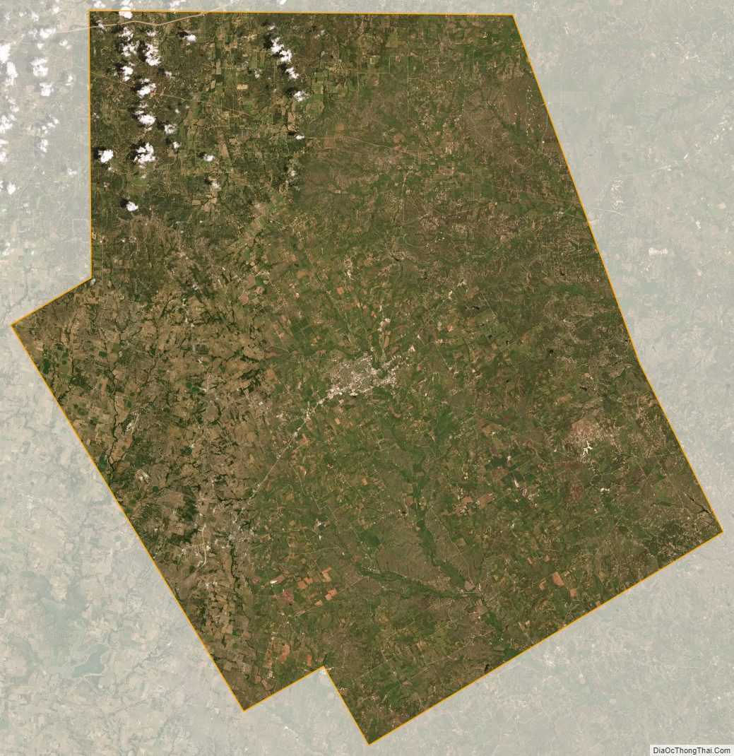
Erath County Satellite Map
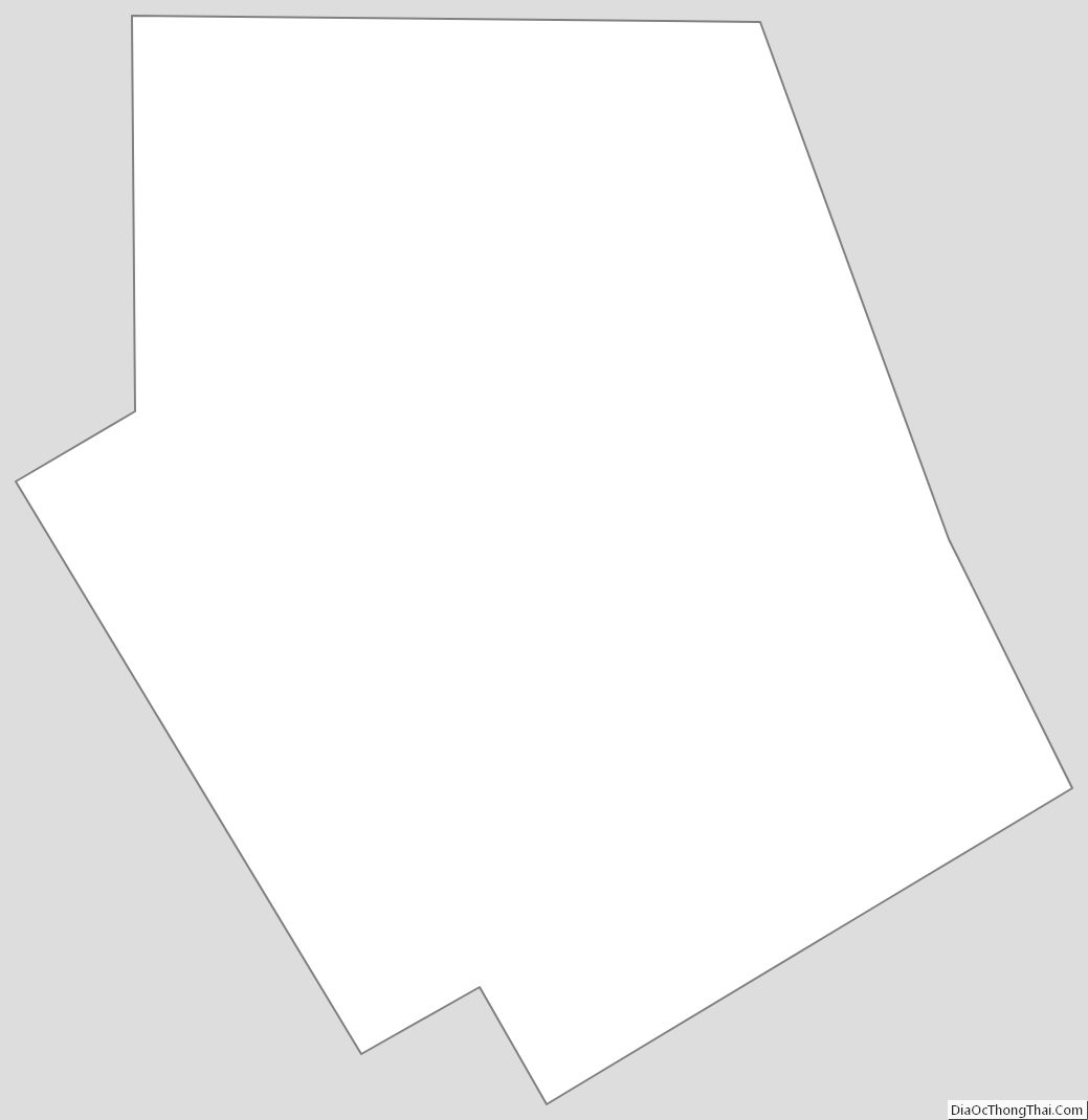
Erath County Outline Map
See also
Map of Texas State and its subdivision:- Anderson
- Andrews
- Angelina
- Aransas
- Archer
- Armstrong
- Atascosa
- Austin
- Bailey
- Bandera
- Bastrop
- Baylor
- Bee
- Bell
- Bexar
- Blanco
- Borden
- Bosque
- Bowie
- Brazoria
- Brazos
- Brewster
- Briscoe
- Brooks
- Brown
- Burleson
- Burnet
- Caldwell
- Calhoun
- Callahan
- Cameron
- Camp
- Carson
- Cass
- Castro
- Chambers
- Cherokee
- Childress
- Clay
- Cochran
- Coke
- Coleman
- Collin
- Collingsworth
- Colorado
- Comal
- Comanche
- Concho
- Cooke
- Coryell
- Cottle
- Crane
- Crockett
- Crosby
- Culberson
- Dallam
- Dallas
- Dawson
- Deaf Smith
- Delta
- Denton
- Dewitt
- Dickens
- Dimmit
- Donley
- Duval
- Eastland
- Ector
- Edwards
- El Paso
- Ellis
- Erath
- Falls
- Fannin
- Fayette
- Fisher
- Floyd
- Foard
- Fort Bend
- Franklin
- Freestone
- Frio
- Gaines
- Galveston
- Garza
- Gillespie
- Glasscock
- Goliad
- Gonzales
- Gray
- Grayson
- Gregg
- Grimes
- Guadalupe
- Hale
- Hall
- Hamilton
- Hansford
- Hardeman
- Hardin
- Harris
- Harrison
- Hartley
- Haskell
- Hays
- Hemphill
- Henderson
- Hidalgo
- Hill
- Hockley
- Hood
- Hopkins
- Houston
- Howard
- Hudspeth
- Hunt
- Hutchinson
- Irion
- Jack
- Jackson
- Jasper
- Jeff Davis
- Jefferson
- Jim Hogg
- Jim Wells
- Johnson
- Jones
- Karnes
- Kaufman
- Kendall
- Kenedy
- Kent
- Kerr
- Kimble
- King
- Kinney
- Kleberg
- Knox
- La Salle
- Lamar
- Lamb
- Lampasas
- Lavaca
- Lee
- Leon
- Liberty
- Limestone
- Lipscomb
- Live Oak
- Llano
- Loving
- Lubbock
- Lynn
- Madison
- Marion
- Martin
- Mason
- Matagorda
- Maverick
- McCulloch
- McLennan
- McMullen
- Medina
- Menard
- Midland
- Milam
- Mills
- Mitchell
- Montague
- Montgomery
- Moore
- Morris
- Motley
- Nacogdoches
- Navarro
- Newton
- Nolan
- Nueces
- Ochiltree
- Oldham
- Orange
- Palo Pinto
- Panola
- Parker
- Parmer
- Pecos
- Polk
- Potter
- Presidio
- Rains
- Randall
- Reagan
- Real
- Red River
- Reeves
- Refugio
- Roberts
- Robertson
- Rockwall
- Runnels
- Rusk
- Sabine
- San Augustine
- San Jacinto
- San Patricio
- San Saba
- Schleicher
- Scurry
- Shackelford
- Shelby
- Sherman
- Smith
- Somervell
- Starr
- Stephens
- Sterling
- Stonewall
- Sutton
- Swisher
- Tarrant
- Taylor
- Terrell
- Terry
- Throckmorton
- Titus
- Tom Green
- Travis
- Trinity
- Tyler
- Upshur
- Upton
- Uvalde
- Val Verde
- Van Zandt
- Victoria
- Walker
- Waller
- Ward
- Washington
- Webb
- Wharton
- Wheeler
- Wichita
- Wilbarger
- Willacy
- Williamson
- Wilson
- Winkler
- Wise
- Wood
- Yoakum
- Young
- Zapata
- Zavala
- Alabama
- Alaska
- Arizona
- Arkansas
- California
- Colorado
- Connecticut
- Delaware
- District of Columbia
- Florida
- Georgia
- Hawaii
- Idaho
- Illinois
- Indiana
- Iowa
- Kansas
- Kentucky
- Louisiana
- Maine
- Maryland
- Massachusetts
- Michigan
- Minnesota
- Mississippi
- Missouri
- Montana
- Nebraska
- Nevada
- New Hampshire
- New Jersey
- New Mexico
- New York
- North Carolina
- North Dakota
- Ohio
- Oklahoma
- Oregon
- Pennsylvania
- Rhode Island
- South Carolina
- South Dakota
- Tennessee
- Texas
- Utah
- Vermont
- Virginia
- Washington
- West Virginia
- Wisconsin
- Wyoming