Falls County is a county in the U.S. state of Texas. As of the 2020 census, its population was 16,968. The county seat is Marlin. It is named for the original 10-foot-tall waterfall on the Brazos River, which existed until the river changed course during a storm in 1866. The present falls is two miles northeast of the original falls, at the Falls on the Brazos Park, a camping site only a few miles out of Marlin on Farm to Market Road 712.
Falls County is part of the Waco, Texas, metropolitan statistical area.
With a large portion of its economy based on agriculture, Falls County is sixth among 254 Texas counties in corn production.
| Name: | Falls County |
|---|---|
| FIPS code: | 48-145 |
| State: | Texas |
| Founded: | 1850 |
| Named for: | Falls on the Brazos Park |
| Seat: | Marlin |
| Largest city: | Marlin |
| Total Area: | 774 sq mi (2,000 km²) |
| Land Area: | 765 sq mi (1,980 km²) |
| Total Population: | 16,968 |
| Population Density: | 22/sq mi (8.5/km²) |
| Time zone: | UTC−6 (Central) |
| Summer Time Zone (DST): | UTC−5 (CDT) |
| Website: | www.co.falls.tx.us |
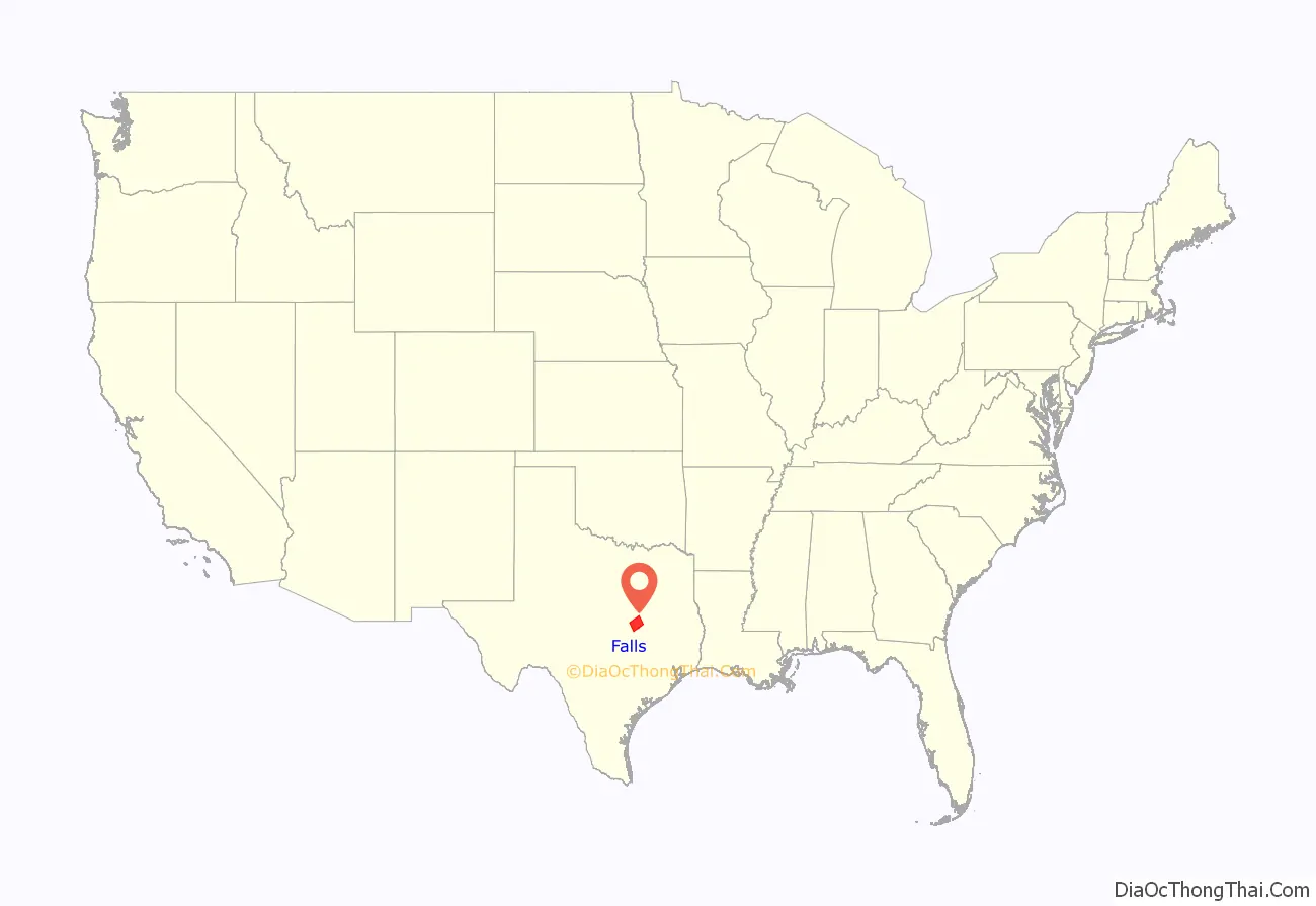
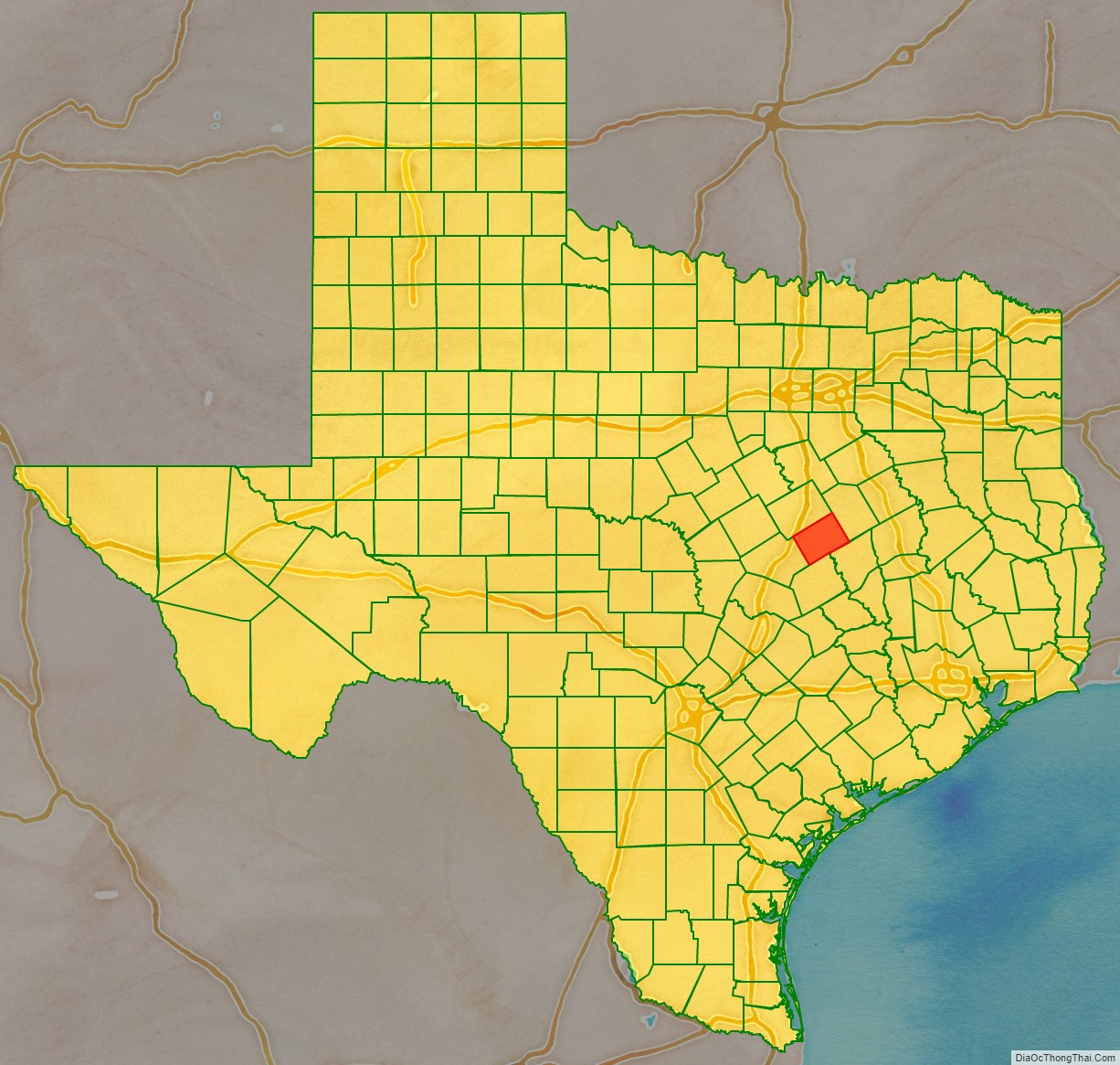
Falls County location map. Where is Falls County?
History
Native Americans
The Brazos River valley served as hunting grounds for several tribes, including Wacos, Tawakonis, and Anadarkos. The Comanches were often a more aggressive band who forced other tribes off the land. The Tawakoni branch of Wichita Indians originated north of Texas, but migrated south into East Texas. From 1843 onward, the Tawakoni were part of treaties made by both the Republic of Texas and the United States.
The Cherokees arrived in the early 1830s. Sam Houston, adopted son of Chief Oolooteka (John Jolly) of the Cherokee, negotiated the February 1836 treaty between Chief Bowl of the Cherokees and the Republic of Texas.
January 1839, Falls County had two brutal massacres by the Anadarkos, under chief José María, at the homes of George Morgan and John Marlin. A retaliatory offensive by settlers was ineffective, and forced the group into a retreat.
In 1846, several tribes negotiated a treaty with the United States government.
Settlers
Empresarios Sterling C. Robertson and Robert Leftwich received a grant from the Coahuila y Tejas legislature to settle 800 families. By contracting how many families each grantee could settle, the government sought to have some control over colonization. Robertson began bringing American settlers to his Nashville colony (later called Robertson’s Colony). Most of the settlers came from Alabama, Tennessee, and Mississippi. He named the capital of the Nashville colony Sarahville de Viesca. Fort Viesca was built in 1834, with a name change to Fort Milam in 1835. The settlement was deserted during the Runaway Scrape of 1836, and reoccupied after the Battle of San Jacinto.
County established and growth
The state legislature formed Falls County from Limestone and Milam Counties in 1850, and named it after the falls of the Brazos River. Marlin became the county seat.
By the census of 1860 the county had 1,716 slaves. Falls County voted in favor of secession from the Union. The county fared better during Reconstruction than most, perhaps due to its distance from areas subject to Union military occupation.
Marlin began to be known by the healing powers of its hot mineral waters by the 1890s. Conrad Hilton built the Falls Hotel, with a tunnel to a mineral bath, to accommodate the business generated by the hot spring.
The Houston and Texas Central Railway became the first railroad through the county around 1870. The Waco Division of the San Antonio and Aransas Pass Railway, in 1886–1925, had multiple stops in Falls County. In 1902, the Missouri Pacific Railroad passed through the county.
A log cabin served as the county’s first courthouse in the 1850s, until the second courthouse was built of white cedar. The second courthouse burned in 1870. A third courthouse was built in 1876, but was damaged by a storm in 1886.
A fourth courthouse was built in 1888, which by the 1930s had greatly deteriorated. The concrete, brick, and stone fifth and present-day courthouse, designed by architect Arthur E. Thomas, was completed in 1939.
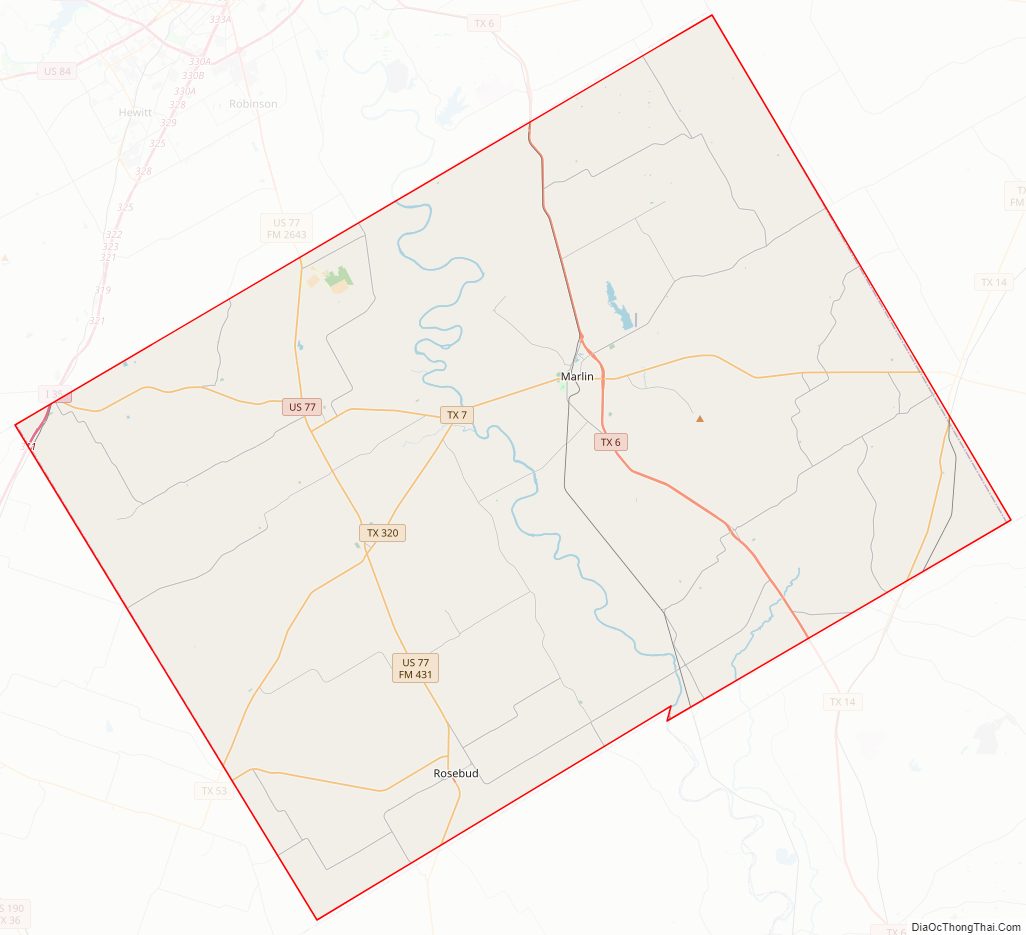
Falls County Road Map
Geography
According to the U.S. Census Bureau, the county has a total area of 774 sq mi (2,000 km), of which 765 sq mi (1,980 km) are land and 8.4 square miles (22 km) (1.1%) are covered by water.
Major highways
- Interstate 35 (two miles)
- U.S. Highway 77
- State Highway 6
- State Highway 7
- State Highway 14
- State Highway 53
- State Highway 320
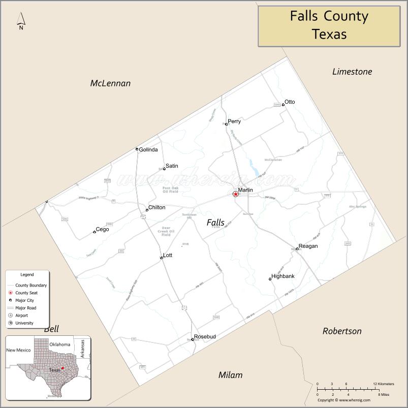
Adjacent counties
- Limestone County (northeast)
- Robertson County (southeast)
- Milam County (south)
- Bell County (southwest)
- McLennan County (northwest)
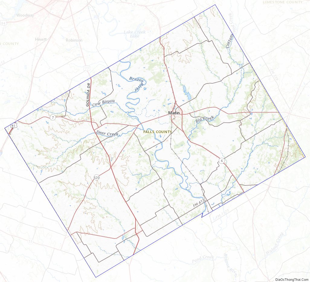
Falls County Topographic Map
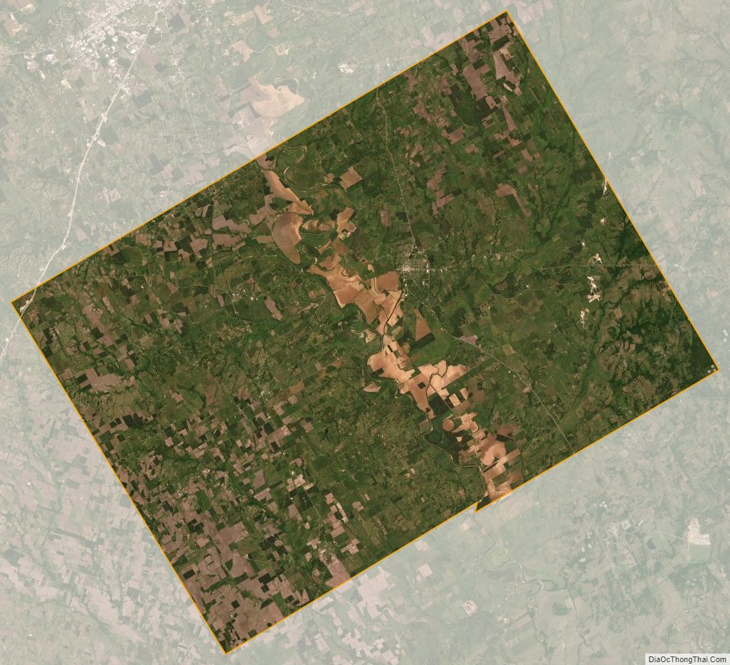
Falls County Satellite Map
Falls County Outline Map

See also
Map of Texas State and its subdivision:- Anderson
- Andrews
- Angelina
- Aransas
- Archer
- Armstrong
- Atascosa
- Austin
- Bailey
- Bandera
- Bastrop
- Baylor
- Bee
- Bell
- Bexar
- Blanco
- Borden
- Bosque
- Bowie
- Brazoria
- Brazos
- Brewster
- Briscoe
- Brooks
- Brown
- Burleson
- Burnet
- Caldwell
- Calhoun
- Callahan
- Cameron
- Camp
- Carson
- Cass
- Castro
- Chambers
- Cherokee
- Childress
- Clay
- Cochran
- Coke
- Coleman
- Collin
- Collingsworth
- Colorado
- Comal
- Comanche
- Concho
- Cooke
- Coryell
- Cottle
- Crane
- Crockett
- Crosby
- Culberson
- Dallam
- Dallas
- Dawson
- Deaf Smith
- Delta
- Denton
- Dewitt
- Dickens
- Dimmit
- Donley
- Duval
- Eastland
- Ector
- Edwards
- El Paso
- Ellis
- Erath
- Falls
- Fannin
- Fayette
- Fisher
- Floyd
- Foard
- Fort Bend
- Franklin
- Freestone
- Frio
- Gaines
- Galveston
- Garza
- Gillespie
- Glasscock
- Goliad
- Gonzales
- Gray
- Grayson
- Gregg
- Grimes
- Guadalupe
- Hale
- Hall
- Hamilton
- Hansford
- Hardeman
- Hardin
- Harris
- Harrison
- Hartley
- Haskell
- Hays
- Hemphill
- Henderson
- Hidalgo
- Hill
- Hockley
- Hood
- Hopkins
- Houston
- Howard
- Hudspeth
- Hunt
- Hutchinson
- Irion
- Jack
- Jackson
- Jasper
- Jeff Davis
- Jefferson
- Jim Hogg
- Jim Wells
- Johnson
- Jones
- Karnes
- Kaufman
- Kendall
- Kenedy
- Kent
- Kerr
- Kimble
- King
- Kinney
- Kleberg
- Knox
- La Salle
- Lamar
- Lamb
- Lampasas
- Lavaca
- Lee
- Leon
- Liberty
- Limestone
- Lipscomb
- Live Oak
- Llano
- Loving
- Lubbock
- Lynn
- Madison
- Marion
- Martin
- Mason
- Matagorda
- Maverick
- McCulloch
- McLennan
- McMullen
- Medina
- Menard
- Midland
- Milam
- Mills
- Mitchell
- Montague
- Montgomery
- Moore
- Morris
- Motley
- Nacogdoches
- Navarro
- Newton
- Nolan
- Nueces
- Ochiltree
- Oldham
- Orange
- Palo Pinto
- Panola
- Parker
- Parmer
- Pecos
- Polk
- Potter
- Presidio
- Rains
- Randall
- Reagan
- Real
- Red River
- Reeves
- Refugio
- Roberts
- Robertson
- Rockwall
- Runnels
- Rusk
- Sabine
- San Augustine
- San Jacinto
- San Patricio
- San Saba
- Schleicher
- Scurry
- Shackelford
- Shelby
- Sherman
- Smith
- Somervell
- Starr
- Stephens
- Sterling
- Stonewall
- Sutton
- Swisher
- Tarrant
- Taylor
- Terrell
- Terry
- Throckmorton
- Titus
- Tom Green
- Travis
- Trinity
- Tyler
- Upshur
- Upton
- Uvalde
- Val Verde
- Van Zandt
- Victoria
- Walker
- Waller
- Ward
- Washington
- Webb
- Wharton
- Wheeler
- Wichita
- Wilbarger
- Willacy
- Williamson
- Wilson
- Winkler
- Wise
- Wood
- Yoakum
- Young
- Zapata
- Zavala
- Alabama
- Alaska
- Arizona
- Arkansas
- California
- Colorado
- Connecticut
- Delaware
- District of Columbia
- Florida
- Georgia
- Hawaii
- Idaho
- Illinois
- Indiana
- Iowa
- Kansas
- Kentucky
- Louisiana
- Maine
- Maryland
- Massachusetts
- Michigan
- Minnesota
- Mississippi
- Missouri
- Montana
- Nebraska
- Nevada
- New Hampshire
- New Jersey
- New Mexico
- New York
- North Carolina
- North Dakota
- Ohio
- Oklahoma
- Oregon
- Pennsylvania
- Rhode Island
- South Carolina
- South Dakota
- Tennessee
- Texas
- Utah
- Vermont
- Virginia
- Washington
- West Virginia
- Wisconsin
- Wyoming