Fayette County is a county located in the north central portion of the U.S. state of Georgia. As of the 2020 census, the population was 119,194, an increase from 106,567 in 2010. Fayette County was established in 1821. The county seat, Fayetteville, was established in 1823. Much of Fayette County is bordered on the east side by the Flint River.
Fayette County was organized in 1821 after the United States signed a treaty at Indian Springs, Georgia with the Creek people for cession of a large portion of their land. The county and its seat, Fayetteville, were both named in honor of the French aristocrat the Marquis de Lafayette, who aided General George Washington in the American Revolutionary War.
Since the late 20th century, Fayette County has been part of the Greater Atlanta Metropolitan Area. It is located south of Atlanta, which is based in Fulton County. Fayette County is minutes from Hartsfield-Jackson International Airport. As a suburb of Atlanta, Fayette County has increased rapidly in population and development since the late 20th century, nearly doubling its population since 1990.
| Name: | Fayette County |
|---|---|
| FIPS code: | 13-113 |
| State: | Georgia |
| Founded: | 1821 |
| Named for: | Marquis de Lafayette |
| Seat: | Fayetteville |
| Largest city: | Peachtree City |
| Total Area: | 199 sq mi (520 km²) |
| Land Area: | 194 sq mi (500 km²) |
| Total Population: | 119,194 |
| Time zone: | UTC−5 (Eastern) |
| Summer Time Zone (DST): | UTC−4 (EDT) |
| Website: | www.fayettecountyga.gov |
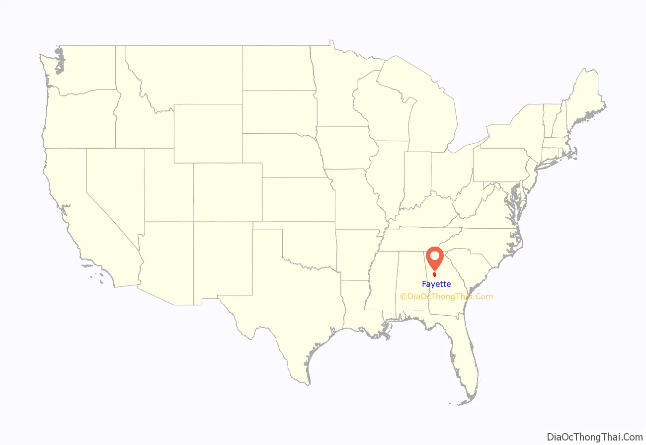
Fayette County location map. Where is Fayette County?
History
Fayette County was created on May 15, 1821, from territory ceded to the United States by the Creek people, who had historically inhabited the area. It was named for the Marquis de Lafayette, French hero of the American Revolutionary War.
In the years following World War II, the county developed suburban residential communities, with many workers commuting to Atlanta. Peachtree City was chartered in 1959. It was developed as the only planned community in the county and in the Southeast; it covers 16,000 acres.
The county population has increased rapidly during the late twentieth century with the growth of Atlanta. It has also benefited from a reverse migration of African Americans to the South, as new residents are attracted to jobs and opportunities. Significant growth and development continues.
In 2002 Charles “Chuck” Floyd was appointed to the position of Chief Magistrate Judge of the county. In 2004 and 2008, he was elected to the position in his own right, the first African American ever elected to any office in the county.
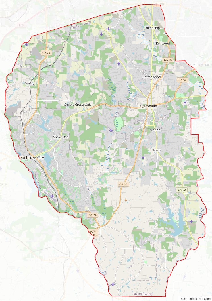
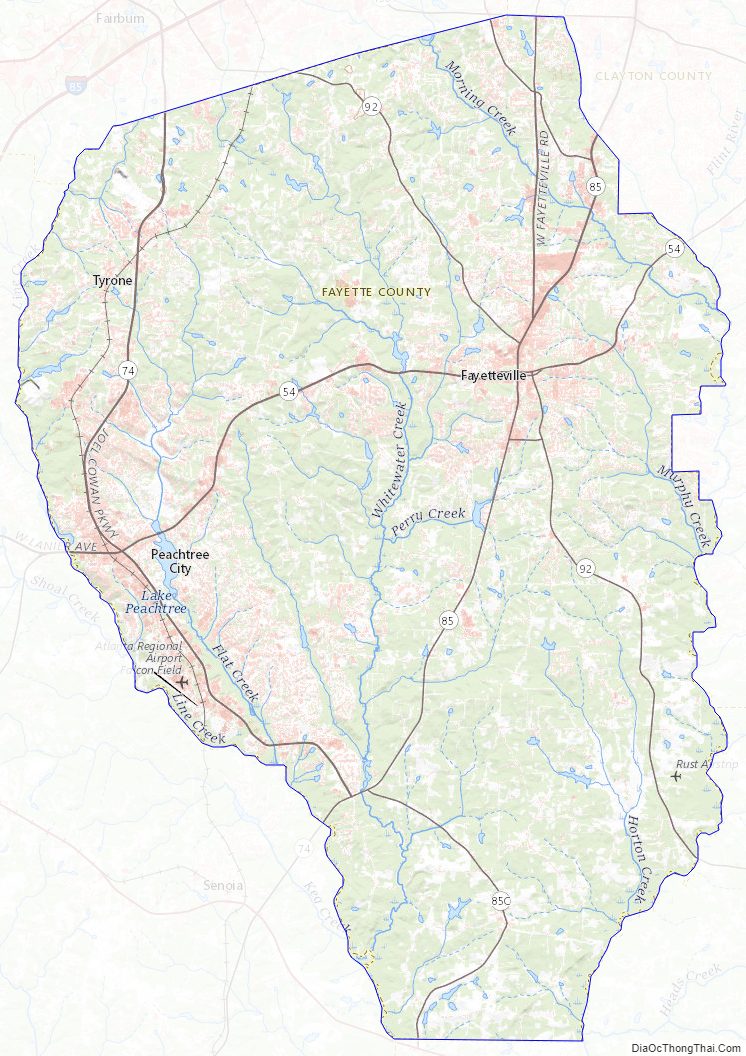
Fayette County Road Map
Geography
According to the U.S. Census Bureau, the county has a total area of 199 square miles (520 km), of which 194 square miles (500 km) is land and 5.0 square miles (13 km) (2.5%) is water.
The Flint River passes through the county and provided the earliest route for transportation and shipping of commodity crops. The entirety of Fayette County is located in the Upper Flint River sub-basin of the ACF River Basin (Apalachicola-Chattahoochee-Flint River Basin).
Major highways
- State Route 54
- State Route 74
- State Route 85
- State Route 92
- State Route 138
- State Route 279
- State Route 314
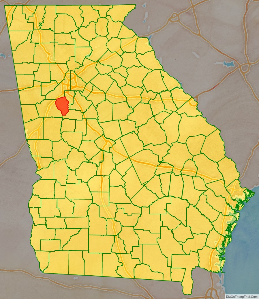
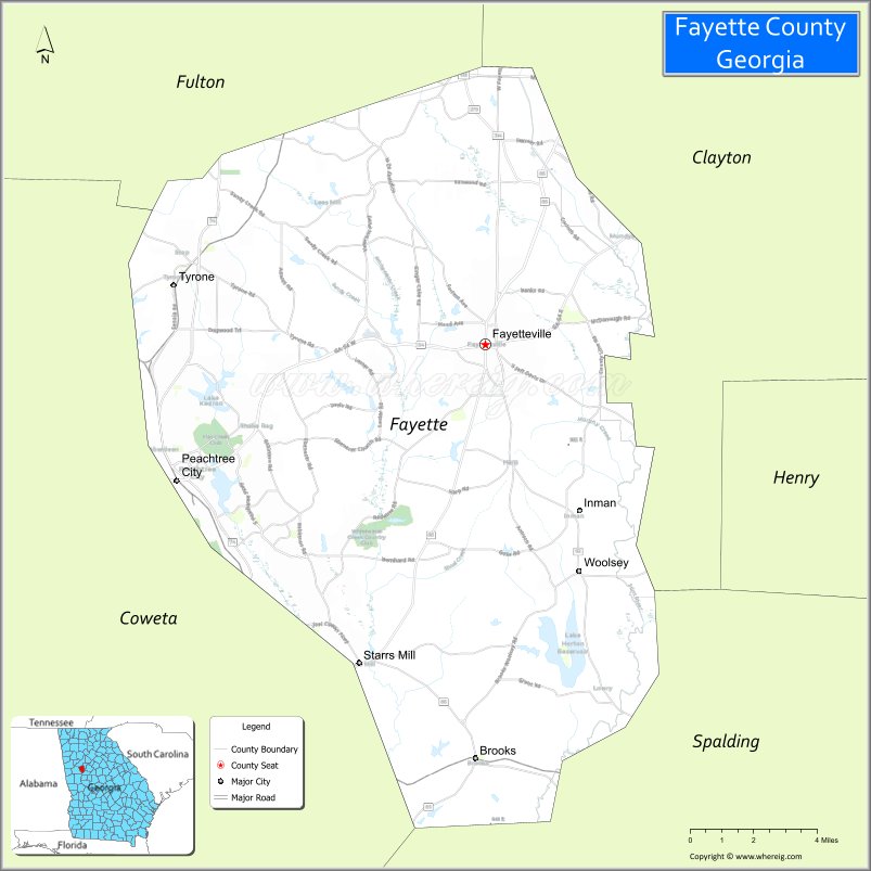
Adjacent counties
- Fulton County – north
- Clayton County – east
- Spalding County – south
- Coweta County – west
Fayette County Topographic Map
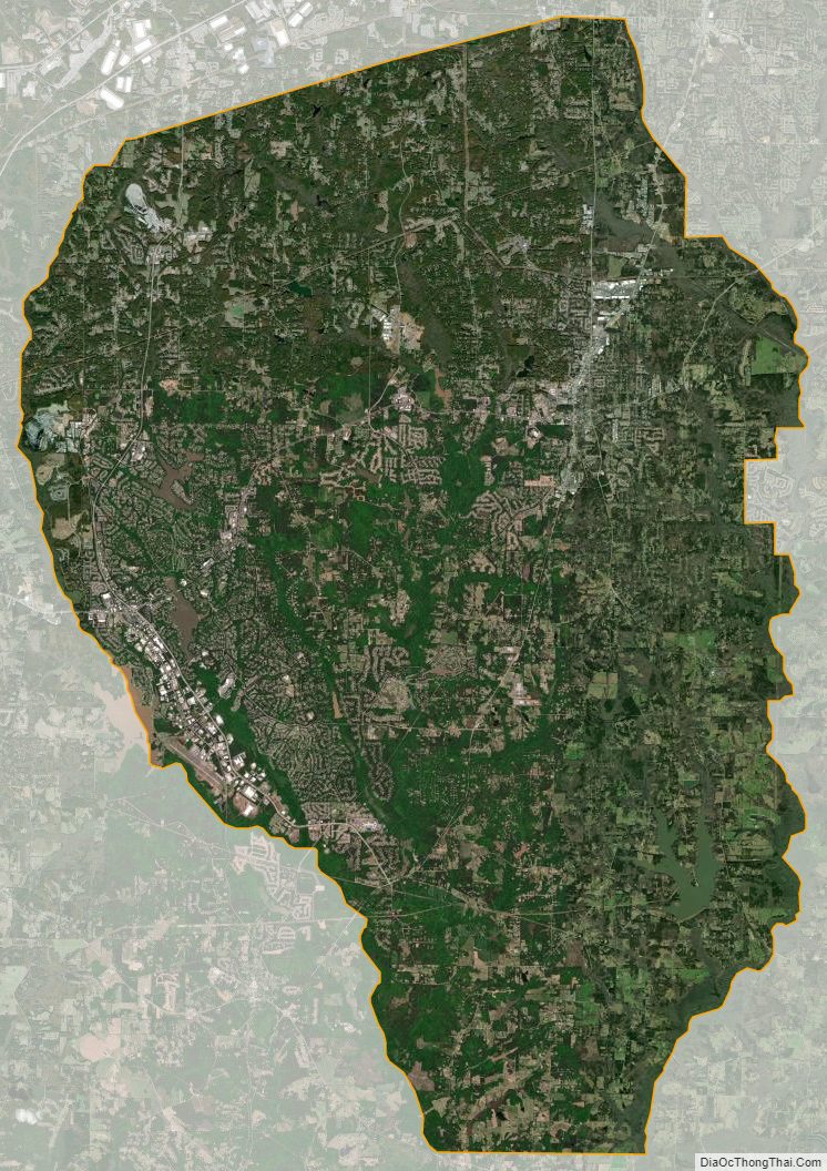
Fayette County Satellite Map
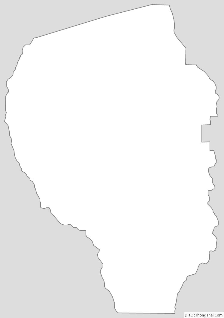
Fayette County Outline Map
See also
Map of Georgia State and its subdivision:- Appling
- Atkinson
- Bacon
- Baker
- Baldwin
- Banks
- Barrow
- Bartow
- Ben Hill
- Berrien
- Bibb
- Bleckley
- Brantley
- Brooks
- Bryan
- Bulloch
- Burke
- Butts
- Calhoun
- Camden
- Candler
- Carroll
- Catoosa
- Charlton
- Chatham
- Chattahoochee
- Chattooga
- Cherokee
- Clarke
- Clay
- Clayton
- Clinch
- Cobb
- Coffee
- Colquitt
- Columbia
- Cook
- Coweta
- Crawford
- Crisp
- Dade
- Dawson
- Decatur
- DeKalb
- Dodge
- Dooly
- Dougherty
- Douglas
- Early
- Echols
- Effingham
- Elbert
- Emanuel
- Evans
- Fannin
- Fayette
- Floyd
- Forsyth
- Franklin
- Fulton
- Gilmer
- Glascock
- Glynn
- Gordon
- Grady
- Greene
- Gwinnett
- Habersham
- Hall
- Hancock
- Haralson
- Harris
- Hart
- Heard
- Henry
- Houston
- Irwin
- Jackson
- Jasper
- Jeff Davis
- Jefferson
- Jenkins
- Johnson
- Jones
- Lamar
- Lanier
- Laurens
- Lee
- Liberty
- Lincoln
- Long
- Lowndes
- Lumpkin
- Macon
- Madison
- Marion
- McDuffie
- McIntosh
- Meriwether
- Miller
- Mitchell
- Monroe
- Montgomery
- Morgan
- Murray
- Muscogee
- Newton
- Oconee
- Oglethorpe
- Paulding
- Peach
- Pickens
- Pierce
- Pike
- Polk
- Pulaski
- Putnam
- Quitman
- Rabun
- Randolph
- Richmond
- Rockdale
- Schley
- Screven
- Seminole
- Spalding
- Stephens
- Stewart
- Sumter
- Talbot
- Taliaferro
- Tattnall
- Taylor
- Telfair
- Terrell
- Thomas
- Tift
- Toombs
- Towns
- Treutlen
- Troup
- Turner
- Twiggs
- Union
- Upson
- Walker
- Walton
- Ware
- Warren
- Washington
- Wayne
- Webster
- Wheeler
- White
- Whitfield
- Wilcox
- Wilkes
- Wilkinson
- Worth
- Alabama
- Alaska
- Arizona
- Arkansas
- California
- Colorado
- Connecticut
- Delaware
- District of Columbia
- Florida
- Georgia
- Hawaii
- Idaho
- Illinois
- Indiana
- Iowa
- Kansas
- Kentucky
- Louisiana
- Maine
- Maryland
- Massachusetts
- Michigan
- Minnesota
- Mississippi
- Missouri
- Montana
- Nebraska
- Nevada
- New Hampshire
- New Jersey
- New Mexico
- New York
- North Carolina
- North Dakota
- Ohio
- Oklahoma
- Oregon
- Pennsylvania
- Rhode Island
- South Carolina
- South Dakota
- Tennessee
- Texas
- Utah
- Vermont
- Virginia
- Washington
- West Virginia
- Wisconsin
- Wyoming