Fentress County is a county located in the U.S. state of Tennessee. As of the 2020 census, the population was 18,489. Its county seat is Jamestown.
| Name: | Fentress County |
|---|---|
| FIPS code: | 47-049 |
| State: | Tennessee |
| Founded: | November 28, 1823 |
| Named for: | James Fentress, state legislator |
| Seat: | Jamestown |
| Largest city: | Jamestown |
| Total Area: | 499 sq mi (1,290 km²) |
| Land Area: | 499 sq mi (1,290 km²) |
| Total Population: | 18,489 |
| Population Density: | 36/sq mi (14/km²) |
| Time zone: | UTC−6 (Central) |
| Summer Time Zone (DST): | UTC−5 (CDT) |
| Website: | www.fentresscountytn.gov |
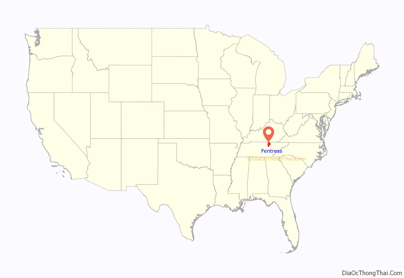
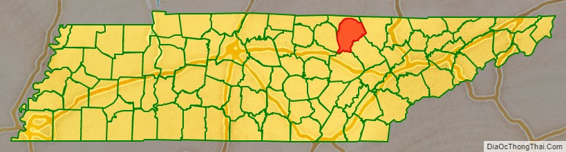
Fentress County location map. Where is Fentress County?
History
Fentress County was formed on November 28, 1823, from portions of Morgan, Overton and White counties. The resulting county was named for James Fentress (1763–1843), who served as speaker of the state house, chairman of Montgomery County Court, and commissioner to select seats for Haywood, Carroll, Gibson and Weakley counties in West Tennessee.
Fentress County was the site of several saltpeter mines. Saltpeter is the main ingredient of gunpowder and was obtained by leaching the earth from local caves. The largest mine was in York Cave, near the Wolf River Post Office. At one time, twenty-five large leaching vats were in operation in this cave. According to Barr (1961) this cave was mined during the Civil War. Buffalo Cave near Jamestown was also a major mine with twelve leaching vats. Manson Saltpeter Cave in Big Indian Creek Valley was a smaller operation with four leaching vats. These caves may also have been mined during the War of 1812, as saltpeter mining was widespread in Kentucky and Tennessee during that era.
In the runup to the American Civil War, when Tennessee Governor Harris asked the State Legislature for a vote of secession, the two representatives from Fentress County (Reese T. Hildreth and R. H. Bledsoe) voted for Secession.
Alvin York (1887–1964), a hero at the Meuse-Argonne Offensive during World War I, was born and lived in Fentress County. He established the Alvin C. York Agricultural Institute in Jamestown in 1924. York’s house and farm are part of Sgt. Alvin C. York State Historic Park in Pall Mall.
County Officials
County Executive: Jimmy Johnson
County Sheriff: Michael Reagon
County Register of Deeds: Trish Slaven
County Road Supervisor: Joey Reagan
County Property Assessor: Melynda Sullivan
County Trustee: Angie Sweet
Circuit Court Clerk: Gina Miller
County Clerk: Marylin Stephens
County Emergency Management Director: James Bilbrey
County 911 Director: Richard Cross
County Fire Chief: Scott King
County Emergency Services Director: Micah Dunford
County Finance Director: Tyler Arms
Clerk and Master: Linda Smith
Election Commission Director: Joey Williams
General Sessions Judge: Todd Burnett
Solid Waste Director: Michael Rick
Library Director: Donna Conatser
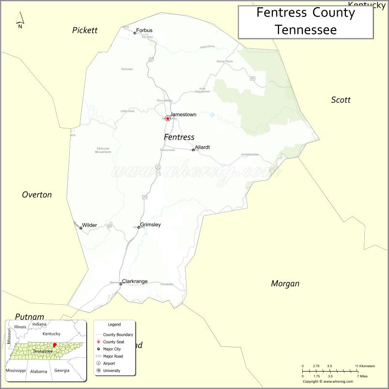
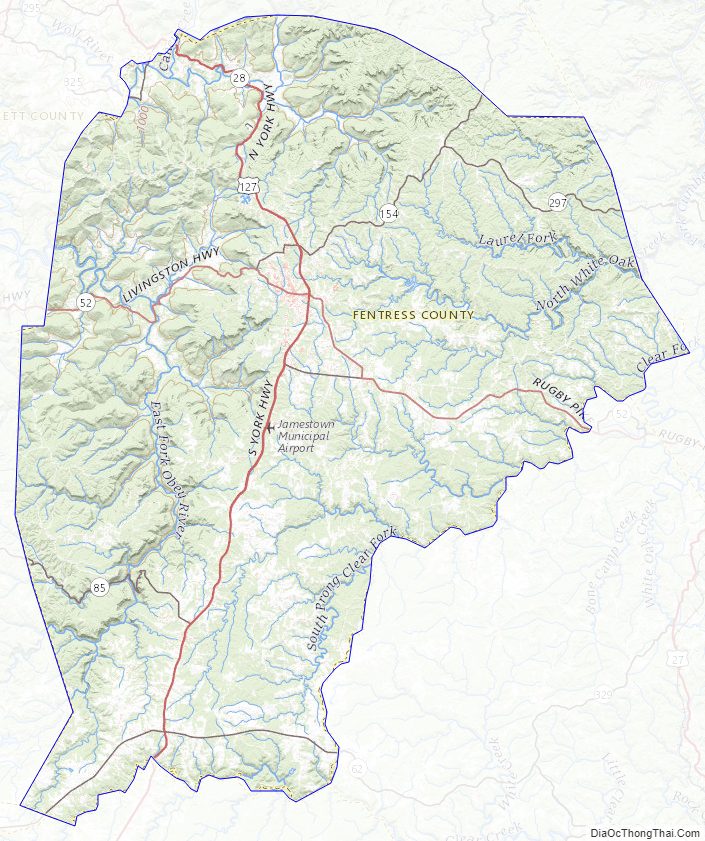
Fentress County Road Map
Geography
According to the U.S. Census Bureau, the county has a total area of 499 square miles (1,290 km), of which 499 square miles (1,290 km) is land and 0.3 square miles (0.78 km) (0.06%) is water.
Fentress County includes part of Dale Hollow Reservoir and is drained by forks of the Obey and Cumberland Rivers.
The county is the easternmost county in the United States to observe Central Time.
Adjacent counties
- Pickett County (north)
- Scott County (east/EST Border)
- Morgan County (southeast/EST Border)
- Cumberland County (south)
- Overton County (west)
- Putnam County (southwest)
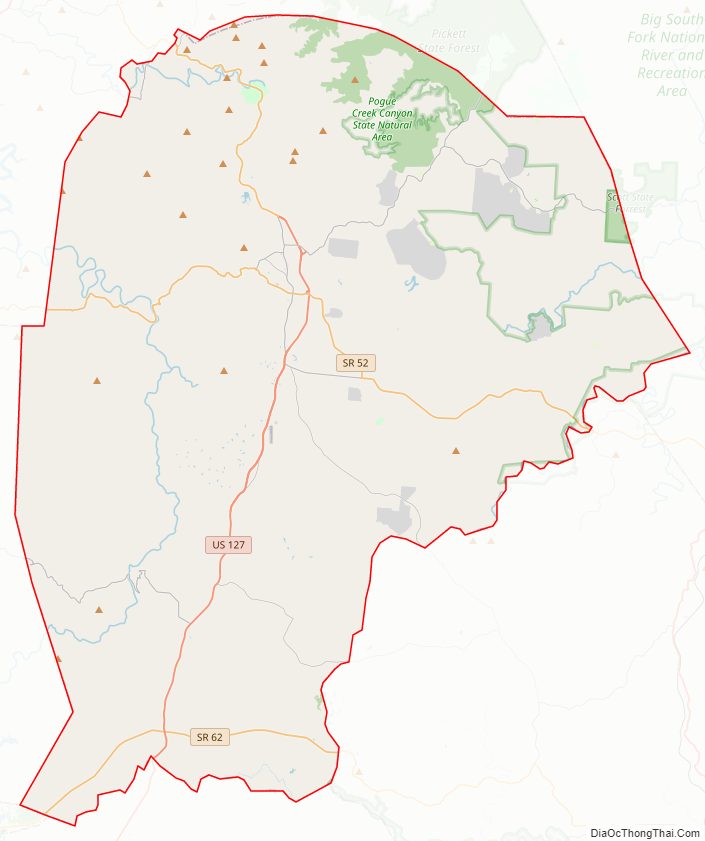
National protected area
- Big South Fork National River and Recreation Area (part)
State protected areas
- Catoosa Wildlife Management Area (part)
- Colditz Cove State Natural Area
- Pickett State Forest (part)
- Pogue Creek Canyon State Natural Area
- Scott State Forest (part)
- Sgt. Alvin C. York State Historic Park
- Skinner Mountain Wildlife Management Area
- Twin Arches State Natural Area (part)
Fentress County Topographic Map
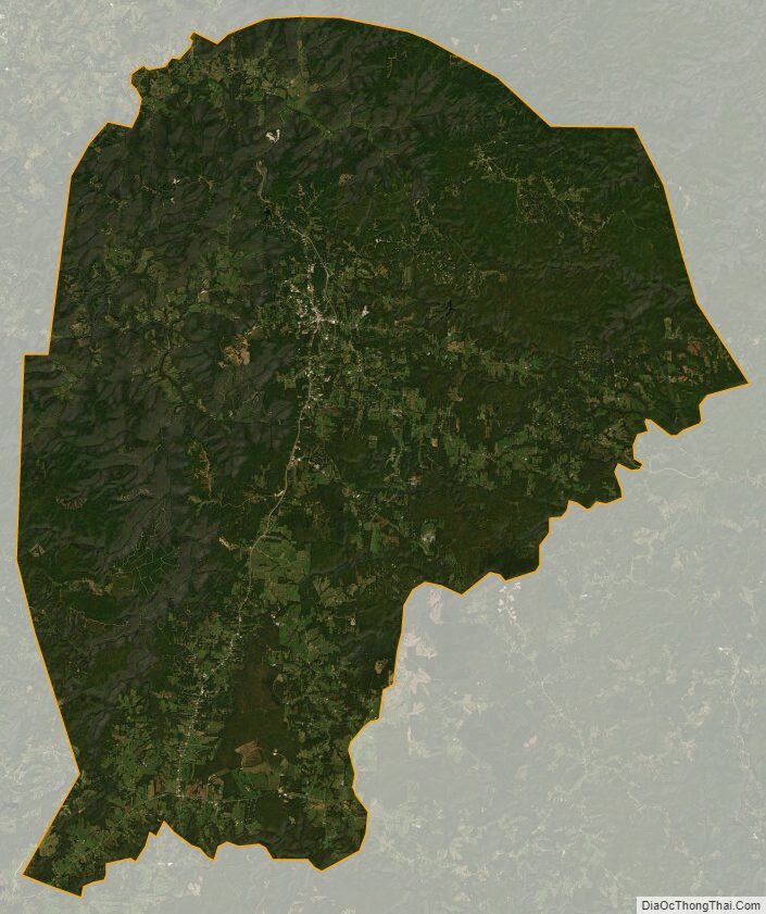
Fentress County Satellite Map
Fentress County Outline Map

See also
Map of Tennessee State and its subdivision:- Anderson
- Bedford
- Benton
- Bledsoe
- Blount
- Bradley
- Campbell
- Cannon
- Carroll
- Carter
- Cheatham
- Chester
- Claiborne
- Clay
- Cocke
- Coffee
- Crockett
- Cumberland
- Davidson
- Decatur
- DeKalb
- Dickson
- Dyer
- Fayette
- Fentress
- Franklin
- Gibson
- Giles
- Grainger
- Greene
- Grundy
- Hamblen
- Hamilton
- Hancock
- Hardeman
- Hardin
- Hawkins
- Haywood
- Henderson
- Henry
- Hickman
- Houston
- Humphreys
- Jackson
- Jefferson
- Johnson
- Knox
- Lake
- Lauderdale
- Lawrence
- Lewis
- Lincoln
- Loudon
- Macon
- Madison
- Marion
- Marshall
- Maury
- McMinn
- McNairy
- Meigs
- Monroe
- Montgomery
- Moore
- Morgan
- Obion
- Overton
- Perry
- Pickett
- Polk
- Putnam
- Rhea
- Roane
- Robertson
- Rutherford
- Scott
- Sequatchie
- Sevier
- Shelby
- Smith
- Stewart
- Sullivan
- Sumner
- Tipton
- Trousdale
- Unicoi
- Union
- Van Buren
- Warren
- Washington
- Wayne
- Weakley
- White
- Williamson
- Wilson
- Alabama
- Alaska
- Arizona
- Arkansas
- California
- Colorado
- Connecticut
- Delaware
- District of Columbia
- Florida
- Georgia
- Hawaii
- Idaho
- Illinois
- Indiana
- Iowa
- Kansas
- Kentucky
- Louisiana
- Maine
- Maryland
- Massachusetts
- Michigan
- Minnesota
- Mississippi
- Missouri
- Montana
- Nebraska
- Nevada
- New Hampshire
- New Jersey
- New Mexico
- New York
- North Carolina
- North Dakota
- Ohio
- Oklahoma
- Oregon
- Pennsylvania
- Rhode Island
- South Carolina
- South Dakota
- Tennessee
- Texas
- Utah
- Vermont
- Virginia
- Washington
- West Virginia
- Wisconsin
- Wyoming