Franklin County is a county located in the U.S. state of Alabama. As of the 2020 census, the population was 32,113. Its county seat is Russellville. Its name is in honor of Benjamin Franklin, famous statesman, scientist, and printer. It is a dry county, although the city of Russellville is wet.
| Name: | Franklin County |
|---|---|
| FIPS code: | 01-059 |
| State: | Alabama |
| Founded: | February 6, 1818 |
| Named for: | Benjamin Franklin |
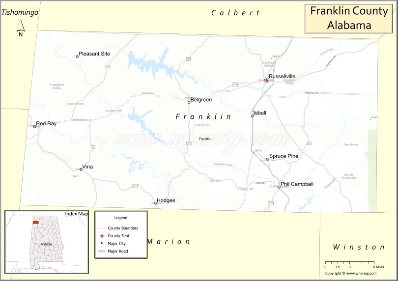
| Seat: | Russellville |
| Largest city: | Russellville |
| Total Area: | 647 sq mi (1,680 km²) |
| Land Area: | 634 sq mi (1,640 km²) |
| Total Population: | 32,113 |
| Population Density: | 50/sq mi (19/km²) |
| Time zone: | UTC−6 (Central) |
| Summer Time Zone (DST): | UTC−5 (CDT) |
| Website: | www.franklincountyal.org |
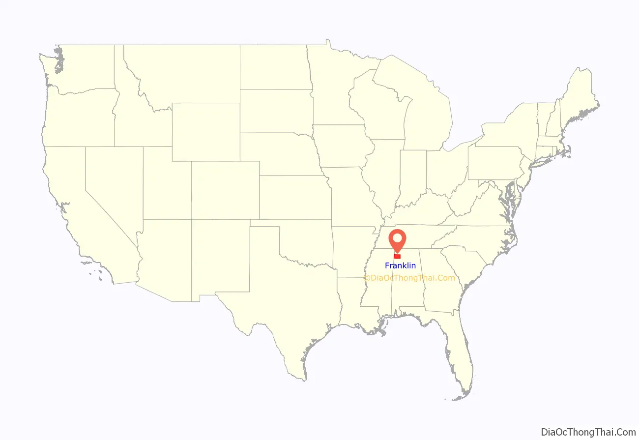
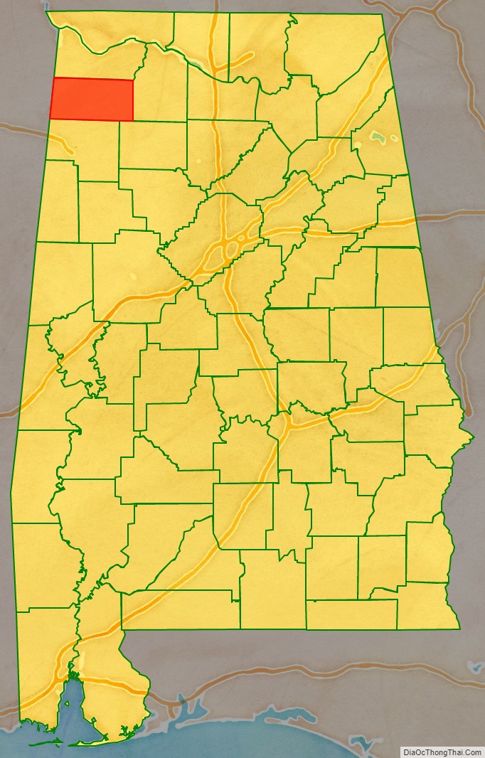
Franklin County location map. Where is Franklin County?
History
Franklin County was established on February 6, 1818.
Colbert County
Colbert County was originally established on February 6, 1867, after it split from Franklin County over political issues after the American Civil War. It was abolished eight months later by an Alabama constitutional convention and then reestablished on February 24, 1870.
Musical history
Many musicians and songwriters are from Franklin County including Billy Sherrill, Ricky Pierce, Eddie Martin and many others.
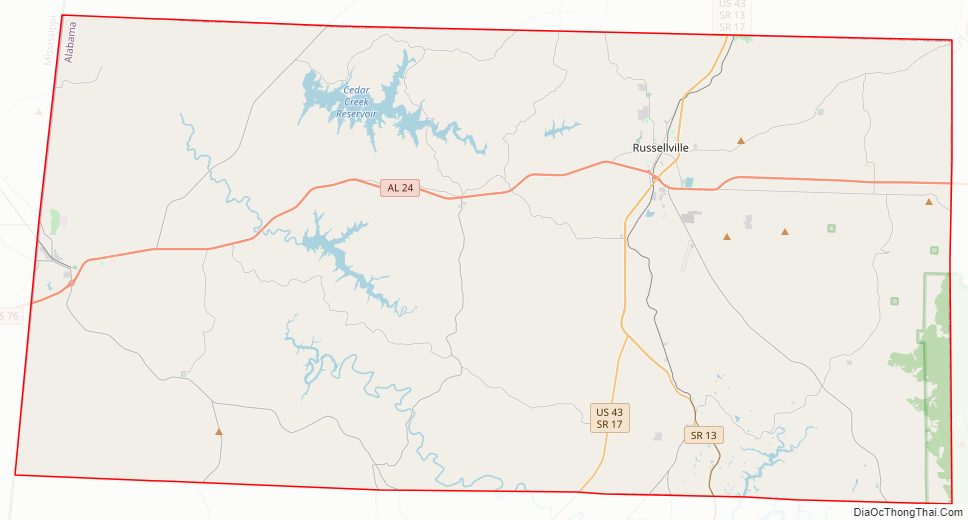
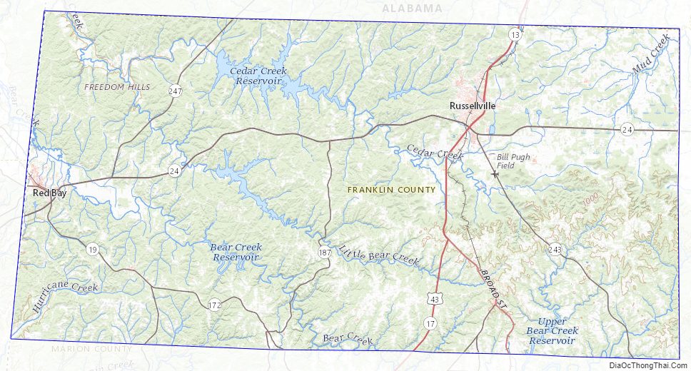
Franklin County Road Map
Geography
According to the United States Census Bureau, the county has a total area of 647 square miles (1,680 km), of which 634 square miles (1,640 km) is land and 13 square miles (34 km) (2.0%) is water.
Adjacent Counties
- Colbert County (north)
- Lawrence County (east)
- Winston County (southeast)
- Marion County (south)
- Itawamba County, Mississippi (southwest)
- Tishomingo County, Mississippi (northwest)
National protected area
- William B. Bankhead National Forest (part)
Franklin County Topographic Map
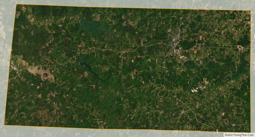
Franklin County Satellite Map
Franklin County Outline Map

See also
Map of Alabama State and its subdivision:- Autauga
- Baldwin
- Barbour
- Bibb
- Blount
- Bullock
- Butler
- Calhoun
- Chambers
- Cherokee
- Chilton
- Choctaw
- Clarke
- Clay
- Cleburne
- Coffee
- Colbert
- Conecuh
- Coosa
- Covington
- Crenshaw
- Cullman
- Dale
- Dallas
- De Kalb
- Elmore
- Escambia
- Etowah
- Fayette
- Franklin
- Geneva
- Greene
- Hale
- Henry
- Houston
- Jackson
- Jefferson
- Lamar
- Lauderdale
- Lawrence
- Lee
- Limestone
- Lowndes
- Macon
- Madison
- Marengo
- Marion
- Marshall
- Mobile
- Monroe
- Montgomery
- Morgan
- Perry
- Pickens
- Pike
- Randolph
- Russell
- Saint Clair
- Shelby
- Sumter
- Talladega
- Tallapoosa
- Tuscaloosa
- Walker
- Washington
- Wilcox
- Winston
- Alabama
- Alaska
- Arizona
- Arkansas
- California
- Colorado
- Connecticut
- Delaware
- District of Columbia
- Florida
- Georgia
- Hawaii
- Idaho
- Illinois
- Indiana
- Iowa
- Kansas
- Kentucky
- Louisiana
- Maine
- Maryland
- Massachusetts
- Michigan
- Minnesota
- Mississippi
- Missouri
- Montana
- Nebraska
- Nevada
- New Hampshire
- New Jersey
- New Mexico
- New York
- North Carolina
- North Dakota
- Ohio
- Oklahoma
- Oregon
- Pennsylvania
- Rhode Island
- South Carolina
- South Dakota
- Tennessee
- Texas
- Utah
- Vermont
- Virginia
- Washington
- West Virginia
- Wisconsin
- Wyoming