Franklin County is a county in Southern Illinois. At the 2020 census, it had a population of 37,804. The largest city is West Frankfort and the county seat is Benton. This area of Southern Illinois is known locally as “Little Egypt”.
| Name: | Franklin County |
|---|---|
| FIPS code: | 17-055 |
| State: | Illinois |
| Founded: | January 2, 1818 |
| Named for: | Benjamin Franklin |
| Seat: | Benton |
| Largest city: | West Frankfort |
| Total Area: | 431 sq mi (1,120 km²) |
| Land Area: | 409 sq mi (1,060 km²) |
| Total Population: | 37,804 |
| Population Density: | 88/sq mi (34/km²) |
| Time zone: | UTC−6 (Central) |
| Summer Time Zone (DST): | UTC−5 (CDT) |
| Website: | www.franklincountyil.gov |
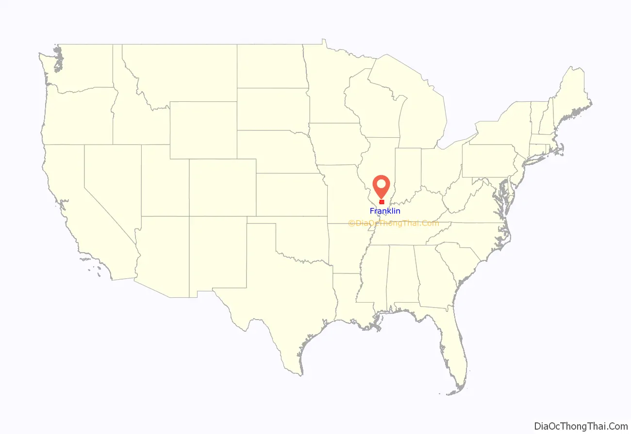
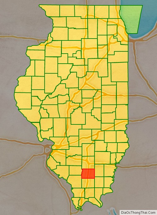
Franklin County location map. Where is Franklin County?
History
Franklin County was established on January 2, 1818, and formed from parts of Gallatin and White counties. It was named for Benjamin Franklin.
Franklin County at the time of its formation in 1818
The creation of Williamson County in 1839 reduced Franklin to its current borders.
Coal mining
Coal was mined in Franklin County as early as 1889, at the King Coal Mine, located at Township 5 South, Range 3 East.
The high levels of gas found in Franklin County’s coal deposits have resulted in mining disasters and explosions over the years. Between 1905 and 1968, there were eleven mine disasters. In 1905, the Zeigler No. 1 mine, located in Zeigler, had an explosion that killed about fifty people. In 1917, an explosion in Old Ben Mine No. 11, located in Christopher, killed 17. The worst explosion occurred in 1951, in the Orient No. 2 Mine in West Frankfort, in which 119 people died.
The West Frankfort quadrangle of Franklin County is home to 17 coal mines, according to a 2004 report.
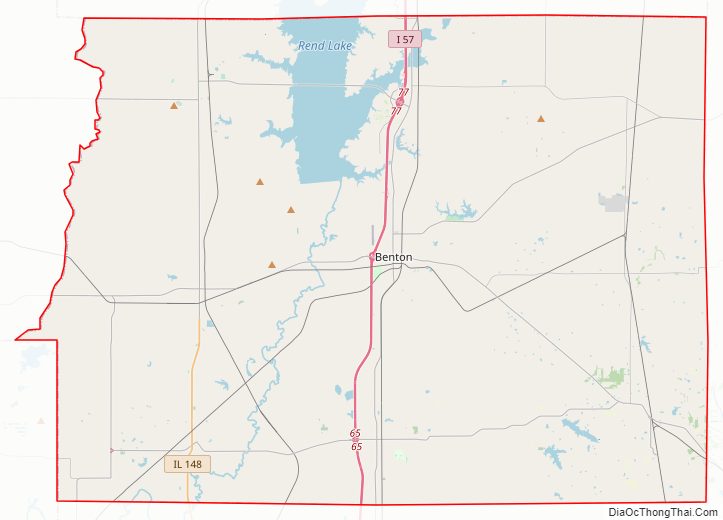
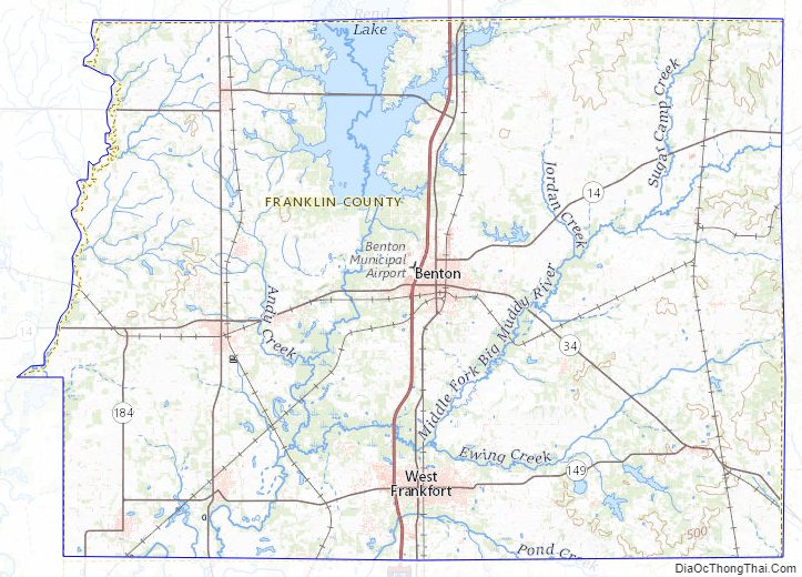
Franklin County Road Map
Geography
According to the U.S. Census Bureau, the county has a total area of 431 square miles (1,120 km), of which 409 square miles (1,060 km) is land and 23 square miles (60 km) (5.2%) is water. Wayne Fitzgerrell State Recreation Area is located in this county.
Climate and weather
In recent years, average temperatures in the county seat of Benton have ranged from a low of 21 °F (−6 °C) in January to a high of 90 °F (32 °C) in July, although a record low of −22 °F (−30 °C) was recorded in January 1977 and a record high of 104 °F (40 °C) was recorded in August 2007. Average monthly precipitation ranged from 2.87 inches (73 mm) in February to 4.59 inches (117 mm) in May.
In 1912, a tornado destroyed facilities at the Possum Ridge Mine.
On March 18, 1925, Franklin County was among five southern Illinois counties effected by the infamous Tri State Tornado. The storm cut across the southern edge of the county, hitting West Frankfort and destroying most of the northern side of town, causing significant damage to the town’s mining facilities. Farther to the east, the village of Parrish was also struck, and was never rebuilt. The storm killed 192 people in Franklin County, injuring hundreds more and leaving scores of people homeless.
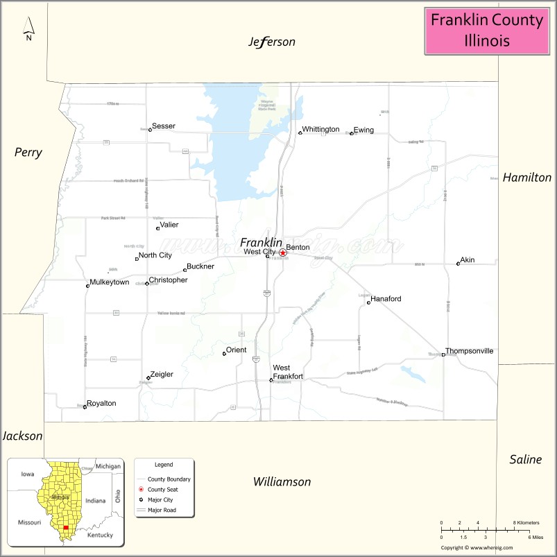
Adjacent counties
- Jefferson County (north)
- Hamilton County (east)
- Saline County (southeast)
- Williamson County (south)
- Jackson County (southwest)
- Perry County (west)
Major highways
- Interstate 57
- Illinois Route 14
- Illinois Route 34
- Illinois Route 37
- Illinois Route 148
- Illinois Route 149
- Illinois Route 154
- Illinois Route 184
Franklin County Topographic Map
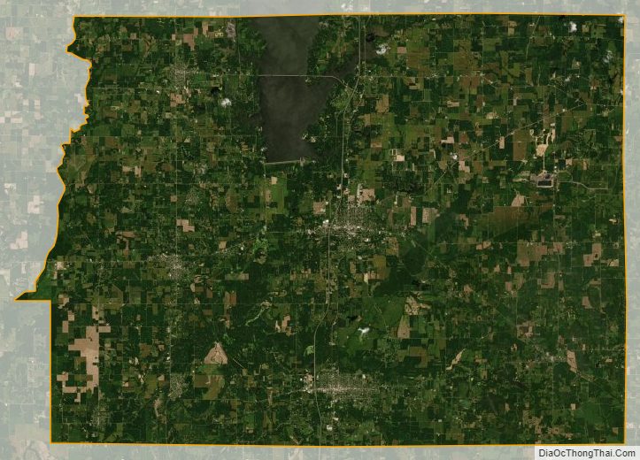
Franklin County Satellite Map
Franklin County Outline Map

See also
Map of Illinois State and its subdivision:- Adams
- Alexander
- Bond
- Boone
- Brown
- Bureau
- Calhoun
- Carroll
- Cass
- Champaign
- Christian
- Clark
- Clay
- Clinton
- Coles
- Cook
- Crawford
- Cumberland
- De Kalb
- De Witt
- Douglas
- Dupage
- Edgar
- Edwards
- Effingham
- Fayette
- Ford
- Franklin
- Fulton
- Gallatin
- Greene
- Grundy
- Hamilton
- Hancock
- Hardin
- Henderson
- Henry
- Iroquois
- Jackson
- Jasper
- Jefferson
- Jersey
- Jo Daviess
- Johnson
- Kane
- Kankakee
- Kendall
- Knox
- La Salle
- Lake
- Lake Michigan
- Lawrence
- Lee
- Livingston
- Logan
- Macon
- Macoupin
- Madison
- Marion
- Marshall
- Mason
- Massac
- McDonough
- McHenry
- McLean
- Menard
- Mercer
- Monroe
- Montgomery
- Morgan
- Moultrie
- Ogle
- Peoria
- Perry
- Piatt
- Pike
- Pope
- Pulaski
- Putnam
- Randolph
- Richland
- Rock Island
- Saint Clair
- Saline
- Sangamon
- Schuyler
- Scott
- Shelby
- Stark
- Stephenson
- Tazewell
- Union
- Vermilion
- Wabash
- Warren
- Washington
- Wayne
- White
- Whiteside
- Will
- Williamson
- Winnebago
- Woodford
- Alabama
- Alaska
- Arizona
- Arkansas
- California
- Colorado
- Connecticut
- Delaware
- District of Columbia
- Florida
- Georgia
- Hawaii
- Idaho
- Illinois
- Indiana
- Iowa
- Kansas
- Kentucky
- Louisiana
- Maine
- Maryland
- Massachusetts
- Michigan
- Minnesota
- Mississippi
- Missouri
- Montana
- Nebraska
- Nevada
- New Hampshire
- New Jersey
- New Mexico
- New York
- North Carolina
- North Dakota
- Ohio
- Oklahoma
- Oregon
- Pennsylvania
- Rhode Island
- South Carolina
- South Dakota
- Tennessee
- Texas
- Utah
- Vermont
- Virginia
- Washington
- West Virginia
- Wisconsin
- Wyoming