Franklin County is a county located in the U.S. state of Mississippi. As of the 2020 census, the population was 7,675. Its county seat is Meadville. The county was formed on December 21, 1809, from portions of Adams County and named for Founding Father Benjamin Franklin. It is bisected by the Homochitto River, which runs diagonally through the county from northeast to southwest.
| Name: | Franklin County |
|---|---|
| FIPS code: | 28-037 |
| State: | Mississippi |
| Founded: | 1809 |
| Named for: | Benjamin Franklin |
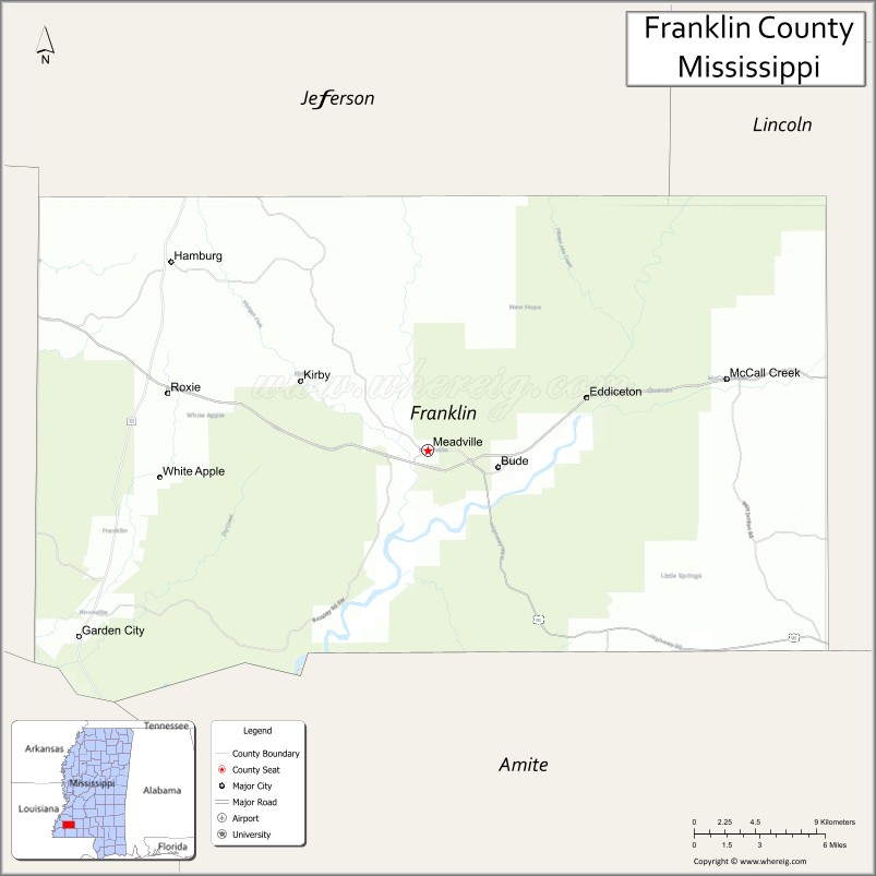
| Seat: | Meadville |
| Largest town: | Bude |
| Total Area: | 567 sq mi (1,470 km²) |
| Land Area: | 564 sq mi (1,460 km²) |
| Total Population: | 7,675 |
| Population Density: | 14/sq mi (5.2/km²) |
| Time zone: | UTC−6 (Central) |
| Summer Time Zone (DST): | UTC−5 (CDT) |
| Website: | www.franklincountyms.com |
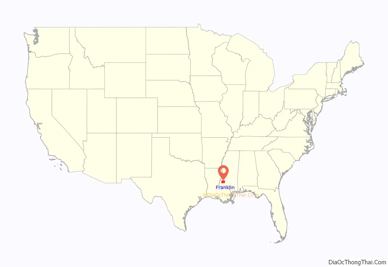
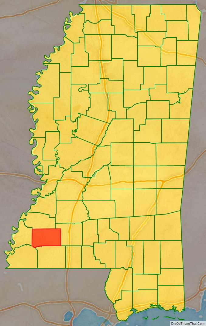
Franklin County location map. Where is Franklin County?
History
This was the fourth county organized in Mississippi. It was initially developed for agriculture, specifically cotton plantations based on enslaved labor of African Americans. Cotton continued to be important to the economy through the 19th century and into the early 20th century.
This still rural county has had a decline in population by about half since 1910. It is the fourth least populous county in the state. Mechanization of agriculture and the blight of the boll weevil both reduced the need for farm workers; they left the area and often the state. Many African Americans went north or west in the Great Migration before and after World War II. The county in the 21st century is majority white in population; in the 2000 census, African Americans composed more than 36% of the population. (See Demographics section below.)
As in the rest of the state, the county had racially segregated facilities under Jim Crow from the late 19th century. Many white residents opposed the civil rights movement of the mid-20th century. In May 1964, Ku Klux Klan members abducted and killed two young black men, Henry Hezekiah Dee and Charles Eddie Moore of Meadville, before Freedom Summer started. Their bodies were not discovered in the Mississippi River until July 1964, during the hunt for three disappeared civil rights workers.
No one was prosecuted at the time, but the case was reopened in 2007, after a documentary had been released on it by Canadian Broadcasting Company. Local man James Ford Seale was convicted of the kidnappings and deaths by an all-white jury in federal court. In 2008 the families of Dee and Moore filed a civil suit against the Franklin County government, charging complicity by its law enforcement in the deaths. On June 21, 2010, Franklin County agreed to an undisclosed settlement in the civil suit with the families of Charles Moore and Henry Dee.
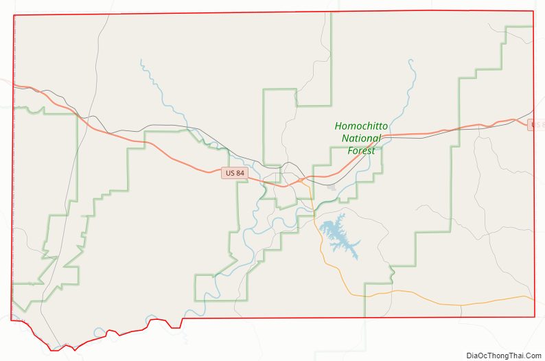
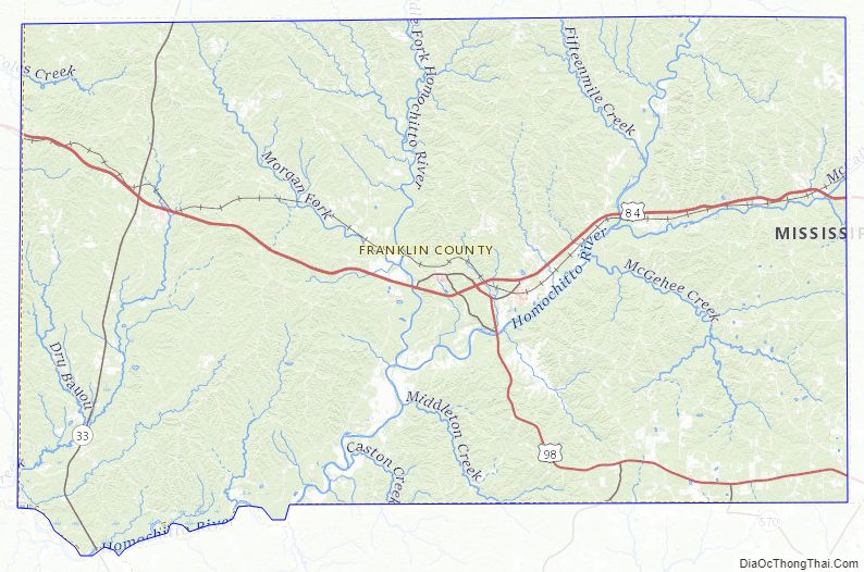
Franklin County Road Map
Geography
According to the U.S. Census Bureau, the county has a total area of 567 square miles (1,470 km), of which 564 square miles (1,460 km) is land and 3.0 square miles (7.8 km) (0.5%) is water.
Major highways
- U.S. Highway 84
- U.S. Highway 98
- Mississippi Highway 33
Adjacent counties
- Jefferson County (north)
- Lincoln County (east)
- Amite County (south)
- Wilkinson County (southwest)
- Adams County (west)
National protected area
- Homochitto National Forest (part)
Franklin County Topographic Map
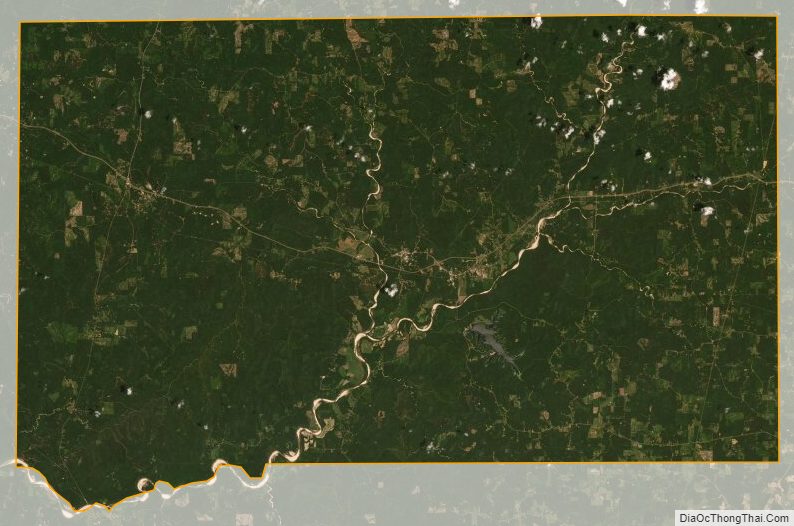
Franklin County Satellite Map
Franklin County Outline Map

See also
Map of Mississippi State and its subdivision:- Adams
- Alcorn
- Amite
- Attala
- Benton
- Bolivar
- Calhoun
- Carroll
- Chickasaw
- Choctaw
- Claiborne
- Clarke
- Clay
- Coahoma
- Copiah
- Covington
- Desoto
- Forrest
- Franklin
- George
- Greene
- Grenada
- Hancock
- Harrison
- Hinds
- Holmes
- Humphreys
- Issaquena
- Itawamba
- Jackson
- Jasper
- Jefferson
- Jefferson Davis
- Jones
- Kemper
- Lafayette
- Lamar
- Lauderdale
- Lawrence
- Leake
- Lee
- Leflore
- Lincoln
- Lowndes
- Madison
- Marion
- Marshall
- Monroe
- Montgomery
- Neshoba
- Newton
- Noxubee
- Oktibbeha
- Panola
- Pearl River
- Perry
- Pike
- Pontotoc
- Prentiss
- Quitman
- Rankin
- Scott
- Sharkey
- Simpson
- Smith
- Stone
- Sunflower
- Tallahatchie
- Tate
- Tippah
- Tishomingo
- Tunica
- Union
- Walthall
- Warren
- Washington
- Wayne
- Webster
- Wilkinson
- Winston
- Yalobusha
- Yazoo
- Alabama
- Alaska
- Arizona
- Arkansas
- California
- Colorado
- Connecticut
- Delaware
- District of Columbia
- Florida
- Georgia
- Hawaii
- Idaho
- Illinois
- Indiana
- Iowa
- Kansas
- Kentucky
- Louisiana
- Maine
- Maryland
- Massachusetts
- Michigan
- Minnesota
- Mississippi
- Missouri
- Montana
- Nebraska
- Nevada
- New Hampshire
- New Jersey
- New Mexico
- New York
- North Carolina
- North Dakota
- Ohio
- Oklahoma
- Oregon
- Pennsylvania
- Rhode Island
- South Carolina
- South Dakota
- Tennessee
- Texas
- Utah
- Vermont
- Virginia
- Washington
- West Virginia
- Wisconsin
- Wyoming