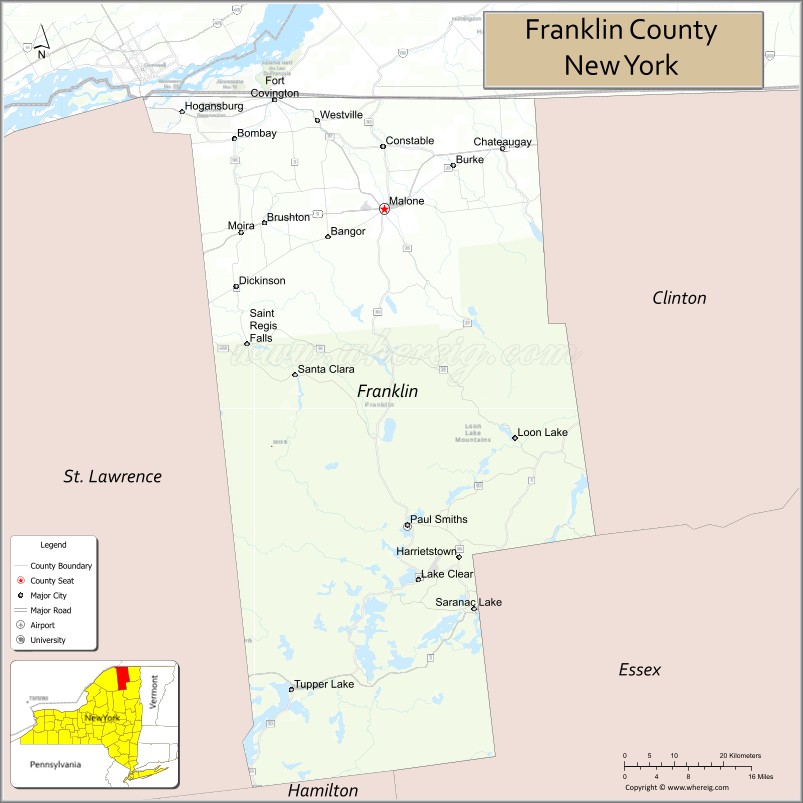
Franklin County is a county on the northern border of the U.S. state of New York. To the north across the Canada–United States border are the Canadian provinces of Quebec and Ontario, from east to west. As of the 2020 census, the county population was 47,555. Its county seat is Malone. The county is named in honor of United States Founding Father Benjamin Franklin.
Franklin County comprises the Malone, NY Micropolitan Statistical Area. Much of Franklin County is within Adirondack Park. Within the border of the county is the St. Regis Mohawk Reservation, or Akwesasne in the Mohawk language. Its population was nearly 3,300 in the 2010 census. The people are linked by community and history with the Mohawk of the Akwesasne reserve across the river, spanning the border of Quebec and Ontario. The Mohawk have had authority under the Jay Treaty to freely cross this international border.
| Name: | Franklin County |
|---|---|
| FIPS code: | 36-033 |
| State: | New York |
| Founded: | 1808 |
| Named for: | Benjamin Franklin |
| Seat: | Malone |
| Total Area: | 1,697 sq mi (4,400 km²) |
| Land Area: | 1,629 sq mi (4,220 km²) |
| Total Population: | 47,555 |
| Population Density: | 29.2/sq mi (11.3/km²) |
| Time zone: | UTC−5 (Eastern) |
| Summer Time Zone (DST): | UTC−4 (EDT) |
| Website: | www.franklincony.org |
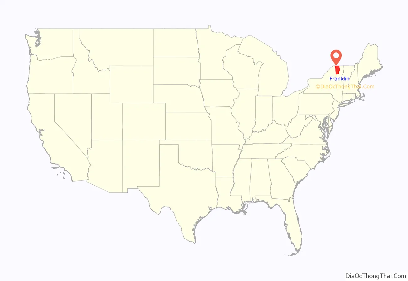
Franklin County location map. Where is Franklin County?

History
This area was long occupied by Iroquoian-speaking peoples. In historic times, a group of primarily Mohawks established a village south of colonial Montreal across the St. Lawrence River; they had been trading with French colonists and many had converted to Catholicism. They were the easternmost nation of the Iroquois League of Five Nations, known in their language as the Haudenosaunee.
After the English conquered the Dutch in the New York area, they established counties in 1683, in the eastern part of New York province and what is now Vermont. Both groups had settled primarily in Albany and along the Hudson River, a major waterway linking the upriver fur trade with the market of Manhattan. The first counties were very large in geographic area, taking in low-density populations. Gradually new counties were formed as colonial settlement increased, but most settlers stayed east of the middle of the Mohawk Valley, as the Iroquois nations controlled the lands beyond that. Historically the French, Dutch and English all traded with the Mohawk, the easternmost of these nations.
The area of the present Franklin County was part of Albany County when it was established in 1683. This was an enormous county, including the northern part of what became New York State as well as all of the present state of Vermont and, in theory, extending westward to the Pacific Ocean. This county was reduced in size on July 3, 1766, by the creation of Cumberland County, and further on March 16, 1770, by the creation of Gloucester County, both containing territory now in Vermont. On March 12, 1772, what was left of Albany County was split into three parts, one remaining under the name Albany County. Charlotte County contained the eastern portion.
In 1784, the name “Charlotte County” was changed to Washington County to honor George Washington, the American Revolutionary War general and later President of the United States of America.
In 1788, Clinton County was split off from Washington County. It comprised a much larger area than the present Clinton County, including several other counties or county parts of the present New York State.
Following the American Revolutionary War, the United States forced the Six Nations of the Haudenosaunee, or Iroquois Confederacy, to cede most of their lands in New York and Pennsylvania, as most had been allies of Great Britain, which had lost to the new United States. After the war, New York State sold off 5 million acres of former Iroquois territory at very low prices, seeking to attract settlers to develop farms and businesses. Land speculators quickly took advantage of the sales. Franklin County was part of the huge speculative Macomb’s Purchase of 1791.
In 1799, Clinton County was reduced in size by the splitting off of Essex County. In 1802, Clinton County was reduced in size by a part of Clinton and two other counties being taken to form the new St. Lawrence County.
Franklin County organized
In 1808, Franklin County was split off from Clinton County and organized. It was named after United States Founding Father Benjamin Franklin. In the early decades many landowners basically were subsistence farmers.
In the late 1880s and 1890s, both the Delaware and Hudson and New York Central railroads were constructed into the Town of Franklin. The Chateaugay branch of the Delaware and Hudson served the hamlet of Onchiota, which developed for the lumber industry. For more than 12 years, a major tract north of Saranac Lake was harvested and millions of feet of timber were shipped out from here.
The railroads carried the timber and products to market, and the industry flourished into the early 20th century until much of the timber was harvested. Several lumber mills operated in this area for decades, including Kinsley Lumber Company, Baker Brothers Lumber Company, and one owned by the Dock and Coal Company. The latter mill was dismantled in 1917 and shipped to Florida to be used in the lumber industry there. The population declined as the lumber industry pulled out of the area.
The railroads contributed to the Town of Franklin becoming a destination for summer travelers. In the late 1800s, Franklin County was home to three of the largest resort hotels in the Adirondacks: Paul Smith’s Hotel, Loon Lake House, and the Rainbow Inn. Due to the construction of highways and restructuring in the railroad industry, passenger service was ended to this remote area in the mid-20th century.
The history of Franklin County is preserved at the Franklin Historical and Museum Society in Malone, New York.
Ray Fadden (Mohawk), with his wife, Christine, and son, John, was the founder and curator of the Six Nations Indian Museum located in Onchiota, a census-designated place in the Town of Franklin. He built the structure from logs he had milled himself. The family-owned museum features more than 3,000 artifacts primarily from the Iroquoian nations, and interprets their culture. They were a prominent confederacy in New York of Six Nations by 1722, and they controlled much of the state west of colonial settlements in Albany and Schenectady.
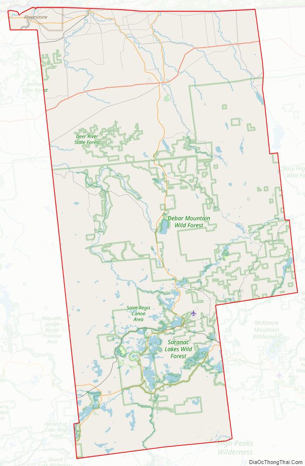
Franklin County Road Map
Geography
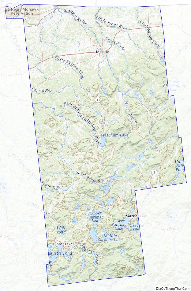
According to the U.S. Census Bureau, the county has a total area of 1,697 square miles (4,400 km), of which 1,629 square miles (4,220 km) is land and 68 square miles (180 km) (4.0%) is water. It is the fourth-largest county in New York by land area. Franklin County is in the northeastern part of New York State. The northern edge borders Quebec and Ontario provinces of Canada.
The Upper, Middle and Lower Saranac lakes are located within the county. These are part of the natural resource attractions in the area. Lower Saranac Lake extends into neighboring Essex County to the southeast. Loon Lake is also located in the county, as is its namesake community.
Adjacent counties and municipality
- Clinton County – east
- Essex County – southeast
- Hamilton County – southwest
- St. Lawrence County – west
- Stormont, Dundas and Glengarry United Counties, Ontario, Canada – northwest
- Le Haut-Saint-Laurent Regional County Municipality, Quebec, Canada – north
Franklin County Topographic Map
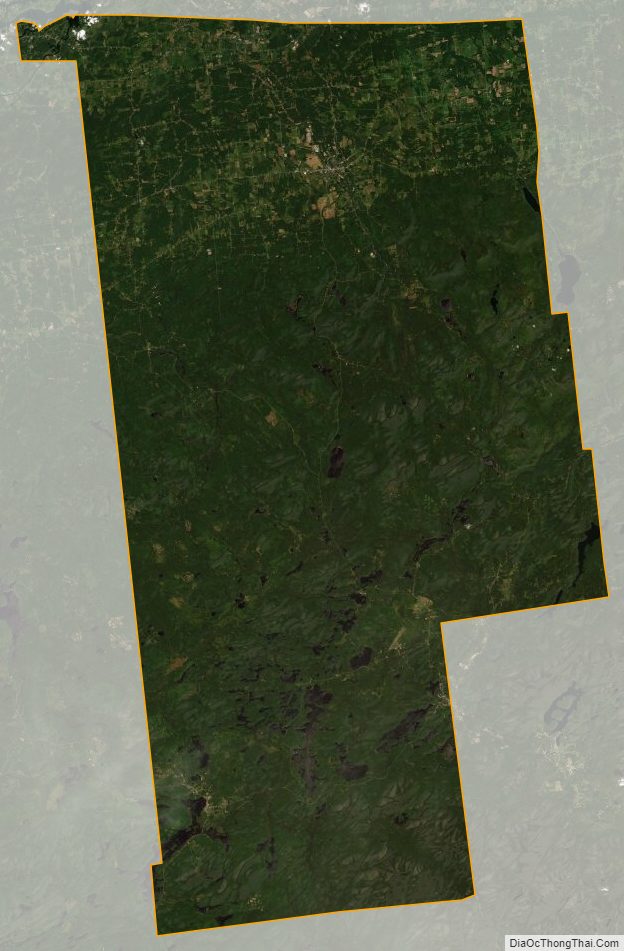
Franklin County Satellite Map
Franklin County Outline Map

See also
Map of New York State and its subdivision:- Albany
- Allegany
- Bronx
- Broome
- Cattaraugus
- Cayuga
- Chautauqua
- Chemung
- Chenango
- Clinton
- Columbia
- Cortland
- Delaware
- Dutchess
- Erie
- Essex
- Franklin
- Fulton
- Genesee
- Greene
- Hamilton
- Herkimer
- Jefferson
- Kings
- Lake Ontario
- Lewis
- Livingston
- Madison
- Monroe
- Montgomery
- Nassau
- New York
- Niagara
- Oneida
- Onondaga
- Ontario
- Orange
- Orleans
- Oswego
- Otsego
- Putnam
- Queens
- Rensselaer
- Richmond
- Rockland
- Saint Lawrence
- Saratoga
- Schenectady
- Schoharie
- Schuyler
- Seneca
- Steuben
- Suffolk
- Sullivan
- Tioga
- Tompkins
- Ulster
- Warren
- Washington
- Wayne
- Westchester
- Wyoming
- Yates
- Alabama
- Alaska
- Arizona
- Arkansas
- California
- Colorado
- Connecticut
- Delaware
- District of Columbia
- Florida
- Georgia
- Hawaii
- Idaho
- Illinois
- Indiana
- Iowa
- Kansas
- Kentucky
- Louisiana
- Maine
- Maryland
- Massachusetts
- Michigan
- Minnesota
- Mississippi
- Missouri
- Montana
- Nebraska
- Nevada
- New Hampshire
- New Jersey
- New Mexico
- New York
- North Carolina
- North Dakota
- Ohio
- Oklahoma
- Oregon
- Pennsylvania
- Rhode Island
- South Carolina
- South Dakota
- Tennessee
- Texas
- Utah
- Vermont
- Virginia
- Washington
- West Virginia
- Wisconsin
- Wyoming