Franklin County is a county in the U.S. state of Ohio. As of the 2020 census, the population was 1,323,807, making it the most populous county in Ohio. Most of its land area is taken up by its county seat, Columbus, the state capital and most populous city in Ohio. The county was established on April 30, 1803, less than two months after Ohio became a state, and was named after Benjamin Franklin. Franklin County originally extended north to Lake Erie before being subdivided into smaller counties. Franklin County is the central county of the Columbus, Ohio Metropolitan Statistical Area.
Franklin County, particularly Columbus, has been a centerpiece for presidential and congressional politics, most notably the 2000 presidential election, the 2004 presidential election, and the 2006 midterm elections. Franklin County is home to one of the largest universities in the United States, Ohio State University, which has about 60,000 students on its main Columbus campus.
It shares a name with Franklin County in Kentucky, where Frankfort is located. This makes it one of two pairs of capital cities in counties of the same name, along with Marion Counties in Indiana and Oregon.
| Name: | Franklin County |
|---|---|
| FIPS code: | 39-049 |
| State: | Ohio |
| Founded: | April 30, 1803 |
| Seat: | Columbus |
| Total Area: | 544 sq mi (1,410 km²) |
| Land Area: | 532 sq mi (1,380 km²) |
| Total Population: | 1,323,807 |
| Population Density: | 2,400/sq mi (940/km²) |
| Time zone: | UTC−5 (North American EST) |
| Summer Time Zone (DST): | UTC−4 (EDT) |
| Website: | franklincountyohio.gov |
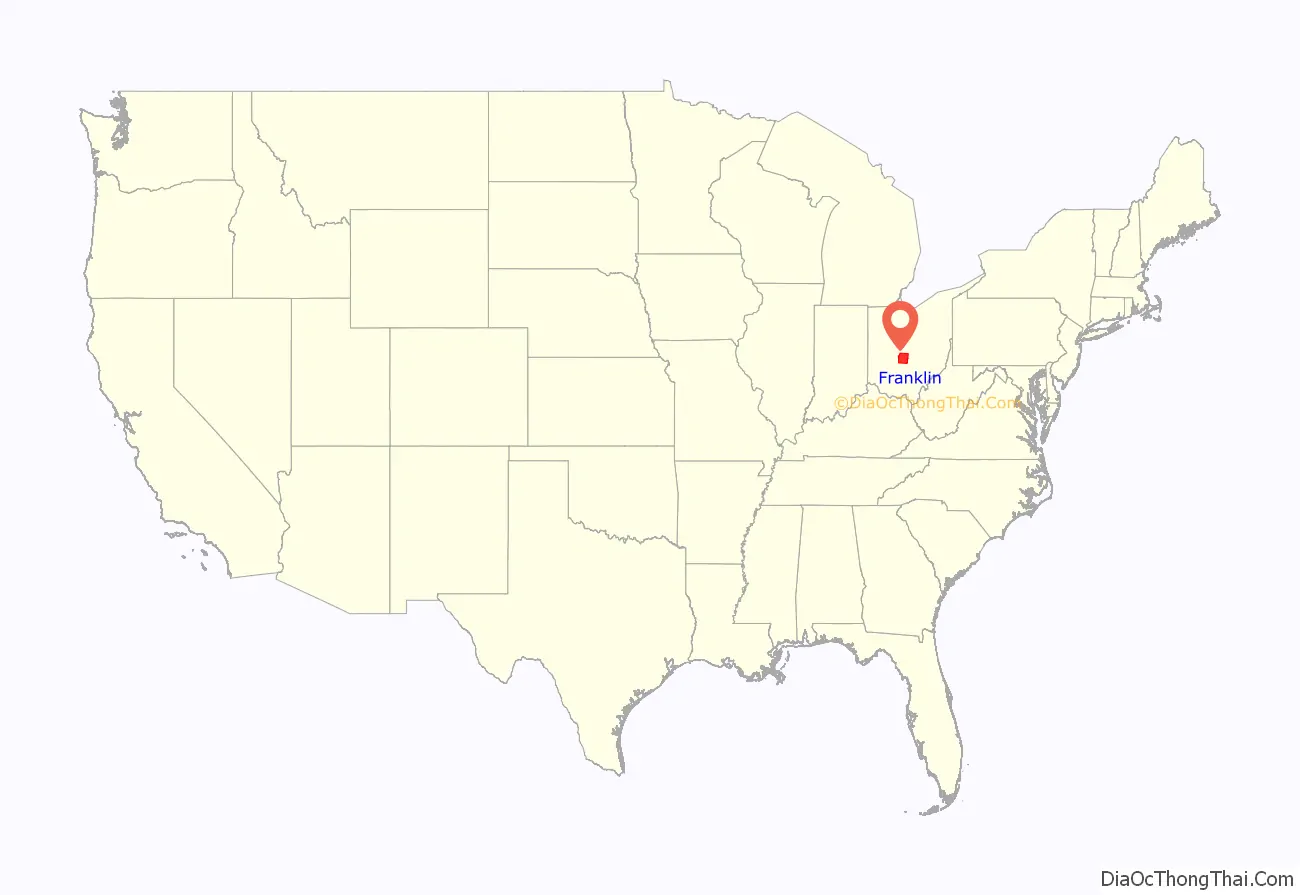
Franklin County location map. Where is Franklin County?
History
On March 30, 1803, the Ohio government authorized the creation of Franklin County. The county originally was part of Ross County. Residents named the county in honor of Benjamin Franklin. In 1816, Franklin County’s Columbus became Ohio’s state capital. Surveyors laid out the city in 1812, and officials incorporated it in 1816. Columbus was not Ohio’s original capital, but the state legislature chose to move the state government there after its location for a short time at Chillicothe and at Zanesville. Columbus was chosen as the site for the new capital because of its central location within the state and access by way of major transportation routes (primarily rivers) at that time. The legislature chose it as Ohio’s capital over a number of other competitors, including Franklinton, Dublin, Worthington, and Delaware.
On May 5, 1802, a group of prospective settlers founded the Scioto Company at the home of Rev. Eber B. Clark in Granby, Connecticut, for the purpose of forming a settlement between the Muskingum River and Great Miami River in the Ohio Country. James Kilbourne was elected president and Josiah Topping secretary. On August 30, 1802, James Kilbourne and Nathaniel Little arrived at Colonel Thomas Worthington’s home in Chillicothe. They tentatively reserved land along the Scioto River on the Pickaway Plains for their new settlement.
On October 5, 1802, the Scioto Company met again in Granby and decided not to purchase the lands along the Scioto River on the Pickaway Plains, but rather to buy land 30 miles (48 km) farther north from Dr. Jonas Stanbery and his partner, an American Revolutionary War general, Jonathan Dayton. Sixteen thousand acres (65 km; 6,500 ha) were purchased along the Whetstone River (now known as the Olentangy River) at $1.50 per acre. This land was part of the United States Military District surveyed by Israel Ludlow in 1797 and divided into townships 5 miles (8.0 km) square.
Before the state legislature’s decision in 1812, Columbus did not exist. The city was originally designed as the state’s new capital, preparing itself for its role in Ohio’s political, economic, and social life. In the years between the first ground-breaking and the actual movement of the capital in 1816, Columbus and Franklin County grew significantly. By 1813, workers had built a penitentiary, and by the following year, residents had established the first church, school, and newspaper in Columbus. Workers completed the Ohio Statehouse in 1861. Columbus and Franklin County grew quickly in population, with the city having 700 people by 1815. Columbus officially became the county seat in 1824. By 1834, the population of Columbus was 4,000 people, officially elevating it to “city” status.
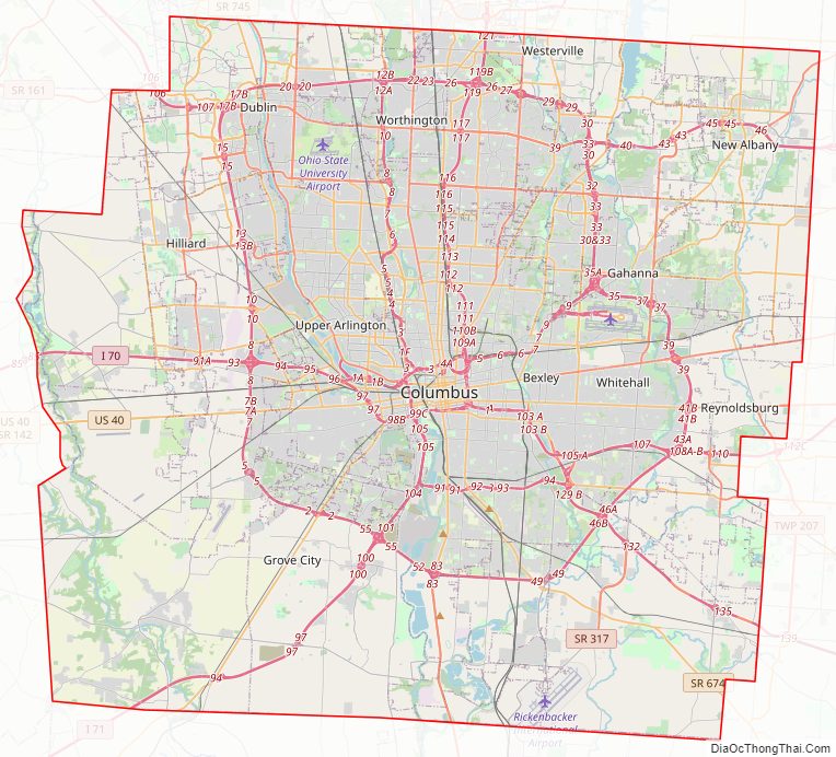
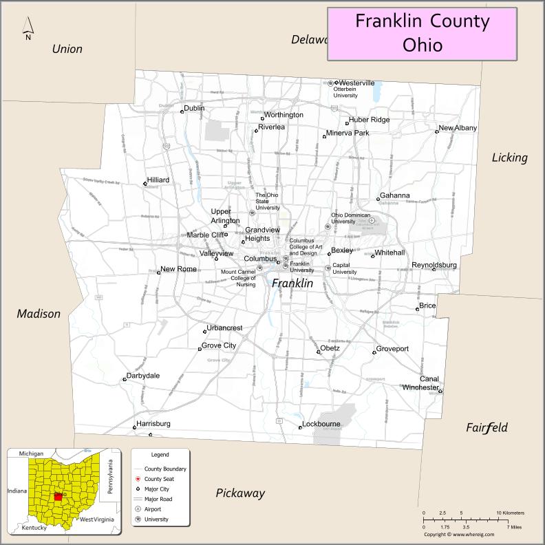
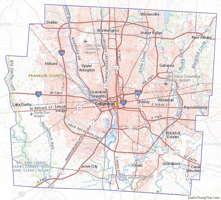
Franklin County Road Map
Geography
According to the United States Census Bureau, the county has a total area of 544 square miles (1,410 km), of which 532 square miles (1,380 km) is land and 11 square miles (28 km) (2.1%) is water. The county is located in the Till Plains and the Appalachian Plateau land regions.
The county is drained by the Olentangy River and the Scioto River. Major creeks in the county include Big Darby Creek, Big Walnut Creek, and Alum Creek. There are two large reservoirs in the county, Hoover Reservoir and Griggs Reservoir.
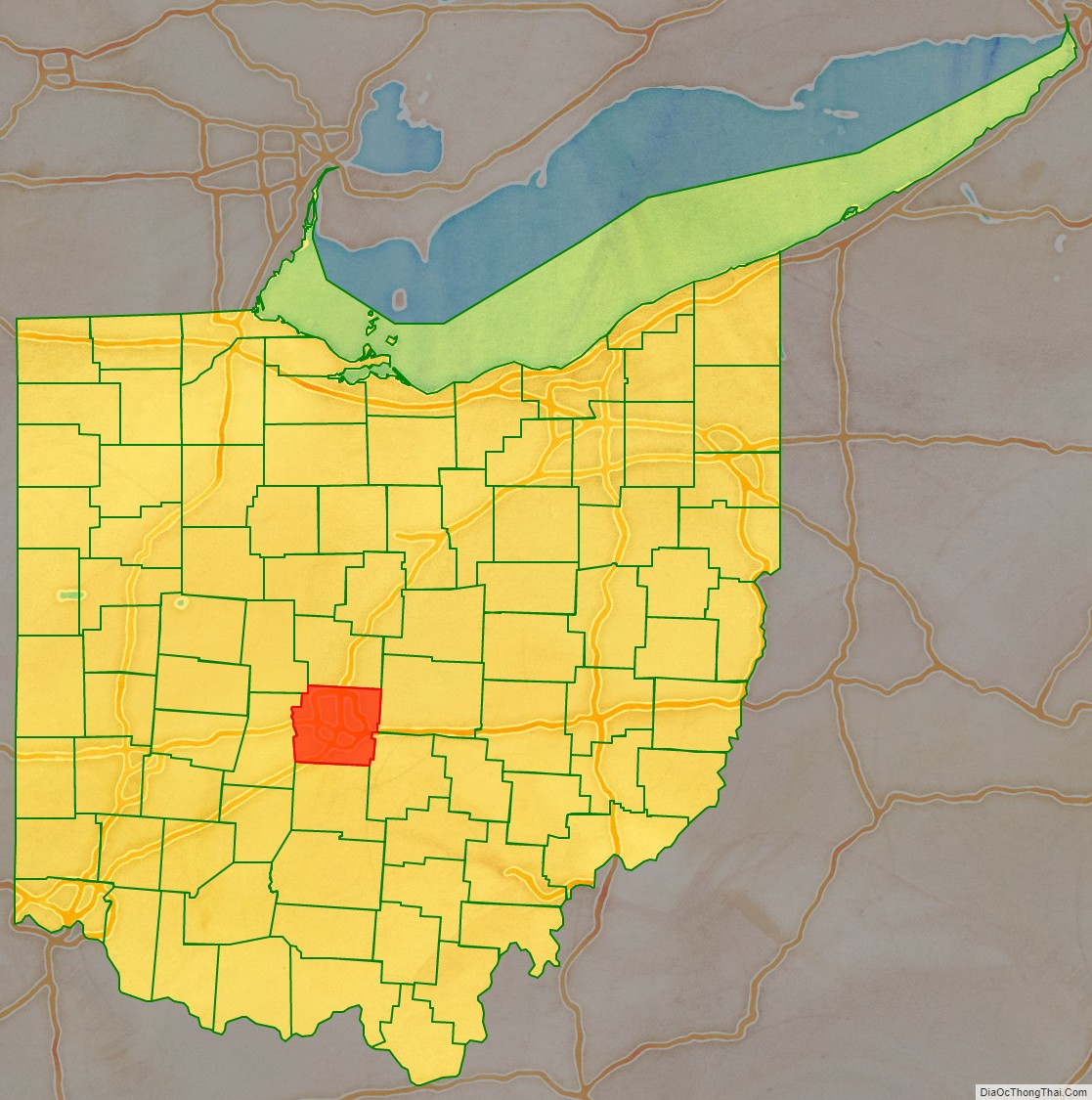
Adjacent counties
- Delaware County (north)
- Fairfield County (southeast)
- Licking County (east)
- Madison County (west)
- Pickaway County (south)
- Union County (northwest)
Major highways
- I-70
- I-71
- I-73 (future)
- I-270
- I-670
- US 23
- US 33
- US 40
- US 62
- SR 3
- SR 16
- SR 104
- SR 161
- SR 257
- SR 315
- SR 317
- SR 605
- SR 665
- SR 745
Franklin County Topographic Map
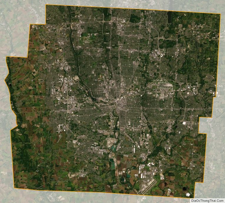
Franklin County Satellite Map
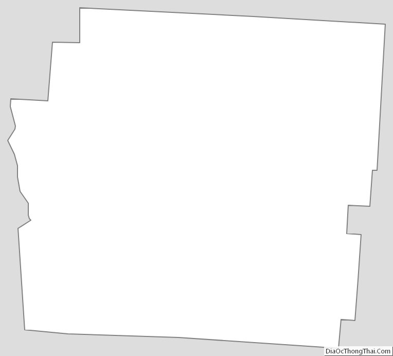
Franklin County Outline Map
See also
Map of Ohio State and its subdivision:- Adams
- Allen
- Ashland
- Ashtabula
- Athens
- Auglaize
- Belmont
- Brown
- Butler
- Carroll
- Champaign
- Clark
- Clermont
- Clinton
- Columbiana
- Coshocton
- Crawford
- Cuyahoga
- Darke
- Defiance
- Delaware
- Erie
- Fairfield
- Fayette
- Franklin
- Fulton
- Gallia
- Geauga
- Greene
- Guernsey
- Hamilton
- Hancock
- Hardin
- Harrison
- Henry
- Highland
- Hocking
- Holmes
- Huron
- Jackson
- Jefferson
- Knox
- Lake
- Lake Erie
- Lawrence
- Licking
- Logan
- Lorain
- Lucas
- Madison
- Mahoning
- Marion
- Medina
- Meigs
- Mercer
- Miami
- Monroe
- Montgomery
- Morgan
- Morrow
- Muskingum
- Noble
- Ottawa
- Paulding
- Perry
- Pickaway
- Pike
- Portage
- Preble
- Putnam
- Richland
- Ross
- Sandusky
- Scioto
- Seneca
- Shelby
- Stark
- Summit
- Trumbull
- Tuscarawas
- Union
- Van Wert
- Vinton
- Warren
- Washington
- Wayne
- Williams
- Wood
- Wyandot
- Alabama
- Alaska
- Arizona
- Arkansas
- California
- Colorado
- Connecticut
- Delaware
- District of Columbia
- Florida
- Georgia
- Hawaii
- Idaho
- Illinois
- Indiana
- Iowa
- Kansas
- Kentucky
- Louisiana
- Maine
- Maryland
- Massachusetts
- Michigan
- Minnesota
- Mississippi
- Missouri
- Montana
- Nebraska
- Nevada
- New Hampshire
- New Jersey
- New Mexico
- New York
- North Carolina
- North Dakota
- Ohio
- Oklahoma
- Oregon
- Pennsylvania
- Rhode Island
- South Carolina
- South Dakota
- Tennessee
- Texas
- Utah
- Vermont
- Virginia
- Washington
- West Virginia
- Wisconsin
- Wyoming