Freestone County is a county in the east-central part of the U.S. state of Texas. As of the 2020 census, its population was 19,435. Its county seat is Fairfield. The county was created in 1850 and organized the next year.
| Name: | Freestone County |
|---|---|
| FIPS code: | 48-161 |
| State: | Texas |
| Founded: | 1850 |
| Seat: | Fairfield |
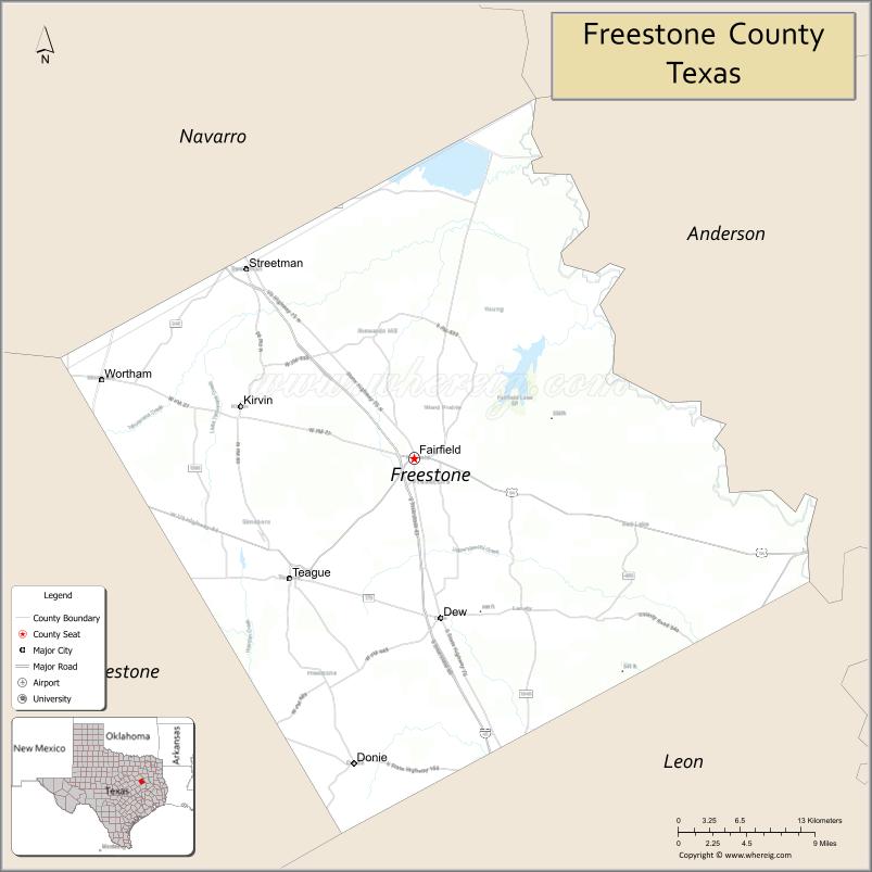
| Largest city: | Teague |
| Total Area: | 892 sq mi (2,310 km²) |
| Land Area: | 878 sq mi (2,270 km²) |
| Total Population: | 19,435 |
| Population Density: | 22/sq mi (8.4/km²) |
| Time zone: | UTC−6 (Central) |
| Summer Time Zone (DST): | UTC−5 (CDT) |
| Website: | www.co.freestone.tx.us |
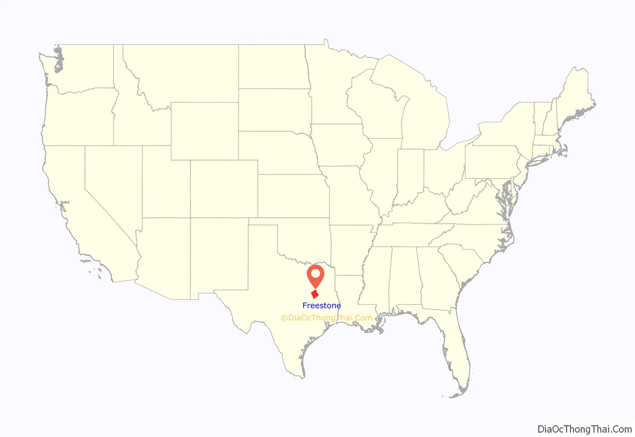
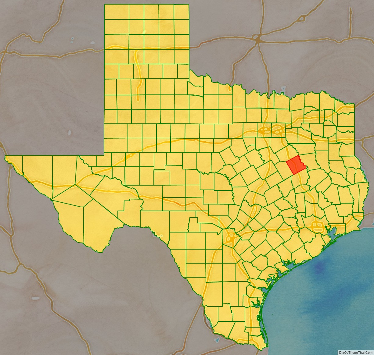
Freestone County location map. Where is Freestone County?
History
Native Americans
Archeological evidence of the farming Kichai band of the Caddoan Mississippian culture dates to 200 BCE in the area.
The Hernando de Soto expedition of 1541 resulted in violent encounters with the Caddo Native Americans who occupied the area. Spanish and French missionaries carried smallpox, measles, malaria, and influenza as endemic diseases; the Caddo suffered epidemics, as they had no acquired immunity to these new diseases. Eventually, the Caddo were forced to reservations.
The Tawakoni branch of Wichita Indians originated as a tribe north of Texas, but migrated south into East Texas. From 1843 onward, the Tawakoni were part of treaties made by both the Republic of Texas and the United States. The name of the Tawakoni was also sometimes spelled as Tehuacana.
County established
In 1826, empresario David G. Burnet received a grant from the Coahuila y Tejas legislature to settle 300 families. By contracting how many families each grantee could settle, the government sought to have some control over colonization.
The threat of Indian hostilities kept most from homesteading in Freestone County until the Treaty of Bird’s Fort. Within three years of the treaty, colonization, primarily from Southern states, had been so successful that the counties surrounding Freestone had already been organized. In 1850, the Texas Legislature formed Freestone County from Limestone County. Freestone is a descriptive name referring to the quality of the soil. The county was organized in 1851. Fairfield was designated as the county seat. Of the county’s total 1860 population of 6,881, more than half (3,613) were slaves.
Freestone County voted 585–3 in favor of secession from the Union. After the Civil War, while the loss of slave labor may have hurt the planters in the local county economy, by the end of Reconstruction, the number of farms doubled, with more smaller farms than before the war. Continuing economic and social tensions after Reconstruction resulted in Whites lynching Blacks to keep them in place as second-class citizens. Freestone County had nine such lynchings from 1877 into the early 20th century, most around the turn of the century. This was the fifth-highest total in the state, tied with that of Grimes County, Texas.
The Houston and Texas Central Railway was constructed to skirt the county to the west and south in 1870, giving the local economy a boost. and the International – Great Northern Railroad The Trinity and Brazos Valley Railway, laid track across the county in 1906, helping the growing economy.
The Prohibition Eighteenth Amendment to the United States Constitution took effect in 1920, banning the sale, manufacturing, and transportation of alcoholic beverages for public consumption. In the period until its repeal by the Twenty-first Amendment to the United States Constitution in 1933, some enterprising individuals in Freestone followed a national trend and began bootlegging for profit. This illegal activity put food on the table for some people during a period when the local economy was in a downward slide.
In 1969, the Texas Utilities Generating Company located a new power plant near Fairfield called Big Brown Power Plant. A dam was built to create Fairfield Lake to provide stored water for a cooling system for the plant. Fairfield Lake State Park was established around the lake and opened to the public in 1976. Big Brown was shut down in February 2018.
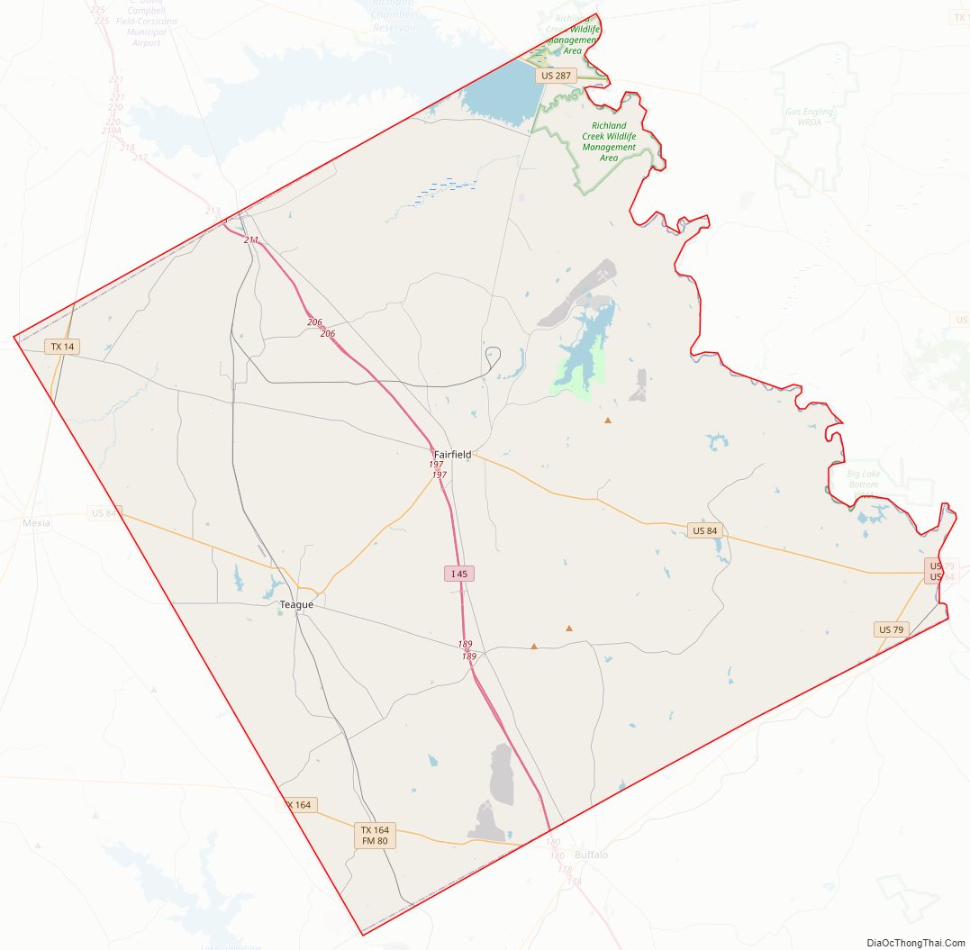
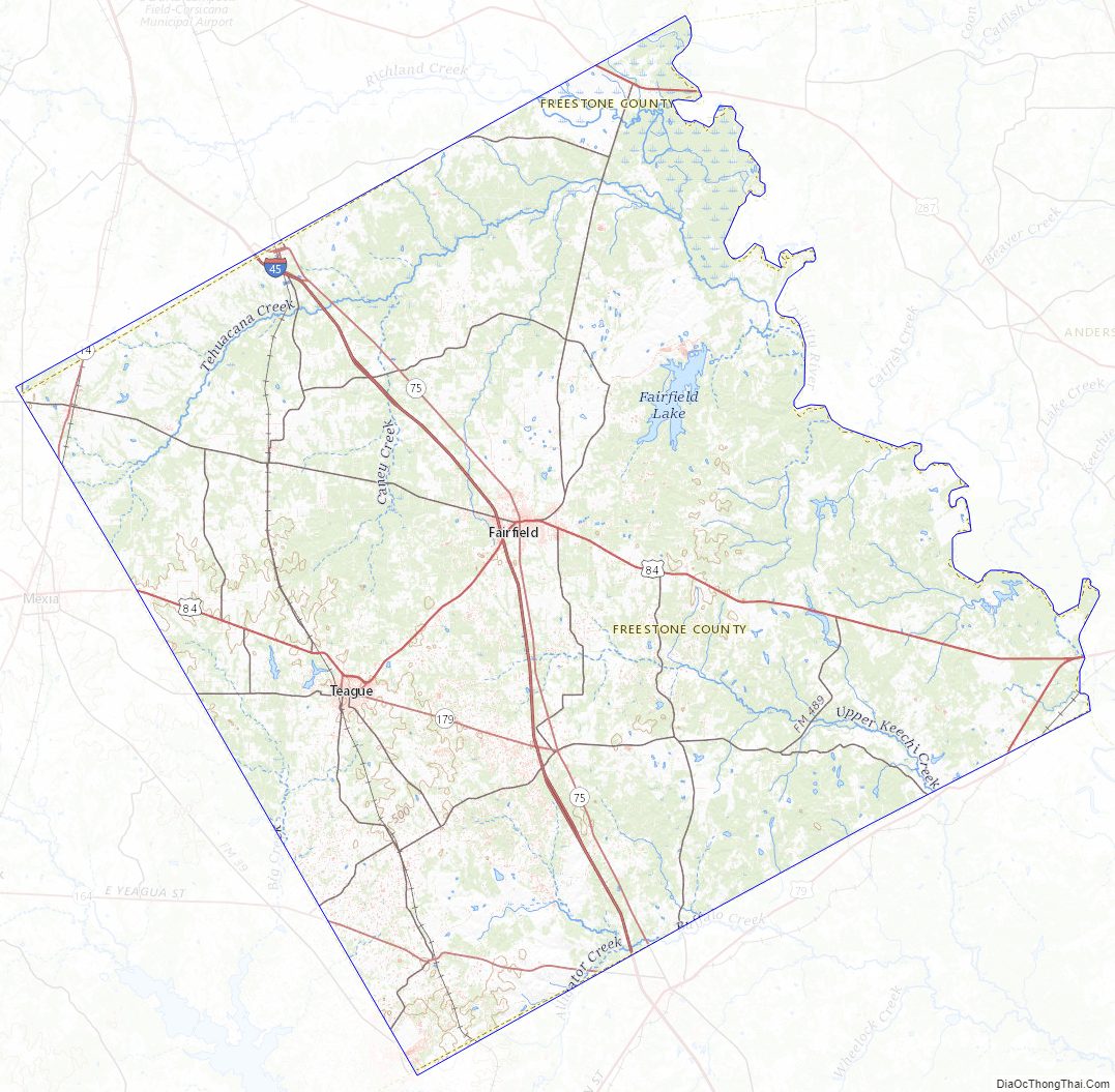
Freestone County Road Map
Geography
According to the U.S. Census Bureau, the county has a total area of 892 sq mi (2,310 km), of which 878 sq mi (2,270 km) are land and 14 sq mi (36 km) (1.6%) are covered by water.
Major highways
- Interstate 45
- U.S. Highway 79
- U.S. Highway 84
- U.S. Highway 287
- State Highway 14
- State Highway 75
- State Highway 164
- State Highway 179
Adjacent counties
- Henderson County (north)
- Anderson County (northeast)
- Leon County (southeast)
- Limestone County (southwest)
- Navarro County (northwest)
Freestone County Topographic Map
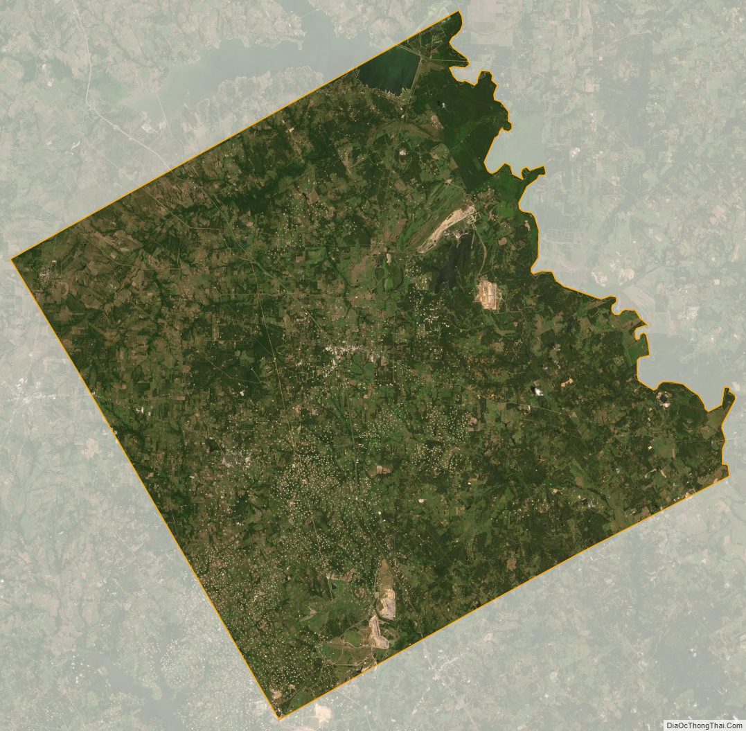
Freestone County Satellite Map
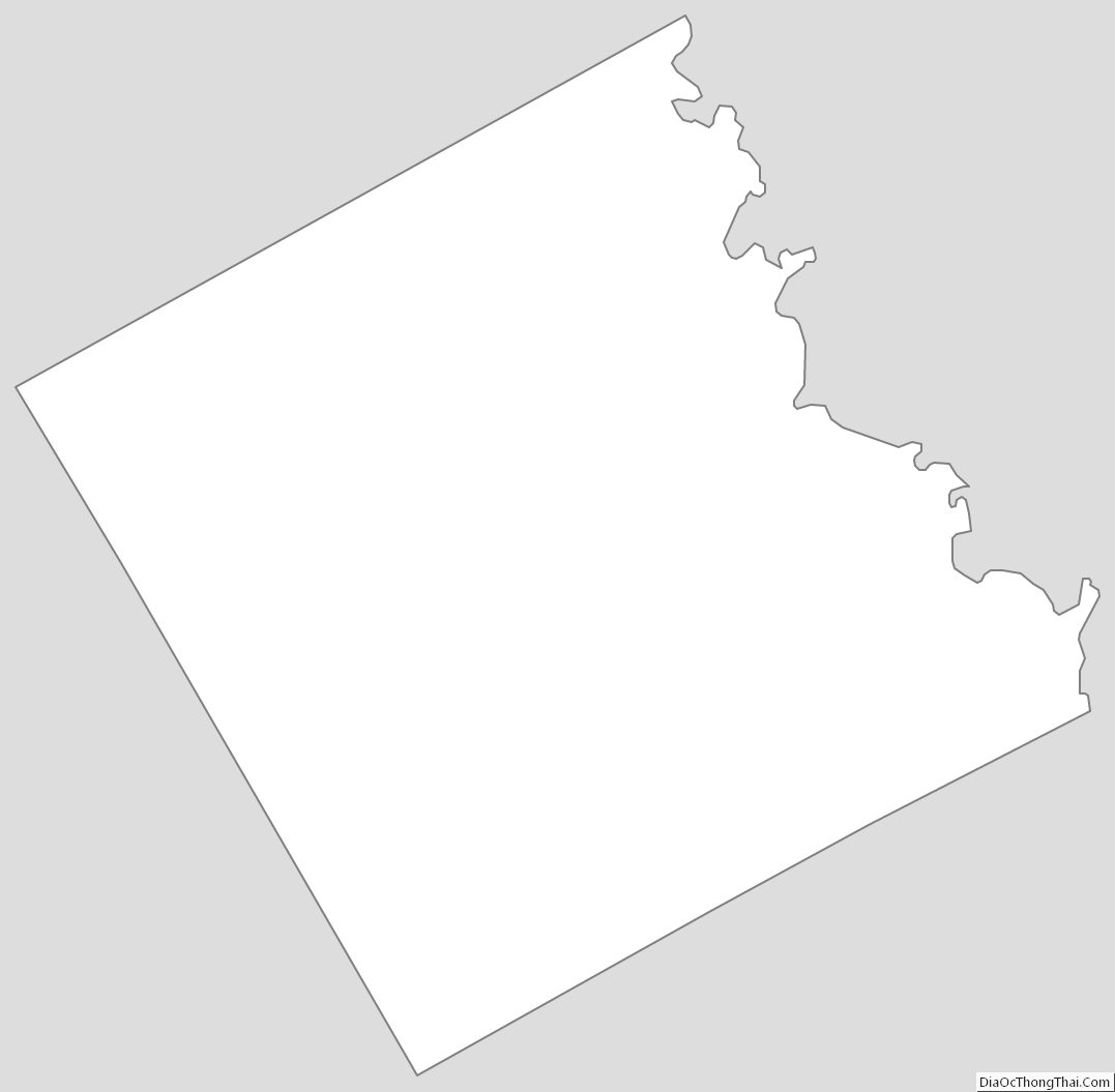
Freestone County Outline Map
See also
Map of Texas State and its subdivision:- Anderson
- Andrews
- Angelina
- Aransas
- Archer
- Armstrong
- Atascosa
- Austin
- Bailey
- Bandera
- Bastrop
- Baylor
- Bee
- Bell
- Bexar
- Blanco
- Borden
- Bosque
- Bowie
- Brazoria
- Brazos
- Brewster
- Briscoe
- Brooks
- Brown
- Burleson
- Burnet
- Caldwell
- Calhoun
- Callahan
- Cameron
- Camp
- Carson
- Cass
- Castro
- Chambers
- Cherokee
- Childress
- Clay
- Cochran
- Coke
- Coleman
- Collin
- Collingsworth
- Colorado
- Comal
- Comanche
- Concho
- Cooke
- Coryell
- Cottle
- Crane
- Crockett
- Crosby
- Culberson
- Dallam
- Dallas
- Dawson
- Deaf Smith
- Delta
- Denton
- Dewitt
- Dickens
- Dimmit
- Donley
- Duval
- Eastland
- Ector
- Edwards
- El Paso
- Ellis
- Erath
- Falls
- Fannin
- Fayette
- Fisher
- Floyd
- Foard
- Fort Bend
- Franklin
- Freestone
- Frio
- Gaines
- Galveston
- Garza
- Gillespie
- Glasscock
- Goliad
- Gonzales
- Gray
- Grayson
- Gregg
- Grimes
- Guadalupe
- Hale
- Hall
- Hamilton
- Hansford
- Hardeman
- Hardin
- Harris
- Harrison
- Hartley
- Haskell
- Hays
- Hemphill
- Henderson
- Hidalgo
- Hill
- Hockley
- Hood
- Hopkins
- Houston
- Howard
- Hudspeth
- Hunt
- Hutchinson
- Irion
- Jack
- Jackson
- Jasper
- Jeff Davis
- Jefferson
- Jim Hogg
- Jim Wells
- Johnson
- Jones
- Karnes
- Kaufman
- Kendall
- Kenedy
- Kent
- Kerr
- Kimble
- King
- Kinney
- Kleberg
- Knox
- La Salle
- Lamar
- Lamb
- Lampasas
- Lavaca
- Lee
- Leon
- Liberty
- Limestone
- Lipscomb
- Live Oak
- Llano
- Loving
- Lubbock
- Lynn
- Madison
- Marion
- Martin
- Mason
- Matagorda
- Maverick
- McCulloch
- McLennan
- McMullen
- Medina
- Menard
- Midland
- Milam
- Mills
- Mitchell
- Montague
- Montgomery
- Moore
- Morris
- Motley
- Nacogdoches
- Navarro
- Newton
- Nolan
- Nueces
- Ochiltree
- Oldham
- Orange
- Palo Pinto
- Panola
- Parker
- Parmer
- Pecos
- Polk
- Potter
- Presidio
- Rains
- Randall
- Reagan
- Real
- Red River
- Reeves
- Refugio
- Roberts
- Robertson
- Rockwall
- Runnels
- Rusk
- Sabine
- San Augustine
- San Jacinto
- San Patricio
- San Saba
- Schleicher
- Scurry
- Shackelford
- Shelby
- Sherman
- Smith
- Somervell
- Starr
- Stephens
- Sterling
- Stonewall
- Sutton
- Swisher
- Tarrant
- Taylor
- Terrell
- Terry
- Throckmorton
- Titus
- Tom Green
- Travis
- Trinity
- Tyler
- Upshur
- Upton
- Uvalde
- Val Verde
- Van Zandt
- Victoria
- Walker
- Waller
- Ward
- Washington
- Webb
- Wharton
- Wheeler
- Wichita
- Wilbarger
- Willacy
- Williamson
- Wilson
- Winkler
- Wise
- Wood
- Yoakum
- Young
- Zapata
- Zavala
- Alabama
- Alaska
- Arizona
- Arkansas
- California
- Colorado
- Connecticut
- Delaware
- District of Columbia
- Florida
- Georgia
- Hawaii
- Idaho
- Illinois
- Indiana
- Iowa
- Kansas
- Kentucky
- Louisiana
- Maine
- Maryland
- Massachusetts
- Michigan
- Minnesota
- Mississippi
- Missouri
- Montana
- Nebraska
- Nevada
- New Hampshire
- New Jersey
- New Mexico
- New York
- North Carolina
- North Dakota
- Ohio
- Oklahoma
- Oregon
- Pennsylvania
- Rhode Island
- South Carolina
- South Dakota
- Tennessee
- Texas
- Utah
- Vermont
- Virginia
- Washington
- West Virginia
- Wisconsin
- Wyoming