Fulton County is a county located in the U.S. state of Arkansas. As of the 2020 census, the population was 12,075. The county seat is Salem. Fulton County was formed on December 21, 1842, and named for William Fulton, the last governor of the Arkansas Territory. It is an alcohol prohibition or dry county.
| Name: | Fulton County |
|---|---|
| FIPS code: | 05-049 |
| State: | Arkansas |
| Founded: | December 21, 1842 |
| Named for: | William Fulton |
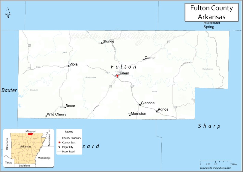
| Seat: | Salem |
| Largest city: | Salem |
| Total Area: | 620 sq mi (1,600 km²) |
| Land Area: | 618 sq mi (1,600 km²) |
| Total Population: | 12,075 |
| Population Density: | 19/sq mi (7.5/km²) |
| Time zone: | UTC−6 (Central) |
| Summer Time Zone (DST): | UTC−5 (CDT) |
| Website: | fulton.ark.org |
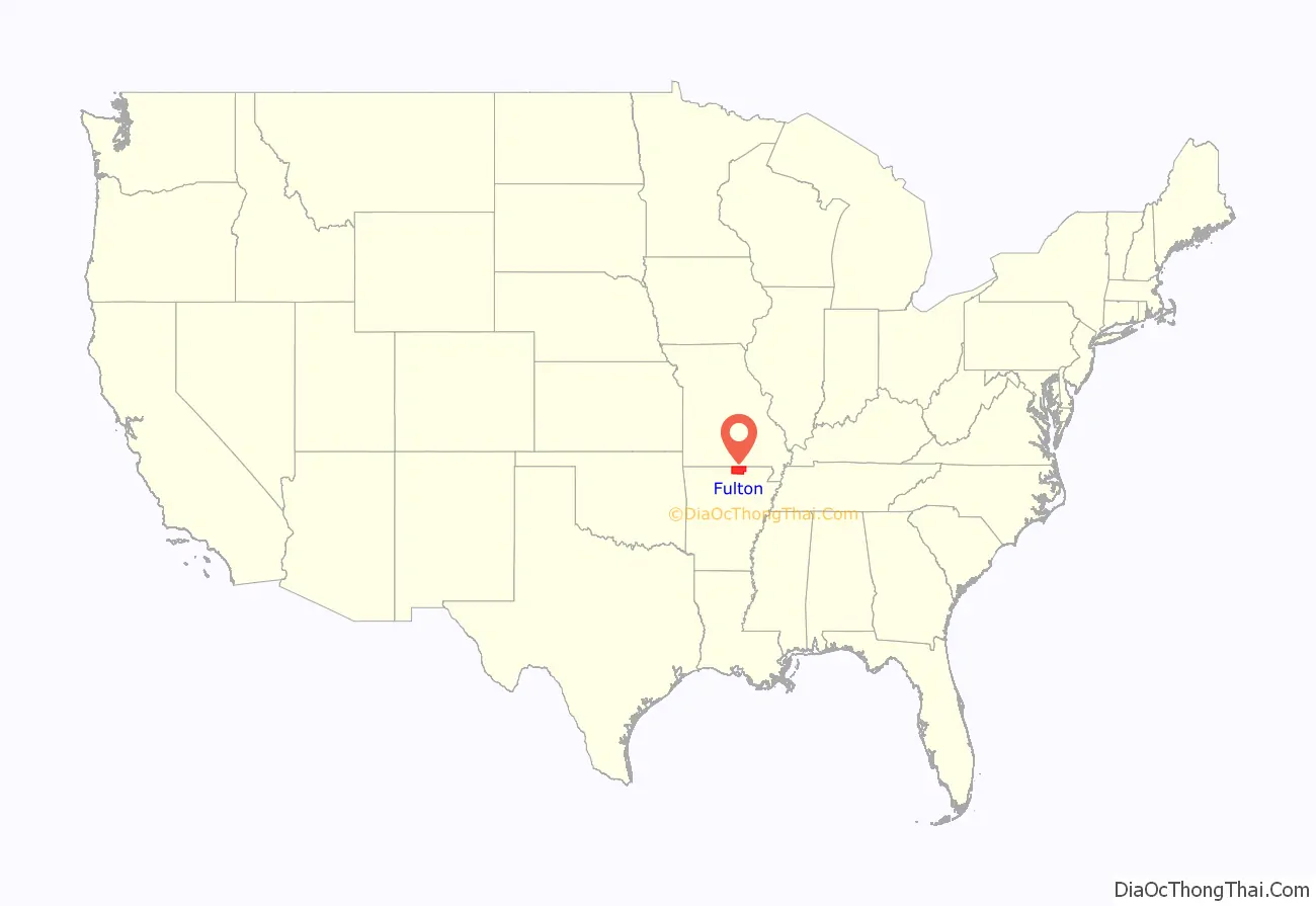
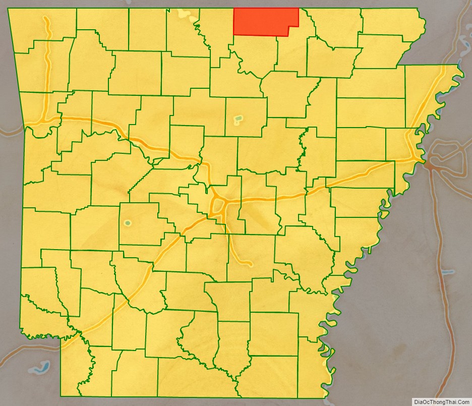
Fulton County location map. Where is Fulton County?
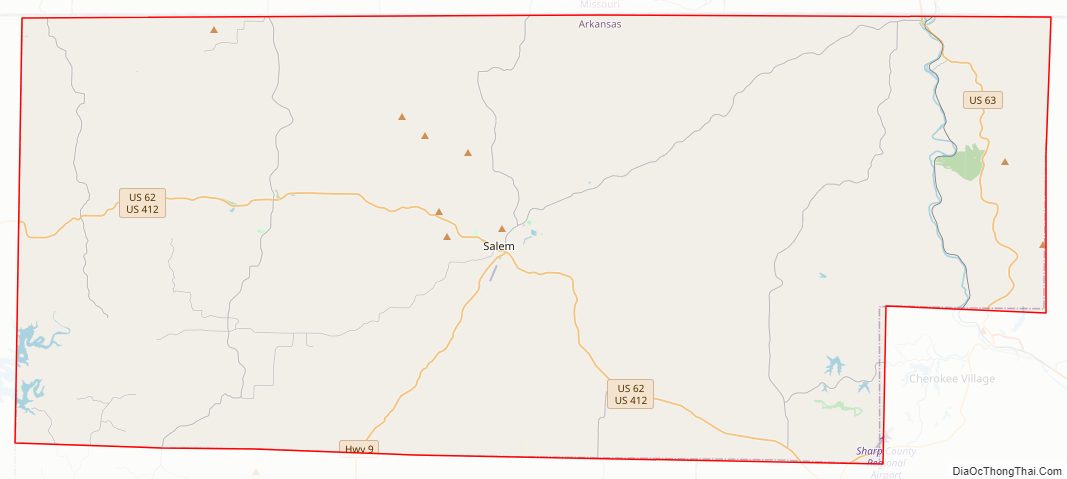
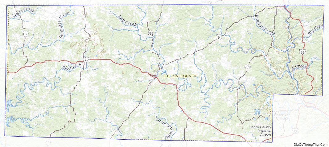
Fulton County Road Map
Geography
According to the U.S. Census Bureau, the county has a total area of 620 square miles (1,600 km), of which 618 square miles (1,600 km) is land and 2.1 square miles (5.4 km) (0.3%) is water.
Major highways
- US 62
- US 63
- US 412
- U.S. Highway 62 Business
- Highway 9
- Highway 87
- Highway 175
- Highway 223
- Highway 289
- Highway 395
Adjacent counties
- Ozark County, Missouri (northwest)
- Howell County, Missouri (north)
- Oregon County, Missouri (northeast)
- Sharp County (east)
- Izard County (south)
- Baxter County (west)
Fulton County Topographic Map
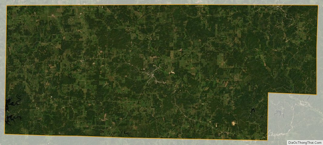
Fulton County Satellite Map
Fulton County Outline Map

See also
Map of Arkansas State and its subdivision:- Arkansas
- Ashley
- Baxter
- Benton
- Boone
- Bradley
- Calhoun
- Carroll
- Chicot
- Clark
- Clay
- Cleburne
- Cleveland
- Columbia
- Conway
- Craighead
- Crawford
- Crittenden
- Cross
- Dallas
- Desha
- Drew
- Faulkner
- Franklin
- Fulton
- Garland
- Grant
- Greene
- Hempstead
- Hot Spring
- Howard
- Independence
- Izard
- Jackson
- Jefferson
- Johnson
- Lafayette
- Lawrence
- Lee
- Lincoln
- Little River
- Logan
- Lonoke
- Madison
- Marion
- Miller
- Mississippi
- Monroe
- Montgomery
- Nevada
- Newton
- Ouachita
- Perry
- Phillips
- Pike
- Poinsett
- Polk
- Pope
- Prairie
- Pulaski
- Randolph
- Saint Francis
- Saline
- Scott
- Searcy
- Sebastian
- Sevier
- Sharp
- Stone
- Union
- Van Buren
- Washington
- White
- Woodruff
- Yell
- Alabama
- Alaska
- Arizona
- Arkansas
- California
- Colorado
- Connecticut
- Delaware
- District of Columbia
- Florida
- Georgia
- Hawaii
- Idaho
- Illinois
- Indiana
- Iowa
- Kansas
- Kentucky
- Louisiana
- Maine
- Maryland
- Massachusetts
- Michigan
- Minnesota
- Mississippi
- Missouri
- Montana
- Nebraska
- Nevada
- New Hampshire
- New Jersey
- New Mexico
- New York
- North Carolina
- North Dakota
- Ohio
- Oklahoma
- Oregon
- Pennsylvania
- Rhode Island
- South Carolina
- South Dakota
- Tennessee
- Texas
- Utah
- Vermont
- Virginia
- Washington
- West Virginia
- Wisconsin
- Wyoming