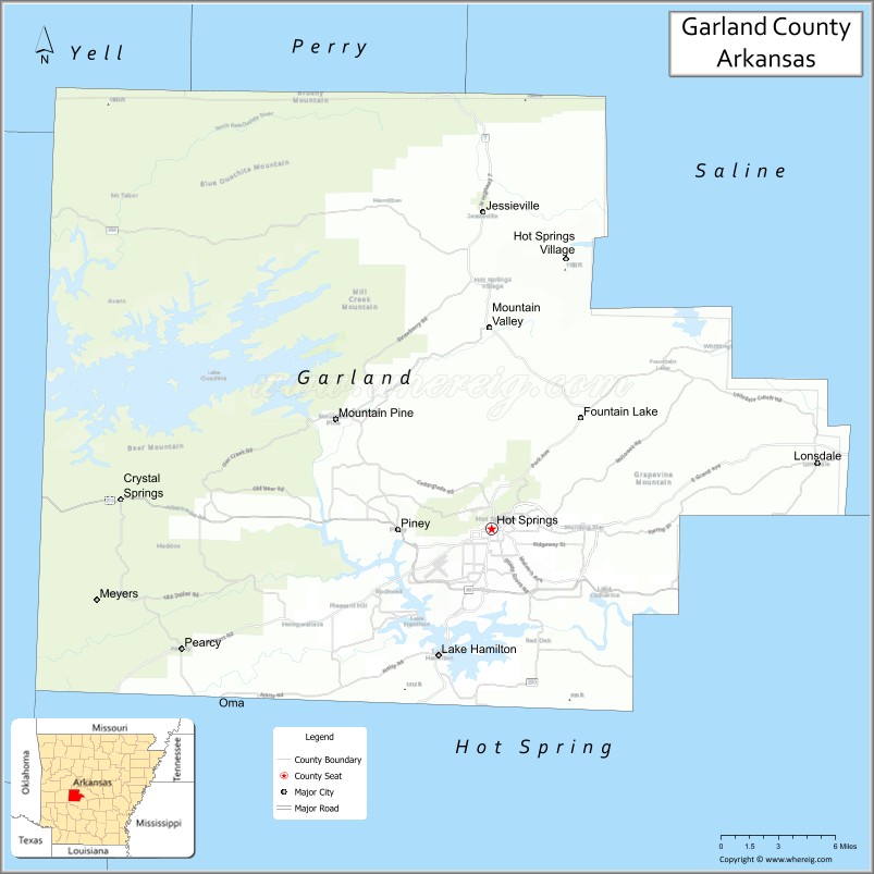
Garland County is located in the U.S. state of Arkansas. As of the 2020 census, the population was 100,180. The county seat is Hot Springs.
Garland County comprises the Hot Springs, AR Metropolitan Statistical Area. The county includes Hot Springs National Park, the only national park in the state of Arkansas as well as the first property to be protected under federal legislation. A law was passed in 1832 supported by President Andrew Jackson to preserve this area, even before Arkansas was admitted as a state.
| Name: | Garland County |
|---|---|
| FIPS code: | 05-051 |
| State: | Arkansas |
| Founded: | April 5, 1873 |
| Named for: | Augustus Hill Garland |
| Seat: | Hot Springs |
| Largest city: | Hot Springs |
| Total Area: | 735 sq mi (1,900 km²) |
| Land Area: | 678 sq mi (1,760 km²) |
| Total Population: | 100,180 |
| Population Density: | 140/sq mi (53/km²) |
| Time zone: | UTC−6 (Central) |
| Summer Time Zone (DST): | UTC−5 (CDT) |
| Website: | www.garlandcounty.org |
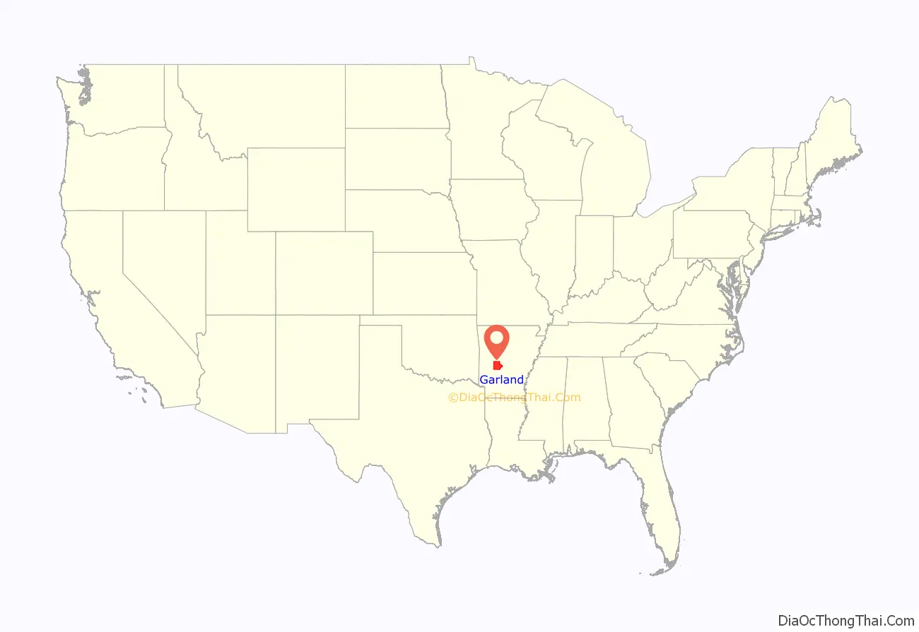
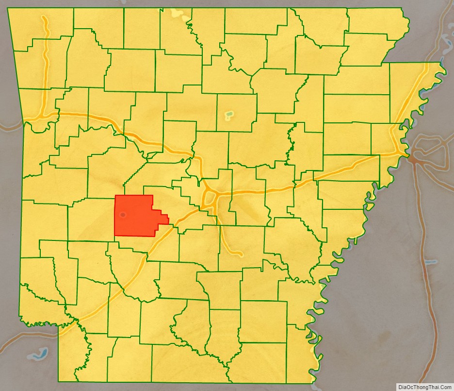
Garland County location map. Where is Garland County?
History
This area was occupied by the historic Natchitoches people, who frequented the hot springs for their healing powers. Their ancestors among regional indigenous peoples had been coming to this area for thousands of years before their time.
After acquiring the Louisiana Territory in 1803, which had been controlled by French and Spanish officials, President Thomas Jefferson requested William Dunbar, a planter and amateur scientist of Natchez, Mississippi, to explore this area. Dunbar led small group of a dozen soldiers and friend George Hunter, a chemist, to the Ouachita Mountains to report on the Indian tribes, minerals, and springs. They reached Hot Springs in December 1804, where they found a basic cabin used by visitors to the springs.
The first European-American settler was Jean Pierre Emanuel Prudhomme, a descendant of French colonists. An owner of a plantation at Red River, Prudhomme was suffering from illness and sought relief from the springs. In 1807 he built the first permanent European house by the springs, living here for two years. Isaac Cates and John Percival, two trappers from Alabama, joined him. Percival foresaw a great potential for the area and built log cabins in order to rent to visitors to the springs.
In 1828, Ludovicus Belding came with wife and children to visit the hot springs. After a few months they built a small hotel for the visitors of the springs.
In 1832 President Andrew Jackson signed legislation to protect the hot springs area for recreational use by American citizens as Hot Springs Reservation, the first time such action was taken. This was four years before Arkansas became a state, on June 15, 1836. A dispute among original settlers and their descendants over control of the property was settled by the US Supreme Court in 1877 in favor of the federal government. Hot Springs National Park was established in 1921 and is managed by the National Park Service.
Garland County is Arkansas’ 68th county, formed during the Reconstruction era on April 5, 1873, from portions of Hot Spring, Montgomery, and Saline counties. It was named for Augustus H. Garland, eleventh governor of Arkansas. It is the only county in the United States with this name.
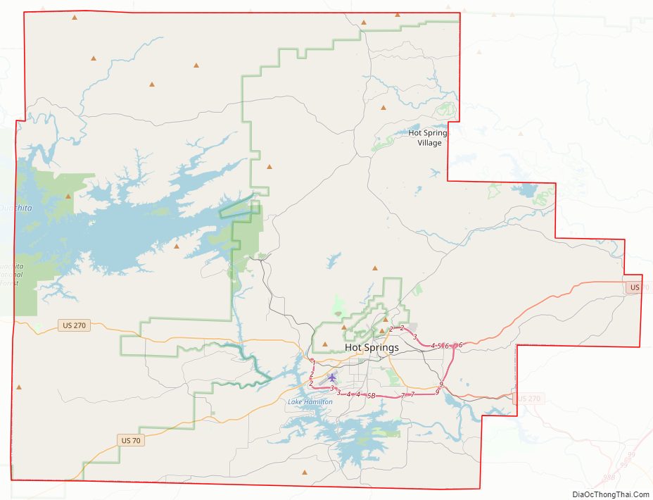
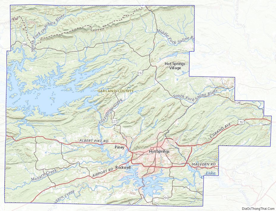
Garland County Road Map
Geography
According to the U.S. Census Bureau, the county has a total area of 735 square miles (1,900 km), of which 678 square miles (1,760 km) is land and 57 square miles (150 km) (7.7%) is water.
Major highways
- U.S. Highway 70
- U.S. Highway 270
- Highway 5
- Highway 7
- Highway 88
Adjacent counties
- Perry County (north)
- Saline County (east)
- Hot Spring County (south)
- Montgomery County (west)
- Yell County (northwest)
National protected areas
- Hot Springs National Park
- Ouachita National Forest (part)
Garland County Topographic Map
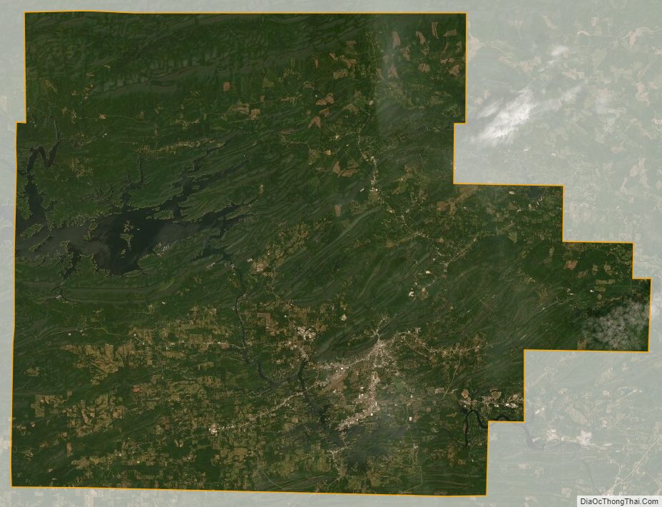
Garland County Satellite Map
Garland County Outline Map

See also
Map of Arkansas State and its subdivision:- Arkansas
- Ashley
- Baxter
- Benton
- Boone
- Bradley
- Calhoun
- Carroll
- Chicot
- Clark
- Clay
- Cleburne
- Cleveland
- Columbia
- Conway
- Craighead
- Crawford
- Crittenden
- Cross
- Dallas
- Desha
- Drew
- Faulkner
- Franklin
- Fulton
- Garland
- Grant
- Greene
- Hempstead
- Hot Spring
- Howard
- Independence
- Izard
- Jackson
- Jefferson
- Johnson
- Lafayette
- Lawrence
- Lee
- Lincoln
- Little River
- Logan
- Lonoke
- Madison
- Marion
- Miller
- Mississippi
- Monroe
- Montgomery
- Nevada
- Newton
- Ouachita
- Perry
- Phillips
- Pike
- Poinsett
- Polk
- Pope
- Prairie
- Pulaski
- Randolph
- Saint Francis
- Saline
- Scott
- Searcy
- Sebastian
- Sevier
- Sharp
- Stone
- Union
- Van Buren
- Washington
- White
- Woodruff
- Yell
- Alabama
- Alaska
- Arizona
- Arkansas
- California
- Colorado
- Connecticut
- Delaware
- District of Columbia
- Florida
- Georgia
- Hawaii
- Idaho
- Illinois
- Indiana
- Iowa
- Kansas
- Kentucky
- Louisiana
- Maine
- Maryland
- Massachusetts
- Michigan
- Minnesota
- Mississippi
- Missouri
- Montana
- Nebraska
- Nevada
- New Hampshire
- New Jersey
- New Mexico
- New York
- North Carolina
- North Dakota
- Ohio
- Oklahoma
- Oregon
- Pennsylvania
- Rhode Island
- South Carolina
- South Dakota
- Tennessee
- Texas
- Utah
- Vermont
- Virginia
- Washington
- West Virginia
- Wisconsin
- Wyoming