Geauga County (/dʒiˈɔːɡə/ jee-AW-gə) is a county in the U.S. state of Ohio. As of the 2020 census, the population was 95,397. The county seat and largest city is Chardon. The county is named for an Onondaga or Seneca language word meaning ‘raccoon’, originally the name of the Grand River. Geauga County is part of the Cleveland-Elyria, OH Metropolitan Statistical Area. In 2008, Forbes Magazine ranked Geauga County as the fourth best place in the United States to raise a family. About 20% of the county’s population is Amish, as of 2017.
| Name: | Geauga County |
|---|---|
| FIPS code: | 39-055 |
| State: | Ohio |
| Founded: | March 1, 1806 |
| Named for: | an Iroquoian word for “raccoon” |
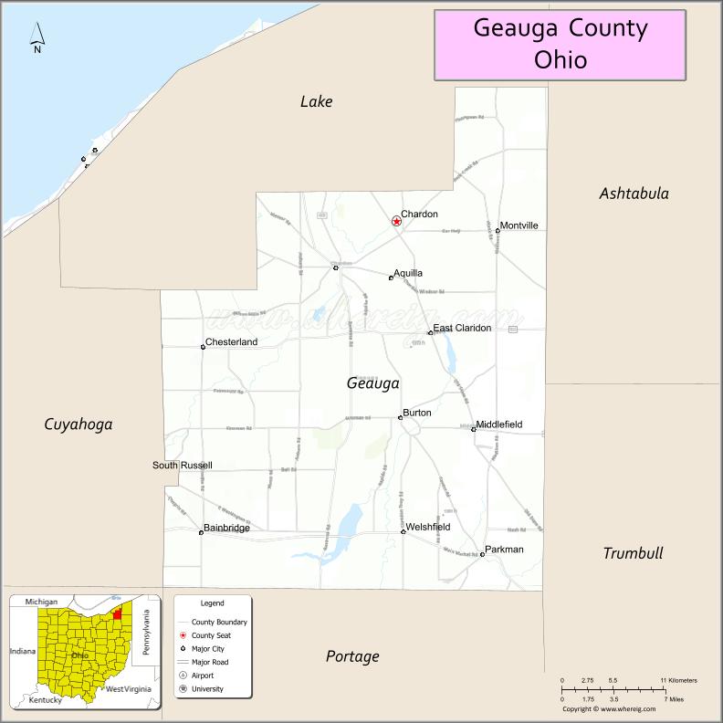
| Seat: | Chardon |
| Largest city: | Chardon |
| Total Area: | 408 sq mi (1,060 km²) |
| Land Area: | 400 sq mi (1,000 km²) |
| Total Population: | 95,397 |
| Population Density: | 230/sq mi (90/km²) |
| Time zone: | UTC−5 (Eastern) |
| Summer Time Zone (DST): | UTC−4 (EDT) |
| Website: | www.co.geauga.oh.us |
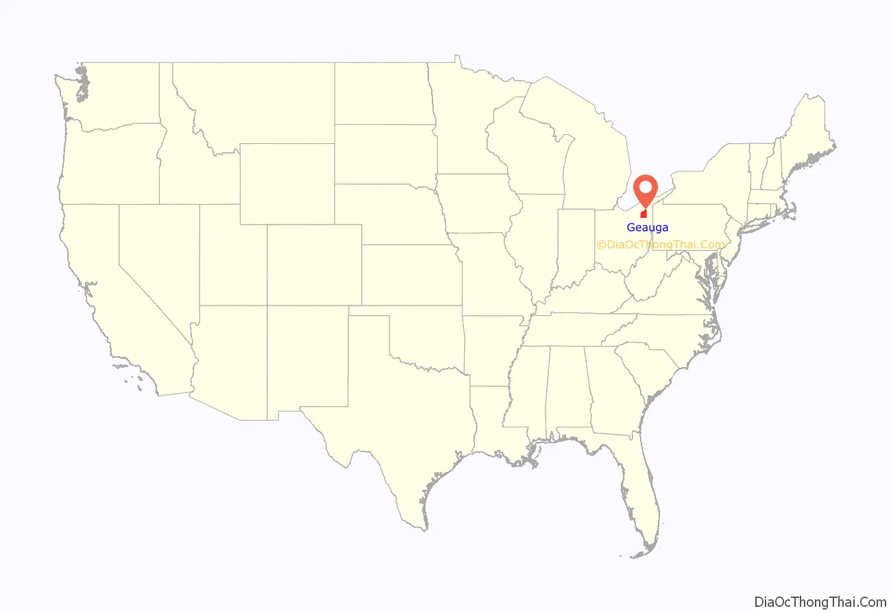
Geauga County location map. Where is Geauga County?
History
Geauga County is named after the Onondaga word jyo’ä·gak or Seneca jo’ä·ka, both meaning ‘raccoon’ (originally the name of the Grand River).
After the discovery of the New World, the land that became Geauga County was originally part of the French colony of Canada (New France), which was ceded in 1763 to Great Britain and renamed Province of Quebec. In the late 18th century the land became part of the Connecticut Western Reserve in the Northwest Territory, and then was purchased by the Connecticut Land Company in 1795.
Geauga County was founded on March 1, 1806, as the second county in the Connecticut Western Reserve, originating from Trumbull County, Ohio. In 1808, the size of Geauga County was reduced by the creation of Ashtabula County, Cuyahoga County, and Lake County.
The present-day boundaries were established in 1840 following the creation of Lake County. A disagreement about the location of the county seat began in 1808 when commissioners from Trumbull County began the process of identifying the seat of justice. Residents in the northern townships wanted the seat in Champion, renamed Painesville, Ohio in 1832. Residents in southern townships desired a centrally located county seat and took advantage of a tract of land donated by Peter Chardon Brooks called Chardon, Ohio. Despite Chardon being selected in 1809, the argument was never really settled. Over the next two decades, population growth in the seven northern townships exceeded the remaining sixteen southern townships, further fueling the disagreement. On January 21, 1840, a petition to create Lake County from seven townships in northern Geauga County and Willoughby Township from Cuyahoga County were presented to the Ohio House of Representatives. Seabury Ford presented petitions against its creation. Lake County was established in March 1840 by the Ohio state legislature. As the newly formed Lake County did not have sufficient territory to meet the requirements for a county, the northern border included submerged land beneath the waters of Lake Erie.
The first settlement in Geauga was at Burton, Ohio in the year 1798, when three families settled there from Connecticut.
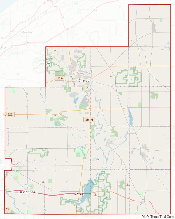
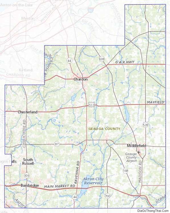
Geauga County Road Map
Geography
According to the U.S. Census Bureau, the county has an area of 408 square miles (1,060 km), of which 400 square miles (1,000 km) is land and 8.1 square miles (21 km) (2.0%) is water.
Geauga County receives the most precipitation of any county in northern Ohio, with most of the county receiving over 42 inches annually in an average year, and some parts exceeding 44 inches.
Drainage system
The geography of Geauga County was radically changed by Illinoian and Wisconsinan glaciation, which is evident in the deranged drainage system, landscape change, and glacial till. The headwaters of three watercourses in the Lake Erie basin are in Geauga County. These include the Cuyahoga River, Chagrin River, and Grand River. Portions of all three are designated Ohio Scenic Rivers.
Point sources of the east branch of the Cuyahoga River are in Hambden Township, Claridon Township, and Burton Township,. The point source of the west branch of the Cuyahoga River is near the intersection of Pond and Rapids Roads in Burton Township.
The point sources of the east branch of the Chagrin River are at Bass Lake in Munson Township and the southwest corner of the city of Chardon. McFarland Creek in Bainbridge Township, sometimes referred to as Chagrin Falls because of the postal zip code, is a tributary of the Aurora branch of the Chagrin River.
Point sources of the Grand River are in Parkman Township, Troy Township, and Swine Creek in Middlefield Township.
While the majority of waterways in Geauga County are part of the Lake Erie watershed, the Silver Creek in Troy Township is a tributary to the west branch of the Mahoning River, part of the Ohio River watershed, the largest tributary to the Mississippi River. There is another Silver Creek in Geauga County in Russell Township, which is a tributary to the east branch of the Chagrin River.
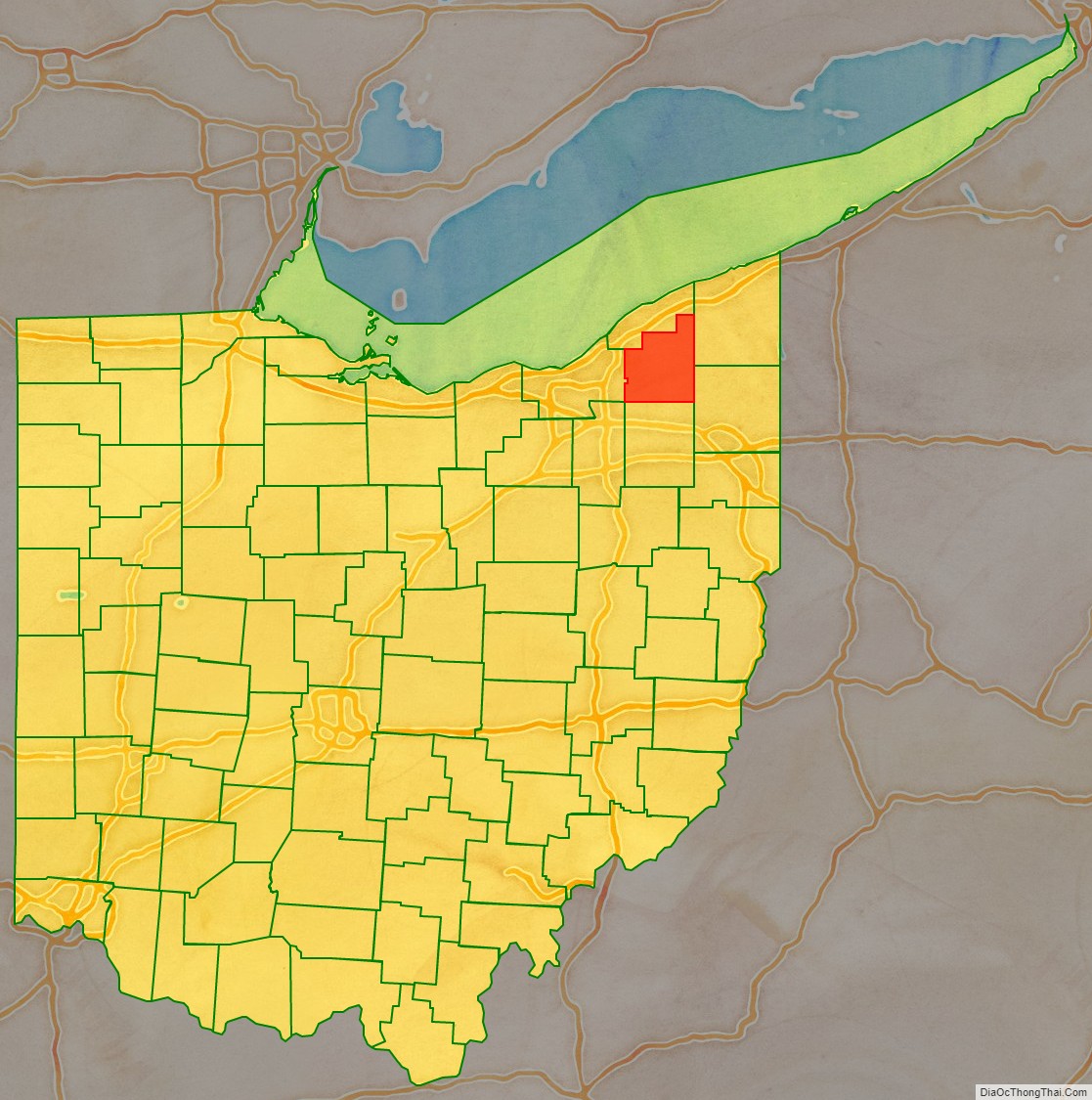
Adjacent counties
- Lake County (north)
- Ashtabula County (northeast)
- Trumbull County (southeast)
- Portage County (south)
- Cuyahoga County (west)
- Summit County (southwest)
Geauga County Topographic Map
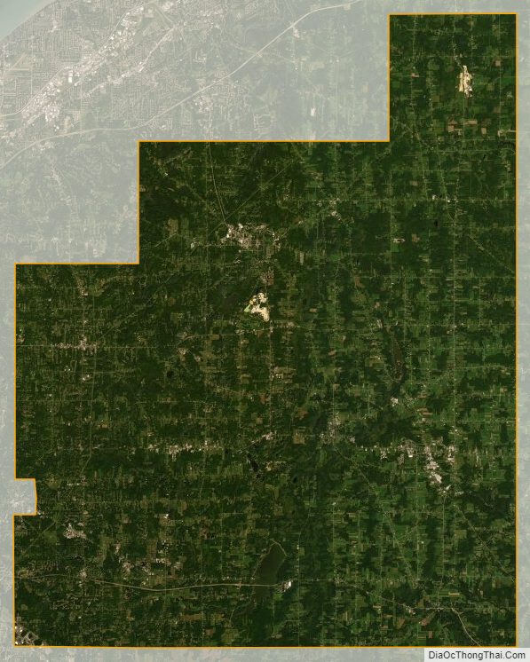
Geauga County Satellite Map
Geauga County Outline Map

See also
Map of Ohio State and its subdivision:- Adams
- Allen
- Ashland
- Ashtabula
- Athens
- Auglaize
- Belmont
- Brown
- Butler
- Carroll
- Champaign
- Clark
- Clermont
- Clinton
- Columbiana
- Coshocton
- Crawford
- Cuyahoga
- Darke
- Defiance
- Delaware
- Erie
- Fairfield
- Fayette
- Franklin
- Fulton
- Gallia
- Geauga
- Greene
- Guernsey
- Hamilton
- Hancock
- Hardin
- Harrison
- Henry
- Highland
- Hocking
- Holmes
- Huron
- Jackson
- Jefferson
- Knox
- Lake
- Lake Erie
- Lawrence
- Licking
- Logan
- Lorain
- Lucas
- Madison
- Mahoning
- Marion
- Medina
- Meigs
- Mercer
- Miami
- Monroe
- Montgomery
- Morgan
- Morrow
- Muskingum
- Noble
- Ottawa
- Paulding
- Perry
- Pickaway
- Pike
- Portage
- Preble
- Putnam
- Richland
- Ross
- Sandusky
- Scioto
- Seneca
- Shelby
- Stark
- Summit
- Trumbull
- Tuscarawas
- Union
- Van Wert
- Vinton
- Warren
- Washington
- Wayne
- Williams
- Wood
- Wyandot
- Alabama
- Alaska
- Arizona
- Arkansas
- California
- Colorado
- Connecticut
- Delaware
- District of Columbia
- Florida
- Georgia
- Hawaii
- Idaho
- Illinois
- Indiana
- Iowa
- Kansas
- Kentucky
- Louisiana
- Maine
- Maryland
- Massachusetts
- Michigan
- Minnesota
- Mississippi
- Missouri
- Montana
- Nebraska
- Nevada
- New Hampshire
- New Jersey
- New Mexico
- New York
- North Carolina
- North Dakota
- Ohio
- Oklahoma
- Oregon
- Pennsylvania
- Rhode Island
- South Carolina
- South Dakota
- Tennessee
- Texas
- Utah
- Vermont
- Virginia
- Washington
- West Virginia
- Wisconsin
- Wyoming