Gladwin County is a county located in the U.S. state of Michigan. As of the 2020 Census, the population was 25,386. The county seat is Gladwin.
| Name: | Gladwin County |
|---|---|
| FIPS code: | 26-051 |
| State: | Michigan |
| Founded: | 1831 |
| Named for: | Henry Gladwin |
| Seat: | Gladwin |
| Largest city: | Gladwin |
| Total Area: | 516 sq mi (1,340 km²) |
| Land Area: | 502 sq mi (1,300 km²) |
| Total Population: | 25,386 |
| Population Density: | 51/sq mi (20/km²) |
| Time zone: | UTC−5 (Eastern) |
| Summer Time Zone (DST): | UTC−4 (EDT) |
| Website: | www.gladwinco.com |
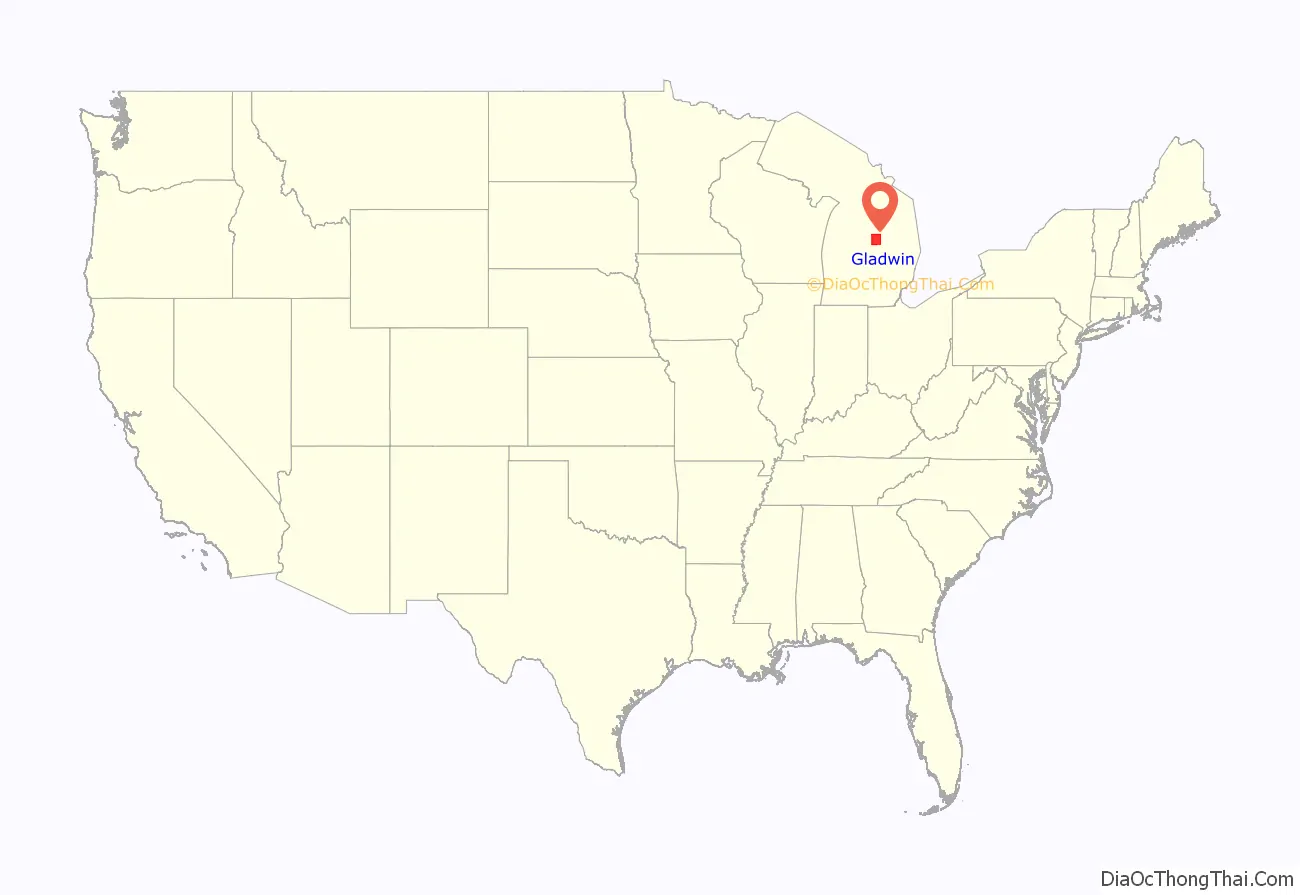
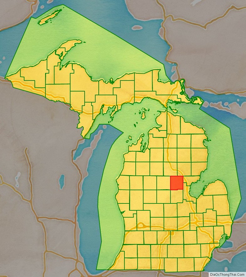
Gladwin County location map. Where is Gladwin County?
History
Prehistory
Gladwin County is a headwaters area. Most of the water that flows out of the county via the Tittabawassee River comes from Gladwin County, only a very small portion flows in from Clare or Roscommon counties. Native Americans crossed this area, and even spent summers here where the fishing was good and summer berries plentiful.
Research is underway to determine the importance of an ancient trail that was noted by the crew of the 1839 re-survey of Township 17 north Range 2 west, which later became Beaverton Township. The eastern terminus of the “Muskegon River Trail” was plotted at the confluence of the three branches of the Tobacco (Assa-mo-quoi-Sepe) River in the northwest corner of Section 12. It is possible that an early cross-country route from Saginaw Bay to Lake Michigan proceeded up the Saginaw, Tittabawassee, and Tobacco Rivers to a point west across Ross Lake from the Beaverton City Cemetery. At that point, the canoes would be portaged along the trail to the Muskegon River, then floated down to Lake Michigan.
Many native artifacts have been found along that route that attest to seasonal occupation, but so far no signs have been found to indicate a permanent settlement.
European arrival
The earliest documented visitors to the area were surveyors who platted the lands under provision of the 1787 Northwest Ordinance. Most of the early work was completed during the 1830s, although some of the survey work was faulty – the surveyors reportedly doubted that the area would ever be settled.
The earliest census to mention residents in the area was in 1860.
The county is named for Henry Gladwin, British military commandant at Detroit in 1763 during Pontiac’s War. The county was set off and named in 1831, and its government was organized in 1875.
Sesquicentennial
The year 2011 marked 150 years since the first permanent settler of record, Marvel Secord, took up residence along the Tittabawassee River in what is now Secord Township. He was a trapper and trader who provided supplies to lumbering camps in the area. Another man, William Brayton, may have been an earlier settler; the 1860 census listed 14 residents, including two families with children. Of these, 11 were associated with lumbering camps that had begun to appear that year, and three were listed as “hunters.” One of the “day laborers” at a camp had brought his wife to the area. The first issue of the Gladwin County Record (1878) mentions his 20 acres (8 Ha) of wheat under cultivation. His stepson, Dr. Russell E. Finch arrived in the area in 1875, becoming the county’s first physician. William Brayton died in 1895. His claim to being the first permanent settler appears valid, except that just before the 1880 census was taken he and his wife went to Lynn, Massachusetts to care for his dying father. He returned to Gladwin after settling his father’s estate in 1882, thus missing being included in the Gladwin County census for 1880.
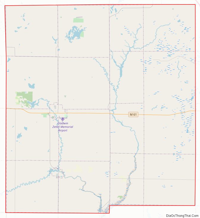
Gladwin County Road Map
Geography
According to the U.S. Census Bureau, the county has a total area of 516 square miles (1,340 km), of which 502 square miles (1,300 km) is land and 14 square miles (36 km) (2.7%) is water. It is the second-smallest county in Michigan by total area. Gladwin County is sometimes considered to be a part of Central Michigan, and at other times is included in Northern Michigan.
Major highways
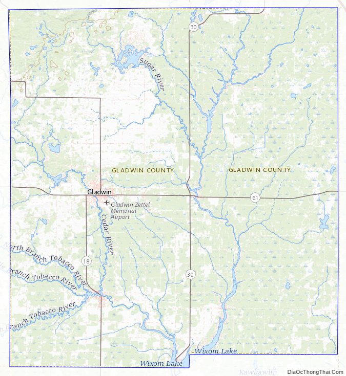
- M-18 runs north–south through the western part of the county. It runs south along the western county line from the county’s northwestern corner for five miles (8.0 km) then runs east and south to Gladwin, then west and south to Beaverton. It exits the county six miles (9.7 km) from the southwestern county corner, running to an intersection with US 10.
- M-30 enters the northeastern part of county two miles (3.2 km) south of the northeastern corner. It runs westerly through the northern part of county, then turns to run south through the center part of county. The highway passes White Star and Billings before exiting the south county line near its midpoint.
- M-61 runs east–west through center part of county and passes Gladwin and White Star.
County designated highways
- F-97
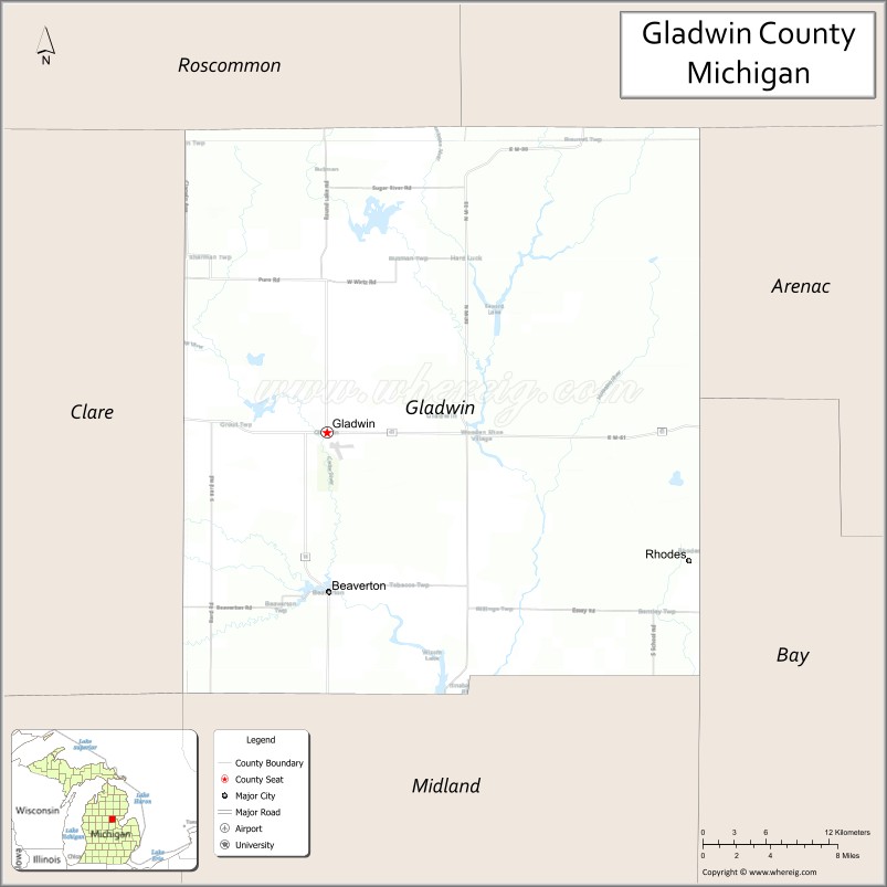
Adjacent counties
- Ogemaw County – northeast
- Arenac County – east
- Bay County – southeast
- Midland County – south
- Clare County – west
- Isabella County – southwest
- Roscommon County – northwest
Gladwin County Topographic Map
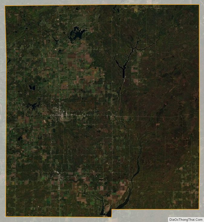
Gladwin County Satellite Map
Gladwin County Outline Map

See also
Map of Michigan State and its subdivision:- Alcona
- Alger
- Allegan
- Alpena
- Antrim
- Arenac
- Baraga
- Barry
- Bay
- Benzie
- Berrien
- Branch
- Calhoun
- Cass
- Charlevoix
- Cheboygan
- Chippewa
- Clare
- Clinton
- Crawford
- Delta
- Dickinson
- Eaton
- Emmet
- Genesee
- Gladwin
- Gogebic
- Grand Traverse
- Gratiot
- Hillsdale
- Houghton
- Huron
- Ingham
- Ionia
- Iosco
- Iron
- Isabella
- Jackson
- Kalamazoo
- Kalkaska
- Kent
- Keweenaw
- Lake
- Lake Hurron
- Lake Michigan
- Lake St. Clair
- Lake Superior
- Lapeer
- Leelanau
- Lenawee
- Livingston
- Luce
- Mackinac
- Macomb
- Manistee
- Marquette
- Mason
- Mecosta
- Menominee
- Midland
- Missaukee
- Monroe
- Montcalm
- Montmorency
- Muskegon
- Newaygo
- Oakland
- Oceana
- Ogemaw
- Ontonagon
- Osceola
- Oscoda
- Otsego
- Ottawa
- Presque Isle
- Roscommon
- Saginaw
- Saint Clair
- Saint Joseph
- Sanilac
- Schoolcraft
- Shiawassee
- Tuscola
- Van Buren
- Washtenaw
- Wayne
- Wexford
- Alabama
- Alaska
- Arizona
- Arkansas
- California
- Colorado
- Connecticut
- Delaware
- District of Columbia
- Florida
- Georgia
- Hawaii
- Idaho
- Illinois
- Indiana
- Iowa
- Kansas
- Kentucky
- Louisiana
- Maine
- Maryland
- Massachusetts
- Michigan
- Minnesota
- Mississippi
- Missouri
- Montana
- Nebraska
- Nevada
- New Hampshire
- New Jersey
- New Mexico
- New York
- North Carolina
- North Dakota
- Ohio
- Oklahoma
- Oregon
- Pennsylvania
- Rhode Island
- South Carolina
- South Dakota
- Tennessee
- Texas
- Utah
- Vermont
- Virginia
- Washington
- West Virginia
- Wisconsin
- Wyoming