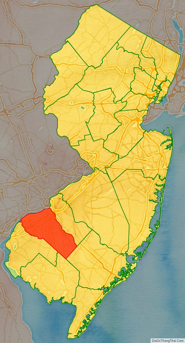
Gloucester County (/ˈɡlɒstər/) is a county in the U.S. state of New Jersey. As of the 2020 census, the county was the state’s 14th-most-populous county, with a population of 302,294, its highest decennial count ever and an increase of 14,006 (+4.9%) from the 288,288 counted in the 2010 census, which in turn represented an increase of 33,615 (+13.2%) from the 2000 census population of 254,673. Its county seat is Woodbury.
The county’s largest city by population was Washington Township which had a population of 48,677 in 2020, while the largest municipality by area was Franklin Township, which covered 56.39 square miles (146.0 km).
The county is part of the Camden, New Jersey metropolitan division of both the Philadelphia-Camden-Wilmington metropolitan statistical area, and the Delaware Valley combined statistical area.
Gloucester County borders Philadelphia, the nation’s sixth most populous city, to its northwest, and is 52 miles (84 km) northwest of Atlantic City. The county is part of South Jersey region of the state. Gloucester County, along with adjacent Salem County, also in South Jersey, have become an East Coast epicenter for logistics and warehouse construction.
| Name: | Gloucester County |
|---|---|
| FIPS code: | 34-015 |
| State: | New Jersey |
| Founded: | 1686 |
| Named for: | Gloucester / Gloucestershire, England |
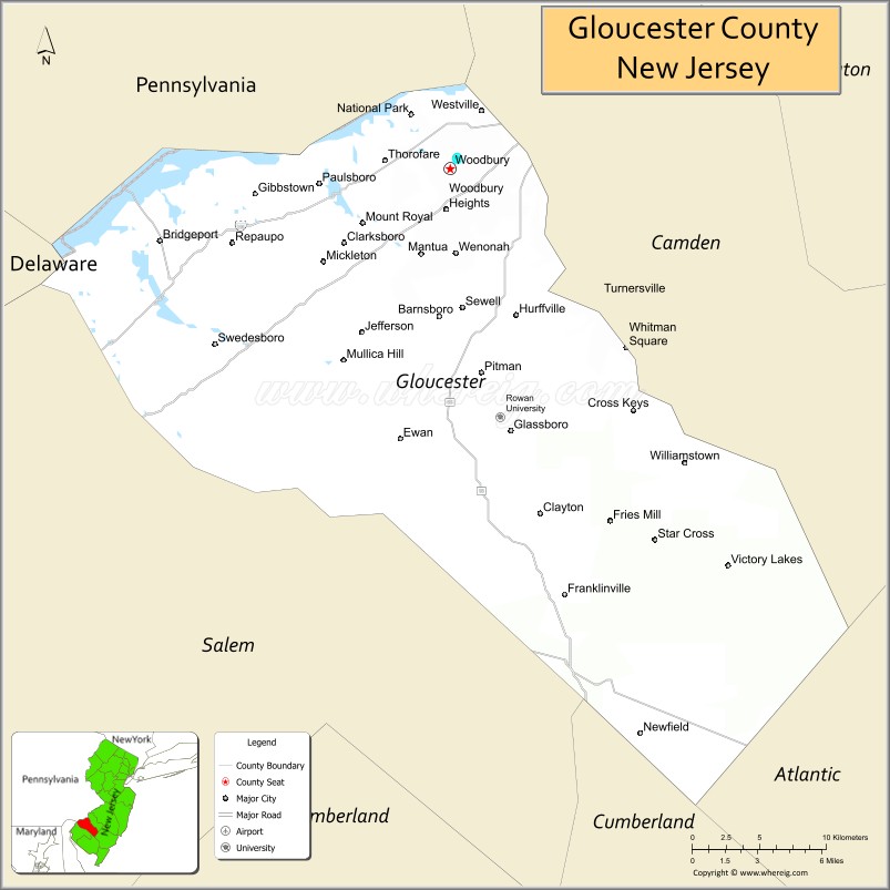
| Seat: | Woodbury |
| Total Area: | 337.18 sq mi (873.3 km²) |
| Land Area: | 322.00 sq mi (834.0 km²) |
| Total Population: | 302,294 |
| Population Density: | 938.8/sq mi (362.5/km²) |
| Website: | www.co.gloucester.nj.us |
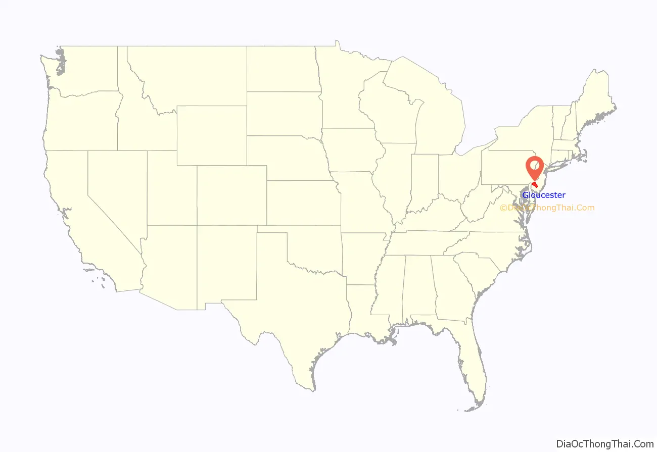
Gloucester County location map. Where is Gloucester County?
History
The county is named after the city of Gloucester and county of Gloucestershire in England. Woodbury, the county seat, was founded in 1683 and is the county’s oldest municipality. National Park in Gloucester County was the site of the American Revolutionary War’s Battle of Red Bank, where Fort Mercer once stood. It is now the site of Red Bank Battlefield Park in National Park. The remains of the Royal Navy’s HMS Augusta were laid in Red Bank Battlefield Park until they were later moved to Gloucester City.
During the colonial era, Gloucester County’s main industry sector was agriculture. Woodbury was the site of the county courthouse, the county jail, a Quaker meeting house that is still in existence, and an inn located on the current location of Woodbury Crossings. Due in part to the county’s many creeks that lead to the Delaware River and Atlantic Ocean, smuggling was once common in the county.
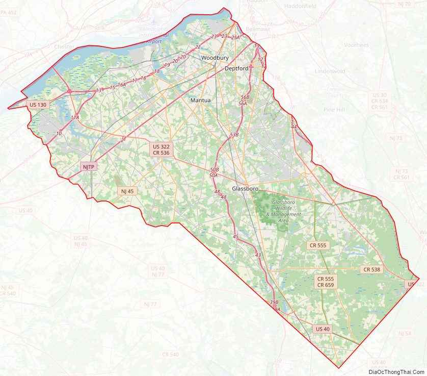
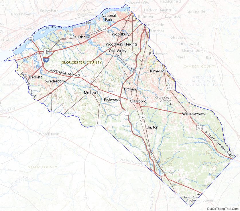
Gloucester County Road Map
Geography
As of the 2010 U.S. census, Gloucester County had a total area of 337.18 square miles (873.3 km), including 322.00 square miles (834.0 km) of land (95.5%) and 15.17 square miles (39.3 km) of water (4.5%). Gloucester County is largely comprised of low-lying rivers and coastal plains. The highest elevation in the county is a slight rise on County Road 654 southeast of Monroe Township that rises to approximately 180 feet (55 m) above sea level. The county’s lowest elevation is at sea level on the Delaware River.
Climate and weather
Average temperatures in the county seat of Woodbury have ranged from a low of 26 °F (−3 °C) in January to a high of 87 °F (31 °C) in July. A record low of −11 °F (−24 °C) was recorded in February 1934 and a record high of 106 °F (41 °C) was recorded in August 1918. Average monthly precipitation ranged from 2.75 inches (70 mm) in February to 4.35 inches (110 mm) in July. The county has a humid subtropical climate (Cfa). Average monthly temperatures in Newfield range from 33.0 °F in January to 76.6 °F in July.
Gloucester County Topographic Map
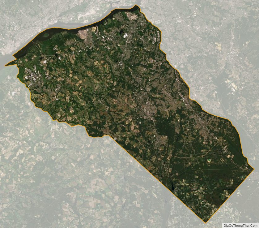
Gloucester County Satellite Map
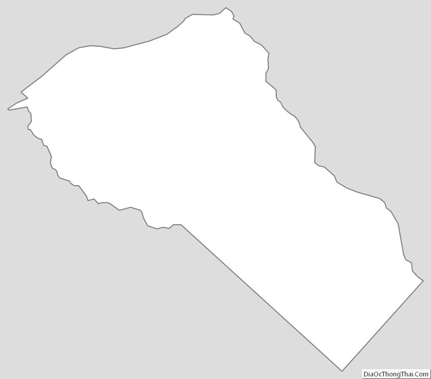
Gloucester County Outline Map
See also
Map of New Jersey State and its subdivision: Map of other states:- Alabama
- Alaska
- Arizona
- Arkansas
- California
- Colorado
- Connecticut
- Delaware
- District of Columbia
- Florida
- Georgia
- Hawaii
- Idaho
- Illinois
- Indiana
- Iowa
- Kansas
- Kentucky
- Louisiana
- Maine
- Maryland
- Massachusetts
- Michigan
- Minnesota
- Mississippi
- Missouri
- Montana
- Nebraska
- Nevada
- New Hampshire
- New Jersey
- New Mexico
- New York
- North Carolina
- North Dakota
- Ohio
- Oklahoma
- Oregon
- Pennsylvania
- Rhode Island
- South Carolina
- South Dakota
- Tennessee
- Texas
- Utah
- Vermont
- Virginia
- Washington
- West Virginia
- Wisconsin
- Wyoming