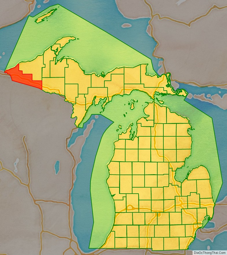
Gogebic County (/ɡoʊˈɡiːbɪk/ goh-GEE-bik or /ɡoʊˈɡɛbɪk/ goh-GEH-bik) is a county in the Upper Peninsula of the U.S. state of Michigan. As of the 2020 census, the population was 14,380. The county seat is Bessemer. Gogebic County is the westernmost county in Michigan, and is one of four Michigan counties within the Central Time Zone. Gogebic County borders Wisconsin to the south, and has a shoreline on Lake Superior to the north.
Gogebic County has long been territory of the Lake Superior Chippewa. The Lac Vieux Desert Indian Reservation is located within Gogebic County.
| Name: | Gogebic County |
|---|---|
| FIPS code: | 26-053 |
| State: | Michigan |
| Founded: | 1887 |
| Named for: | Lake Gogebic |
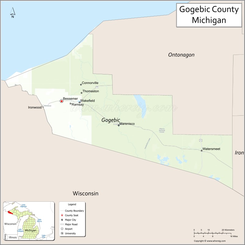
| Seat: | Bessemer |
| Largest city: | Ironwood |
| Total Area: | 1,476 sq mi (3,820 km²) |
| Land Area: | 1,102 sq mi (2,850 km²) |
| Total Population: | 14,380 |
| Population Density: | 15/sq mi (6/km²) |
| Time zone: | UTC−6 (Central) |
| Summer Time Zone (DST): | UTC−5 (CDT) |
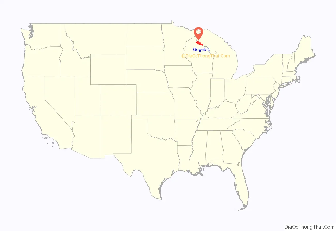
Gogebic County location map. Where is Gogebic County?
History
Gogebic County was organized in 1887, partitioned from Ontonagon County. The county’s name derives from a lake of the same name, which was originally rendered Agogebic. Sources agree that the name is from Ojibwe, but differ on the original meaning. The county’s website suggests it meant “body of water hanging on high,” but an 1884 military annal said it meant “water-mold lake” (Agogibing). (See also: List of place names of Native American origin in Michigan)
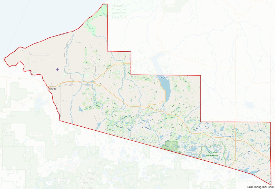
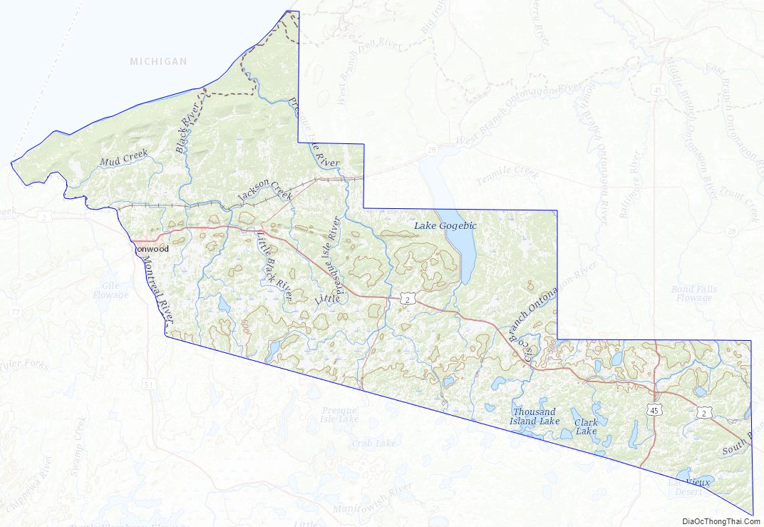
Gogebic County Road Map
Geography
According to the U.S. Census Bureau, the county has a total area of 1,476 square miles (3,820 km), of which 1,102 square miles (2,850 km) is land and 374 square miles (970 km) (25%) is water.
Water features
- Lake Superior – forms the county’s northern land border.
- Lake Gogebic – the largest lake in the Upper Peninsula.
- Montreal River – forms the county’s western border, as well as the state’s border with Wisconsin in this area.
Adjacent counties
- Ontonagon County – north, northeast
- Iron County – east
- Vilas County, Wisconsin – south
- Iron County, Wisconsin – southwest
- Ashland County, Wisconsin – northwest
National protected area
- Ottawa National Forest (part)
State protected area
- Lake Gogebic State Park
Gogebic County Topographic Map
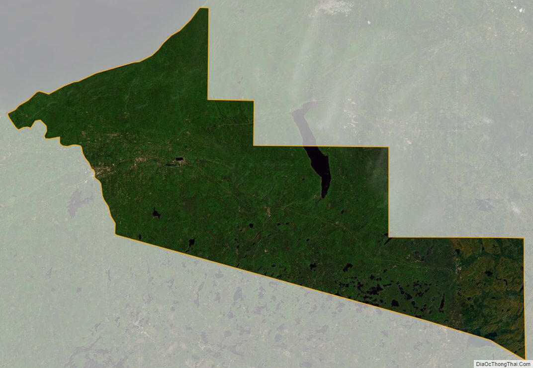
Gogebic County Satellite Map
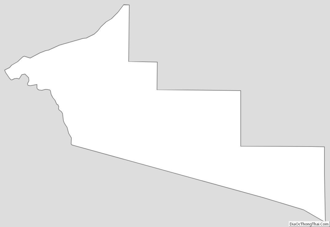
Gogebic County Outline Map
See also
Map of Michigan State and its subdivision:- Alcona
- Alger
- Allegan
- Alpena
- Antrim
- Arenac
- Baraga
- Barry
- Bay
- Benzie
- Berrien
- Branch
- Calhoun
- Cass
- Charlevoix
- Cheboygan
- Chippewa
- Clare
- Clinton
- Crawford
- Delta
- Dickinson
- Eaton
- Emmet
- Genesee
- Gladwin
- Gogebic
- Grand Traverse
- Gratiot
- Hillsdale
- Houghton
- Huron
- Ingham
- Ionia
- Iosco
- Iron
- Isabella
- Jackson
- Kalamazoo
- Kalkaska
- Kent
- Keweenaw
- Lake
- Lake Hurron
- Lake Michigan
- Lake St. Clair
- Lake Superior
- Lapeer
- Leelanau
- Lenawee
- Livingston
- Luce
- Mackinac
- Macomb
- Manistee
- Marquette
- Mason
- Mecosta
- Menominee
- Midland
- Missaukee
- Monroe
- Montcalm
- Montmorency
- Muskegon
- Newaygo
- Oakland
- Oceana
- Ogemaw
- Ontonagon
- Osceola
- Oscoda
- Otsego
- Ottawa
- Presque Isle
- Roscommon
- Saginaw
- Saint Clair
- Saint Joseph
- Sanilac
- Schoolcraft
- Shiawassee
- Tuscola
- Van Buren
- Washtenaw
- Wayne
- Wexford
- Alabama
- Alaska
- Arizona
- Arkansas
- California
- Colorado
- Connecticut
- Delaware
- District of Columbia
- Florida
- Georgia
- Hawaii
- Idaho
- Illinois
- Indiana
- Iowa
- Kansas
- Kentucky
- Louisiana
- Maine
- Maryland
- Massachusetts
- Michigan
- Minnesota
- Mississippi
- Missouri
- Montana
- Nebraska
- Nevada
- New Hampshire
- New Jersey
- New Mexico
- New York
- North Carolina
- North Dakota
- Ohio
- Oklahoma
- Oregon
- Pennsylvania
- Rhode Island
- South Carolina
- South Dakota
- Tennessee
- Texas
- Utah
- Vermont
- Virginia
- Washington
- West Virginia
- Wisconsin
- Wyoming