Grady County is a county located in the U.S. state of Oklahoma. As of the 2010 census, the population was 52,431. Its county seat is Chickasha. It was named for Henry W. Grady, an editor of the Atlanta Constitution and southern orator.
Grady County is part of the Oklahoma City, OK Metropolitan Statistical Area.
| Name: | Grady County |
|---|---|
| FIPS code: | 40-051 |
| State: | Oklahoma |
| Founded: | 1907 |
| Named for: | Henry W. Grady |
| Seat: | Chickasha |
| Largest city: | Chickasha |
| Total Area: | 1,105 sq mi (2,860 km²) |
| Land Area: | 1,100 sq mi (3,000 km²) |
| Total Population: | 52,431 |
| Population Density: | 50/sq mi (20/km²) |
| Time zone: | UTC−6 (Central) |
| Summer Time Zone (DST): | UTC−5 (CDT) |
| Website: | www.gradycountyok.com |
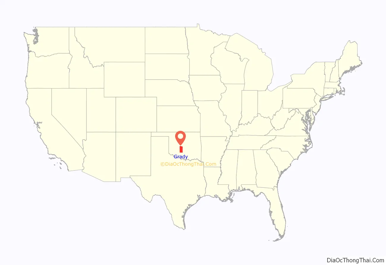
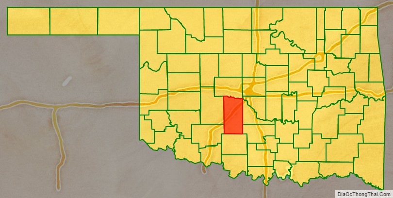
Grady County location map. Where is Grady County?
History
Grady County was part of the land given to the Choctaw by the Treaty of Dancing Rabbit Creek, in exchange for property in the southeastern United States. In 1837, the Chickasaw joined the Choctaws, and in 1855 a treaty separated the two tribes, and the Chickasaw acquired an area that included much of Grady County. Most of the present Grady County became a part of Pickens County in the Chickasaw Nation.
Before the Civil War, Randolph B. Marcy blazed the California Road through this area, reporting a Waco and a Wichita village. In 1858, while the Comanches were holding a meeting with the Wichita, Choctaw, and Chickasaw, Federal troops attacked a party of Comanches. Although the commander of Fort Arbuckle had been informed about the meeting, the troops’ commander, Major Earl Van Dorn, had not consulted him before the attack. As a result, the troops killed 60 Comanches and four Wichitas. Fearing a Comanche reprisal, the other tribes fled to safety at Fort Arbuckle. At the end of the Civil War, the Five Civilized Tribes and the Caddo, Delaware, Kiowa, Comanche, Apache, Cheyenne, Arapaho, and Osage signed a peace agreement and pledged to stand united against any unjust demands that the federal government made at the war’s end. The agreement was known as the Camp Napoleon Compact.
The first railroad in this area was built to the town of Minco in 1890 by the Chicago, Kansas and Nebraska Railway. The company was acquired by the Chicago, Rock Island and Pacific Railroad (Rock Island) during the following year. In 1892, the Rock Island built a track connecting Chickasha, Ninnekah, and Rush Springs to the Texas border. The same railroad built a line from Chickasha to Mangum in 1900. The Oklahoma City and Western Railroad (sold to the St. Louis and San Francisco Railway in 1907) constructed tracks from Oklahoma City to Chickasha, which it extended to the Texas border in the following year. Between 1906 and 1910, the Oklahoma Central Railway (sold to the Atchison, Topeka and Santa Fe Railway in 1914) built from Lehigh to Chickasha.
The 1898 Curtis Act stripped the Chickasaw Nation of its authority, and communal land was forced into allotment, paving the way for statehood. When Oklahoma acquired statehood in 1907, the Chickasaw Nation ceased to exist, Grady County was organized and Chickasha was named the county seat. In 1911, Grady County annexed Washington, Prairie Valley, and the northern section of Dutton townships formerly in Caddo County, Oklahoma.
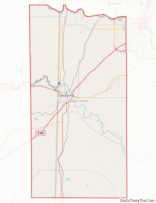
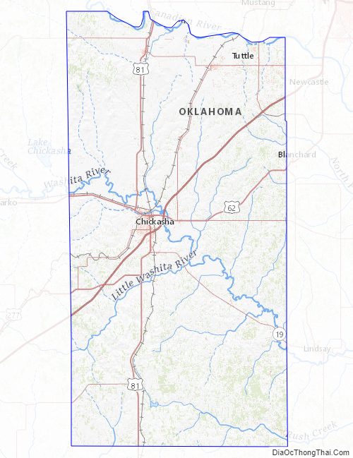
Grady County Road Map
Geography
According to the U.S. Census Bureau, the county has a total area of 1,105 square miles (2,860 km), of which 1,100 square miles (2,800 km) is land and 4.4 square miles (11 km) (0.4%) is water. The county lies in the Red Bed Plains, and is mostly covered with rolling prairie. The Canadian River forms the northern boundary and the Washita River runs through the middle.
Major highways
- Interstate 44
- H.E. Bailey Turnpike
- U.S. Highway 62
- U.S. Highway 81
- U.S. Highway 277
- State Highway 9
- State Highway 17
- State Highway 19
- State Highway 92
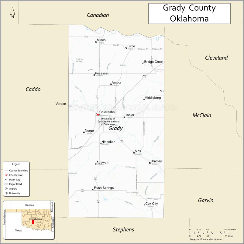
Adjacent counties
- Canadian County (north)
- McClain County (east)
- Garvin County (southeast)
- Stephens County (south)
- Comanche County (southwest)
- Caddo County (west)
Grady County Topographic Map
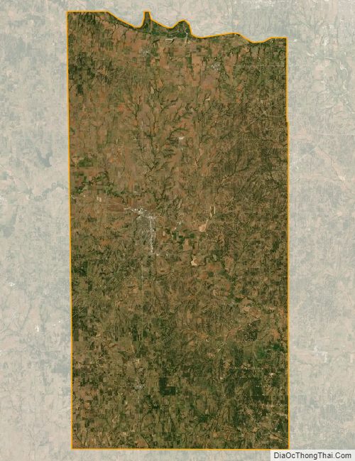
Grady County Satellite Map
Grady County Outline Map

See also
Map of Oklahoma State and its subdivision:- Adair
- Alfalfa
- Atoka
- Beaver
- Beckham
- Blaine
- Bryan
- Caddo
- Canadian
- Carter
- Cherokee
- Choctaw
- Cimarron
- Cleveland
- Coal
- Comanche
- Cotton
- Craig
- Creek
- Custer
- Delaware
- Dewey
- Ellis
- Garfield
- Garvin
- Grady
- Grant
- Greer
- Harmon
- Harper
- Haskell
- Hughes
- Jackson
- Jefferson
- Johnston
- Kay
- Kingfisher
- Kiowa
- Latimer
- Le Flore
- Lincoln
- Logan
- Love
- Major
- Marshall
- Mayes
- McClain
- McCurtain
- McIntosh
- Murray
- Muskogee
- Noble
- Nowata
- Okfuskee
- Oklahoma
- Okmulgee
- Osage
- Ottawa
- Pawnee
- Payne
- Pittsburg
- Pontotoc
- Pottawatomie
- Pushmataha
- Roger Mills
- Rogers
- Seminole
- Sequoyah
- Stephens
- Texas
- Tillman
- Tulsa
- Wagoner
- Washington
- Washita
- Woods
- Woodward
- Alabama
- Alaska
- Arizona
- Arkansas
- California
- Colorado
- Connecticut
- Delaware
- District of Columbia
- Florida
- Georgia
- Hawaii
- Idaho
- Illinois
- Indiana
- Iowa
- Kansas
- Kentucky
- Louisiana
- Maine
- Maryland
- Massachusetts
- Michigan
- Minnesota
- Mississippi
- Missouri
- Montana
- Nebraska
- Nevada
- New Hampshire
- New Jersey
- New Mexico
- New York
- North Carolina
- North Dakota
- Ohio
- Oklahoma
- Oregon
- Pennsylvania
- Rhode Island
- South Carolina
- South Dakota
- Tennessee
- Texas
- Utah
- Vermont
- Virginia
- Washington
- West Virginia
- Wisconsin
- Wyoming