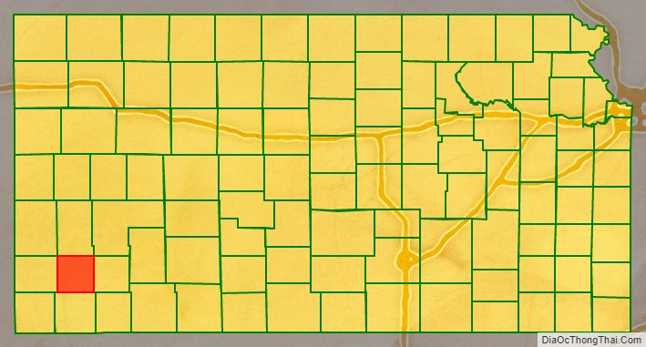
Grant County (county code GT) is a county located in the U.S. state of Kansas. As of the 2020 census, the county population was 7,352. Its county seat and only city is Ulysses. Both the county and its seat are named after Ulysses S. Grant, 18th President of the United States.
| Name: | Grant County |
|---|---|
| FIPS code: | 20-067 |
| State: | Kansas |
| Founded: | March 20, 1873 |
| Named for: | Ulysses S. Grant |
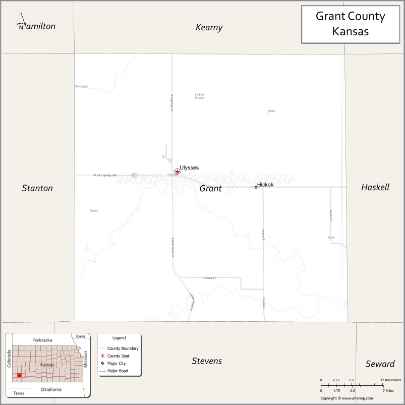
| Seat: | Ulysses |
| Largest city: | Ulysses |
| Total Area: | 575 sq mi (1,490 km²) |
| Land Area: | 575 sq mi (1,490 km²) |
| Total Population: | 7,352 |
| Population Density: | 12.8/sq mi (4.9/km²) |
| Time zone: | UTC−6 (Central) |
| Summer Time Zone (DST): | UTC−5 (CDT) |
| Website: | GrantCoKS.org |
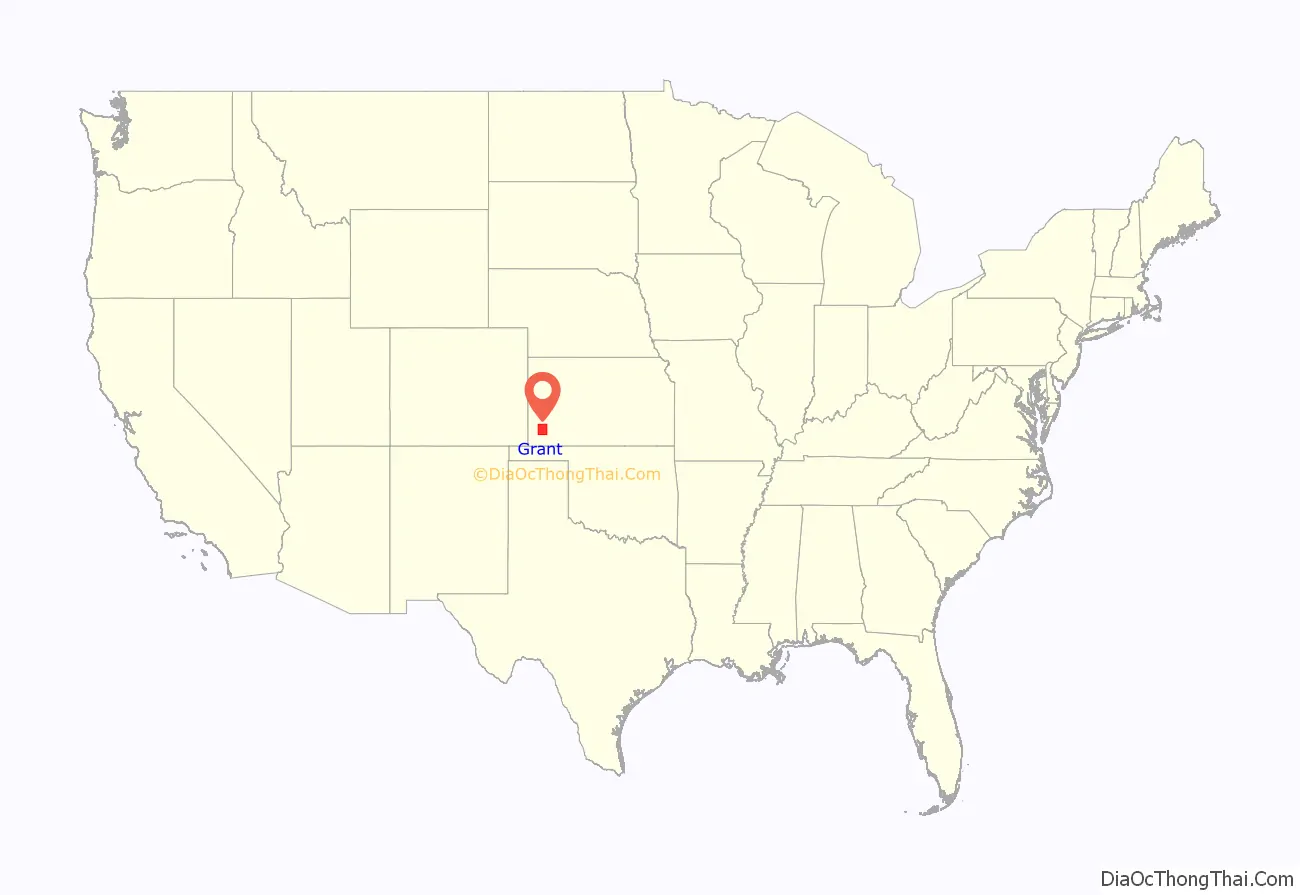
Grant County location map. Where is Grant County?
History
In 1873, the part of Kansas west of Range 25 was divided into 25 new counties. The new counties were Decatur, Rawlins, Cheyenne, Sheridan, Thomas, Sherman, Lane, Buffalo, Foote, Meade, Scott, Sequoyah, Arapahoe, Seward, Wichita, Kearny, Greeley, Hamilton, Stanton, Kansas, Stevens, and Grant.
Grant County, Kansas was named after Ulysses S. Grant, the 18th President of the United States (1869–1877), and incumbent president at the time of the county’s formation. The initial survey establishing county boundaries was in the summer of 1874.
In 1883, Kearny, Sequoyah, Arapahoe, Kansas, Stevens, Meade, Clark and Grant counties disappeared. Hamilton, Ford, Seward, and Hodgeman counties enlarged and Finney County was created. Grant County was split with the western portion becoming a part of Hamilton County and the eastern portion becoming a part of the newly created Finney County.
On June 9, 1888, Grant County was again established as a Kansas county, with original county boundaries, with the first officers of the new Grant County being sworn in on June 18, 1888.
In October 1888, the county seat election for Grant County resulted in victory for Ulysses, Kansas, election results were:.
Early Day Settlements
- “Old” Ulysses, subsequently moved to New Ulysses in 1909
- Surprise-Tilden
- Cincinnati-Appomattox
- Shockey (Shockeyville)
- Golden
- Zionville
- Lawson
- Waterford
- Gognac
- Spurgeon
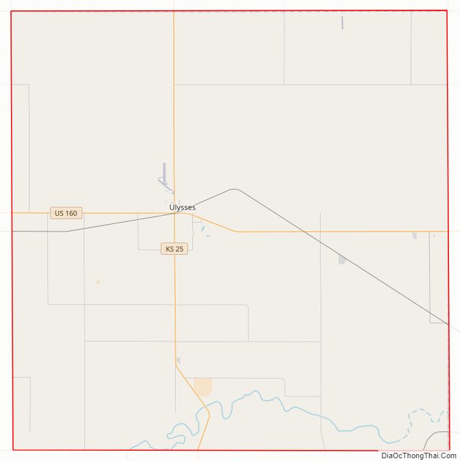
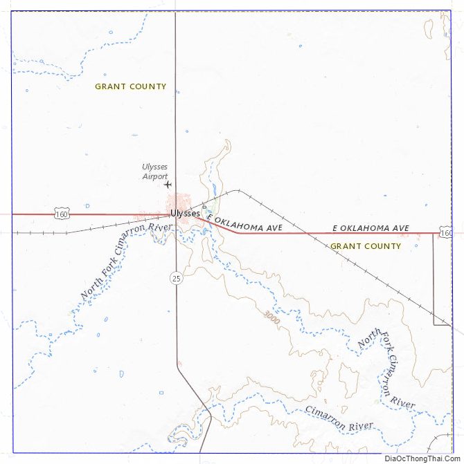
Grant County Road Map
Geography
According to the U.S. Census Bureau, the county has a total area of 575 square miles (1,490 km), of which 575 square miles (1,490 km) is land and 0.3 square miles (0.78 km) (0.06%) is water.
Major highways
- U.S. Highway 160
- Kansas Highway 25
Adjacent counties
- Kearny County (north)
- Finney County (northeast)
- Haskell County (east)
- Stevens County (south)
- Stanton County (west)
- Hamilton County (northwest)
Grant County Topographic Map
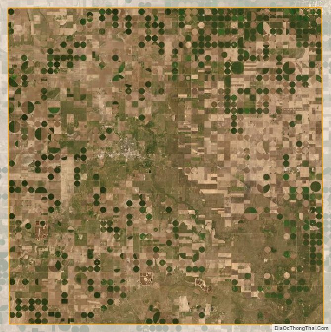
Grant County Satellite Map
Grant County Outline Map

See also
Map of Kansas State and its subdivision:- Allen
- Anderson
- Atchison
- Barber
- Barton
- Bourbon
- Brown
- Butler
- Chase
- Chautauqua
- Cherokee
- Cheyenne
- Clark
- Clay
- Cloud
- Coffey
- Comanche
- Cowley
- Crawford
- Decatur
- Dickinson
- Doniphan
- Douglas
- Edwards
- Elk
- Ellis
- Ellsworth
- Finney
- Ford
- Franklin
- Geary
- Gove
- Graham
- Grant
- Gray
- Greeley
- Greenwood
- Hamilton
- Harper
- Harvey
- Haskell
- Hodgeman
- Jackson
- Jefferson
- Jewell
- Johnson
- Kearny
- Kingman
- Kiowa
- Labette
- Lane
- Leavenworth
- Lincoln
- Linn
- Logan
- Lyon
- Marion
- Marshall
- McPherson
- Meade
- Miami
- Mitchell
- Montgomery
- Morris
- Morton
- Nemaha
- Neosho
- Ness
- Norton
- Osage
- Osborne
- Ottawa
- Pawnee
- Phillips
- Pottawatomie
- Pratt
- Rawlins
- Reno
- Republic
- Rice
- Riley
- Rooks
- Rush
- Russell
- Saline
- Scott
- Sedgwick
- Seward
- Shawnee
- Sheridan
- Sherman
- Smith
- Stafford
- Stanton
- Stevens
- Sumner
- Thomas
- Trego
- Wabaunsee
- Wallace
- Washington
- Wichita
- Wilson
- Woodson
- Wyandotte
- Alabama
- Alaska
- Arizona
- Arkansas
- California
- Colorado
- Connecticut
- Delaware
- District of Columbia
- Florida
- Georgia
- Hawaii
- Idaho
- Illinois
- Indiana
- Iowa
- Kansas
- Kentucky
- Louisiana
- Maine
- Maryland
- Massachusetts
- Michigan
- Minnesota
- Mississippi
- Missouri
- Montana
- Nebraska
- Nevada
- New Hampshire
- New Jersey
- New Mexico
- New York
- North Carolina
- North Dakota
- Ohio
- Oklahoma
- Oregon
- Pennsylvania
- Rhode Island
- South Carolina
- South Dakota
- Tennessee
- Texas
- Utah
- Vermont
- Virginia
- Washington
- West Virginia
- Wisconsin
- Wyoming