Grant County is a county located in the U.S. state of Wisconsin. As of the 2020 census, the population was 51,938. Its county seat is Lancaster. The county is named after the Grant River, in turn named after a fur trader who lived in the area when Wisconsin was a territory. Grant County comprises the Platteville, WI Micropolitan Statistical Area. It is in the tri-state area of Illinois, Iowa, and Wisconsin, and is crossed by travelers commuting to Madison from a number of eastern Iowan cities, and by residents of northern Illinois traveling to the Twin Cities or La Crosse, Wisconsin.
| Name: | Grant County |
|---|---|
| FIPS code: | 55-043 |
| State: | Wisconsin |
| Founded: | 1837 |
| Seat: | Lancaster |
| Largest city: | Platteville |
| Total Area: | 1,183 sq mi (3,060 km²) |
| Land Area: | 1,147 sq mi (2,970 km²) |
| Total Population: | 51,938 |
| Population Density: | 45.3/sq mi (17.5/km²) |
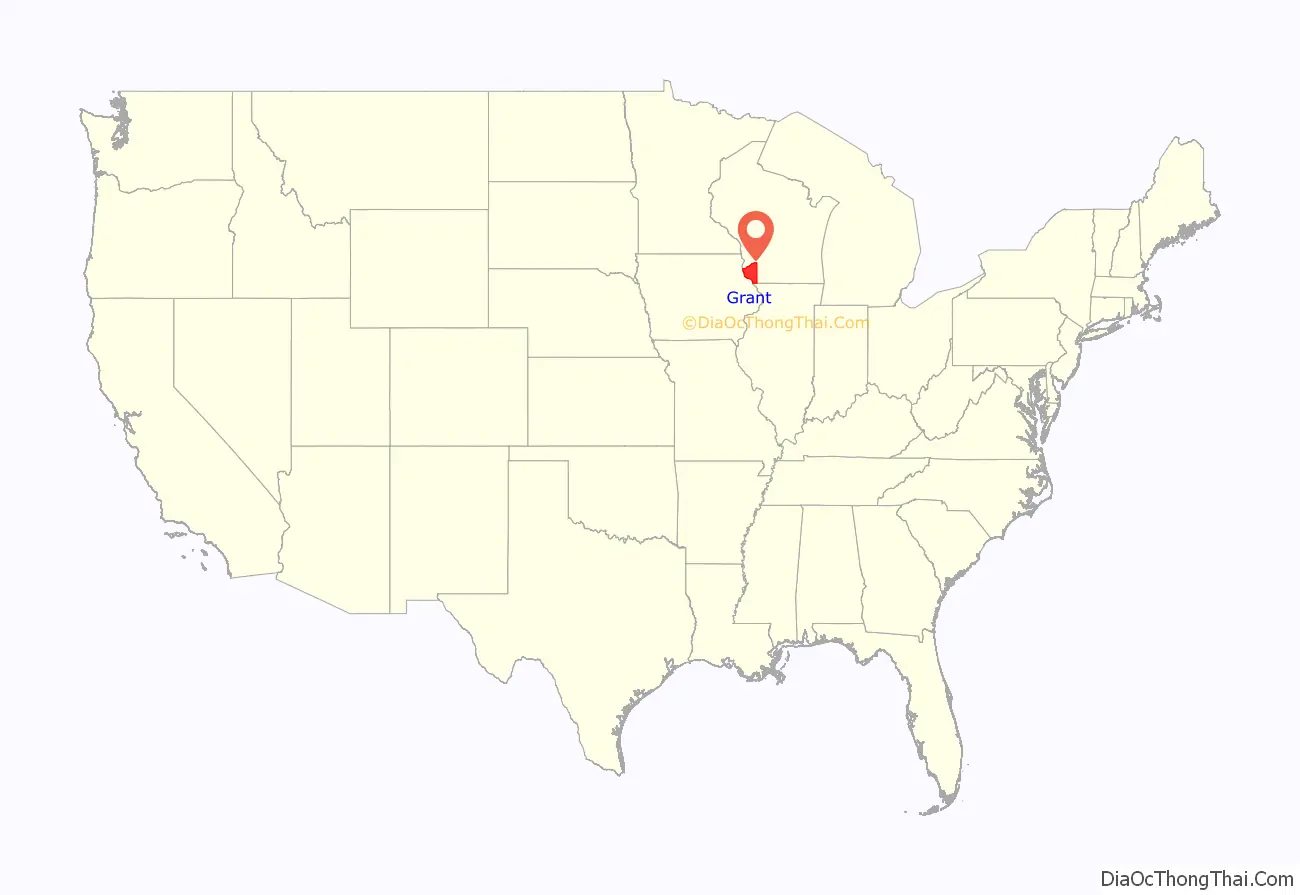
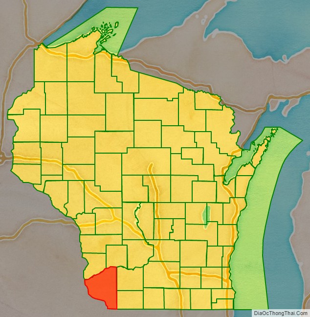
Grant County location map. Where is Grant County?
History
Indian presence
What is now Grant County was largely uninhabited prior to contact with Europeans, as it was a border region between the territories of the Kickapoo, Menominee, and Illinois tribes. The only Native Americans to have a permanent settlement in the area were the Fox tribe, who had a temporary village in what is now the extreme northeast of the county during the mid-1700s.
Colonial period
Between 1520 and 1620 this area was nominally ruled by Spain, although the lack of explorers left the region completely untouched by Spanish authority. The first Frenchmen to reach what is now Grant County were Jacques Marquette and Louis Joliet, who explored the region in the spring of 1673, after setting out from what would later become Green Bay. No permanent settlement was made. In 1680 Louis Hennepin also passed through the region that would later become Grant County, also making no permanent settlement. In 1689 Nicholas Perrot passed through the territory and claimed it for the King of France. The first settlement was a temporary trading post that Pierre Marin founded in 1725.
The British technically ruled the region during the period between the French and Indian War and the American Revolution, though no effort was made to settle or administer the region. After the abandonment of Marin’s trading post, the region went unvisited until the expedition of Jonathan Carver, a Connecticut Yankee who passed through what is now Grant County in 1766 during an attempt to discover the Pacific Ocean.
American period
In 1783, the British government acknowledged the jurisdiction of the United States over the land east of the Mississippi River, including what is now Grant County. American and European traders visiting the region over the next decades were yet as nomadic as the Indians, and no records survive. Grant County was created as part of Wisconsin Territory in 1837. It was named after an Indian trader; his first name, origins, and eventual fate are all unknown.
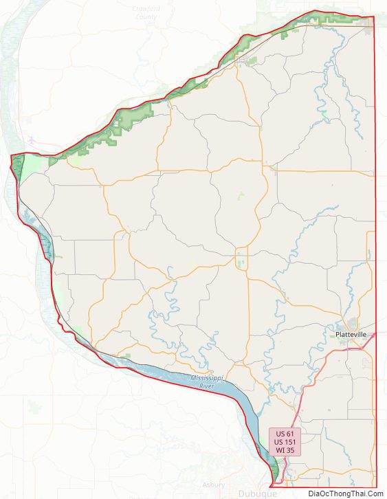
Grant County Road Map
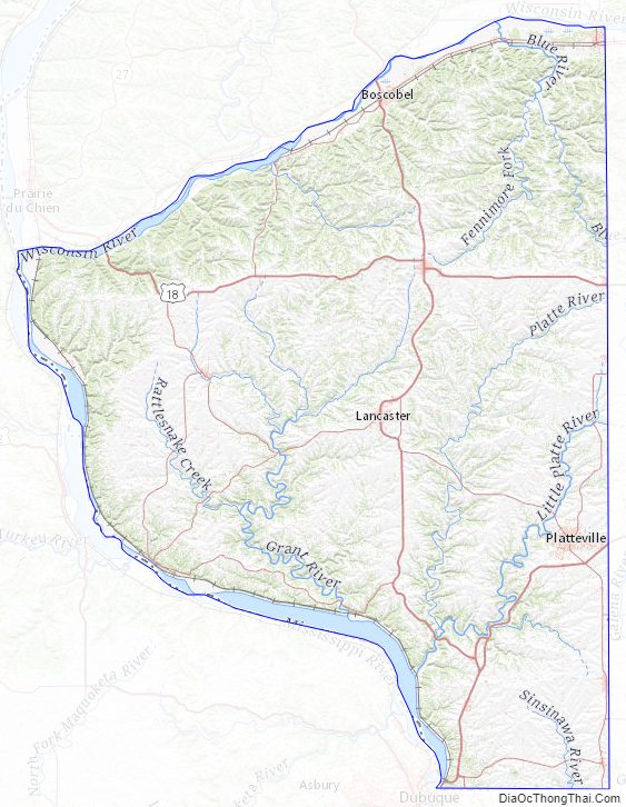
Geography
According to the U.S. Census Bureau, the county has a total area of 1,183 square miles (3,060 km), of which 1,147 square miles (2,970 km) is land and 36 square miles (93 km) (3.1%) is water.
Major highways
- U.S. Highway 18
- U.S. Highway 61
- U.S. Highway 151
- Highway 11 (Wisconsin)
- Highway 35 (Wisconsin)
- Highway 80 (Wisconsin)
- Highway 81 (Wisconsin)
- Highway 133 (Wisconsin)
Railroads
- BNSF
- Wisconsin and Southern Railroad
Buses
- Platteville Public Transportation
- List of intercity bus stops in Wisconsin
Airports
- KOVS – Boscobel Municipal Airport
- KPVB – Platteville Municipal Airport serves the county and surrounding communities.
- 73C – Lancaster Municipal Airport enhances county service.
- C74 – Cassville Municipal Airport
Adjacent counties
- Crawford County, Wisconsin – north
- Richland County, Wisconsin – northeast
- Iowa County, Wisconsin – east
- Lafayette County, Wisconsin – east
- Jo Daviess County, Illinois – southeast
- Dubuque County, Iowa – south
- Clayton County, Iowa – west
Grant County Topographic Map
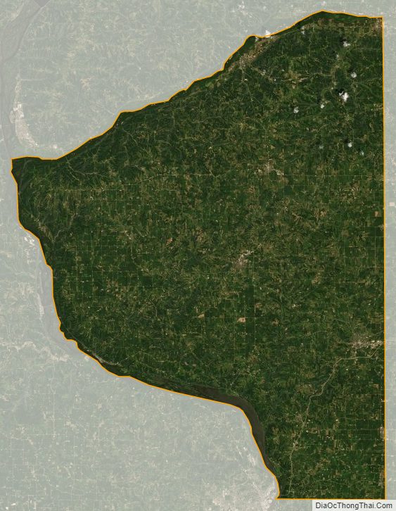
Grant County Satellite Map
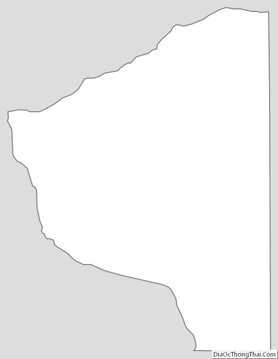
Grant County Outline Map
See also
Map of Wisconsin State and its subdivision:- Adams
- Ashland
- Barron
- Bayfield
- Brown
- Buffalo
- Burnett
- Calumet
- Chippewa
- Clark
- Columbia
- Crawford
- Dane
- Dodge
- Door
- Douglas
- Dunn
- Eau Claire
- Florence
- Fond du Lac
- Forest
- Grant
- Green
- Green Lake
- Iowa
- Iron
- Jackson
- Jefferson
- Juneau
- Kenosha
- Kewaunee
- La Crosse
- Lafayette
- Lake Michigan
- Lake Superior
- Langlade
- Lincoln
- Manitowoc
- Marathon
- Marinette
- Marquette
- Menominee
- Milwaukee
- Monroe
- Oconto
- Oneida
- Outagamie
- Ozaukee
- Pepin
- Pierce
- Polk
- Portage
- Price
- Racine
- Richland
- Rock
- Rusk
- Saint Croix
- Sauk
- Sawyer
- Shawano
- Sheboygan
- Taylor
- Trempealeau
- Vernon
- Vilas
- Walworth
- Washburn
- Washington
- Waukesha
- Waupaca
- Waushara
- Winnebago
- Wood
- Alabama
- Alaska
- Arizona
- Arkansas
- California
- Colorado
- Connecticut
- Delaware
- District of Columbia
- Florida
- Georgia
- Hawaii
- Idaho
- Illinois
- Indiana
- Iowa
- Kansas
- Kentucky
- Louisiana
- Maine
- Maryland
- Massachusetts
- Michigan
- Minnesota
- Mississippi
- Missouri
- Montana
- Nebraska
- Nevada
- New Hampshire
- New Jersey
- New Mexico
- New York
- North Carolina
- North Dakota
- Ohio
- Oklahoma
- Oregon
- Pennsylvania
- Rhode Island
- South Carolina
- South Dakota
- Tennessee
- Texas
- Utah
- Vermont
- Virginia
- Washington
- West Virginia
- Wisconsin
- Wyoming